1
arXiv Papers
15
Total Publications
Profile
Academic Profile
Metrics
Statistics
1
arXiv Papers
15
Total Publications
Network
Similar Authors
Publications
Papers on arXiv
arXiv
Transport-Related Surface Detection with Machine Learning: Analyzing
Temporal Trends in Madrid and Vienna
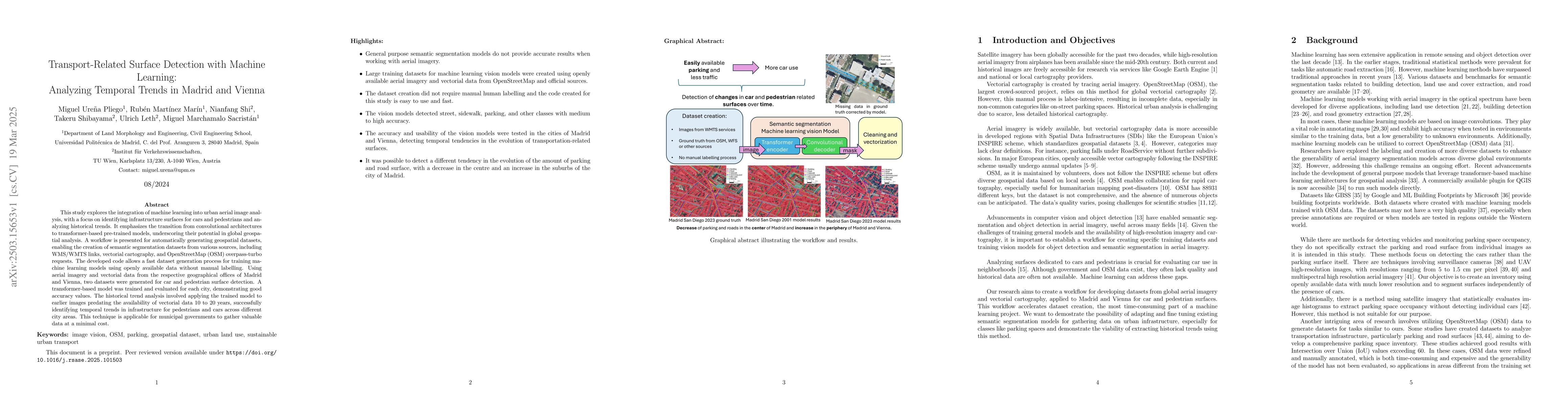
This study explores the integration of machine learning into urban aerial image analysis, with a focus on identifying infrastructure surfaces for cars and pedestrians and analyzing historical trends. ...