Academic Profile
Statistics
Similar Authors
Papers on arXiv
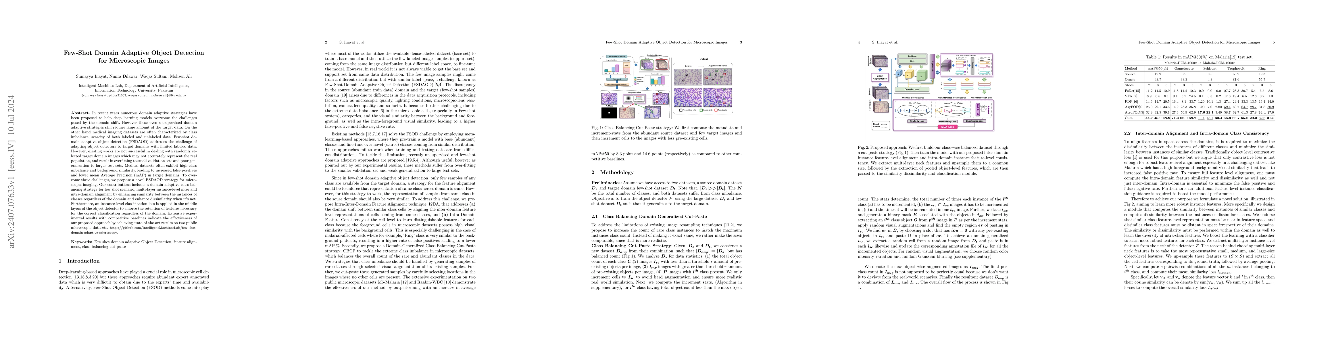
In recent years, numerous domain adaptive strategies have been proposed to help deep learning models overcome the challenges posed by domain shift. However, even unsupervised domain adaptive strategie...
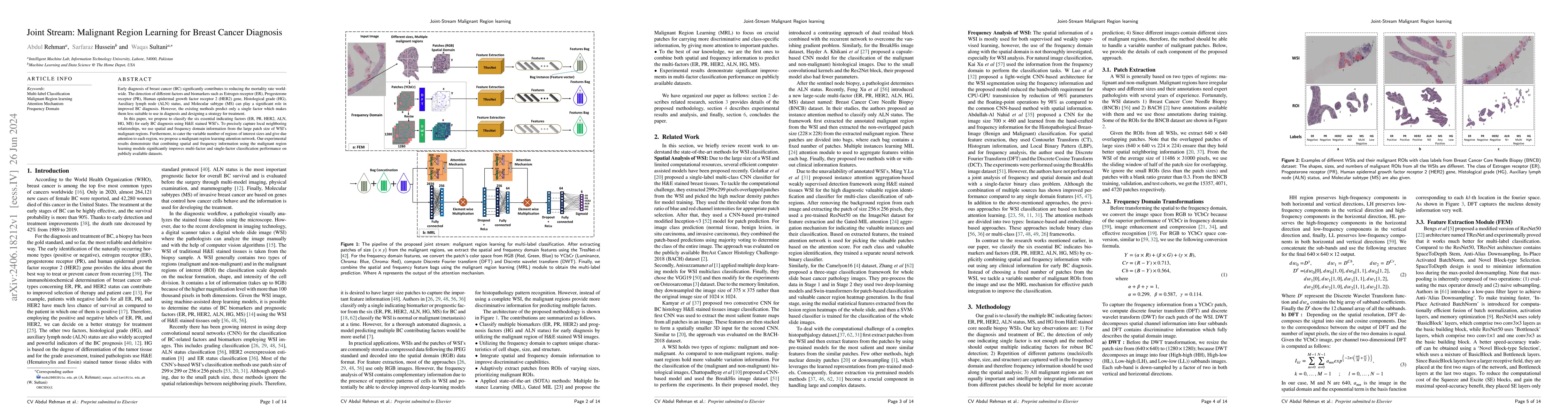
Early diagnosis of breast cancer (BC) significantly contributes to reducing the mortality rate worldwide. The detection of different factors and biomarkers such as Estrogen receptor (ER), Progesterone...
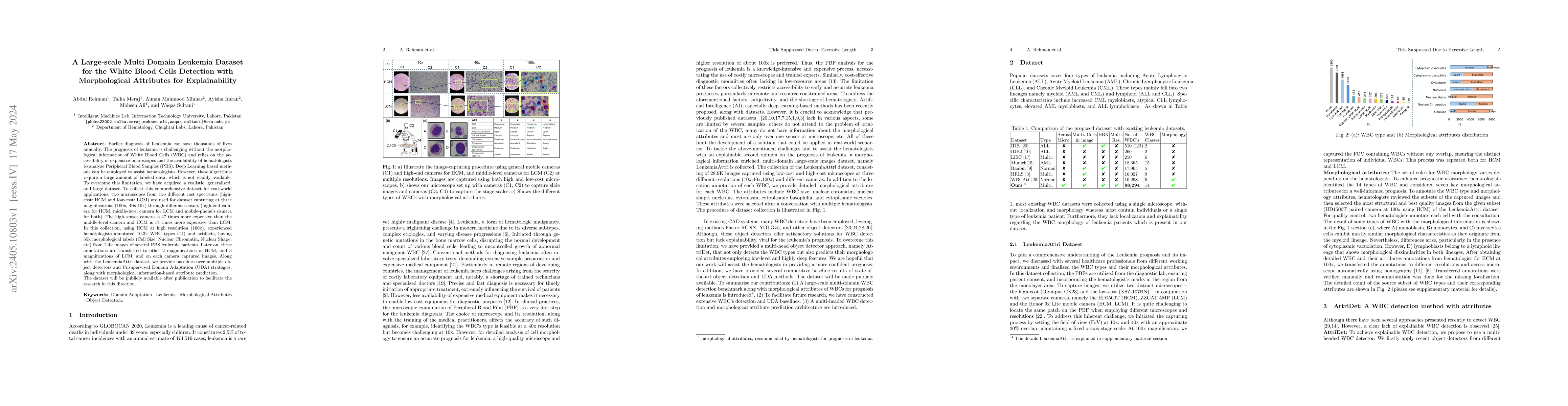
Earlier diagnosis of Leukemia can save thousands of lives annually. The prognosis of leukemia is challenging without the morphological information of White Blood Cells (WBC) and relies on the access...
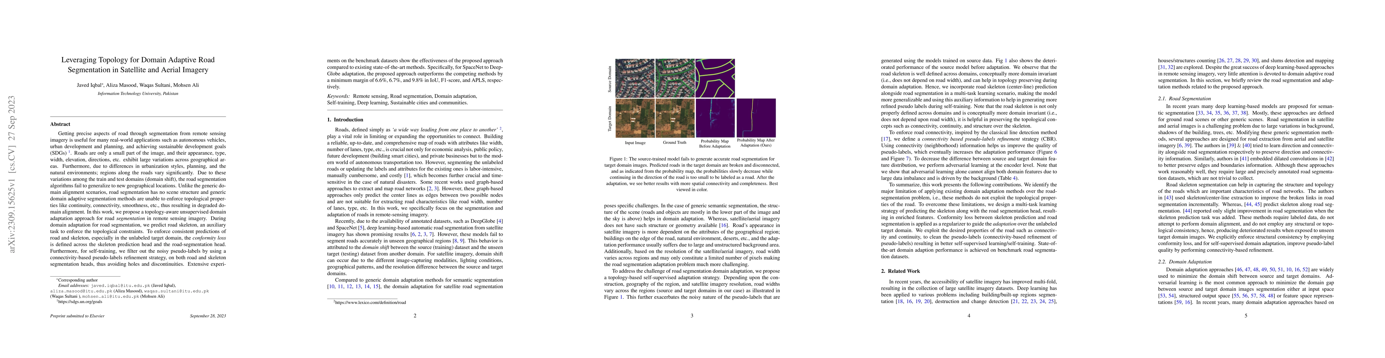
Getting precise aspects of road through segmentation from remote sensing imagery is useful for many real-world applications such as autonomous vehicles, urban development and planning, and achieving...
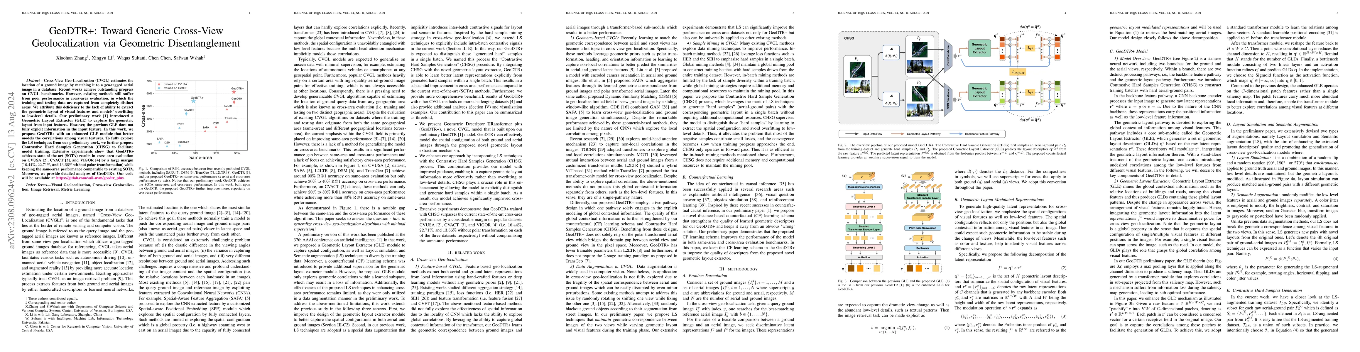
Cross-View Geo-Localization (CVGL) estimates the location of a ground image by matching it to a geo-tagged aerial image in a database. Recent works achieve outstanding progress on CVGL benchmarks. H...
Semantic understanding of roadways is a key enabling factor for safe autonomous driving. However, existing autonomous driving datasets provide well-structured urban roads while ignoring unstructured...
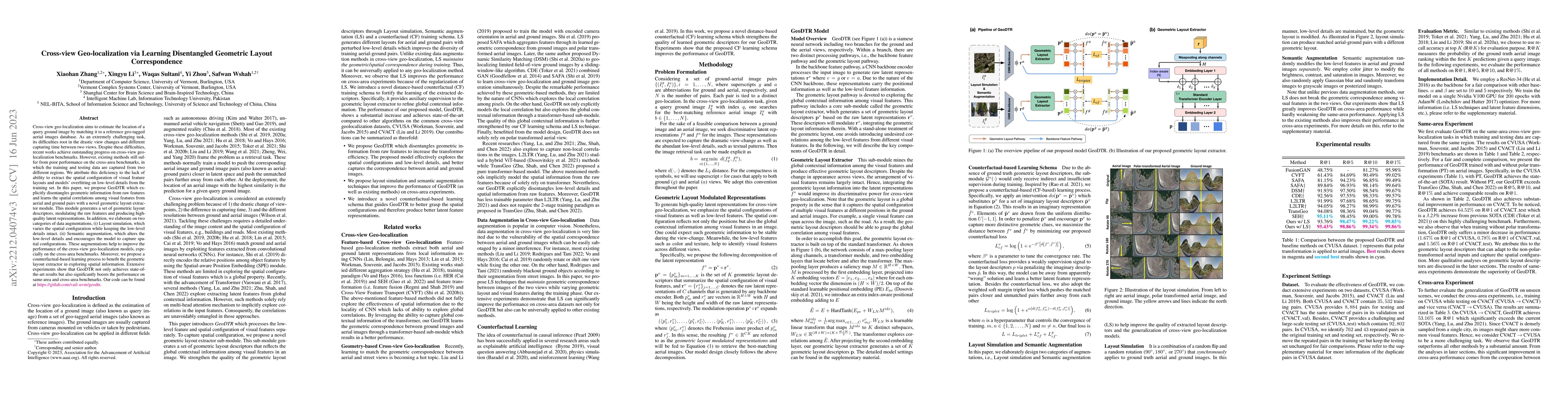
Cross-view geo-localization aims to estimate the location of a query ground image by matching it to a reference geo-tagged aerial images database. As an extremely challenging task, its difficulties ...
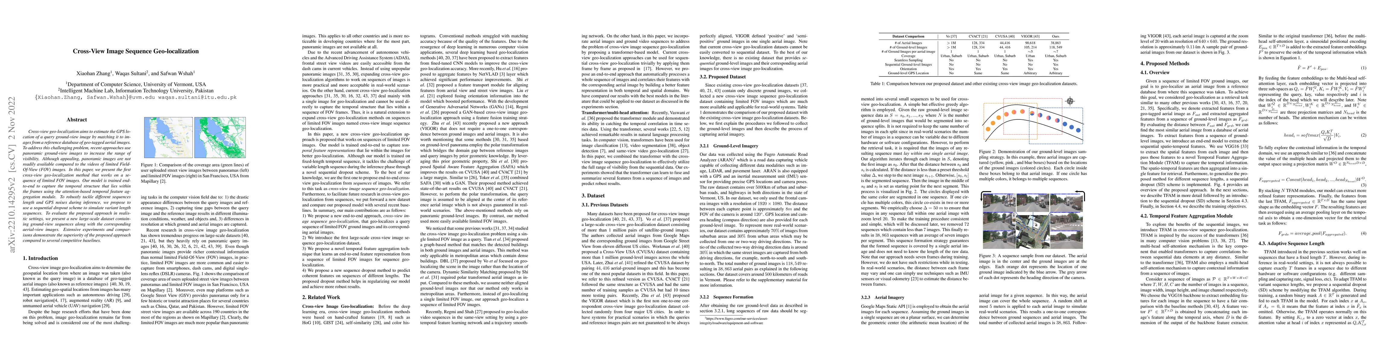
Cross-view geo-localization aims to estimate the GPS location of a query ground-view image by matching it to images from a reference database of geo-tagged aerial images. To address this challenging...
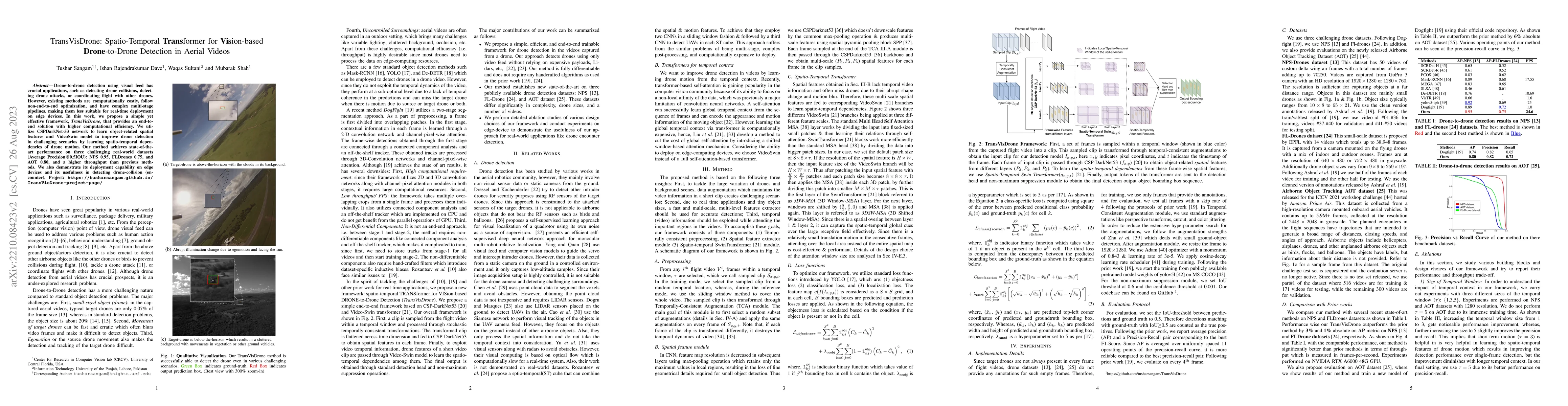
Drone-to-drone detection using visual feed has crucial applications, such as detecting drone collisions, detecting drone attacks, or coordinating flight with other drones. However, existing methods ...
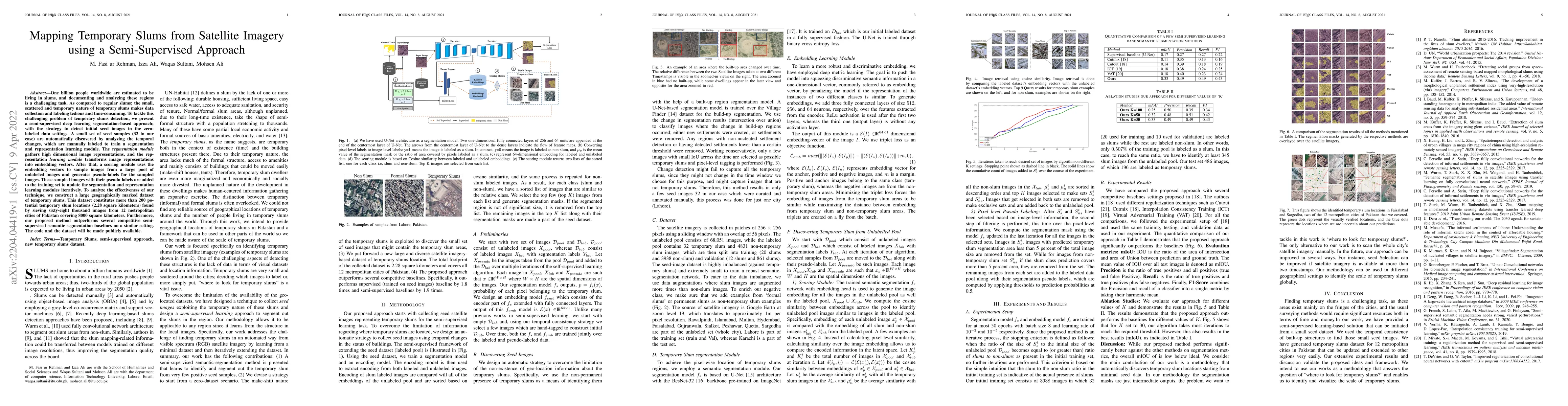
One billion people worldwide are estimated to be living in slums, and documenting and analyzing these regions is a challenging task. As compared to regular slums; the small, scattered and temporary ...
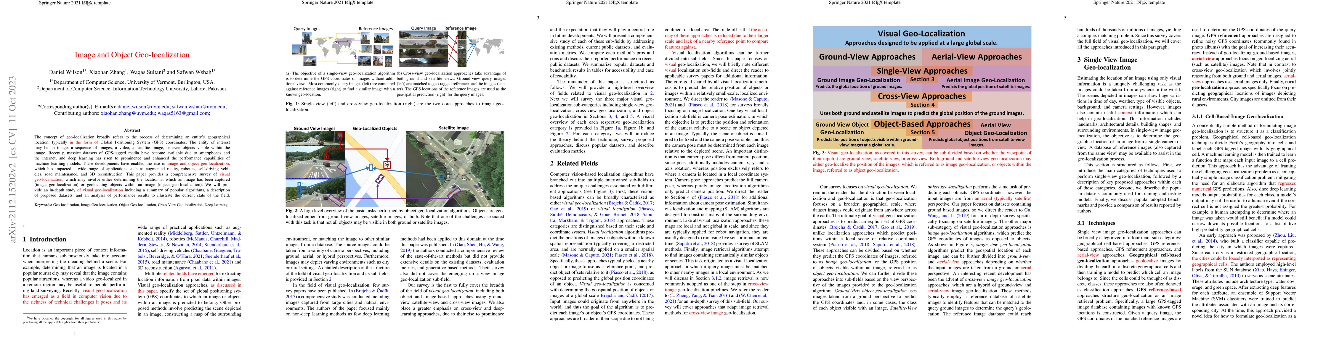
The concept of geo-localization refers to the process of determining where on earth some `entity' is located, typically using Global Positioning System (GPS) coordinates. The entity of interest may ...
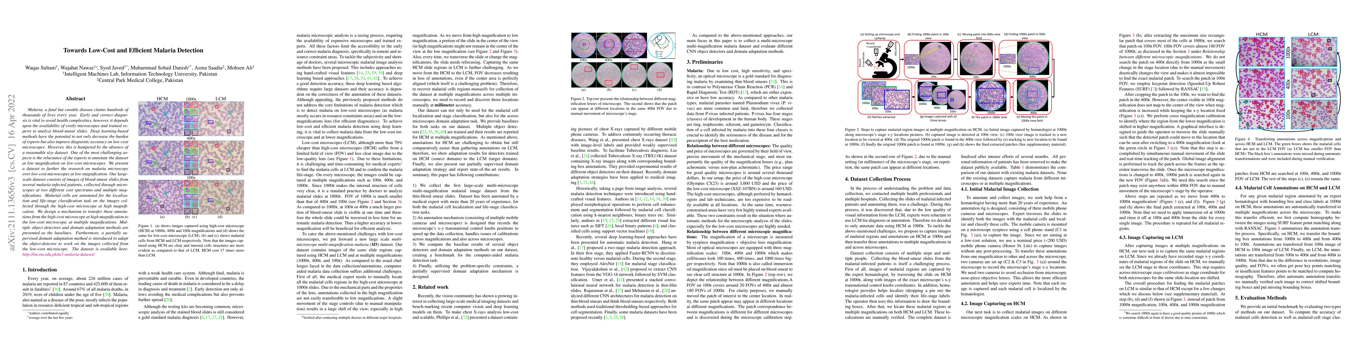
Malaria, a fatal but curable disease claims hundreds of thousands of lives every year. Early and correct diagnosis is vital to avoid health complexities, however, it depends upon the availability of...
Deep neural networks have shown promising results in disease detection and classification using medical image data. However, they still suffer from the challenges of handling real-world scenarios es...
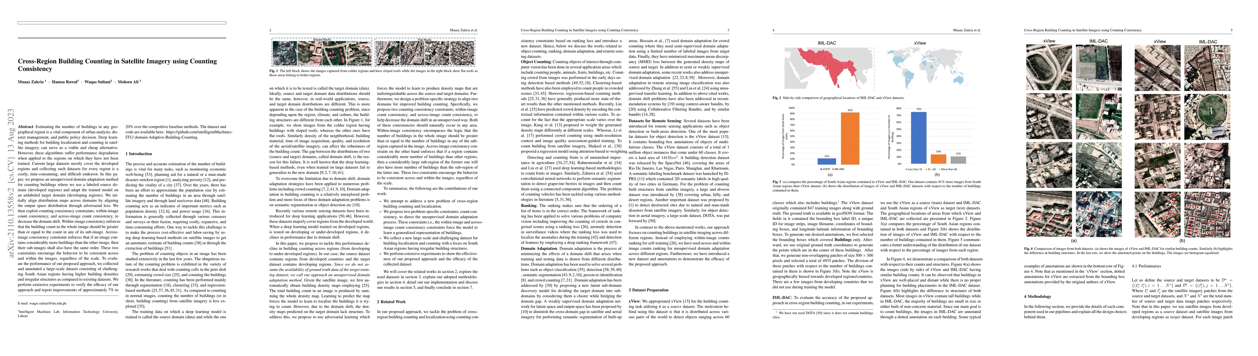
Estimating the number of buildings in any geographical region is a vital component of urban analysis, disaster management, and public policy decision. Deep learning methods for building localization...
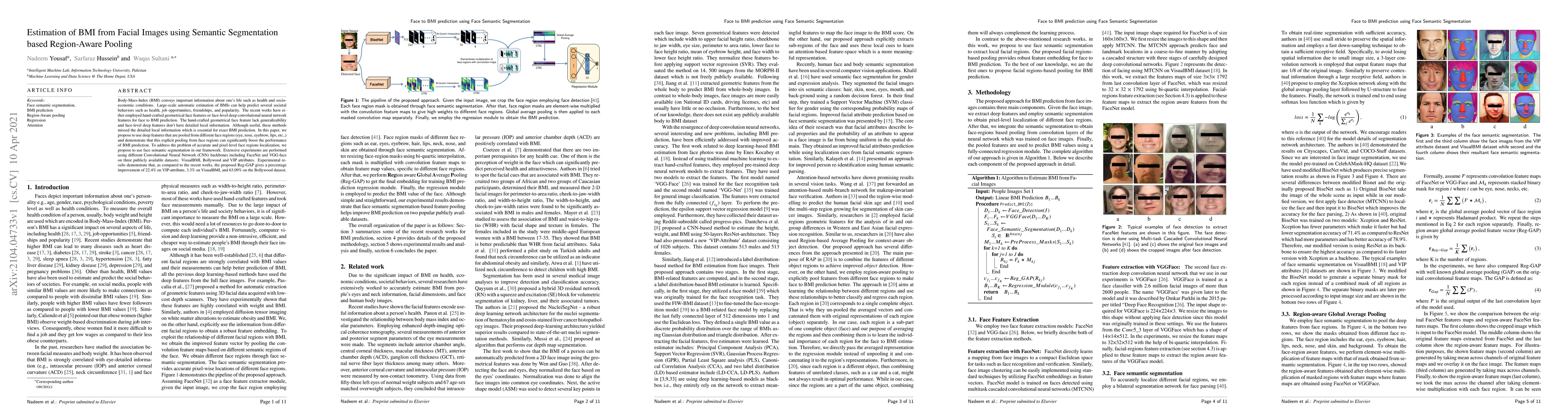
Body-Mass-Index (BMI) conveys important information about one's life such as health and socio-economic conditions. Large-scale automatic estimation of BMIs can help predict several societal behavior...
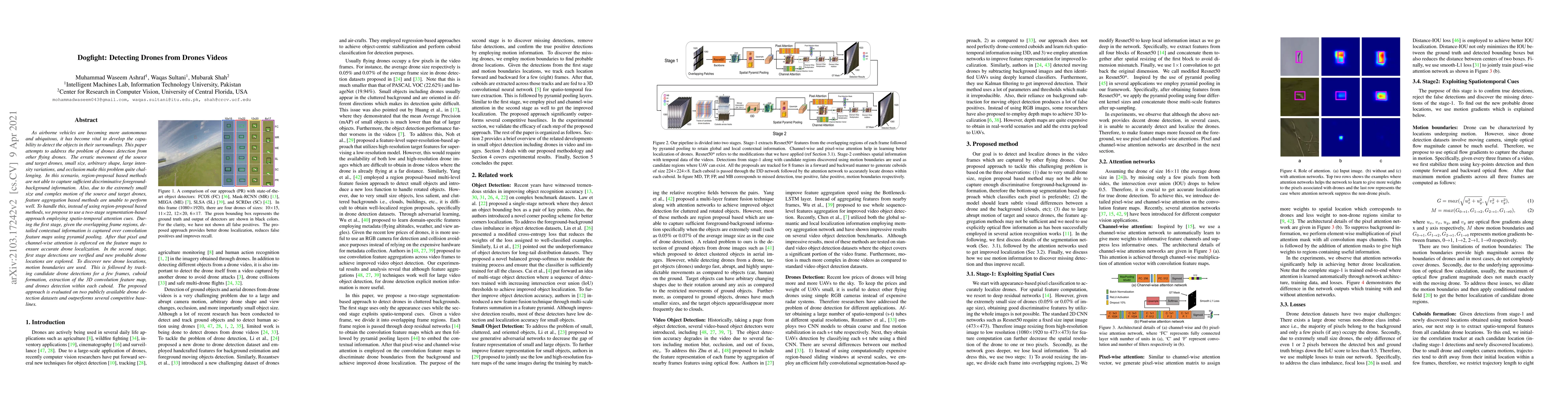
As airborne vehicles are becoming more autonomous and ubiquitous, it has become vital to develop the capability to detect the objects in their surroundings. This paper attempts to address the proble...
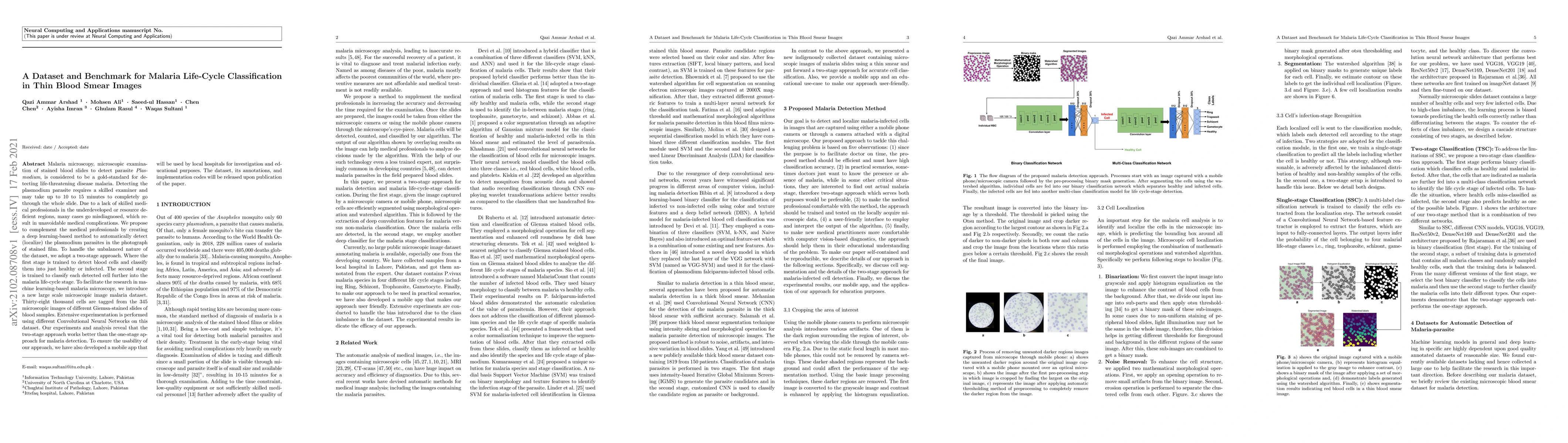
Malaria microscopy, microscopic examination of stained blood slides to detect parasite Plasmodium, is considered to be a gold-standard for detecting life-threatening disease malaria. Detecting the p...
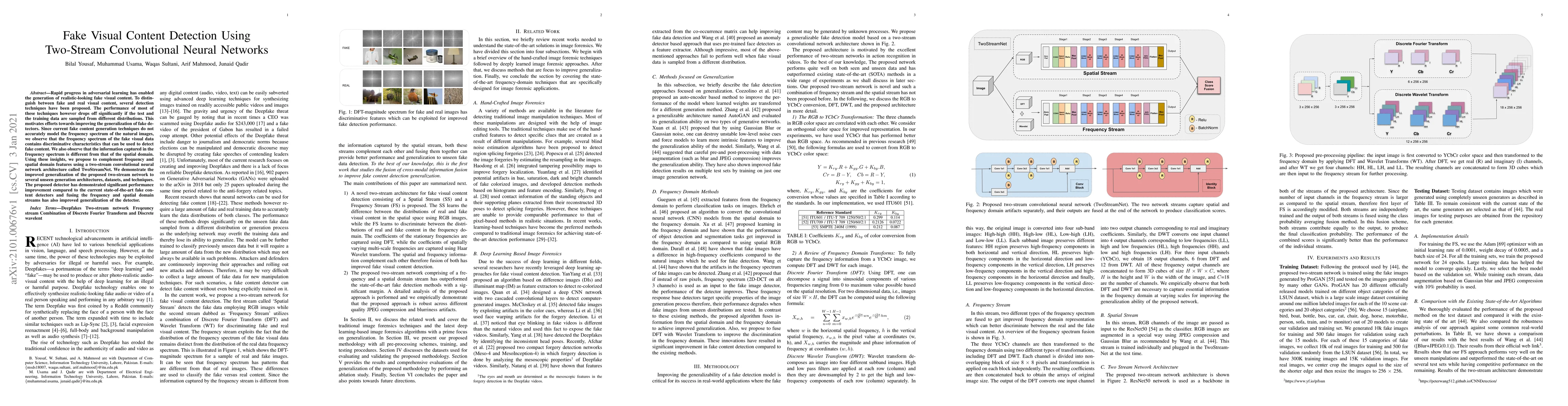
Rapid progress in adversarial learning has enabled the generation of realistic-looking fake visual content. To distinguish between fake and real visual content, several detection techniques have bee...
The goal of human action recognition is to temporally or spatially localize the human action of interest in video sequences. Temporal localization (i.e. indicating the start and end frames of the ac...
In modern intelligent video surveillance systems, automatic anomaly detection through computer vision analytics plays a pivotal role which not only significantly increases monitoring efficiency but ...
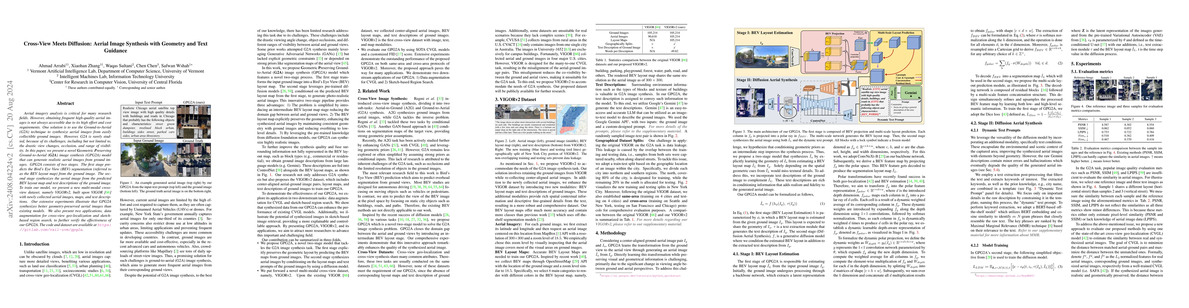
Aerial imagery analysis is critical for many research fields. However, obtaining frequent high-quality aerial images is not always accessible due to its high effort and cost requirements. One solution...
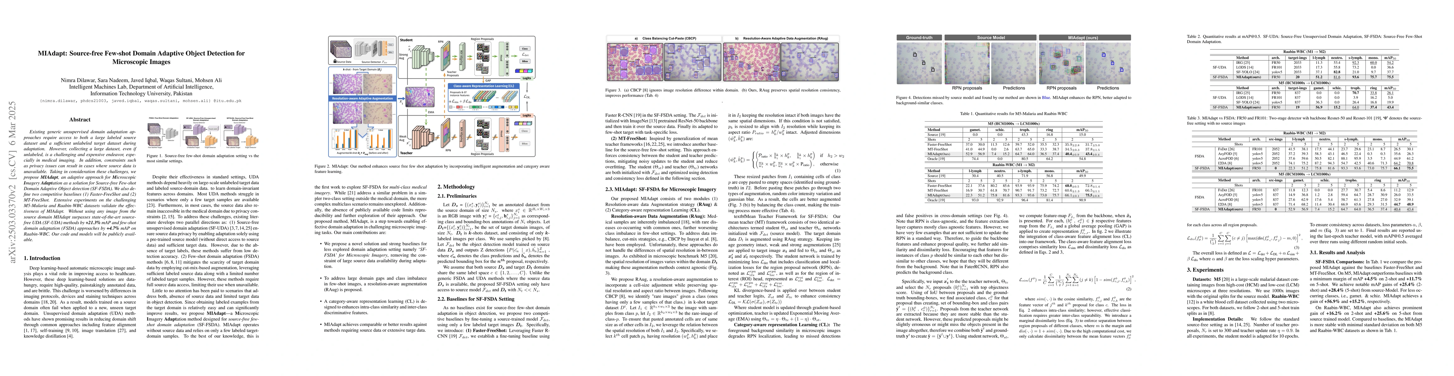
Existing generic unsupervised domain adaptation approaches require access to both a large labeled source dataset and a sufficient unlabeled target dataset during adaptation. However, collecting a larg...
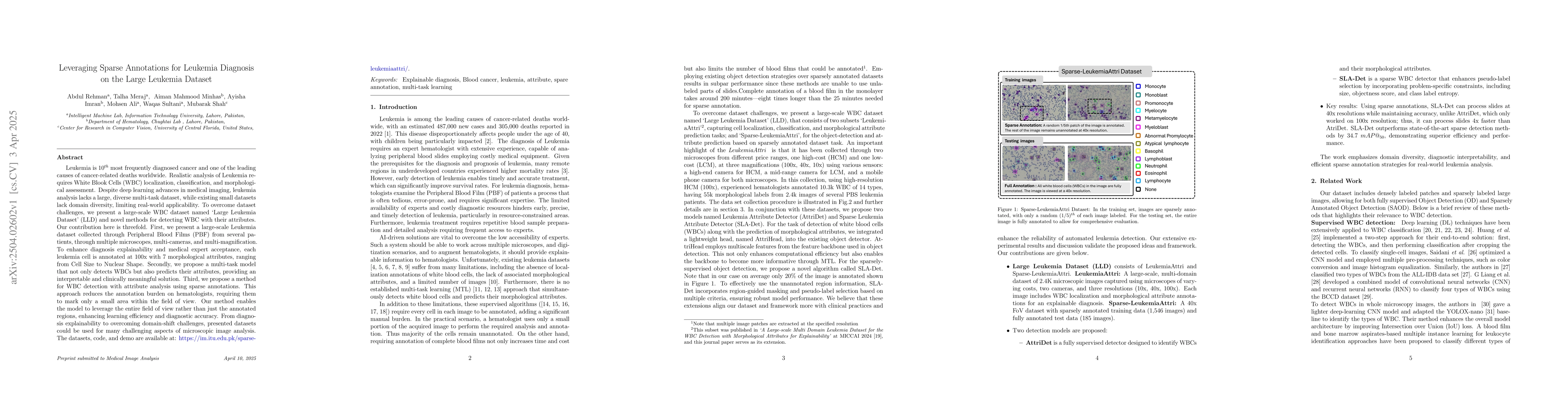
Leukemia is 10th most frequently diagnosed cancer and one of the leading causes of cancer related deaths worldwide. Realistic analysis of Leukemia requires White Blook Cells (WBC) localization, classi...
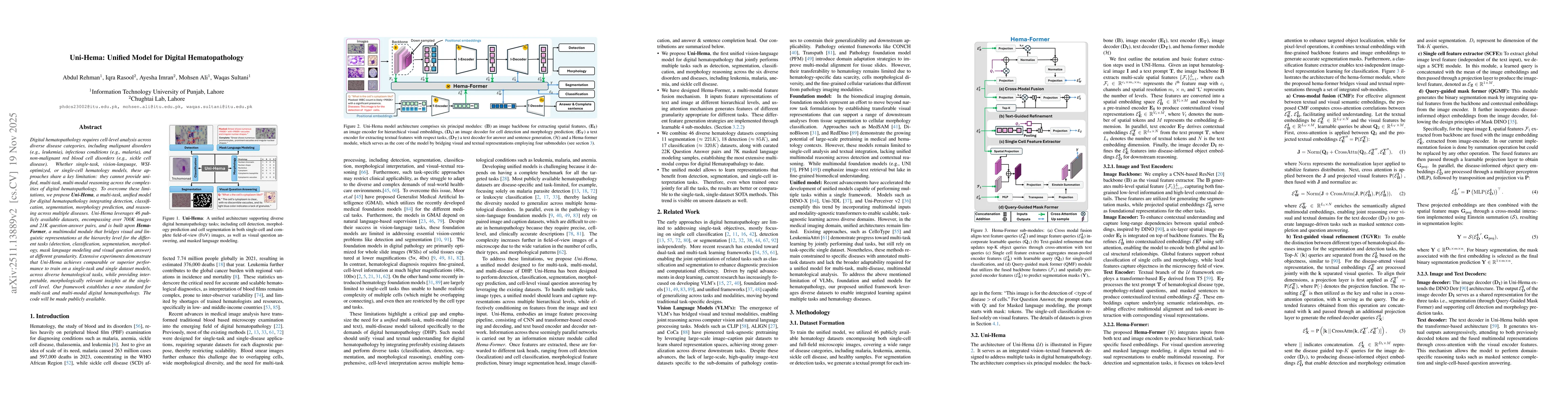
Digital hematopathology requires cell-level analysis across diverse disease categories, including malignant disorders (e.g., leukemia), infectious conditions (e.g., malaria), and non-malignant red blo...
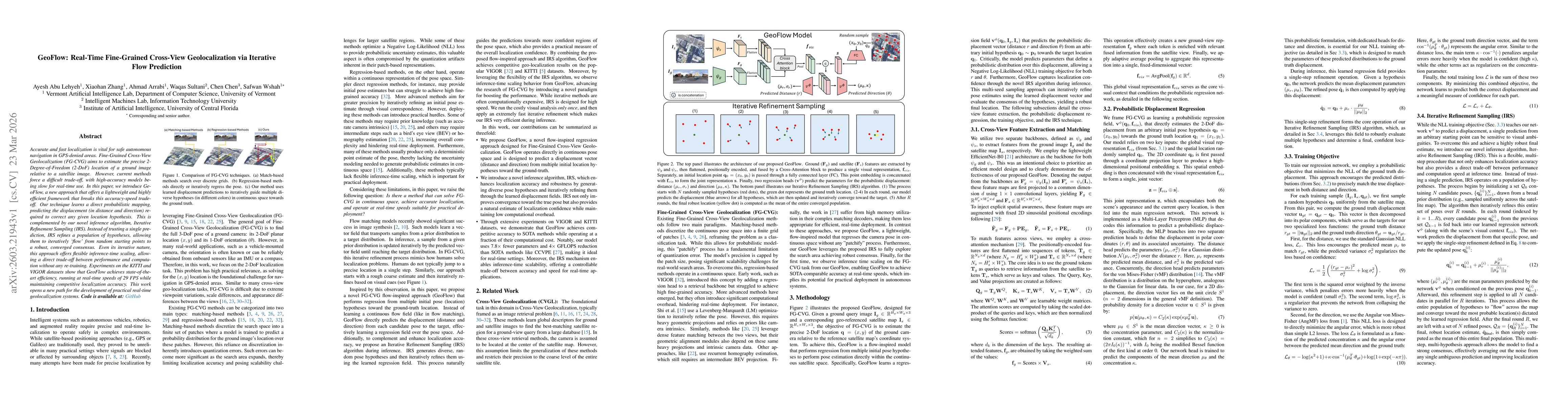
Accurate and fast localization is vital for safe autonomous navigation in GPS-denied areas. Fine-Grained Cross-View Geolocalization (FG-CVG) aims to estimate the precise 2-Degree-of-Freedom (2-DoF) lo...
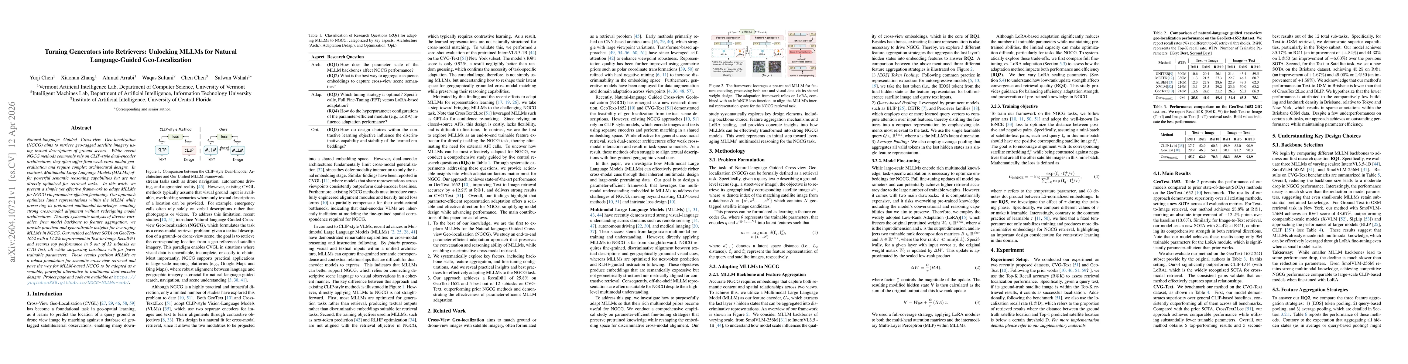
Natural-language Guided Cross-view Geo-localization (NGCG) aims to retrieve geo-tagged satellite imagery using textual descriptions of ground scenes. While recent NGCG methods commonly rely on CLIP-st...
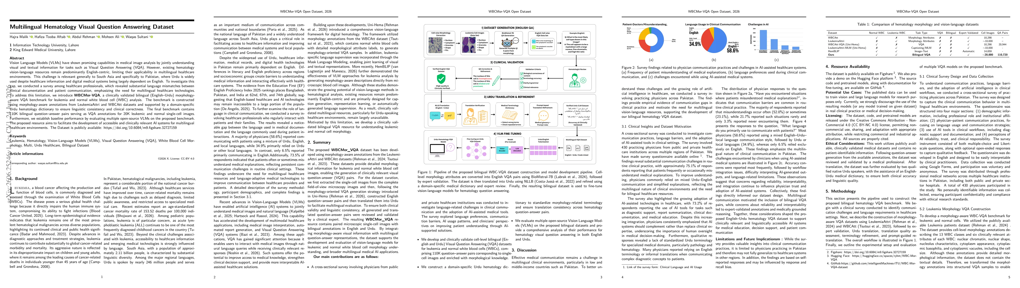
Vision Language Models (VLMs) have shown promising capabilities in medical image analysis by jointly understanding visual and textual information for tasks such as Visual Question Answering. However, ...