Academic Profile
Statistics
Similar Authors
Papers on arXiv
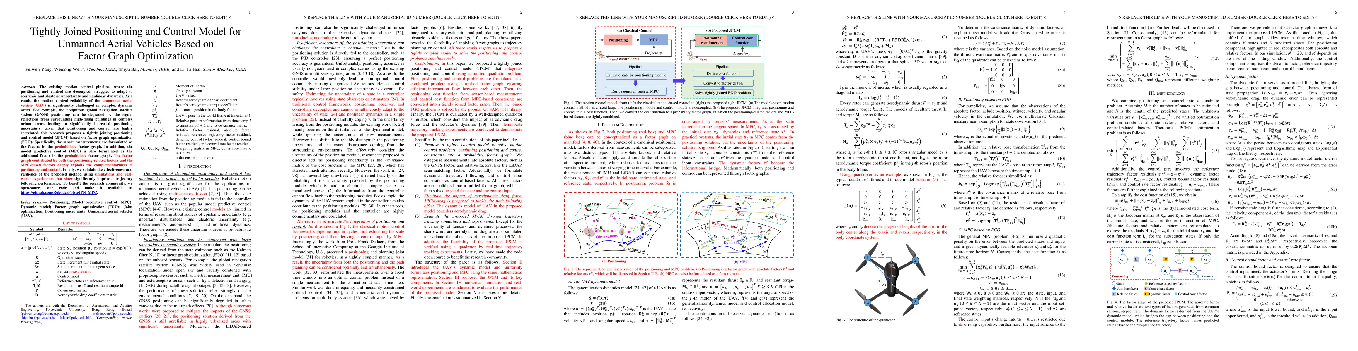
The execution of flight missions by unmanned aerial vehicles (UAV) primarily relies on navigation. In particular, the navigation pipeline has traditionally been divided into positioning and control,...
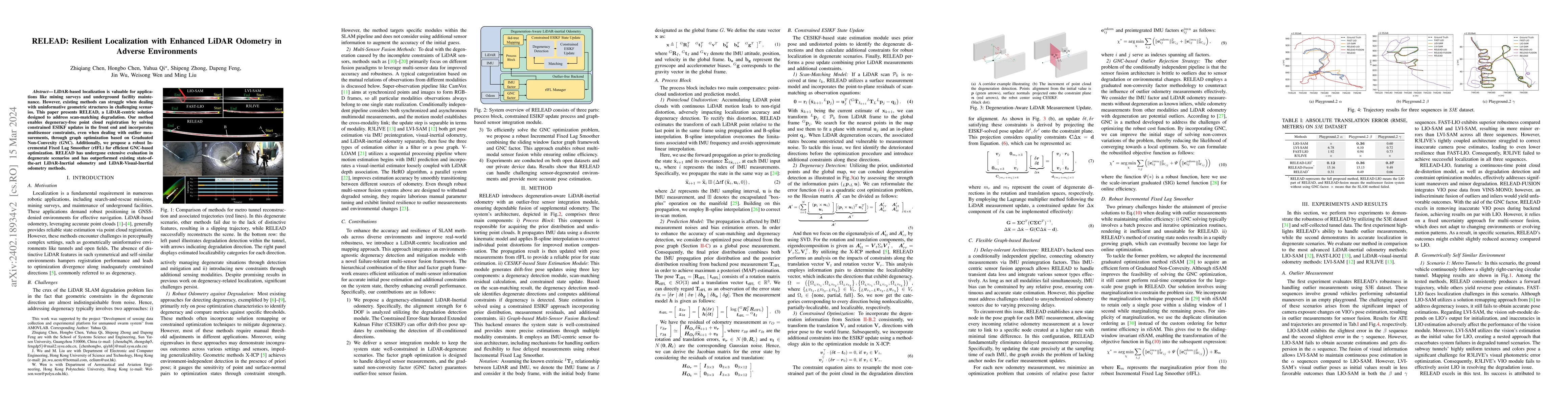
LiDAR-based localization is valuable for applications like mining surveys and underground facility maintenance. However, existing methods can struggle when dealing with uninformative geometric struc...
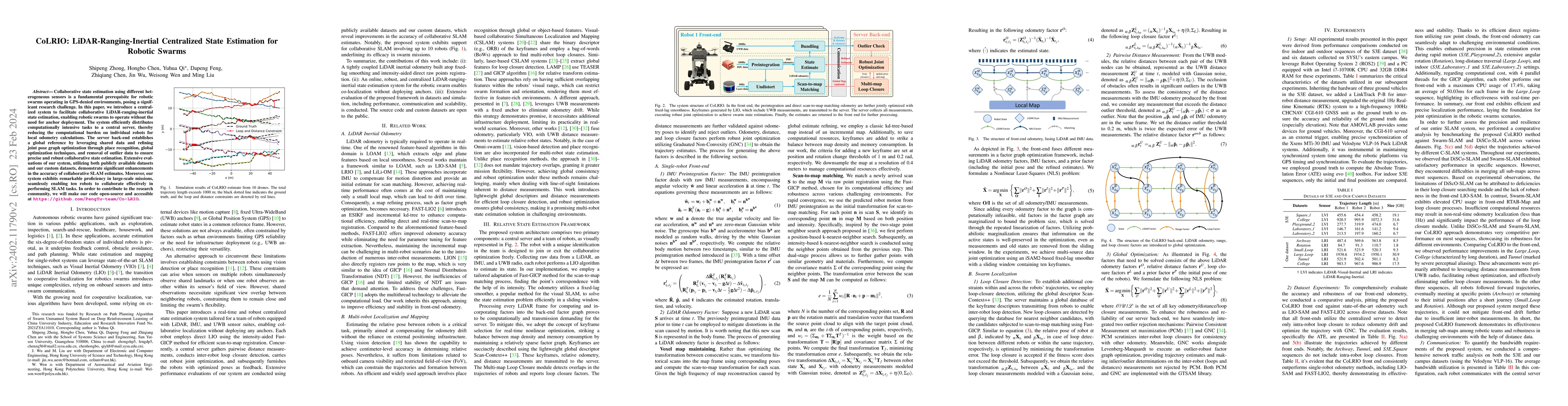
Collaborative state estimation using different heterogeneous sensors is a fundamental prerequisite for robotic swarms operating in GPS-denied environments, posing a significant research challenge. I...
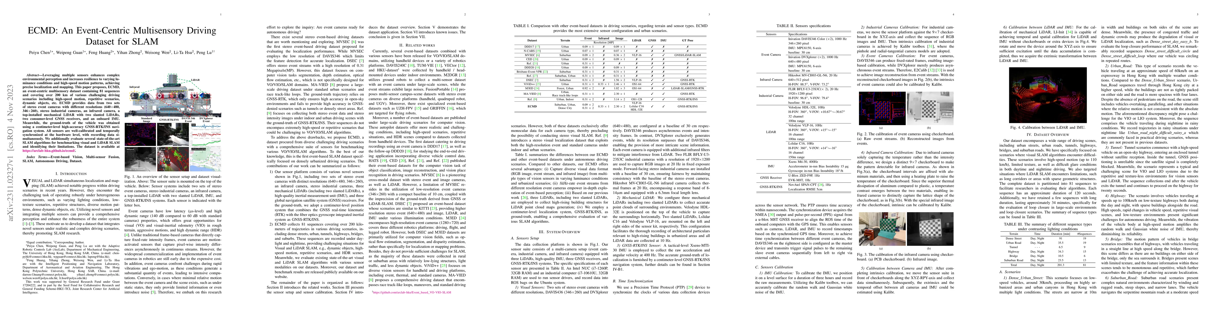
Leveraging multiple sensors enhances complex environmental perception and increases resilience to varying luminance conditions and high-speed motion patterns, achieving precise localization and mapp...
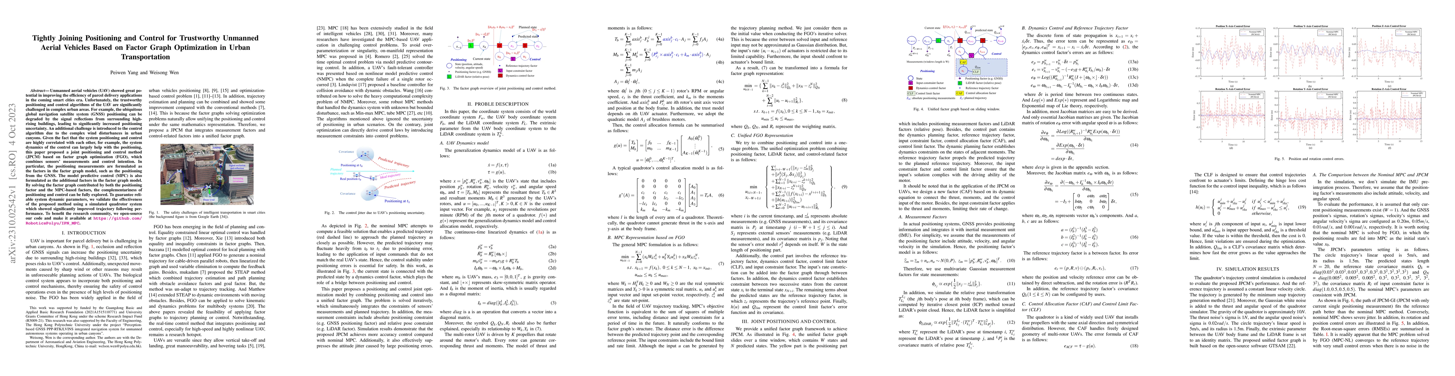
Unmanned aerial vehicles (UAV) showed great potential in improving the efficiency of parcel delivery applications in the coming smart cities era. Unfortunately, the trustworthy positioning and contr...
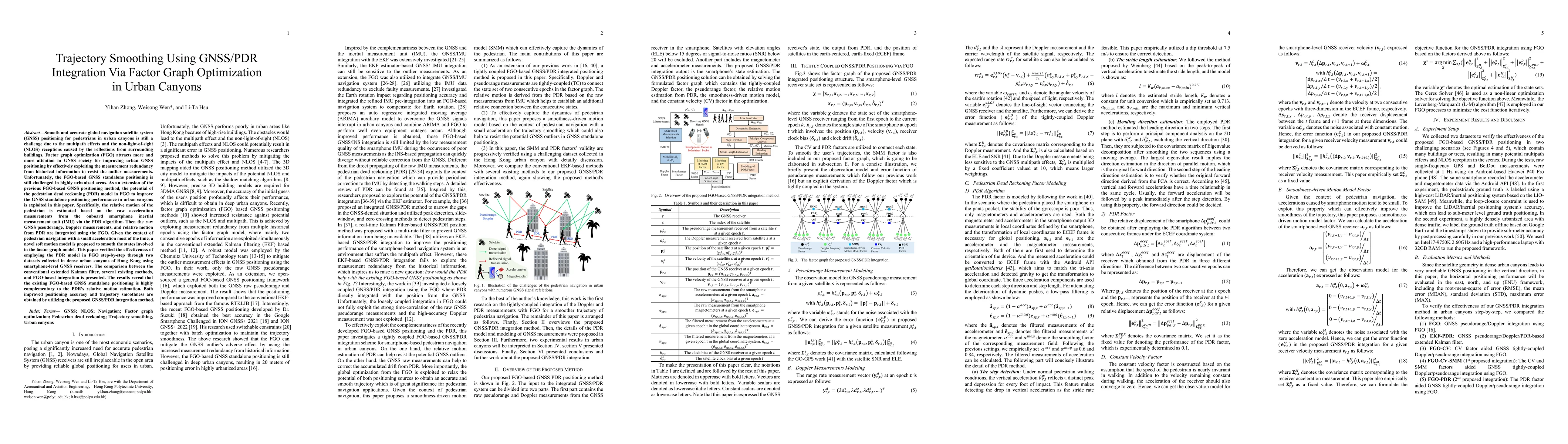
Accurate and smooth global navigation satellite system (GNSS) positioning for pedestrians in urban canyons is still a challenge due to the multipath effects and the non-light-of-sight (NLOS) recepti...
GNSS and LiDAR odometry are complementary as they provide absolute and relative positioning, respectively. Their integration in a loosely-coupled manner is straightforward but is challenged in urban...
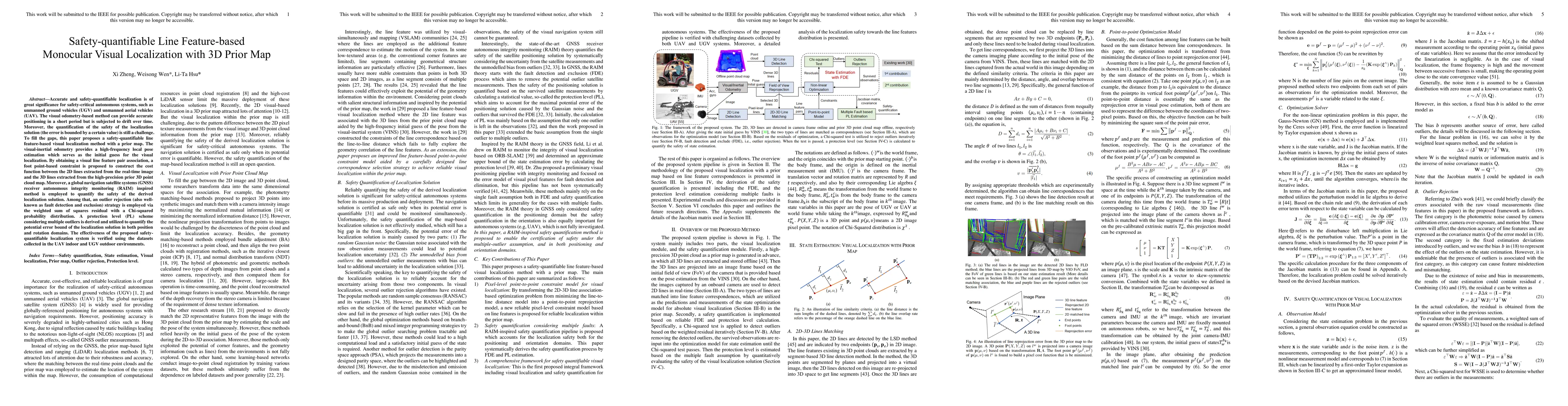
Accurate and safety-quantifiable localization is of great significance for safety-critical autonomous systems, such as unmanned ground vehicles (UGV) and unmanned aerial vehicles (UAV). The visual o...
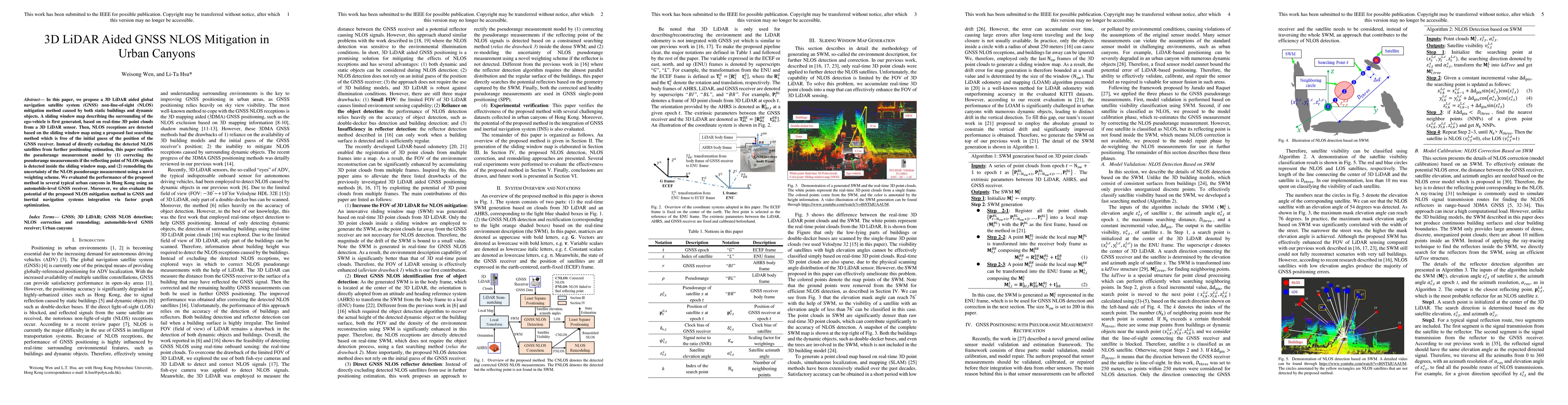
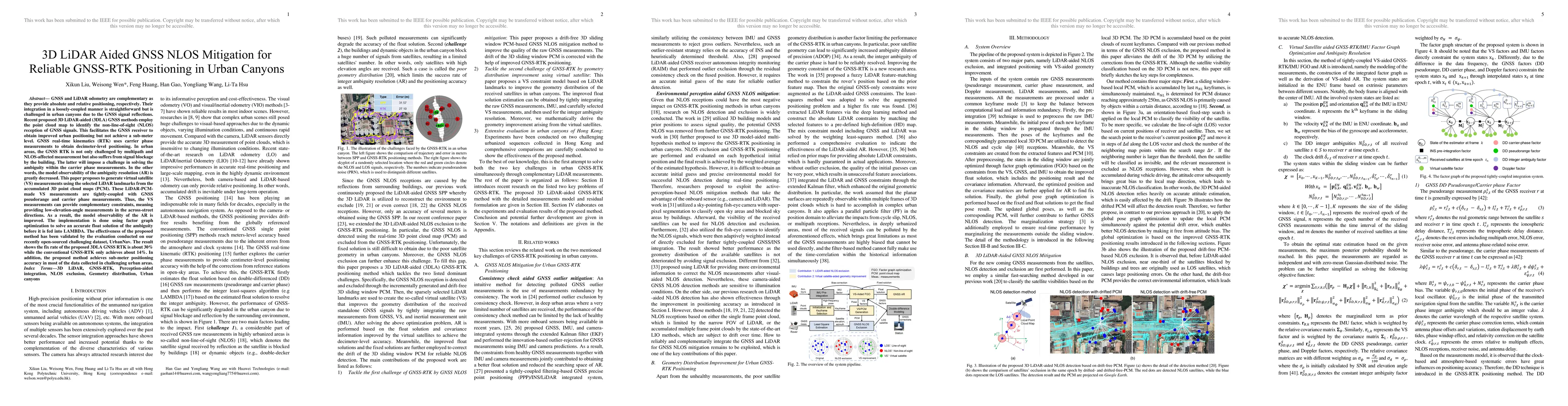
In this paper, we propose a 3D LiDAR aided global navigation satellite system (GNSS) non-line-of-sight (NLOS) mitigation method caused by both static buildings and dynamic objects. A sliding window ...
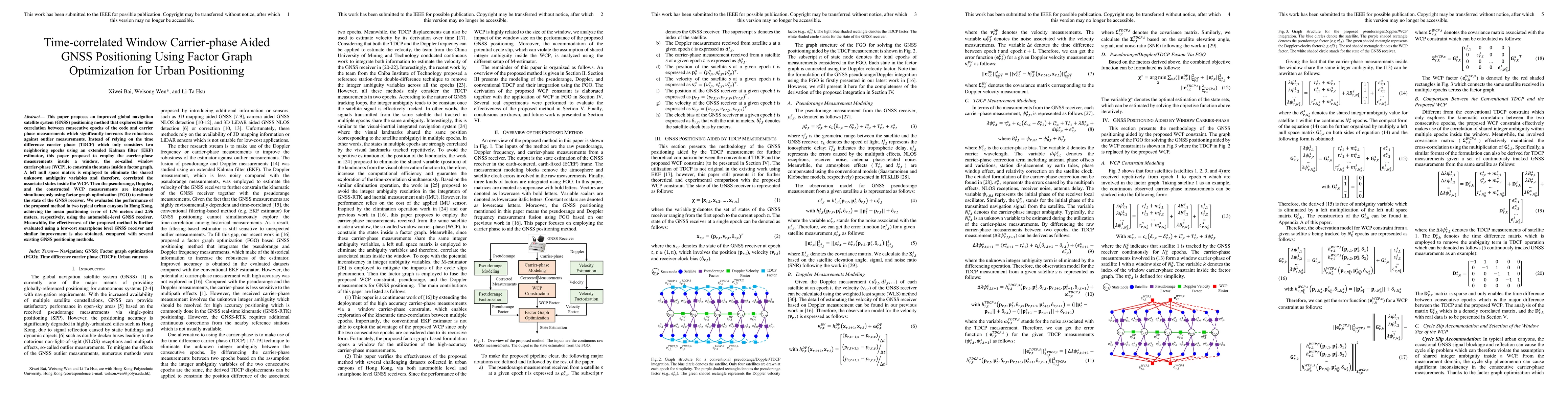
This paper proposes an improved global navigation satellite system (GNSS) positioning method that explores the time correlation between consecutive epochs of the code and carrier phase measurements ...
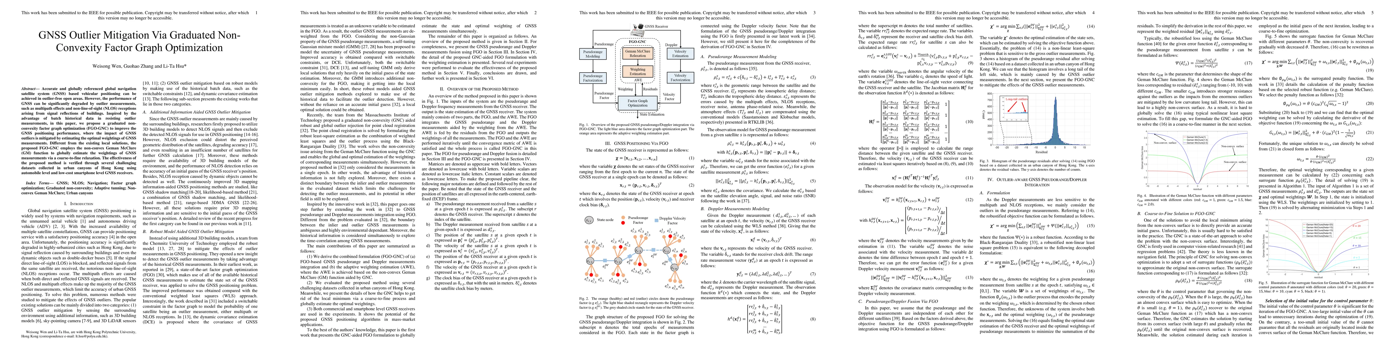
Accurate and globally referenced global navigation satellite system (GNSS) based vehicular positioning can be achieved in outlier-free open areas. However, the performance of GNSS can be significant...
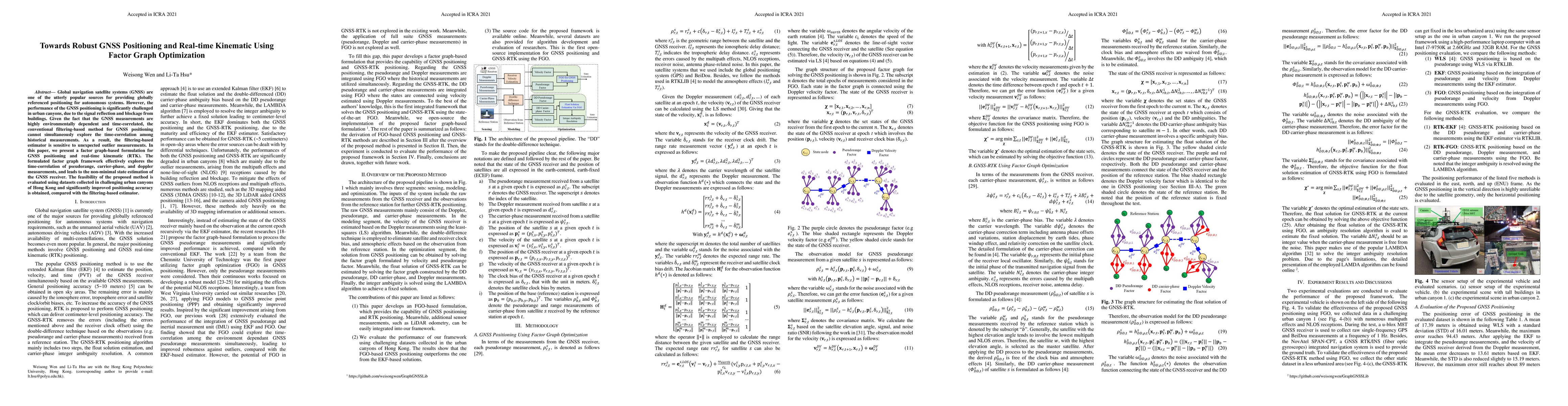
Global navigation satellite systems (GNSS) are one of the utterly popular sources for providing globally referenced positioning for autonomous systems. However, the performance of the GNSS positioni...
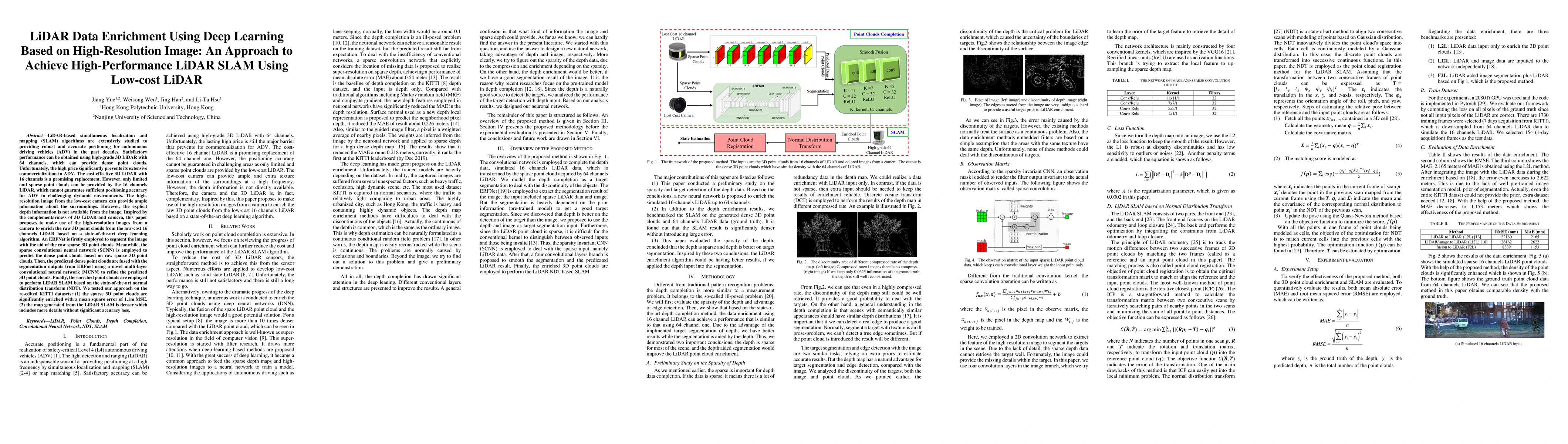
LiDAR-based SLAM algorithms are extensively studied to providing robust and accurate positioning for autonomous driving vehicles (ADV) in the past decades. Satisfactory performance can be obtained u...
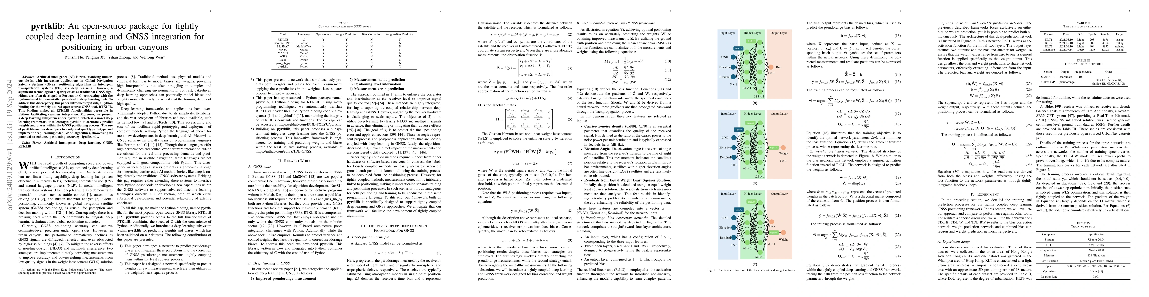
Artificial intelligence (AI) is revolutionizing numerous fields, with increasing applications in Global Navigation Satellite Systems (GNSS) positioning algorithms in intelligent transportation systems...
Fault detection is crucial to ensure the reliability of navigation systems. However, mainstream fault detection methods are developed based on Gaussian assumptions on nominal errors, while current att...
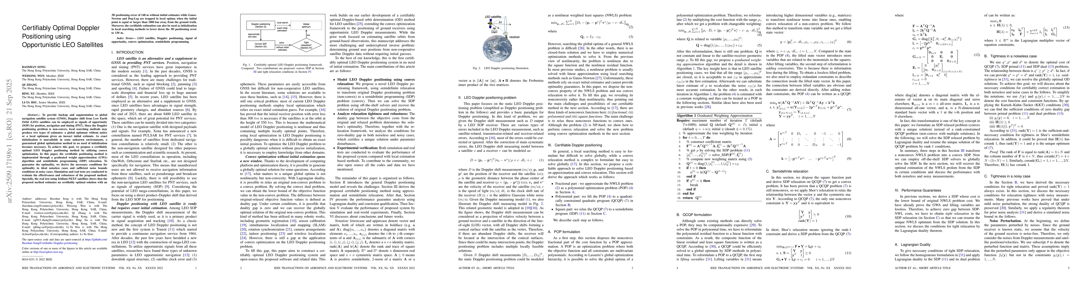
To provide backup and augmentation to global navigation satellite system (GNSS), Doppler shift from Low Earth Orbit (LEO) satellites can be employed as signals of opportunity (SOP) for position, navig...
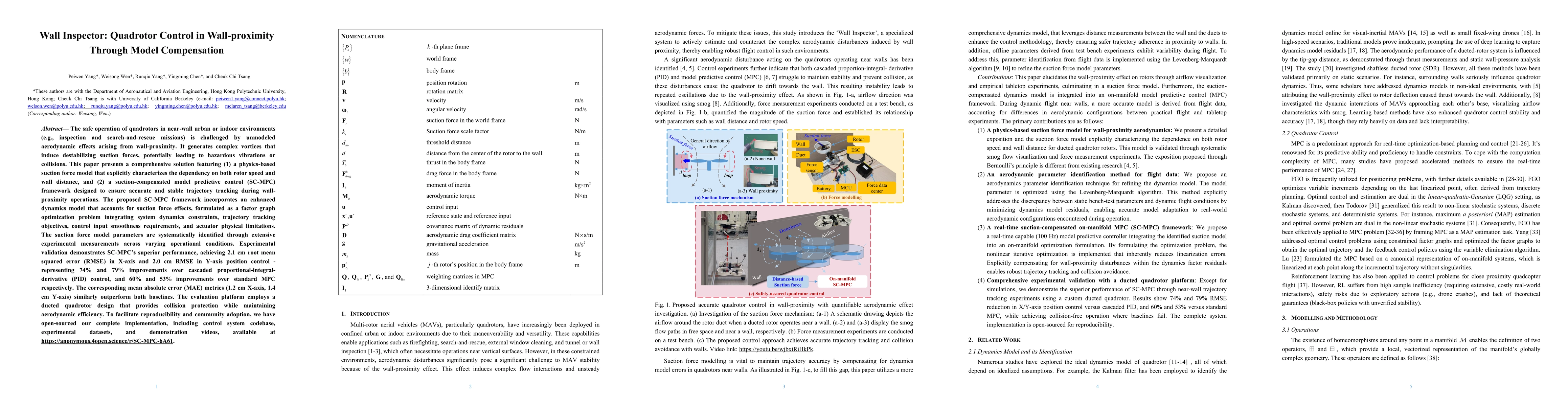
The safe operation of quadrotors in near-wall urban or indoor environments (e.g., inspection and search-and-rescue missions) is challenged by unmodeled aerodynamic effects arising from wall-proximity....
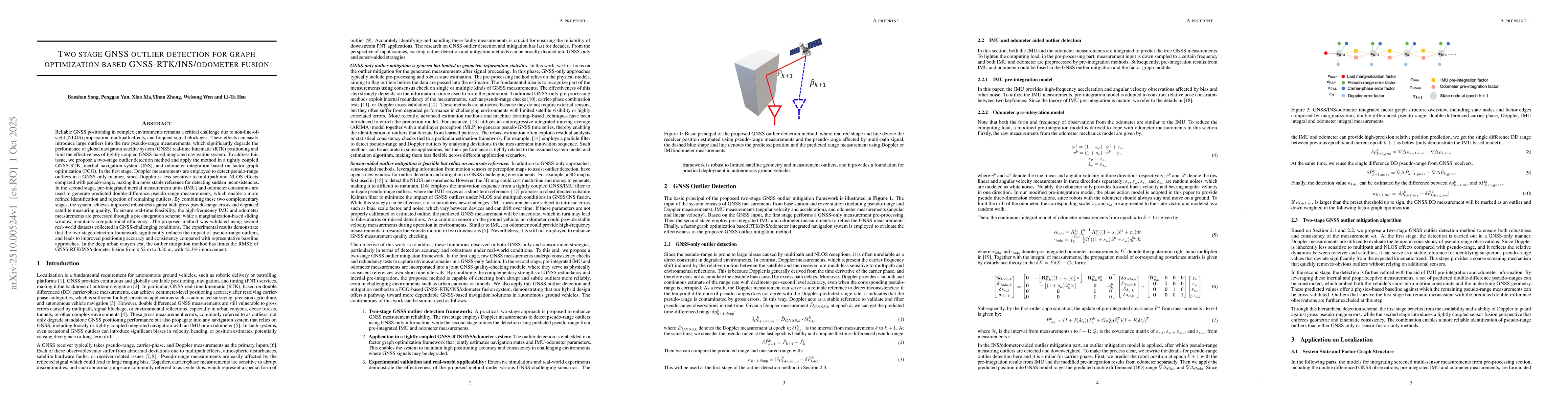
Reliable GNSS positioning in complex environments remains a critical challenge due to non-line-of-sight (NLOS) propagation, multipath effects, and frequent signal blockages. These effects can easily i...
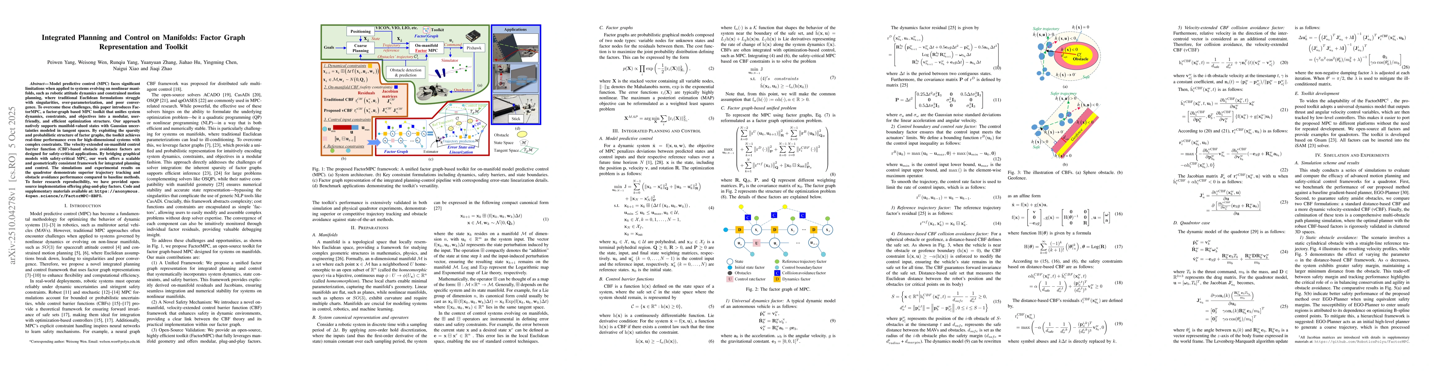
Model predictive control (MPC) faces significant limitations when applied to systems evolving on nonlinear manifolds, such as robotic attitude dynamics and constrained motion planning, where tradition...
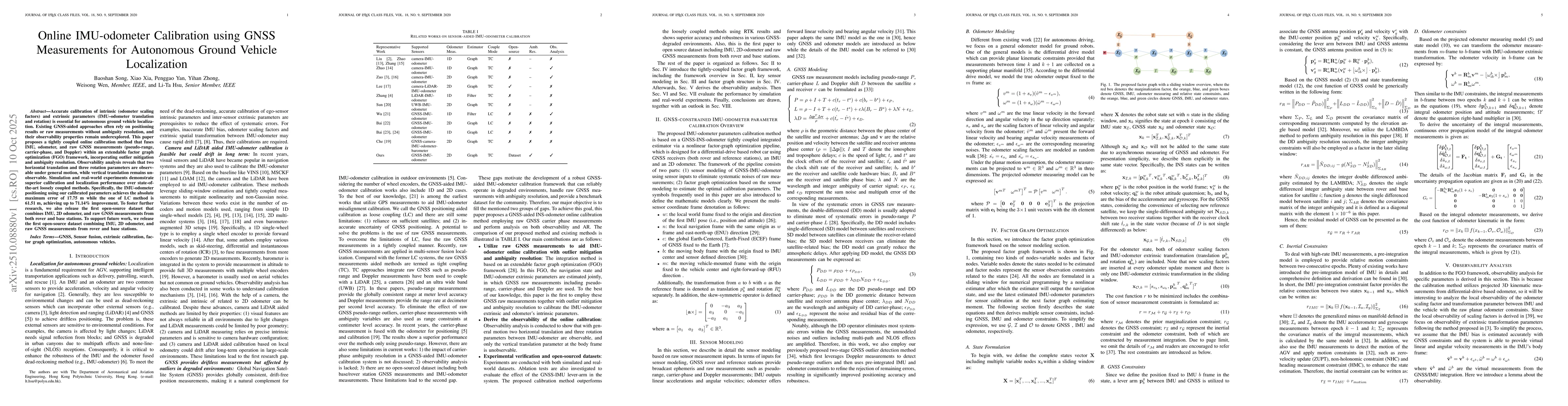
Accurate calibration of intrinsic (odometer scaling factors) and extrinsic parameters (IMU-odometer translation and rotation) is essential for autonomous ground vehicle localization. Existing GNSS-aid...
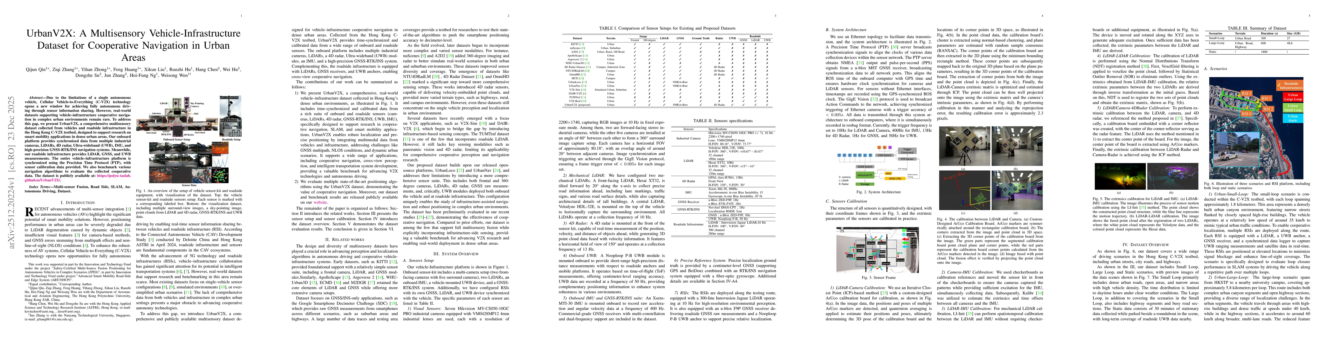
Due to the limitations of a single autonomous vehicle, Cellular Vehicle-to-Everything (C-V2X) technology opens a new window for achieving fully autonomous driving through sensor information sharing. H...
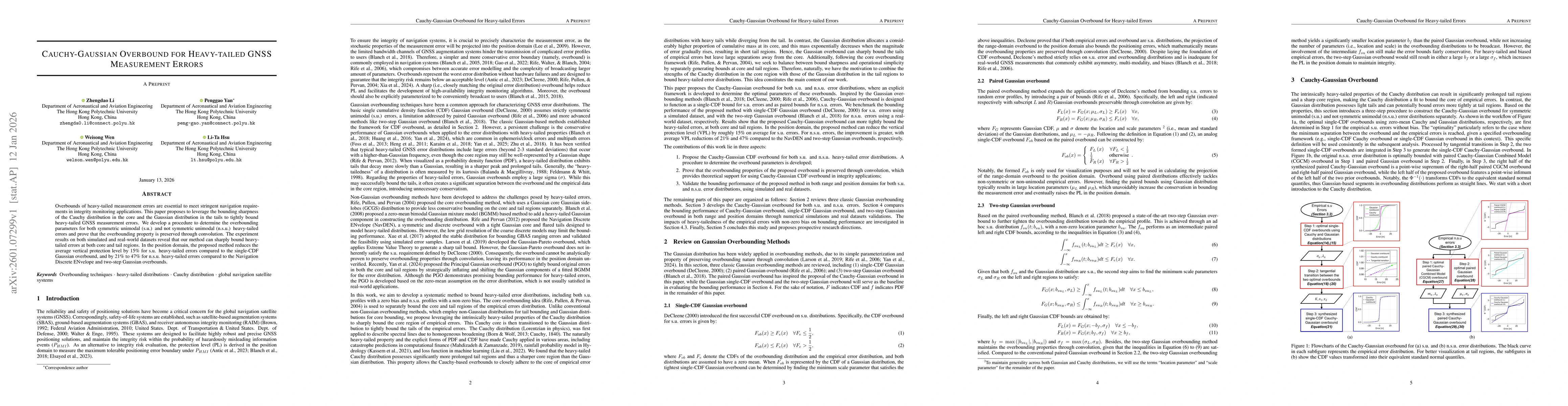
Overbounds of heavy-tailed measurement errors are essential to meet stringent navigation requirements in integrity monitoring applications. This paper proposes to leverage the bounding sharpness of th...
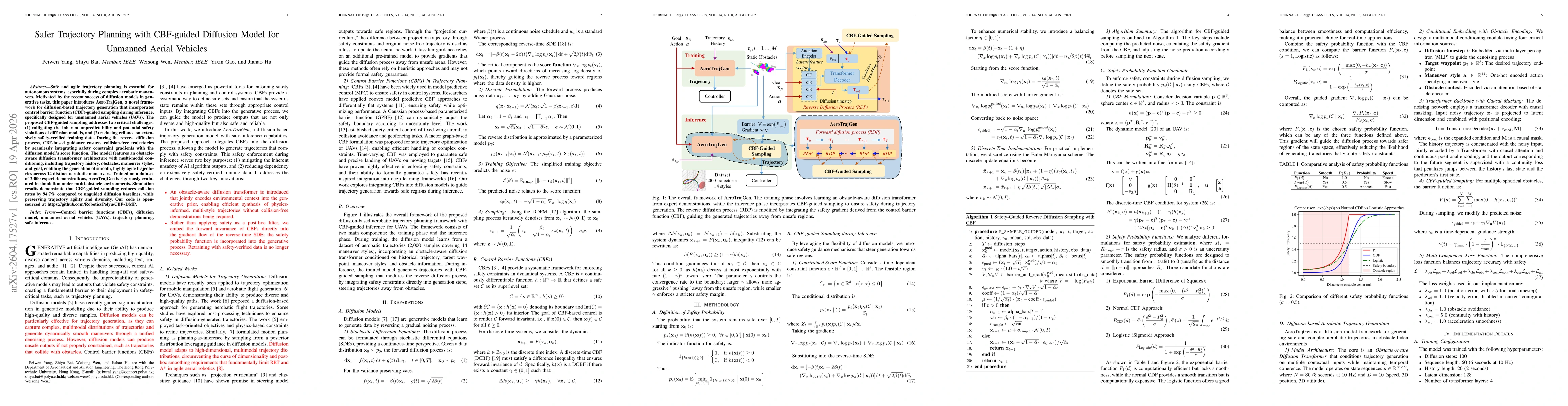
Safe and agile trajectory planning is essential for autonomous systems, especially during complex aerobatic maneuvers. Motivated by the recent success of diffusion models in generative tasks, this pap...