Xianghui Ze
6 papers on arXiv
Academic Profile
Statistics
Similar Authors
Papers on arXiv
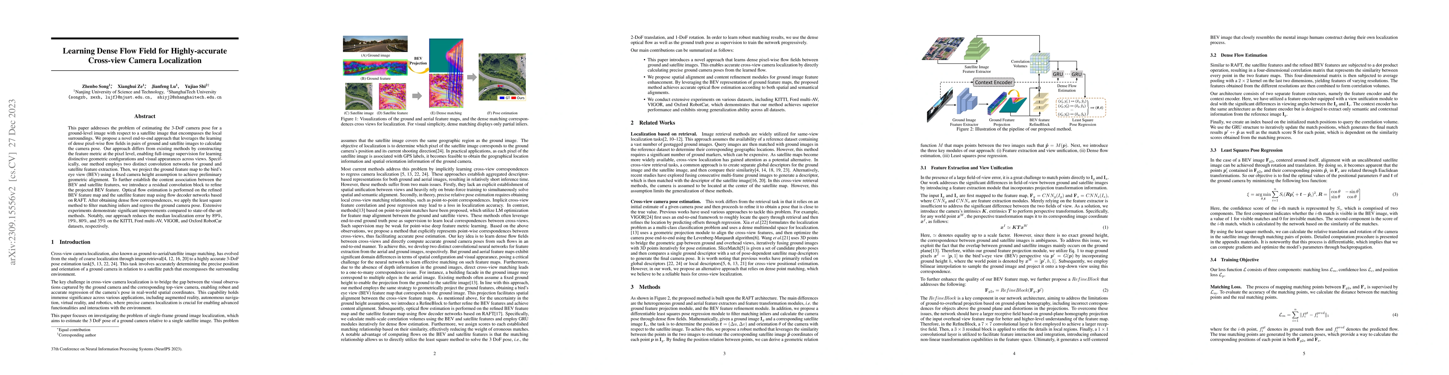
Learning Dense Flow Field for Highly-accurate Cross-view Camera Localization
This paper addresses the problem of estimating the 3-DoF camera pose for a ground-level image with respect to a satellite image that encompasses the local surroundings. We propose a novel end-to-end...
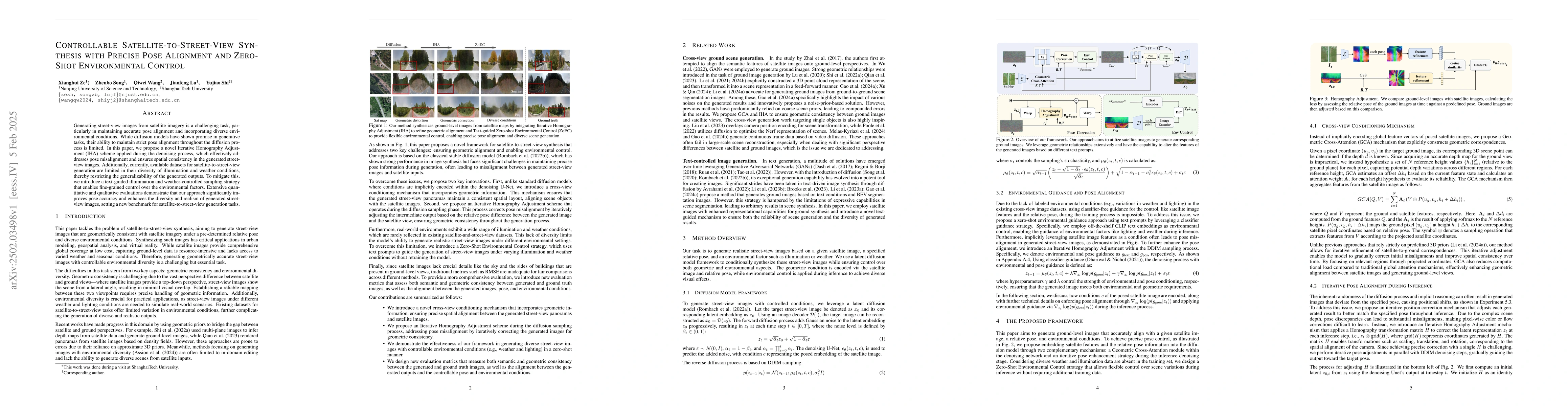
Controllable Satellite-to-Street-View Synthesis with Precise Pose Alignment and Zero-Shot Environmental Control
Generating street-view images from satellite imagery is a challenging task, particularly in maintaining accurate pose alignment and incorporating diverse environmental conditions. While diffusion mode...
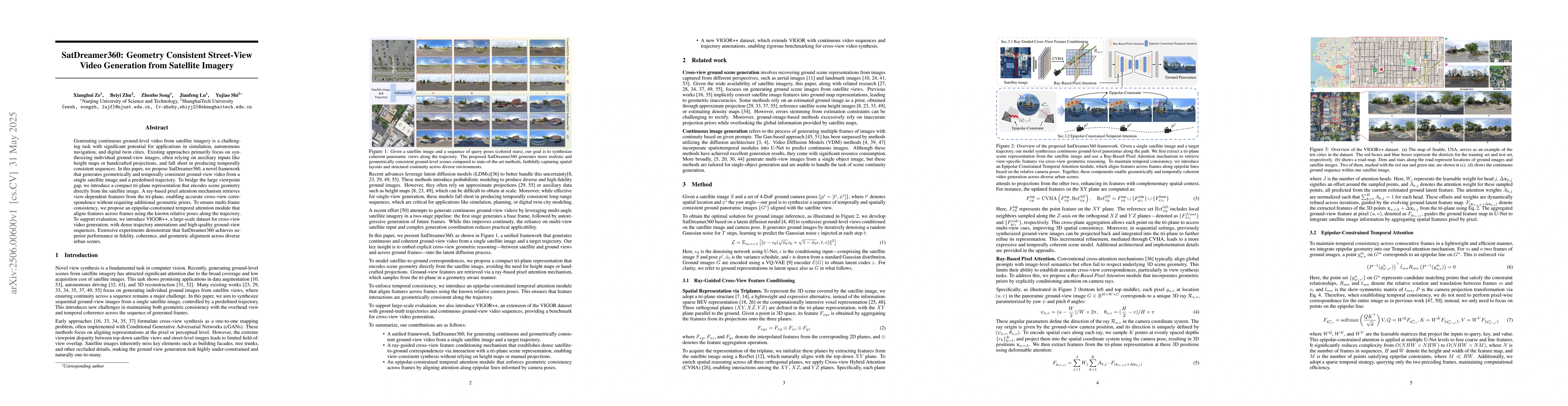
SatDreamer360: Geometry Consistent Street-View Video Generation from Satellite Imagery
Generating continuous ground-level video from satellite imagery is a challenging task with significant potential for applications in simulation, autonomous navigation, and digital twin cities. Existin...
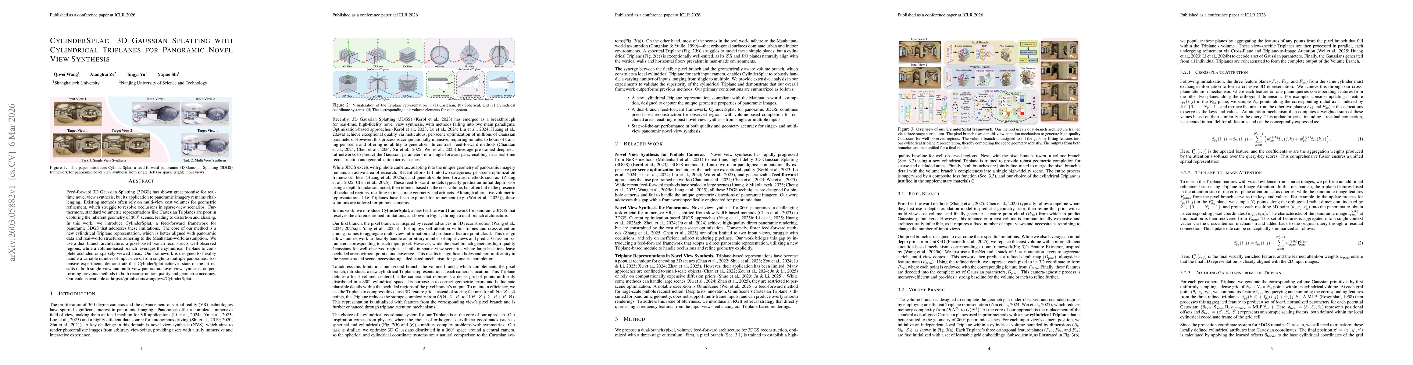
CylinderSplat: 3D Gaussian Splatting with Cylindrical Triplanes for Panoramic Novel View Synthesis
Feed-forward 3D Gaussian Splatting (3DGS) has shown great promise for real-time novel view synthesis, but its application to panoramic imagery remains challenging. Existing methods often rely on multi...
Seeing Across Skies and Streets: Feedforward 3D Reconstruction from Satellite, Drone, and Ground Images
Cross-view localization classically asks: where does this ground image lie on the satellite tile? Existing methods are typically limited to 3-DoF estimates -- an $(x,y)$ position and a yaw angle -- be...
Empowering Feed-Forward Reconstruction Models with Metric Scale via Satellite Images
Feed-forward 3D reconstruction models have recently shown strong generalization across diverse scenes, yet most of them recover geometry only up to an unknown global scale. This scale ambiguity limits...