Academic Profile
Statistics
Similar Authors
Papers on arXiv
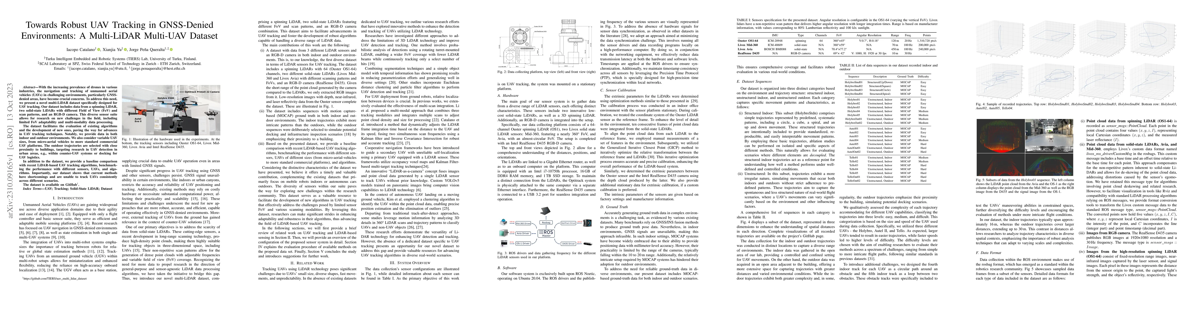
With the increasing prevalence of drones in various industries, the navigation and tracking of unmanned aerial vehicles (UAVs) in challenging environments, particularly GNSS-denied areas, have becom...
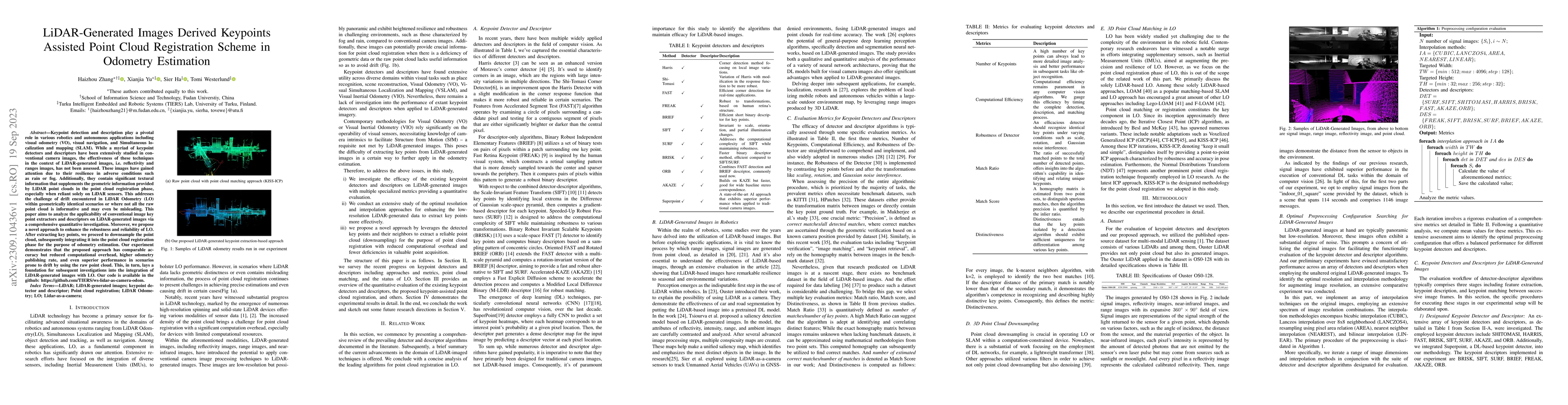
Keypoint detection and description play a pivotal role in various robotics and autonomous applications including visual odometry (VO), visual navigation, and Simultaneous localization and mapping (S...
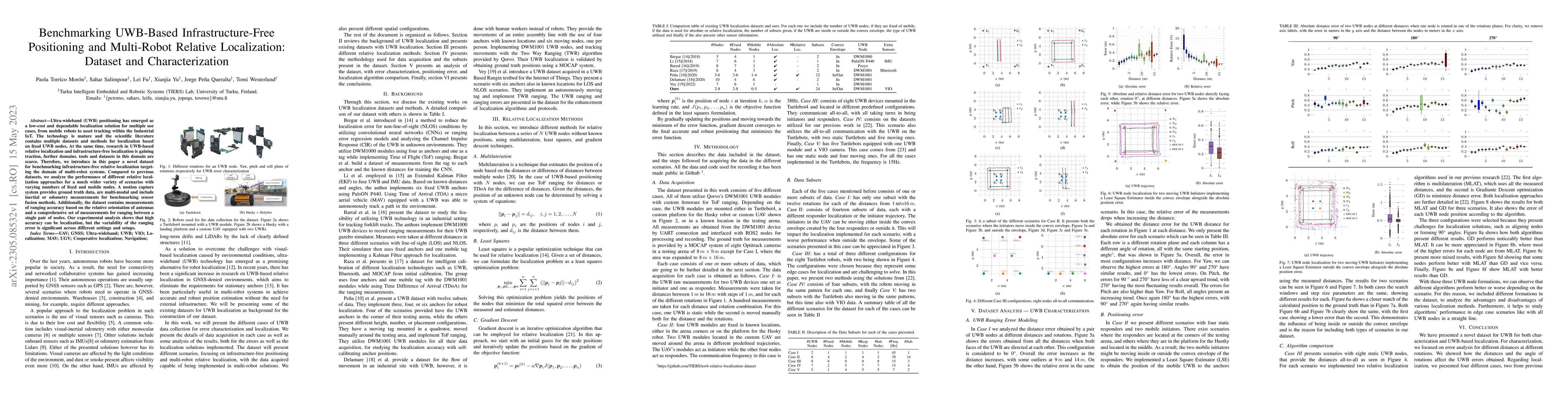
Ultra-wideband (UWB) positioning has emerged as a low-cost and dependable localization solution for multiple use cases, from mobile robots to asset tracking within the Industrial IoT. The technology...
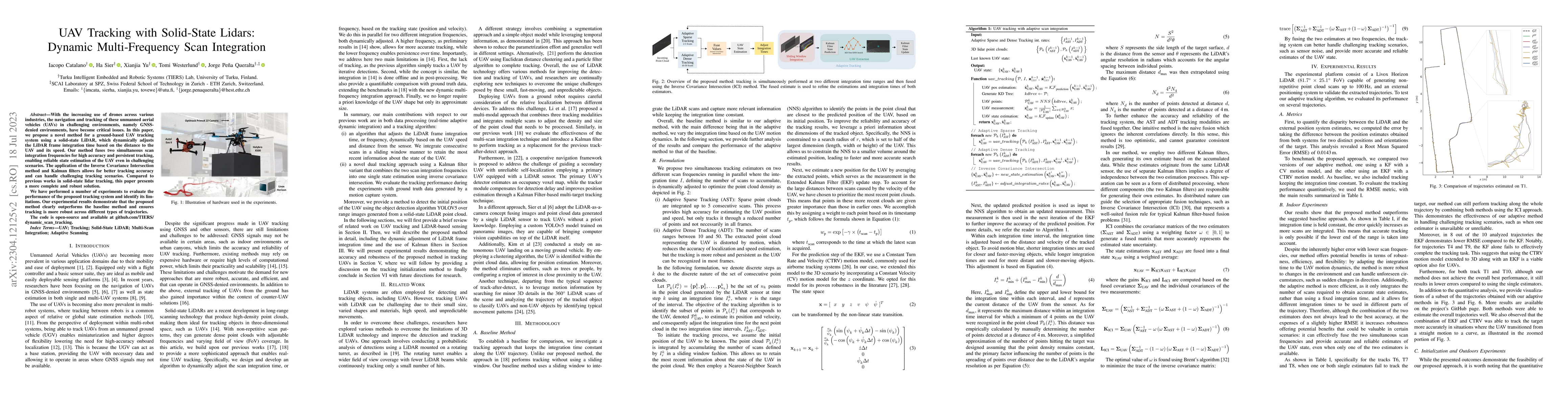
With the increasing use of drones across various industries, the navigation and tracking of these unmanned aerial vehicles (UAVs) in challenging environments (such as GNSS-denied environments) have ...
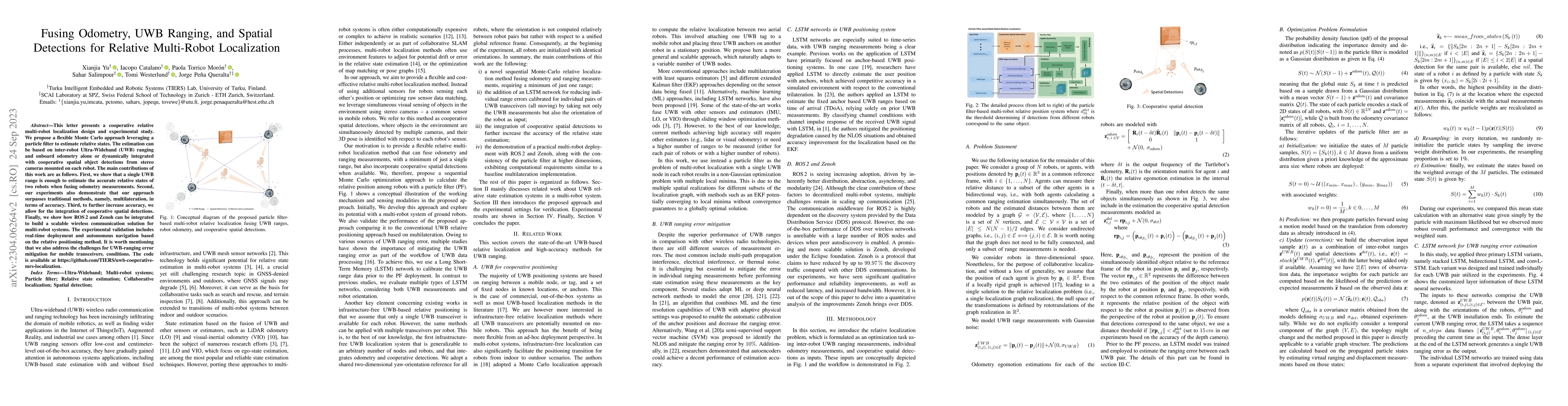
This letter presents a cooperative relative multi-robot localization design and experimental study. We propose a flexible Monte Carlo approach leveraging a particle filter to estimate relative state...
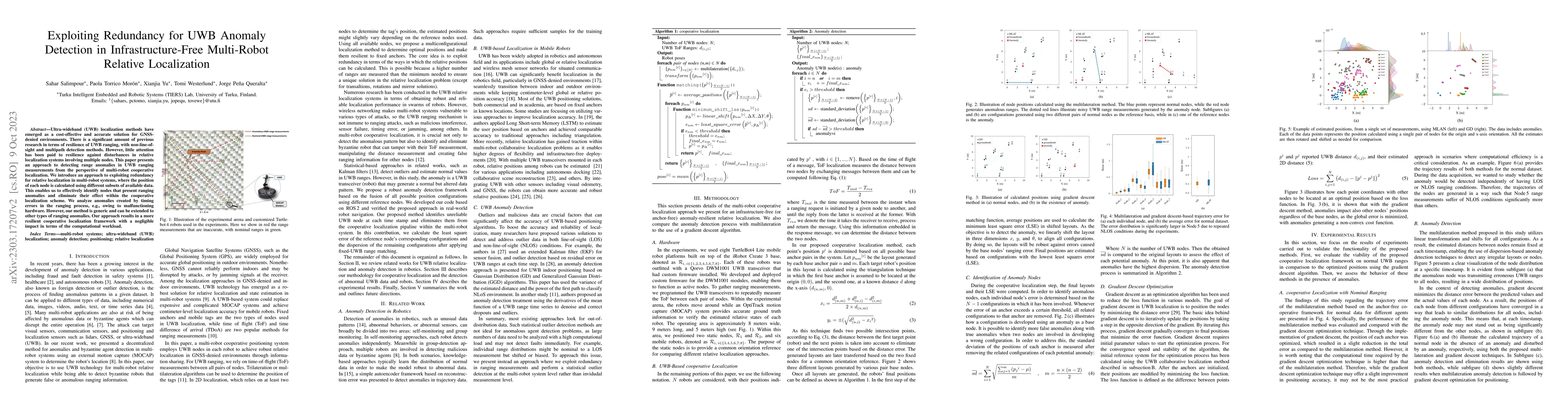
Ultra-wideband (UWB) localization methods have emerged as a cost-effective and accurate solution for GNSS-denied environments. There is a significant amount of previous research in terms of resilien...
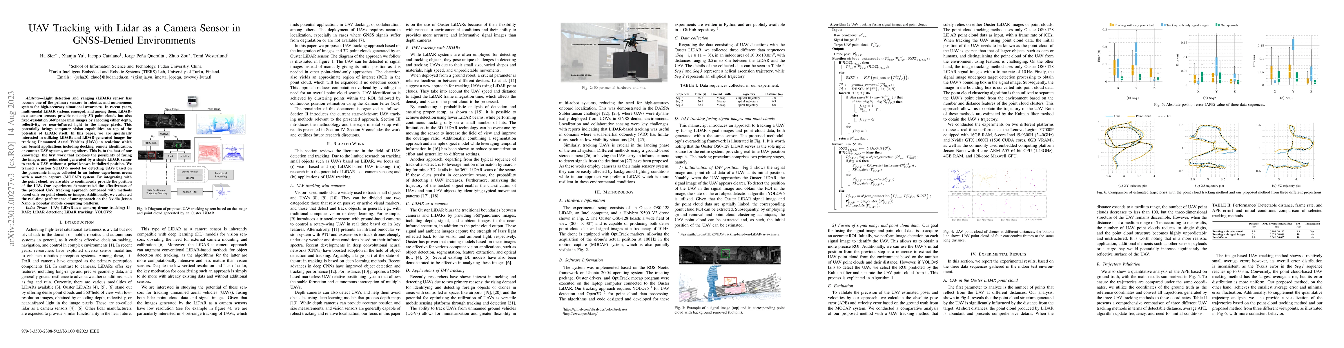
LiDAR has become one of the primary sensors in robotics and autonomous system for high-accuracy situational awareness. In recent years, multi-modal LiDAR systems emerged, and among them, LiDAR-as-a-...
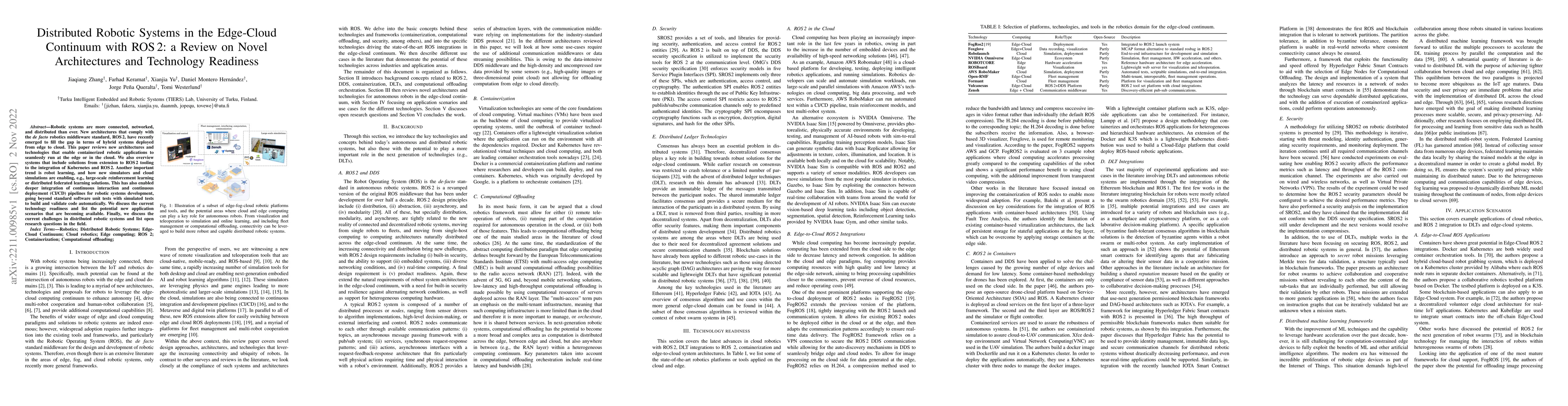
Robotic systems are more connected, networked, and distributed than ever. New architectures that comply with the \textit{de facto} robotics middleware standard, ROS\,2, have recently emerged to fill...
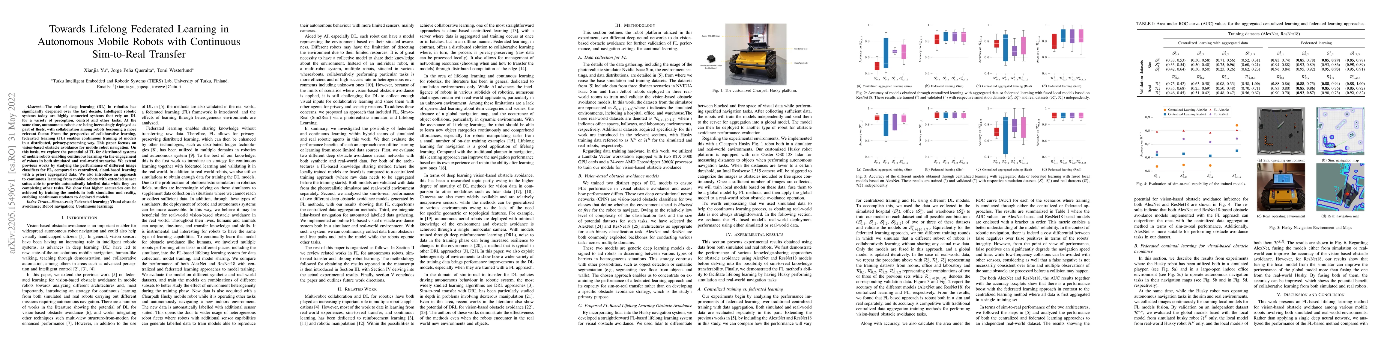
The role of deep learning (DL) in robotics has significantly deepened over the last decade. Intelligent robotic systems today are highly connected systems that rely on DL for a variety of perception...
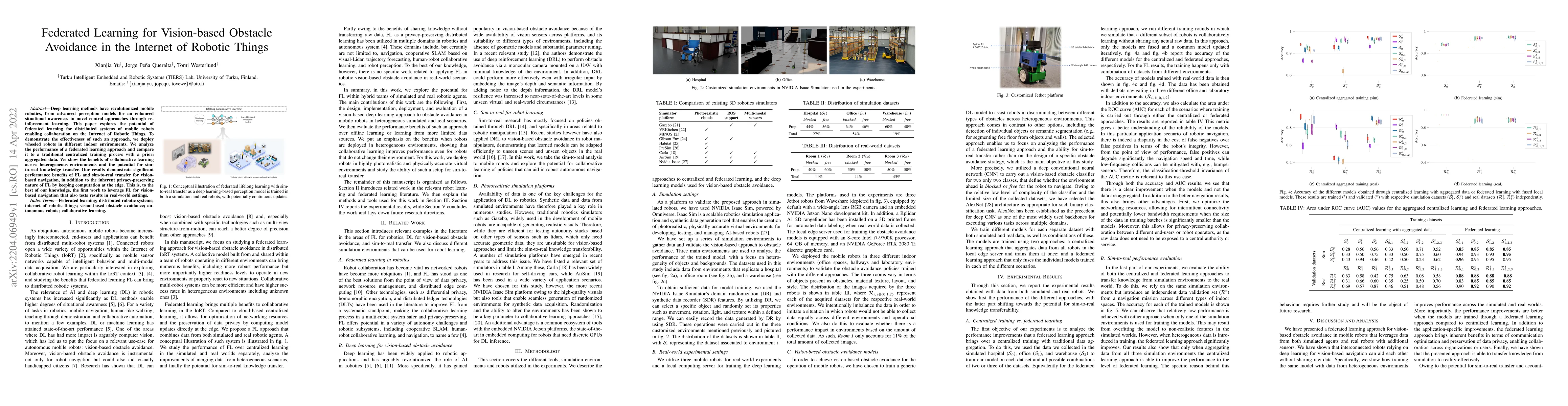
Deep learning methods have revolutionized mobile robotics, from advanced perception models for an enhanced situational awareness to novel control approaches through reinforcement learning. This pape...
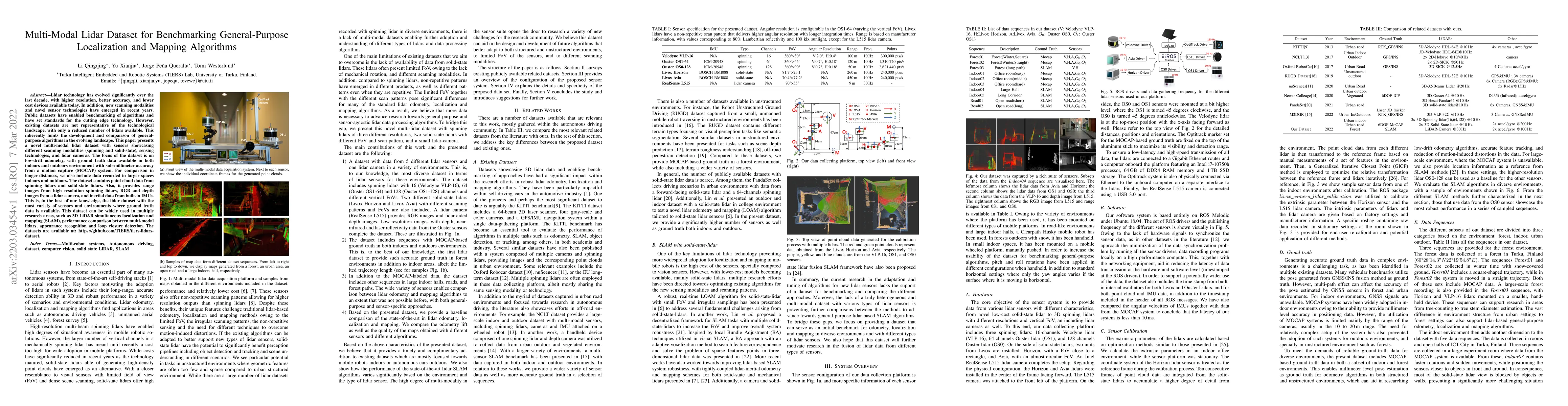
Lidar technology has evolved significantly over the last decade, with higher resolution, better accuracy, and lower cost devices available today. In addition, new scanning modalities and novel senso...
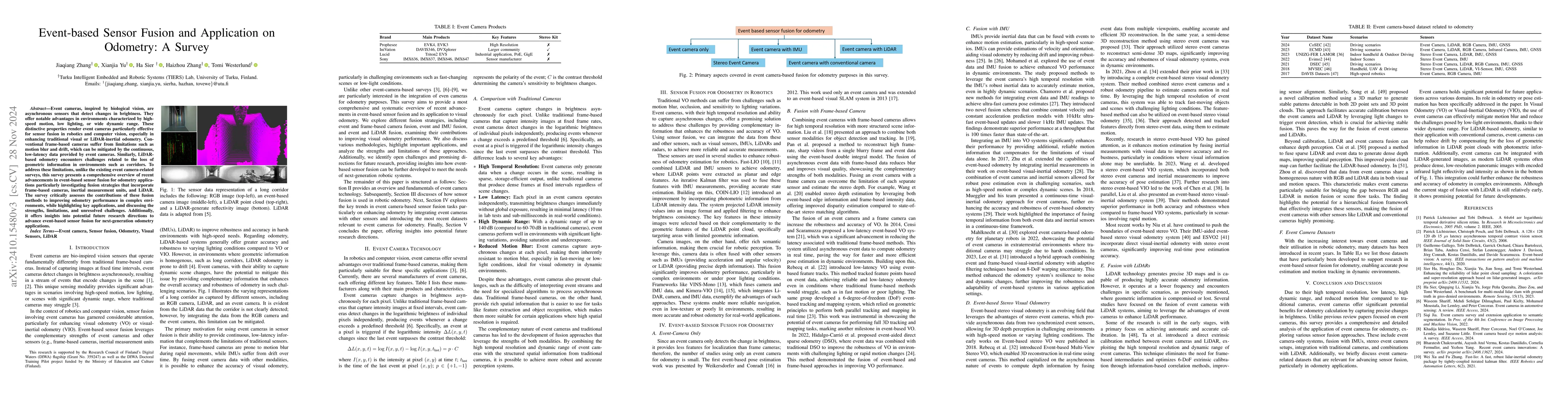
Event cameras, inspired by biological vision, are asynchronous sensors that detect changes in brightness, offering notable advantages in environments characterized by high-speed motion, low lighting, ...
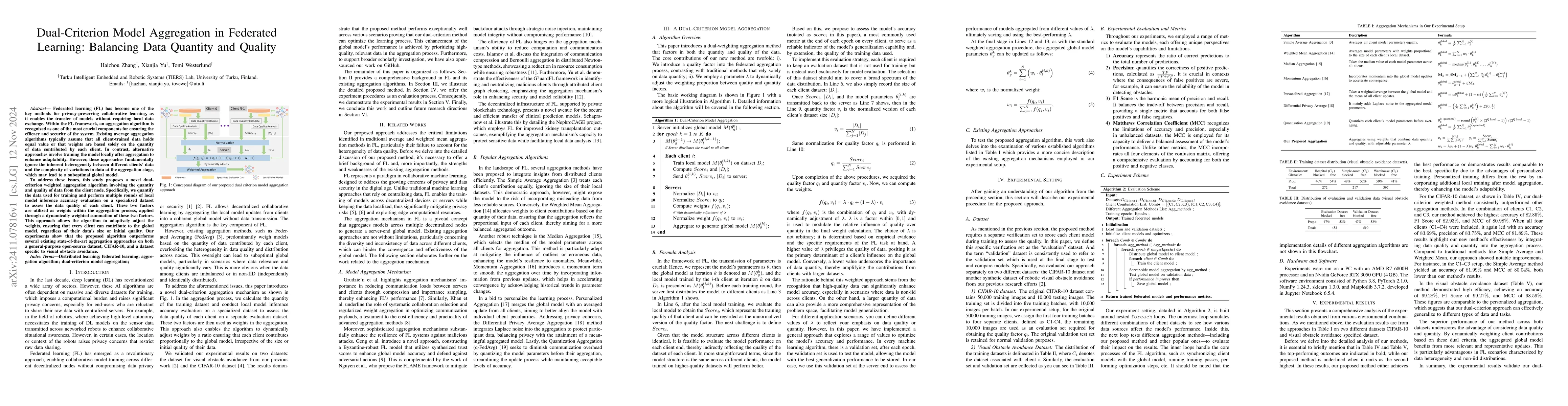
Federated learning (FL) has become one of the key methods for privacy-preserving collaborative learning, as it enables the transfer of models without requiring local data exchange. Within the FL frame...
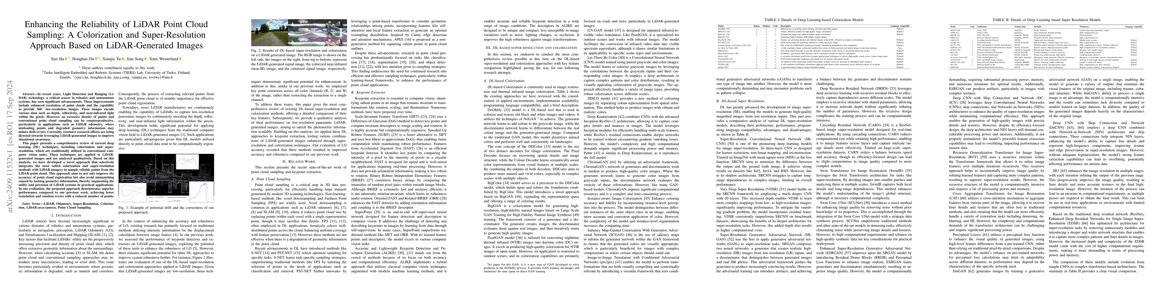
In recent years, Light Detection and Ranging (LiDAR) technology, a critical sensor in robotics and autonomous systems, has seen significant advancements. These improvements include enhanced resolution...
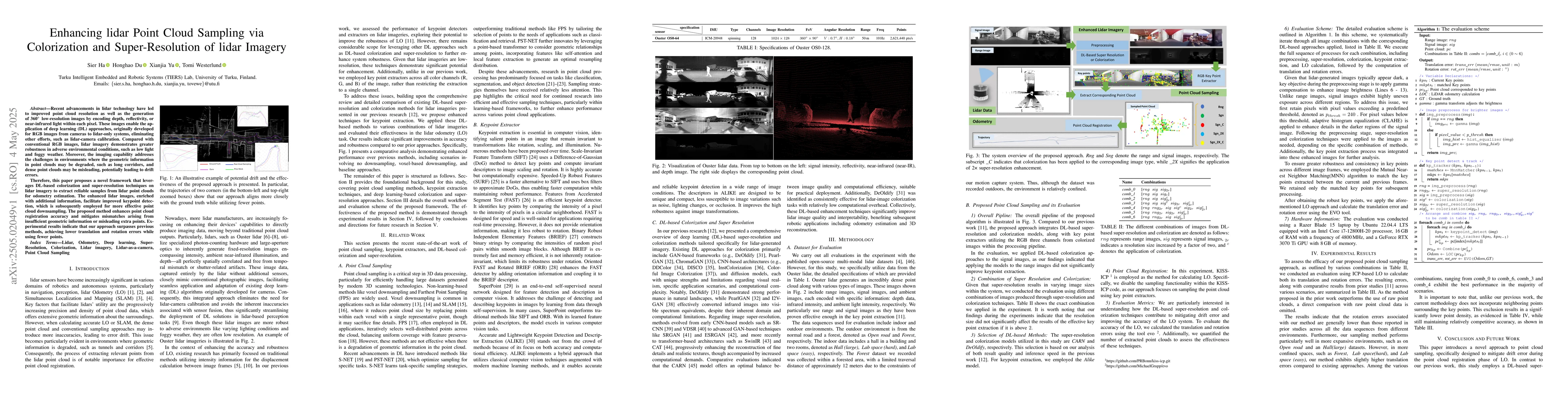
Recent advancements in lidar technology have led to improved point cloud resolution as well as the generation of 360 degrees, low-resolution images by encoding depth, reflectivity, or near-infrared li...
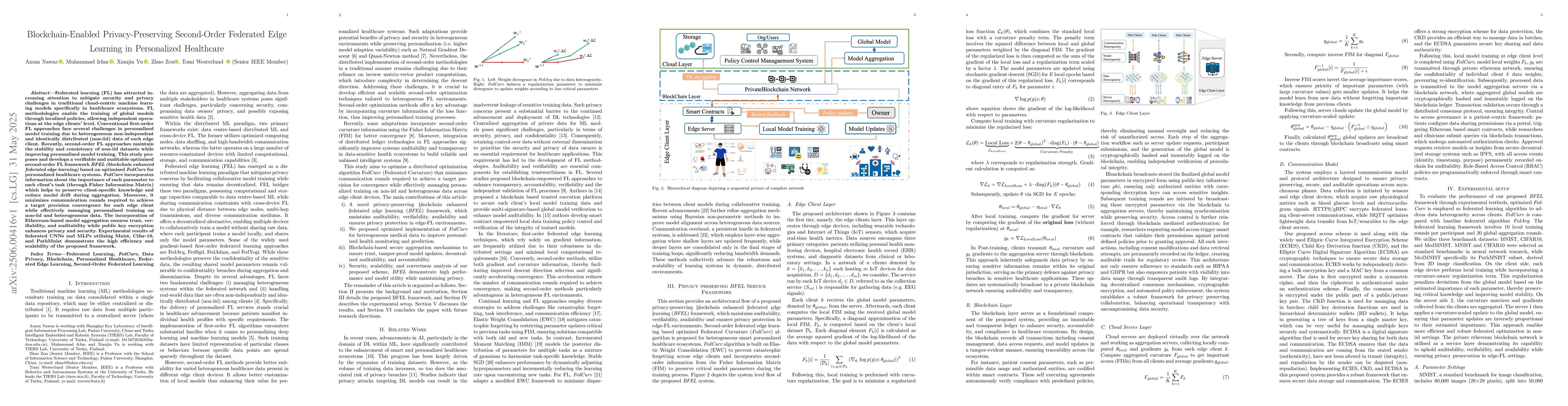
Federated learning (FL) has attracted increasing attention to mitigate security and privacy challenges in traditional cloud-centric machine learning models specifically in healthcare ecosystems. FL me...
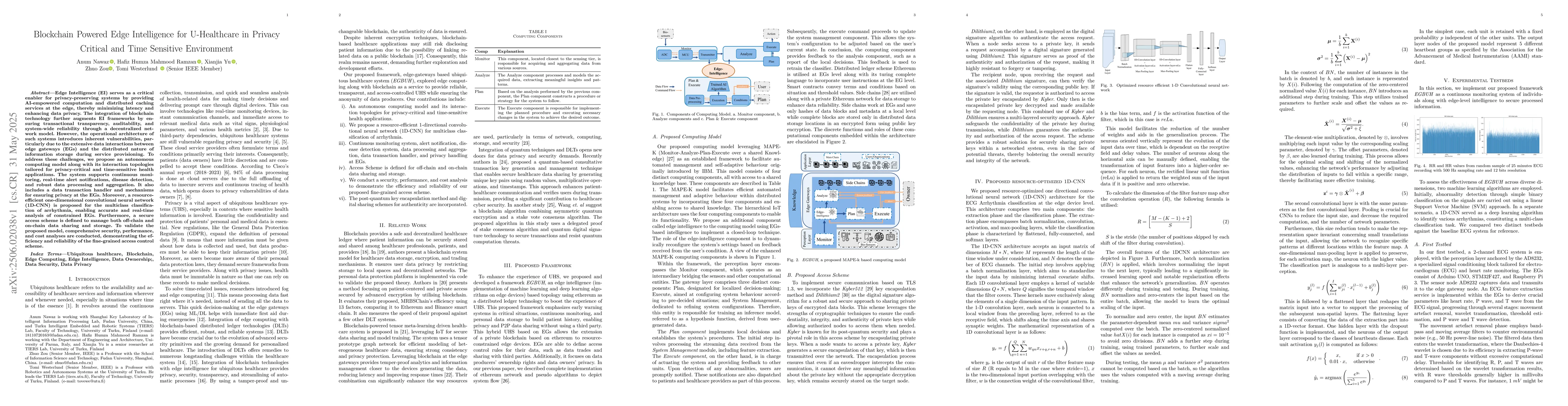
Edge Intelligence (EI) serves as a critical enabler for privacy-preserving systems by providing AI-empowered computation and distributed caching services at the edge, thereby minimizing latency and en...
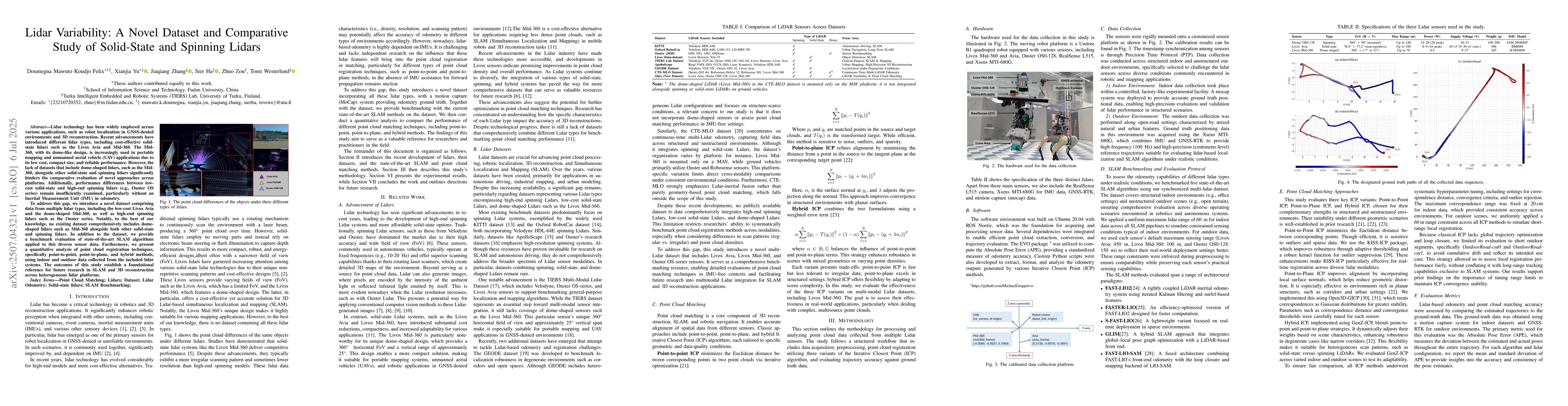
Lidar technology has been widely employed across various applications, such as robot localization in GNSS-denied environments and 3D reconstruction. Recent advancements have introduced different lidar...
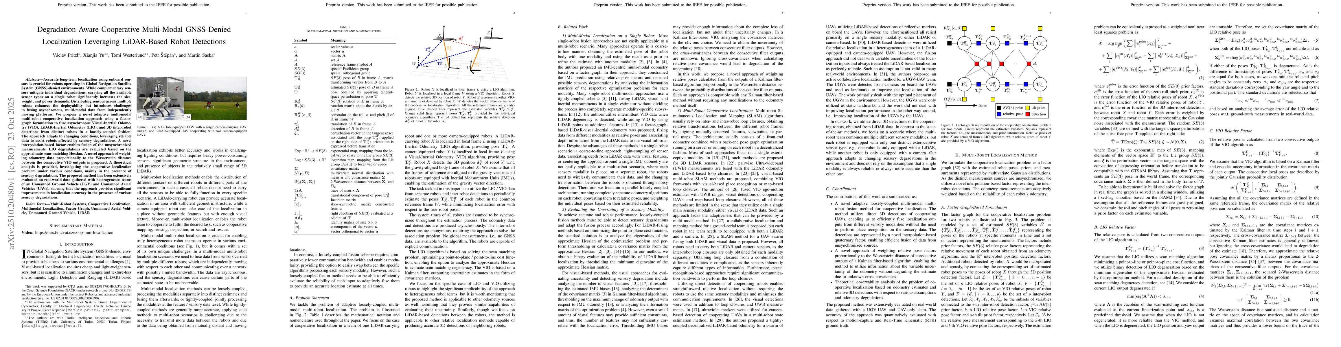
Accurate long-term localization using onboard sensors is crucial for robots operating in Global Navigation Satellite System (GNSS)-denied environments. While complementary sensors mitigate individual ...

Lidar-based SLAM systems are highly sensitive to adverse conditions such as occlusion, noise, and field-of-view (FoV) degradation, yet existing robustness evaluation methods either lack physical groun...
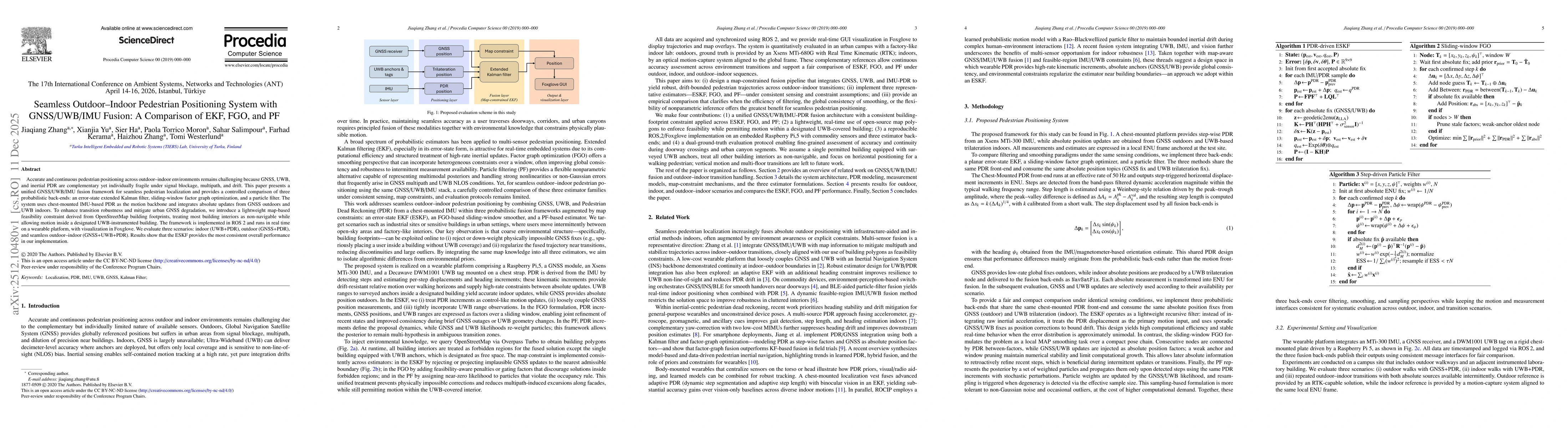
Accurate and continuous pedestrian positioning across outdoor-indoor environments remains challenging because GNSS, UWB, and inertial PDR are complementary yet individually fragile under signal blocka...
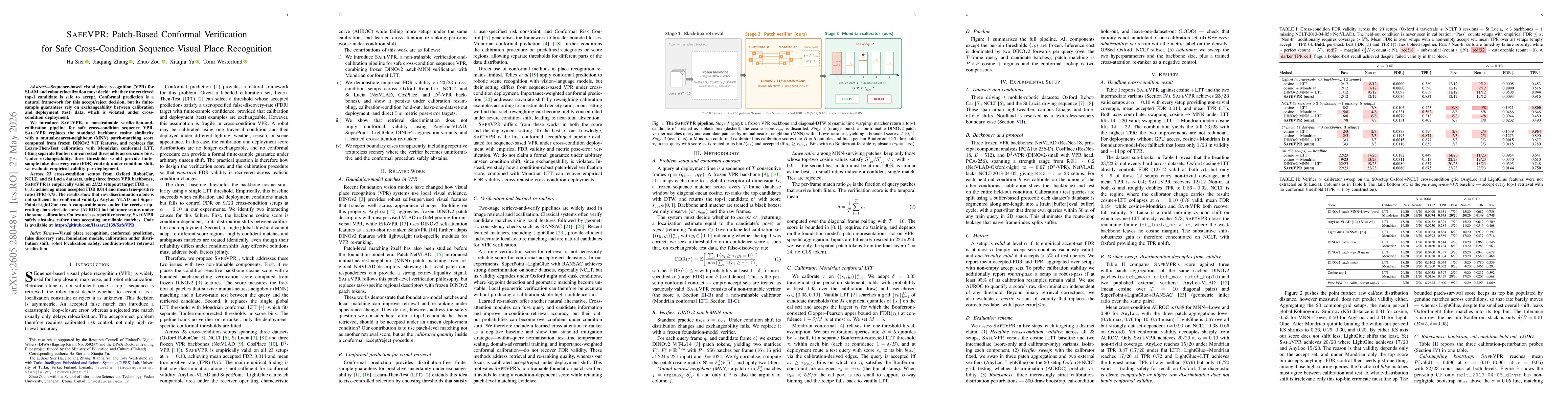
Sequence-based visual place recognition (VPR) for SLAM and robot relocalization must decide whether the retrieved top-1 candidate is safe to accept. Conformal prediction is a natural framework for thi...