Yu Xianjia

5 papers on arXiv

Academic Profile

Name: Xianjia Yu
Total Papers: 2

Statistics

arXiv Papers 5
Total Publications 2

Papers on arXiv

Thumbnail for Robust Multi-Modal Multi-LiDAR-Inertial Odometry and Mapping for Indoor
  Environments

Robust Multi-Modal Multi-LiDAR-Inertial Odometry and Mapping for Indoor Environments

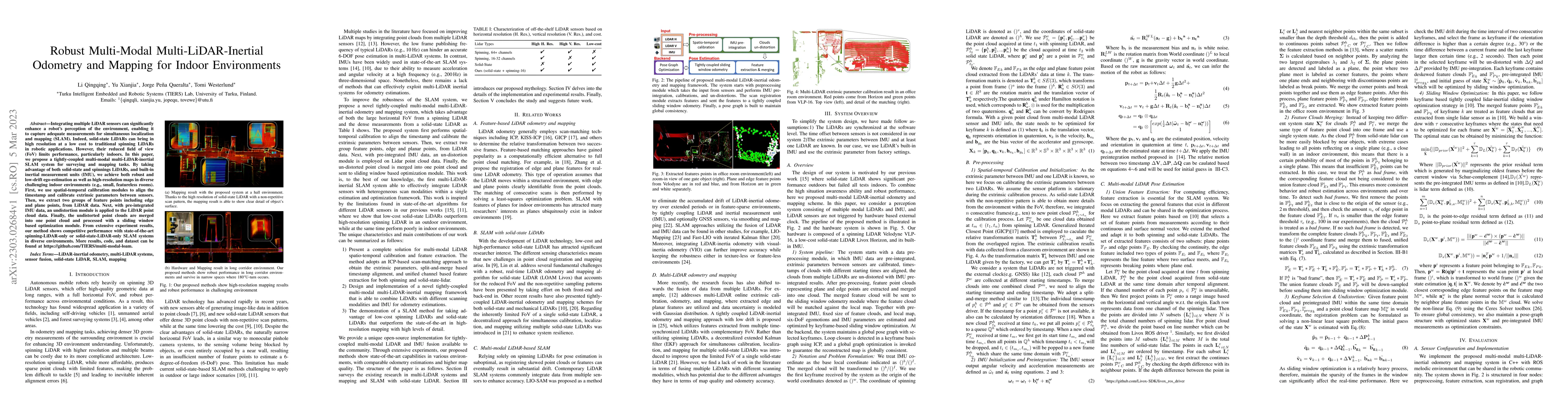
Integrating multiple LiDAR sensors can significantly enhance a robot's perception of the environment, enabling it to capture adequate measurements for simultaneous localization and mapping (SLAM). I...

Thumbnail for A Benchmark for Multi-Modal Lidar SLAM with Ground Truth in GNSS-Denied
  Environments

A Benchmark for Multi-Modal Lidar SLAM with Ground Truth in GNSS-Denied Environments

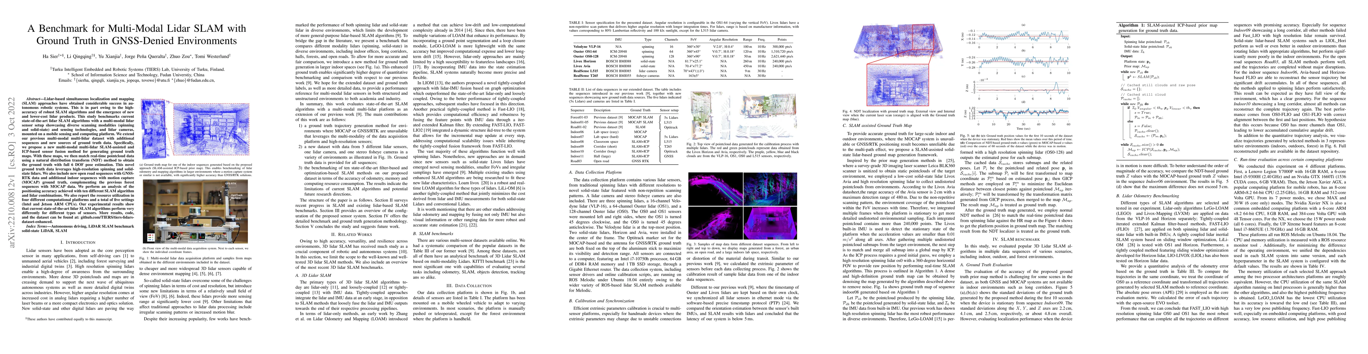
Lidar-based simultaneous localization and mapping (SLAM) approaches have obtained considerable success in autonomous robotic systems. This is in part owing to the high-accuracy of robust SLAM algori...

Thumbnail for Analyzing General-Purpose Deep-Learning Detection and Segmentation
  Models with Images from a Lidar as a Camera Sensor

Analyzing General-Purpose Deep-Learning Detection and Segmentation Models with Images from a Lidar as a Camera Sensor

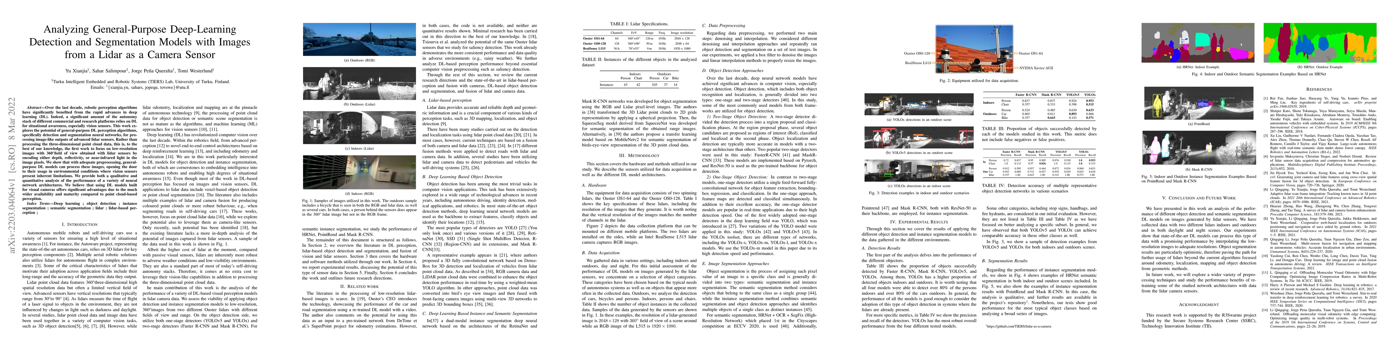
Over the last decade, robotic perception algorithms have significantly benefited from the rapid advances in deep learning (DL). Indeed, a significant amount of the autonomy stack of different commer...

Thumbnail for Towards Large-Scale Scalable MAV Swarms with ROS2 and UWB-based Situated
  Communication

Towards Large-Scale Scalable MAV Swarms with ROS2 and UWB-based Situated Communication

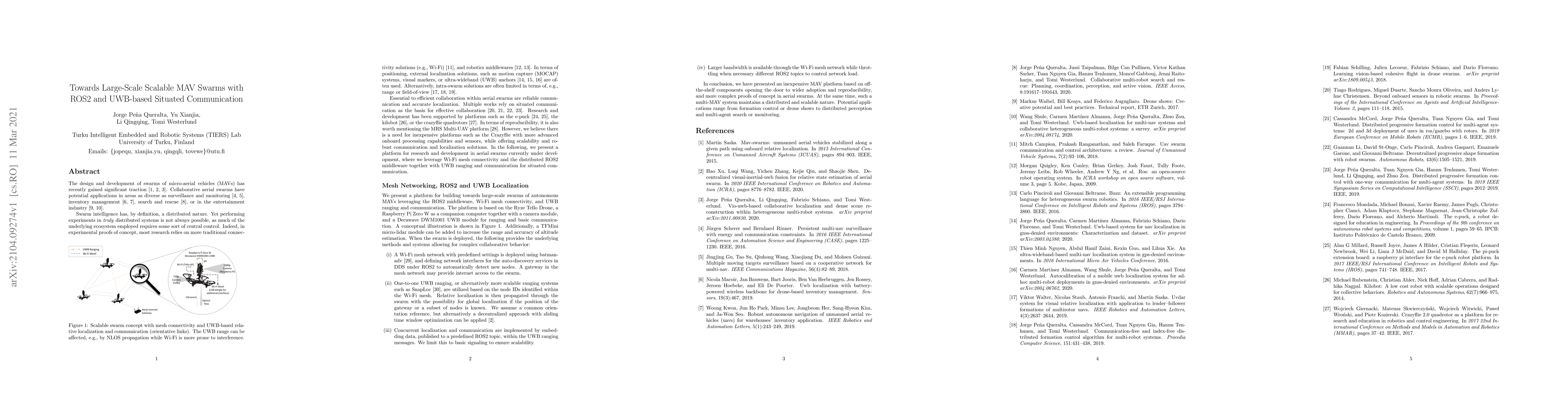
The design and development of swarms of micro-aerial vehicles (MAVs) has recently gained significant traction. Collaborative aerial swarms have potential applications in areas as diverse as surveill...

Thumbnail for Cooperative UWB-Based Localization for Outdoors Positioning and
  Navigation of UAVs aided by Ground Robots

Cooperative UWB-Based Localization for Outdoors Positioning and Navigation of UAVs aided by Ground Robots

Unmanned aerial vehicles (UAVs) are becoming largely ubiquitous with an increasing demand for aerial data. Accurate navigation and localization, required for precise data collection in many industri...

This website uses cookies to ensure you get the best experience. Learn more