Academic Profile
Statistics
Similar Authors
Papers on arXiv
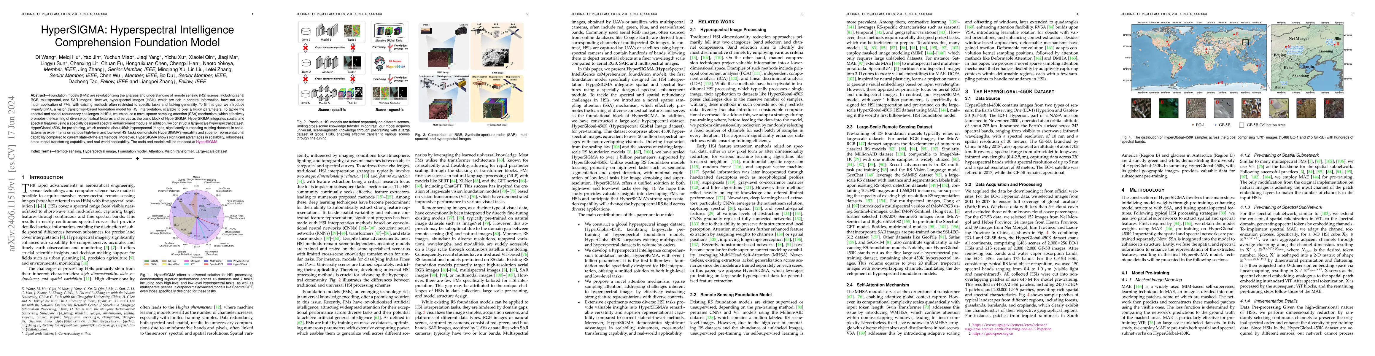
Foundation models (FMs) are revolutionizing the analysis and understanding of remote sensing (RS) scenes, including aerial RGB, multispectral, and SAR images. However, hyperspectral images (HSIs), whi...
Large models have demonstrated significant progress across various domains, particularly in tasks related to text generation. In the domain of Table to Text, many Large Language Model (LLM)-based me...
Global forest cover is critical to the provision of certain ecosystem services. With the advent of the google earth engine cloud platform, fine resolution global land cover mapping task could be acc...
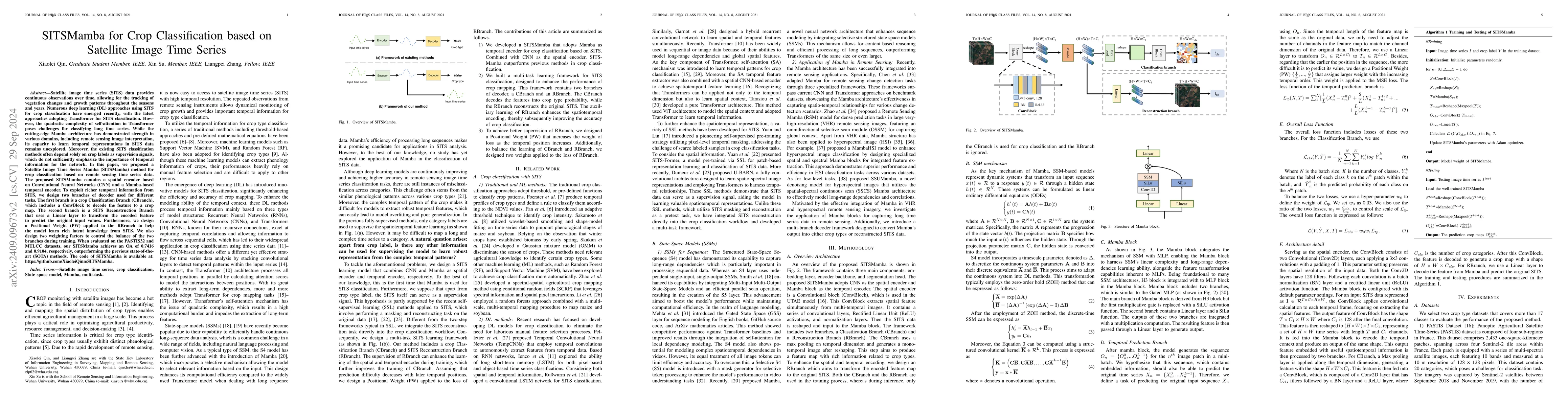
Satellite image time series (SITS) data provides continuous observations over time, allowing for the tracking of vegetation changes and growth patterns throughout the seasons and years. Numerous deep ...
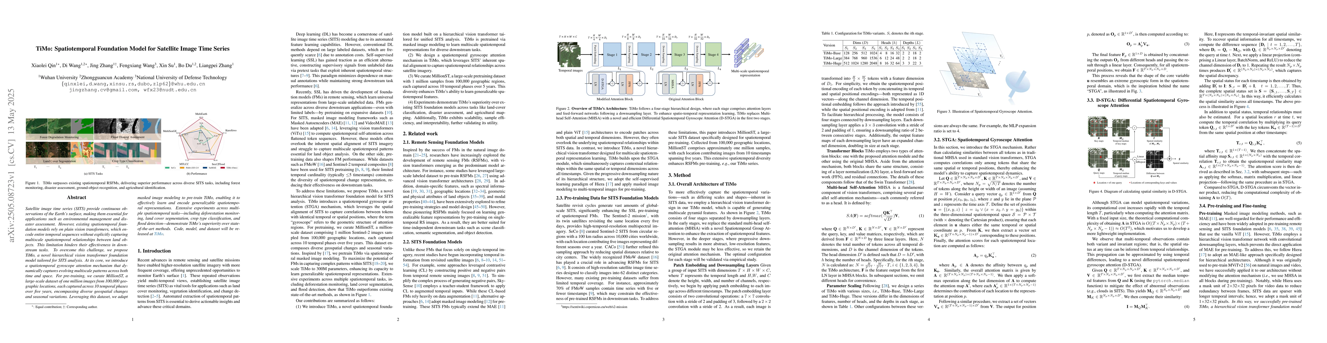
Satellite image time series (SITS) provide continuous observations of the Earth's surface, making them essential for applications such as environmental management and disaster assessment. However, exi...
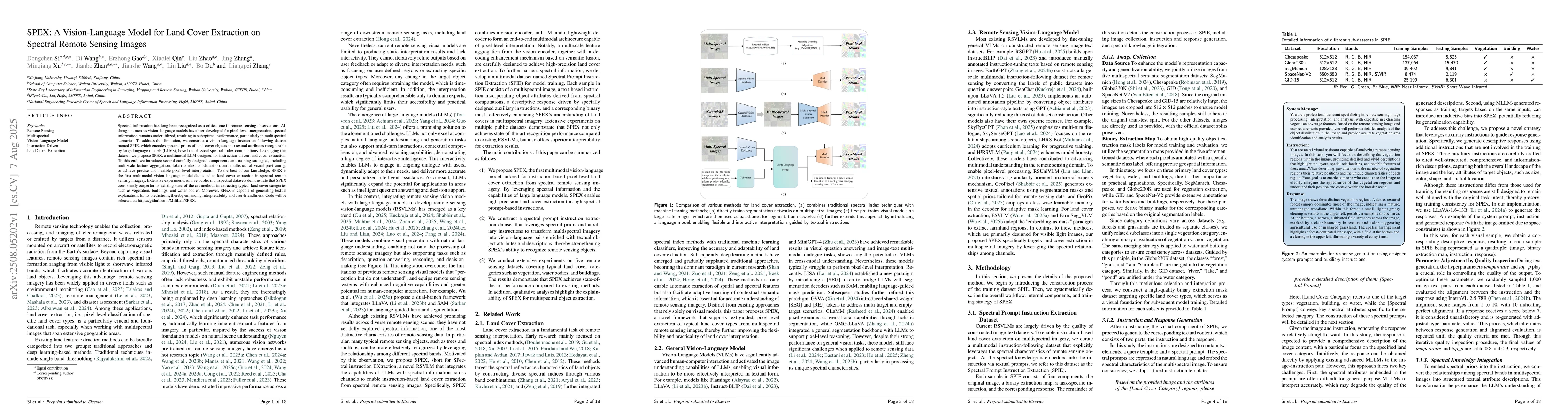
Spectral information has long been recognized as a critical cue in remote sensing observations. Although numerous vision-language models have been developed for pixel-level interpretation, spectral in...
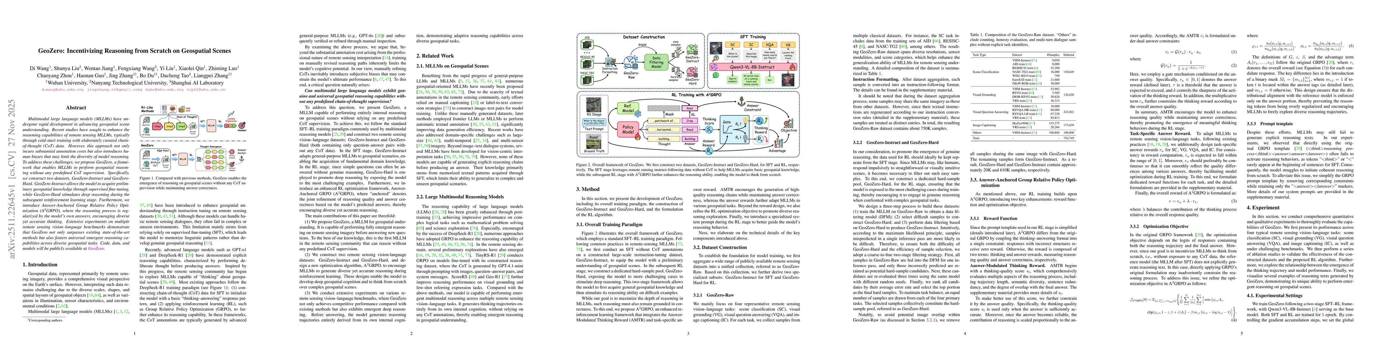
Multimodal large language models (MLLMs) have undergone rapid development in advancing geospatial scene understanding. Recent studies have sought to enhance the reasoning capabilities of remote sensin...