Academic Profile
Statistics
Similar Authors
Papers on arXiv
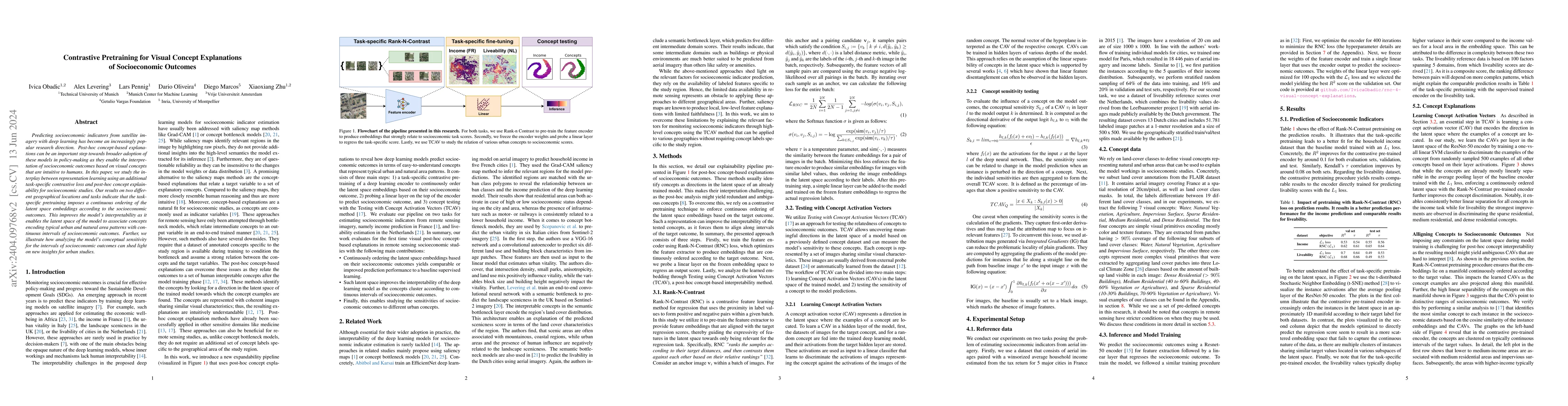
Predicting socioeconomic indicators from satellite imagery with deep learning has become an increasingly popular research direction. Post-hoc concept-based explanations can be an important step towa...
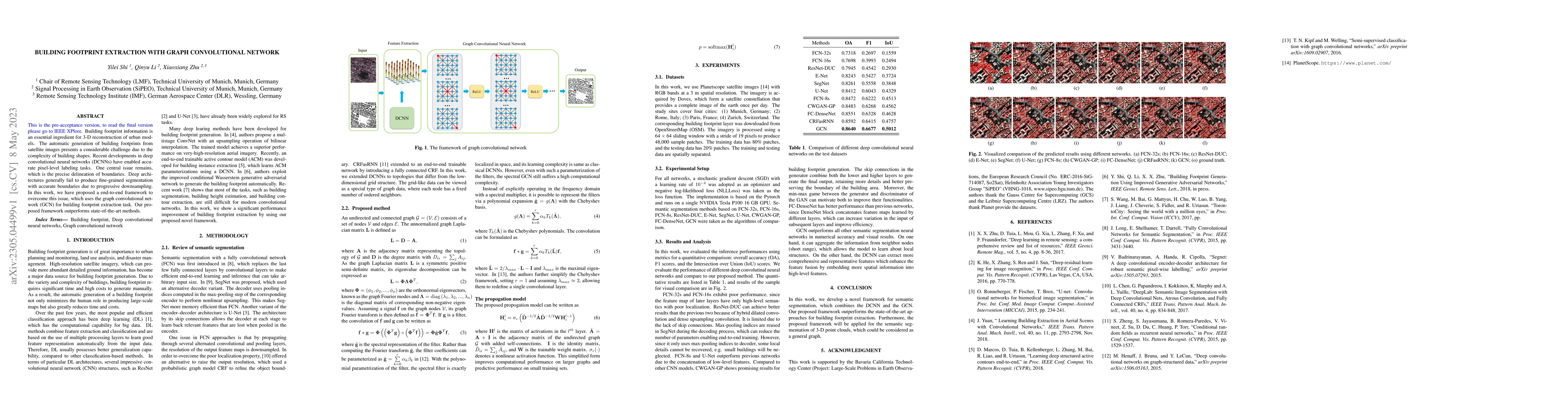
Building footprint information is an essential ingredient for 3-D reconstruction of urban models. The automatic generation of building footprints from satellite images presents a considerable challe...
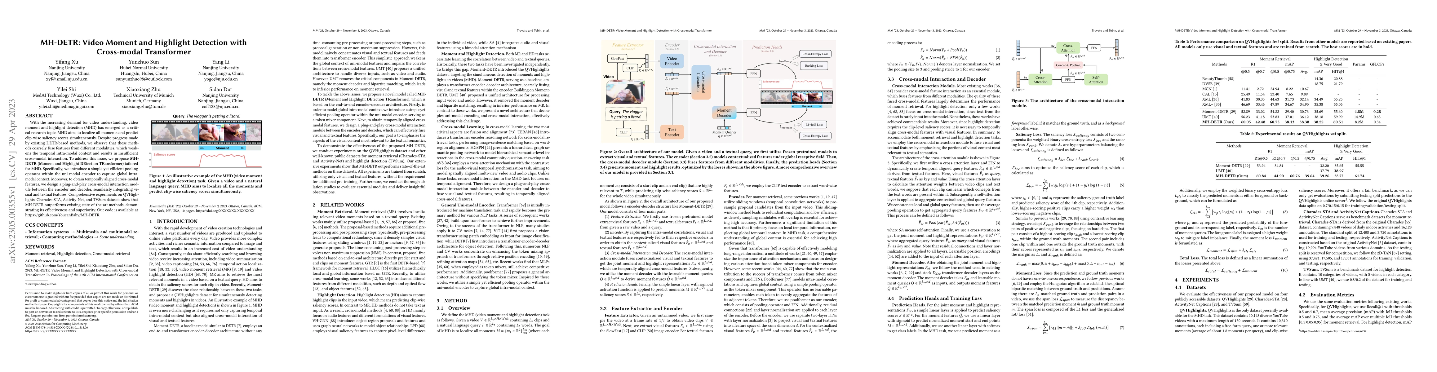
With the increasing demand for video understanding, video moment and highlight detection (MHD) has emerged as a critical research topic. MHD aims to localize all moments and predict clip-wise salien...
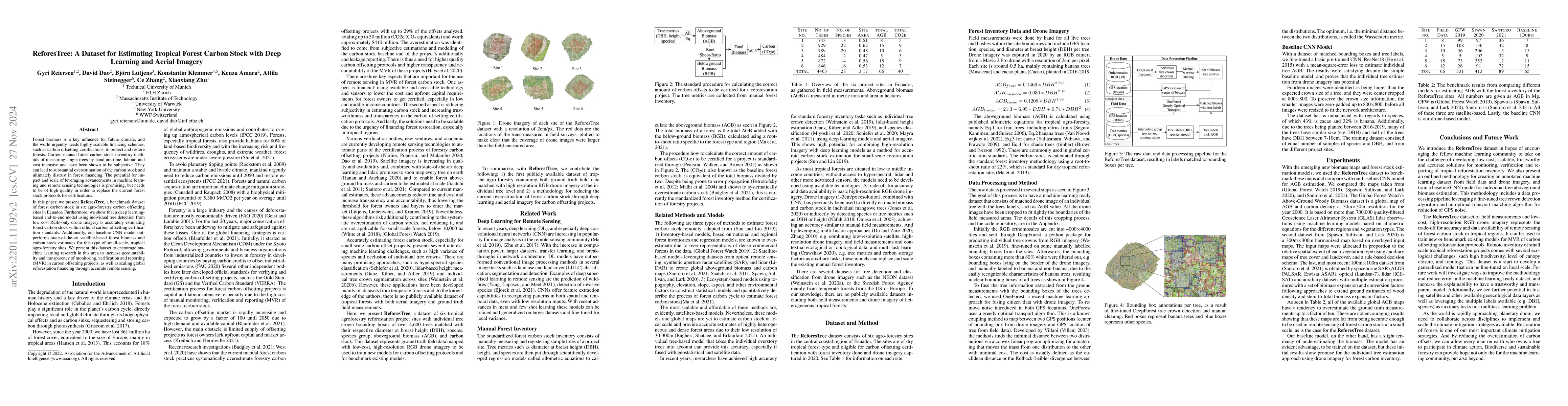
Forest biomass is a key influence for future climate, and the world urgently needs highly scalable financing schemes, such as carbon offsetting certifications, to protect and restore forests. Curren...
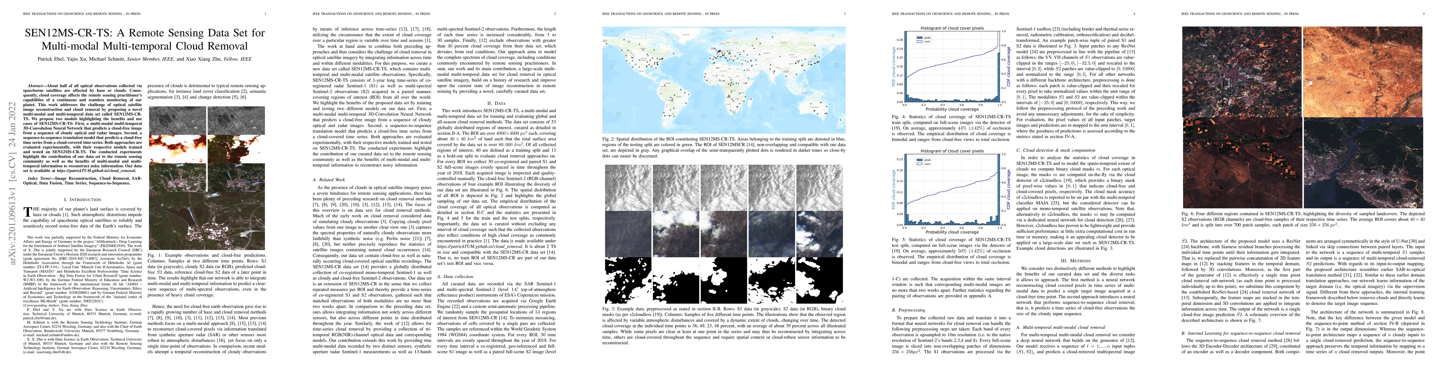
About half of all optical observations collected via spaceborne satellites are affected by haze or clouds. Consequently, cloud coverage affects the remote sensing practitioner's capabilities of a co...
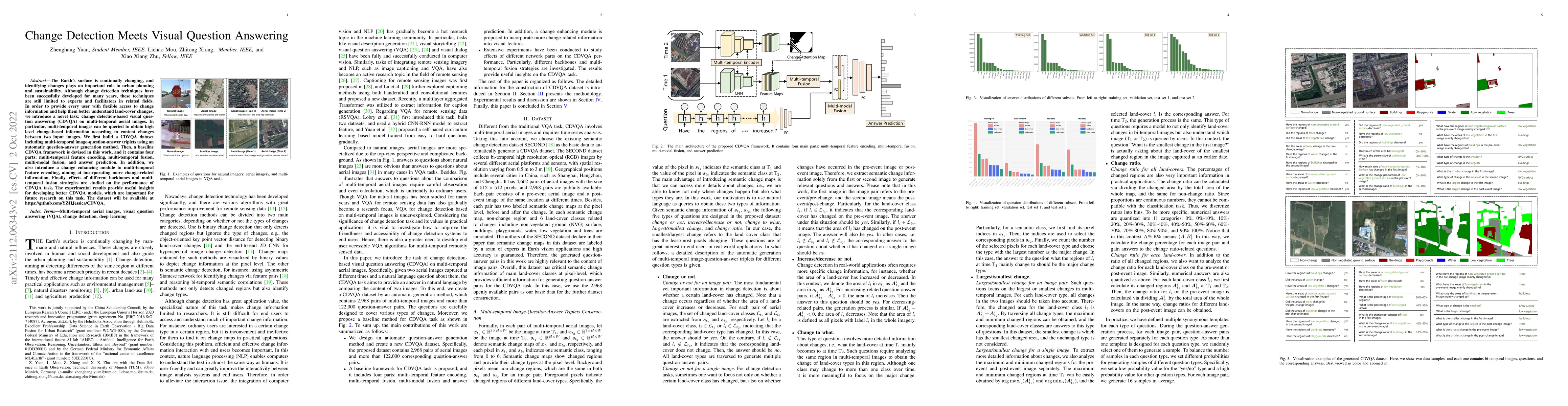
The Earth's surface is continually changing, and identifying changes plays an important role in urban planning and sustainability. Although change detection techniques have been successfully develop...
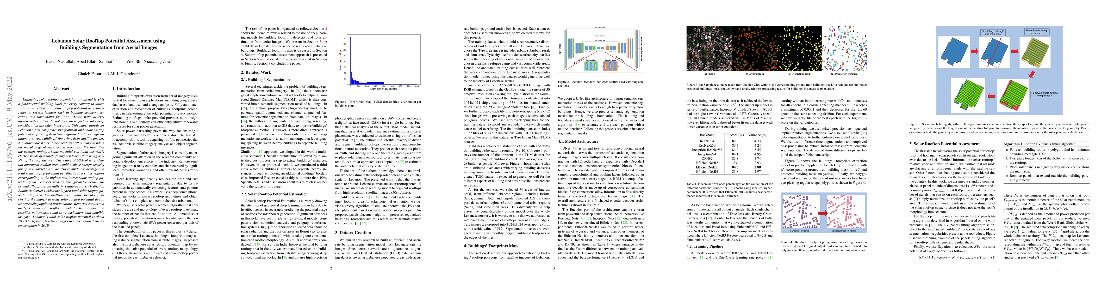
Estimating solar rooftop potential at a national level is a fundamental building block for every country to utilize solar power efficiently. Solar rooftop potential assessment relies on several feat...
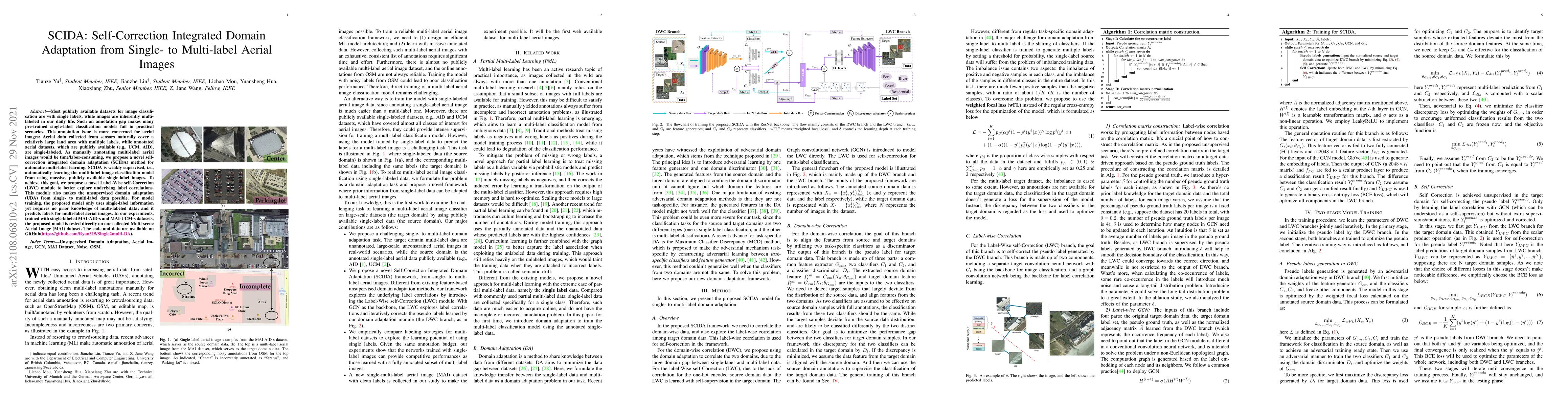
Most publicly available datasets for image classification are with single labels, while images are inherently multi-labeled in our daily life. Such an annotation gap makes many pre-trained single-la...
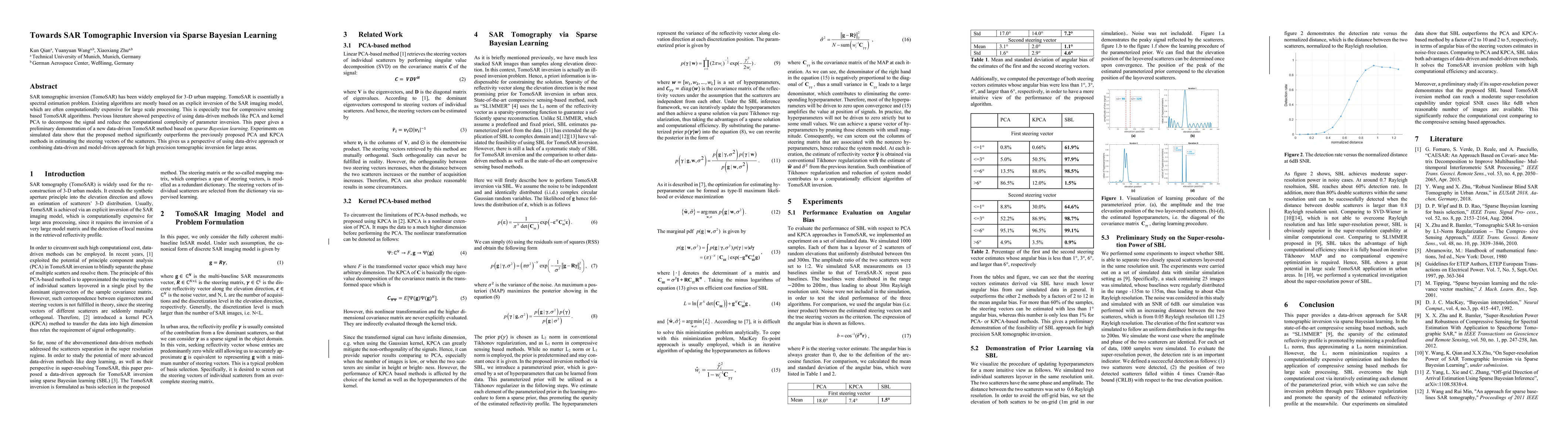
Existing SAR tomography (TomoSAR) algorithms are mostly based on an inversion of the SAR imaging model, which are often computationally expensive. Previous study showed perspective of using data-dri...
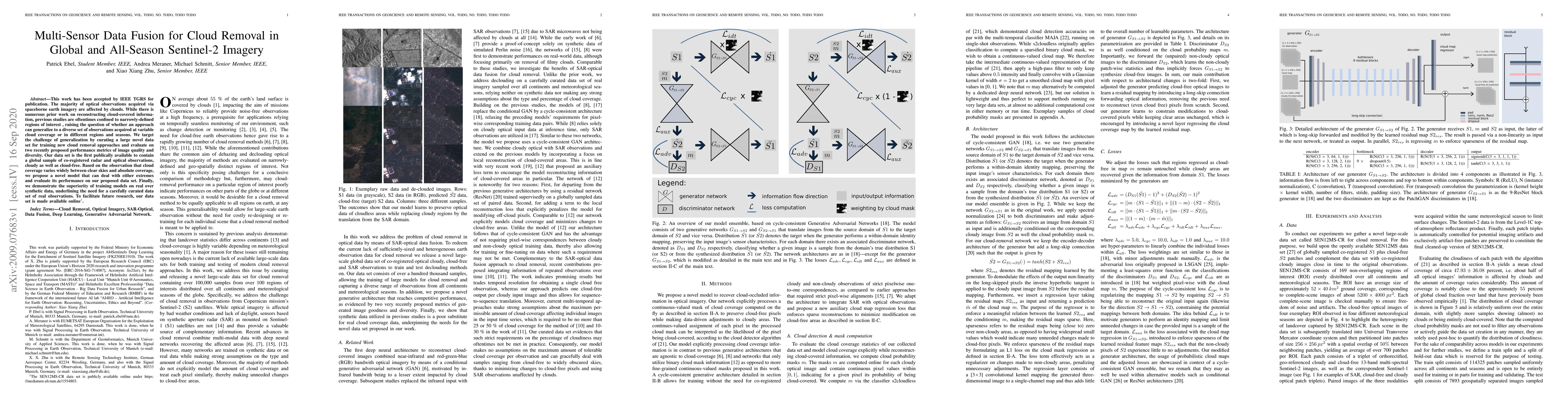
This work has been accepted by IEEE TGRS for publication. The majority of optical observations acquired via spaceborne earth imagery are affected by clouds. While there is numerous prior work on rec...
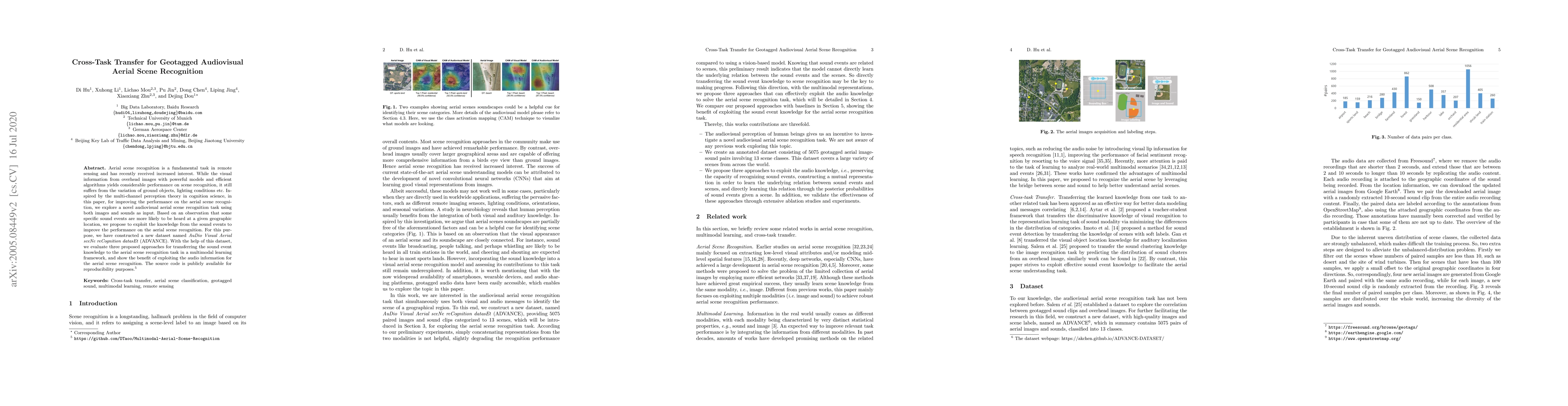
Aerial scene recognition is a fundamental task in remote sensing and has recently received increased interest. While the visual information from overhead images with powerful models and efficient al...
Automatically and rapidly understanding Earth's surface is fundamental to our grasp of the living environment and informed decision-making. This underscores the need for a unified system with comprehe...
Tweets provides valuable semantic context for earth observation tasks and serves as a complementary modality to remote sensing imagery. In building function classification (BFC), tweets are often coll...
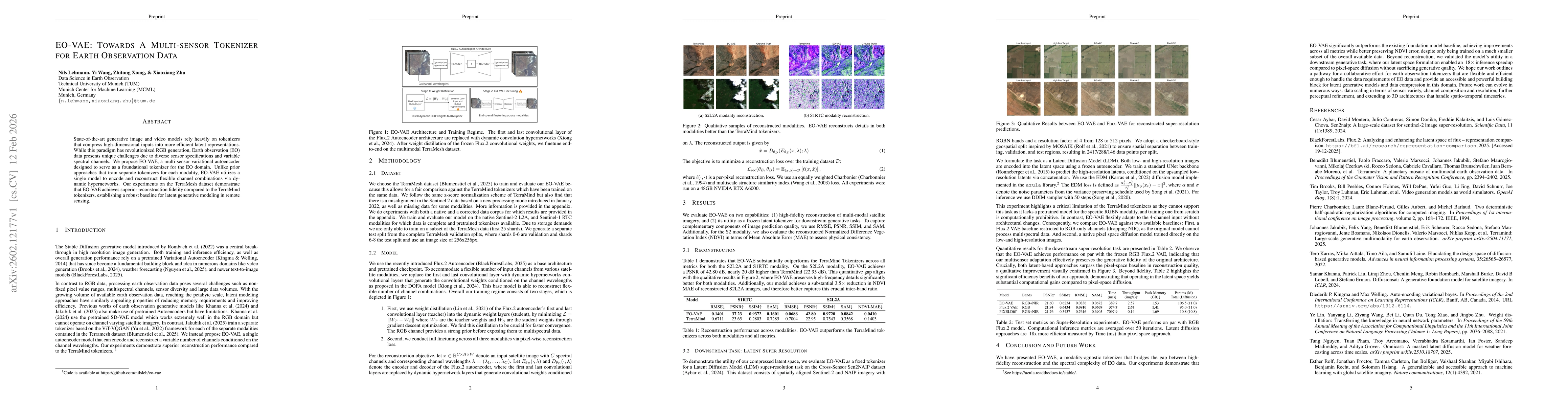
State-of-the-art generative image and video models rely heavily on tokenizers that compress high-dimensional inputs into more efficient latent representations. While this paradigm has revolutionized R...
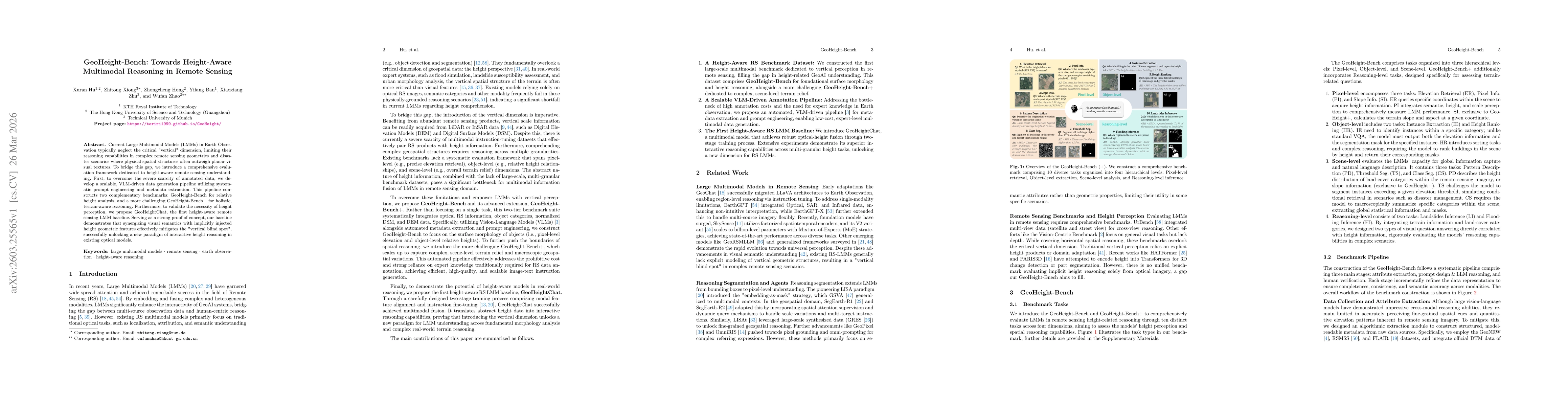
Current Large Multimodal Models (LMMs) in Earth Observation typically neglect the critical "vertical" dimension, limiting their reasoning capabilities in complex remote sensing geometries and disaster...
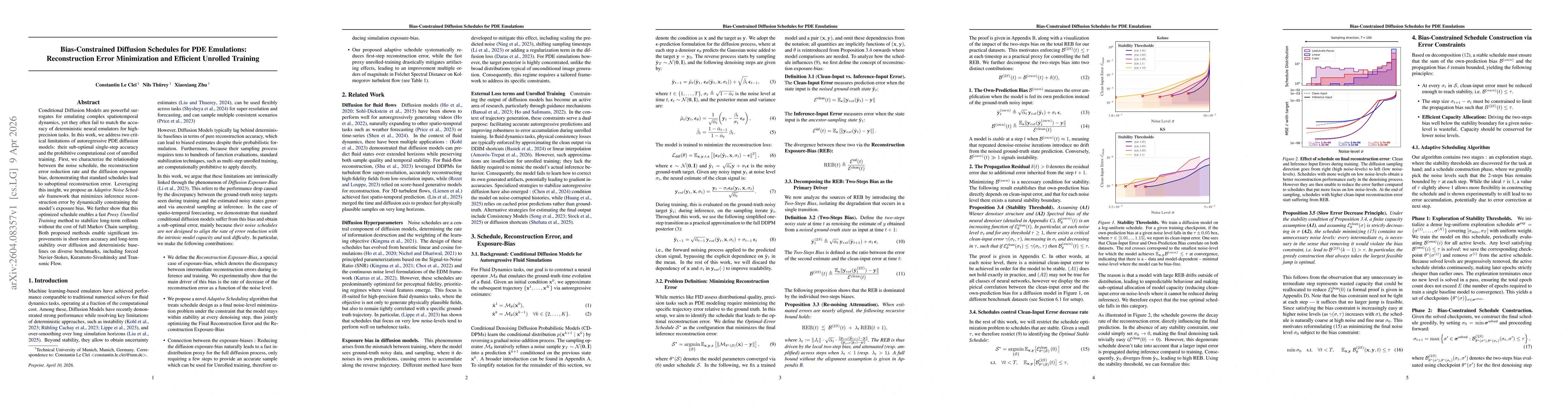
Conditional Diffusion Models are powerful surrogates for emulating complex spatiotemporal dynamics, yet they often fail to match the accuracy of deterministic neural emulators for high-precision tasks...