Publication
Metrics
AI Quick Summary
This paper proposes an end-to-end framework using graph convolutional networks (GCNs) to accurately extract building footprints from satellite images, addressing the challenge of precise boundary delineation. The proposed method outperforms existing state-of-the-art techniques in fine-grained segmentation.
Paper Preview
Abstract
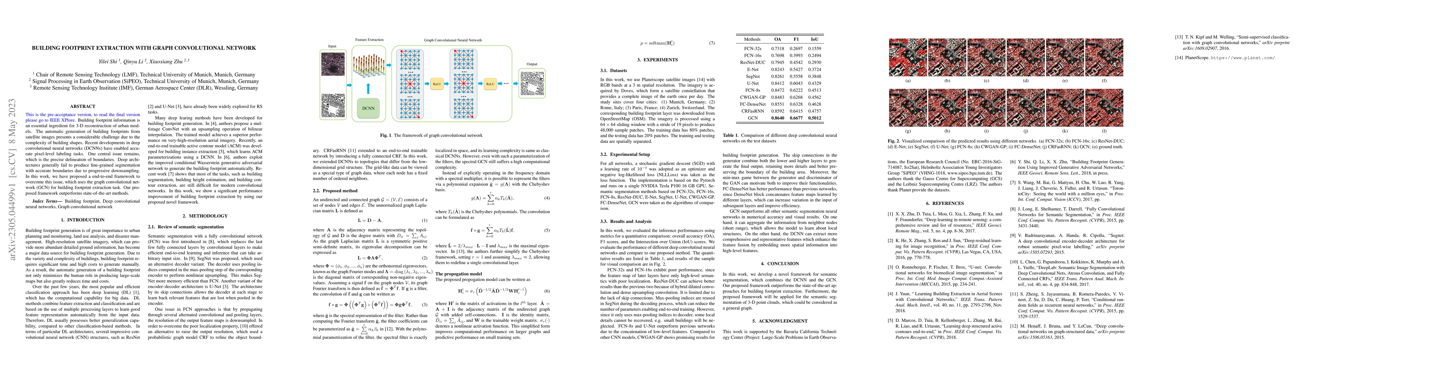
Building footprint information is an essential ingredient for 3-D reconstruction of urban models. The automatic generation of building footprints from satellite images presents a considerable challenge due to the complexity of building shapes. Recent developments in deep convolutional neural networks (DCNNs) have enabled accurate pixel-level labeling tasks. One central issue remains, which is the precise delineation of boundaries. Deep architectures generally fail to produce fine-grained segmentation with accurate boundaries due to progressive downsampling. In this work, we have proposed a end-to-end framework to overcome this issue, which uses the graph convolutional network (GCN) for building footprint extraction task. Our proposed framework outperforms state-of-the-art methods.
AI Key Findings
Get AI-generated insights about this paper's methodology, results, significance, and more — seven facets brought into focus.
Impact
Paper Details
Authors
PDF Preview
Key Terms
Citation Network
Current paper (gray), citations (green), references (blue)
Display is limited for performance on very large graphs.
Discussion 0