Academic Profile
Statistics
Similar Authors
Papers on arXiv
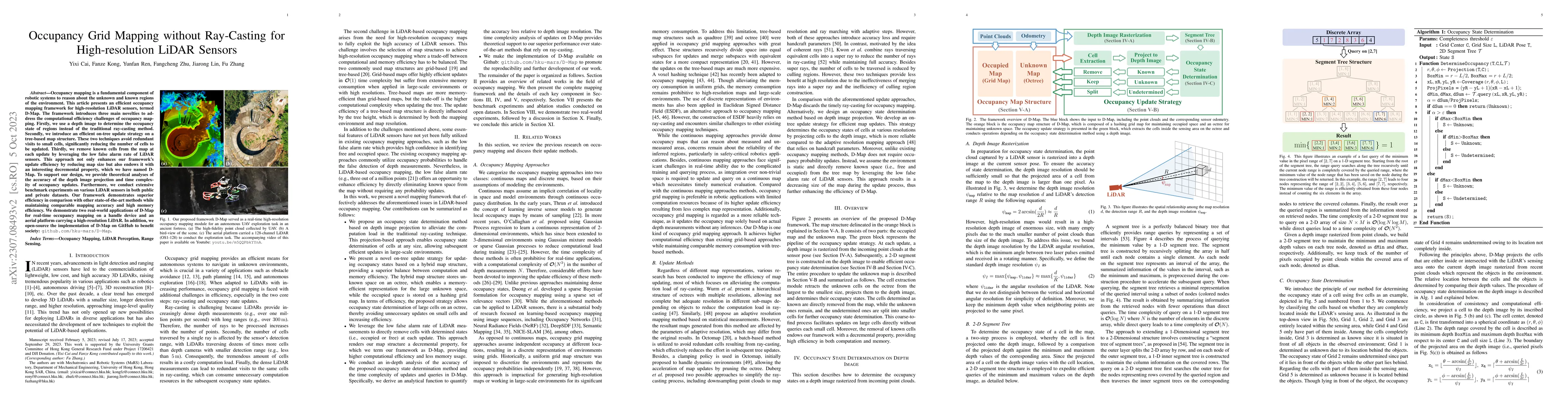
Occupancy mapping is a fundamental component of robotic systems to reason about the unknown and known regions of the environment. This article presents an efficient occupancy mapping framework for h...
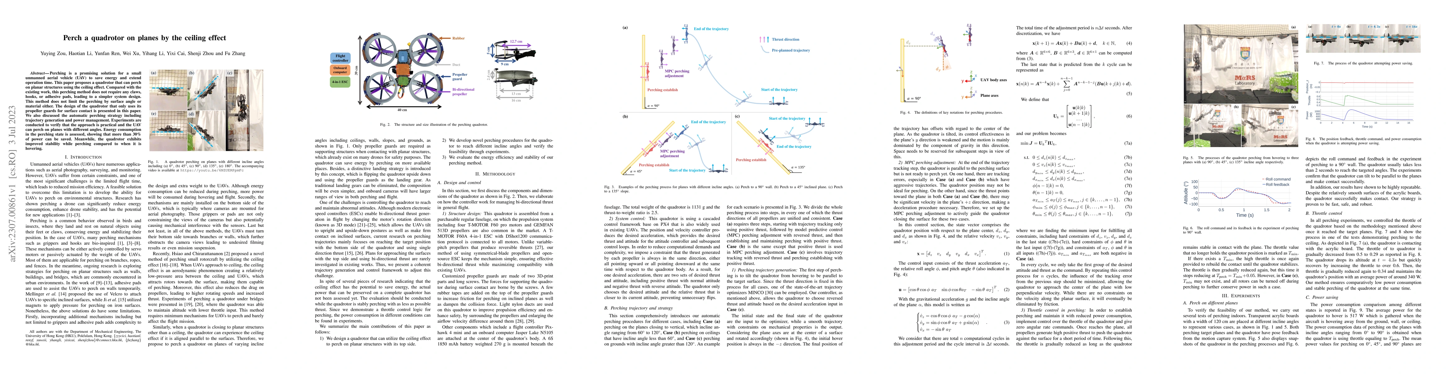
Perching is a promising solution for a small unmanned aerial vehicle (UAV) to save energy and extend operation time. This paper proposes a quadrotor that can perch on planar structures using the cei...
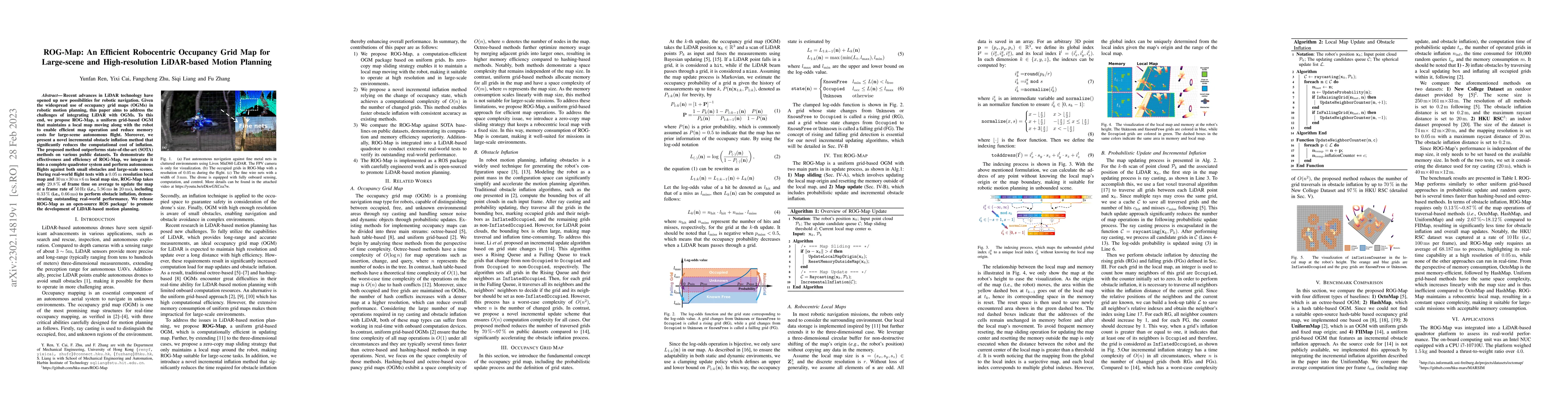
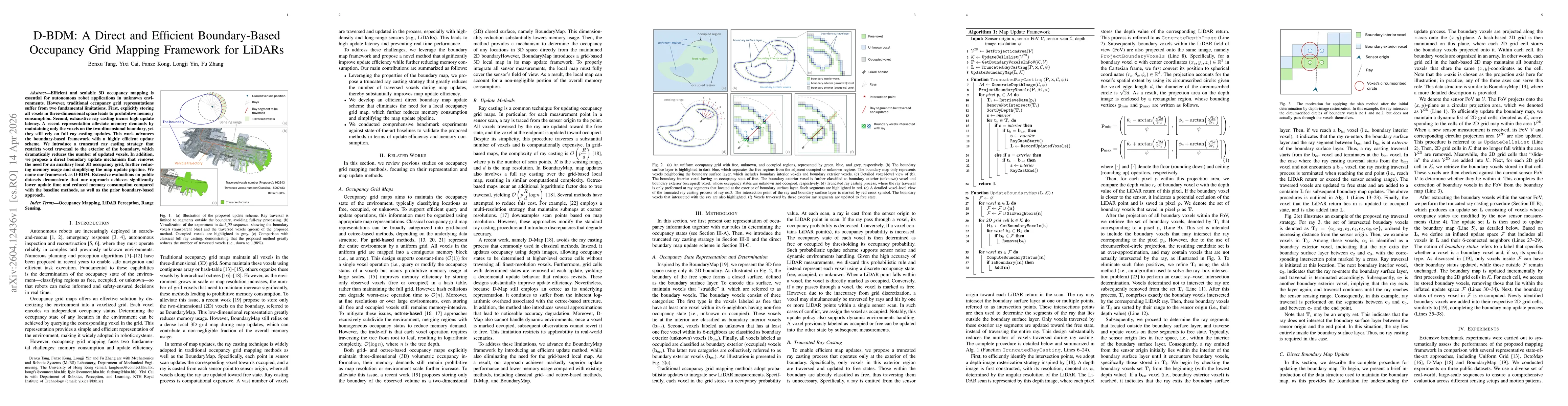
Recent advances in LiDAR technology have opened up new possibilities for robotic navigation. Given the widespread use of occupancy grid maps (OGMs) in robotic motion planning, this paper aims to add...
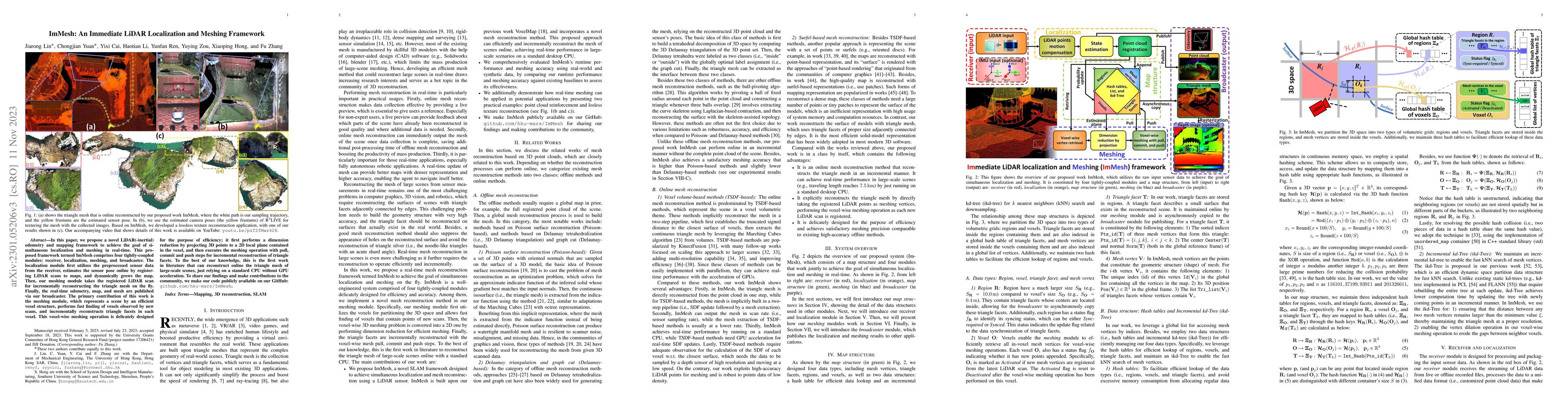
In this paper, we propose a novel LiDAR(-inertial) odometry and mapping framework to achieve the goal of simultaneous localization and meshing in real-time. This proposed framework termed ImMesh com...
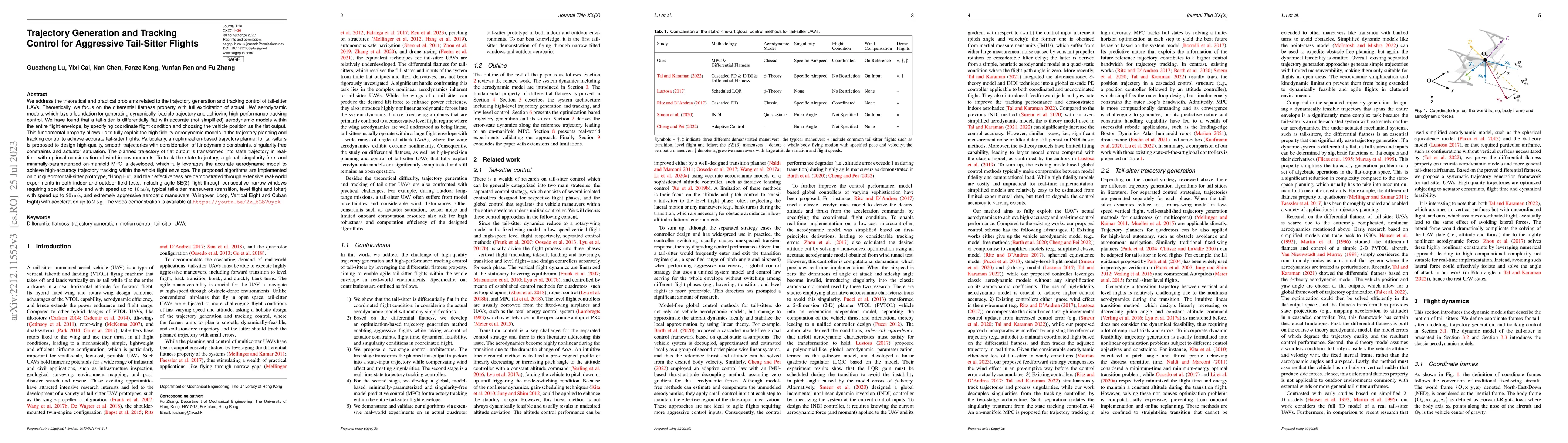
We address the theoretical and practical problems related to the trajectory generation and tracking control of tail-sitter UAVs. Theoretically, we focus on the differential flatness property with fu...
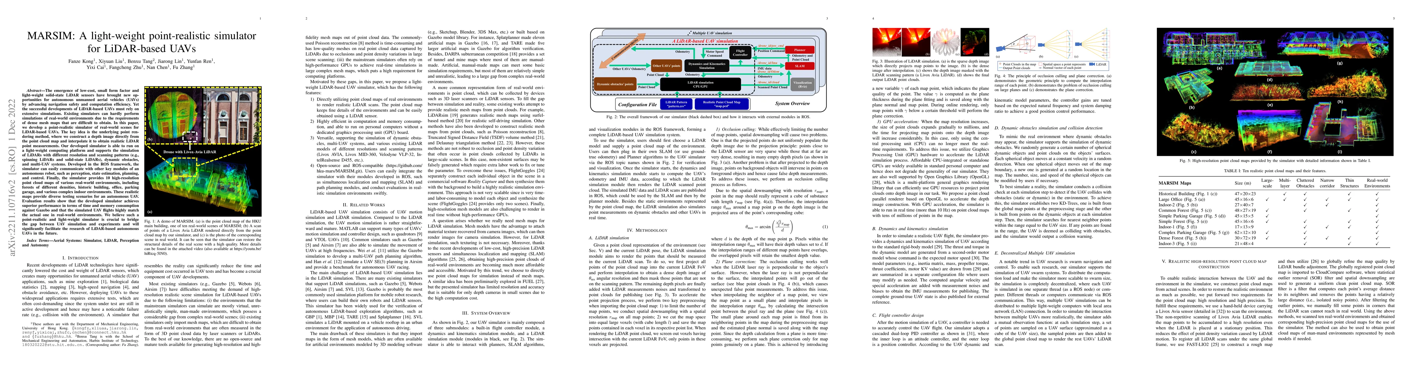
The emergence of low-cost, small form factor and light-weight solid-state LiDAR sensors have brought new opportunities for autonomous unmanned aerial vehicles (UAVs) by advancing navigation safety a...
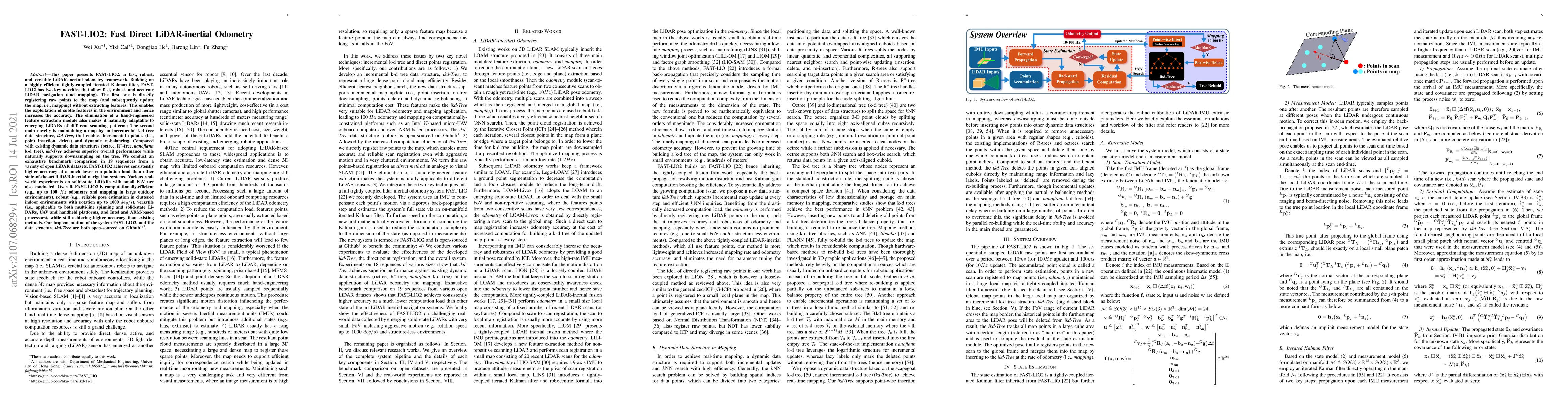
This paper presents FAST-LIO2: a fast, robust, and versatile LiDAR-inertial odometry framework. Building on a highly efficient tightly-coupled iterated Kalman filter, FAST-LIO2 has two key novelties...
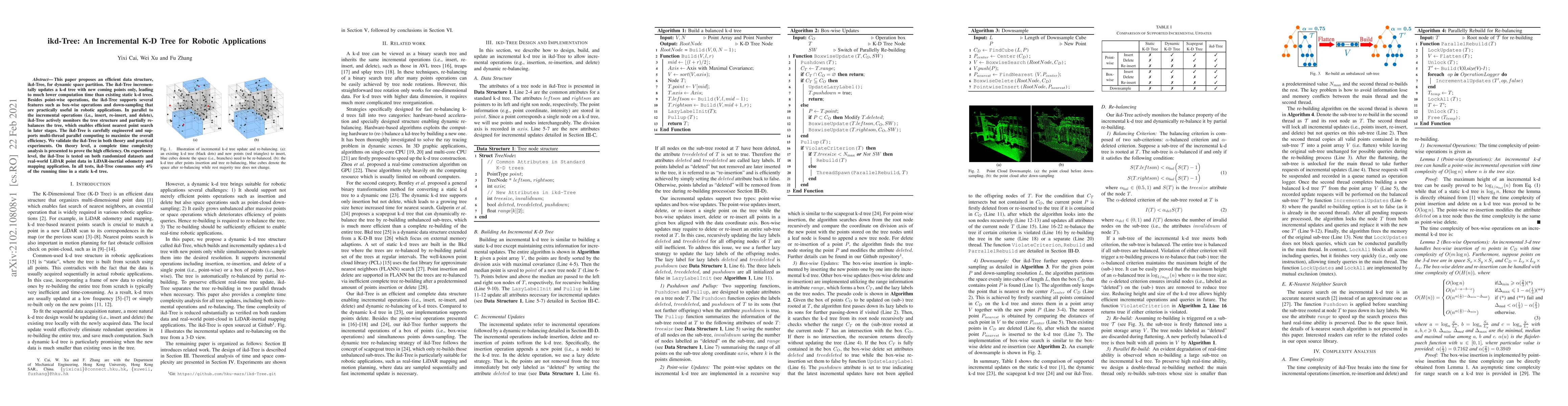
This paper proposes an efficient data structure, ikd-Tree, for dynamic space partition. The ikd-Tree incrementally updates a k-d tree with new coming points only, leading to much lower computation t...
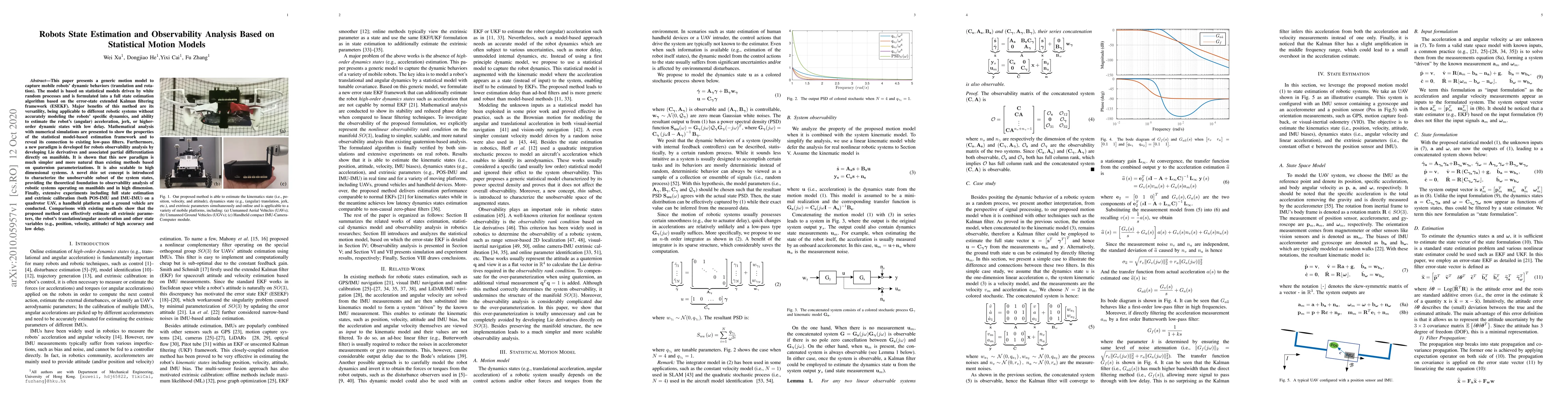
This paper presents a generic motion model to capture mobile robots' dynamic behaviors (translation and rotation). The model is based on statistical models driven by white random processes and is fo...
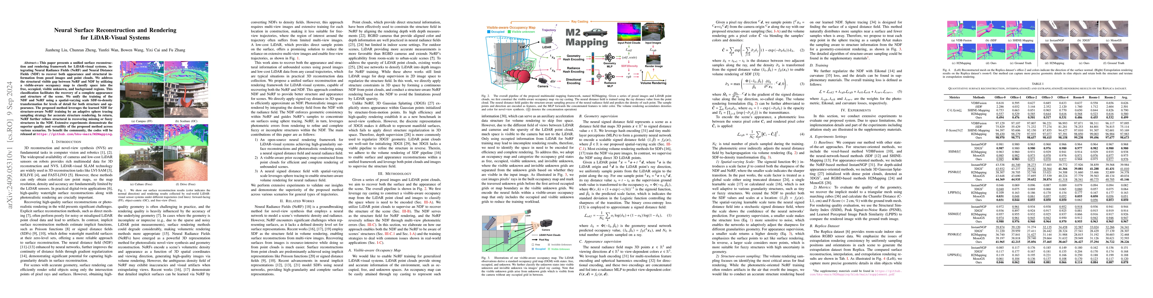
This paper presents a unified surface reconstruction and rendering framework for LiDAR-visual systems, integrating Neural Radiance Fields (NeRF) and Neural Distance Fields (NDF) to recover both appear...
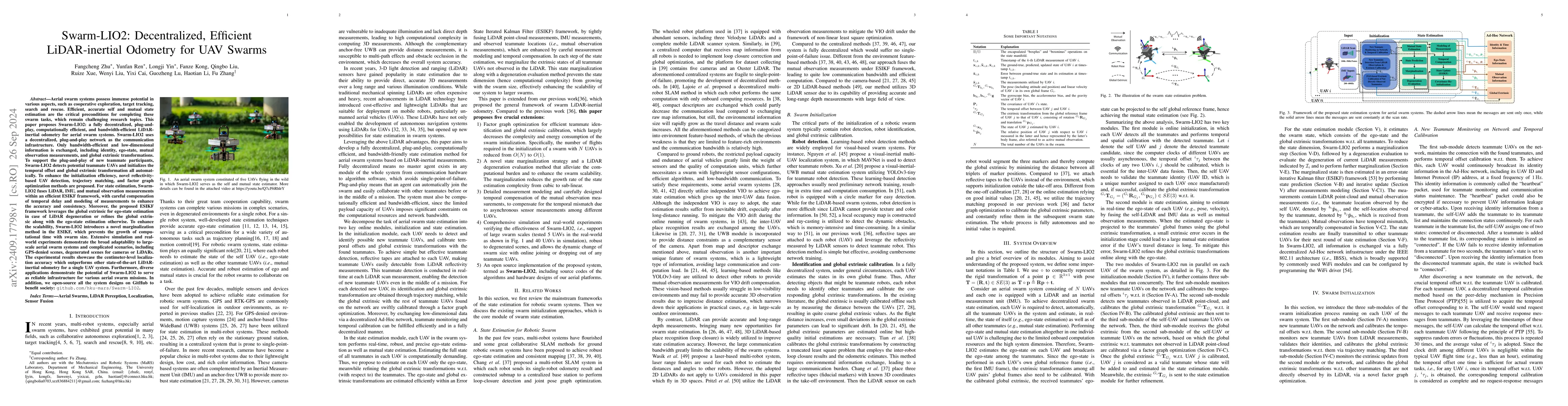
Aerial swarm systems possess immense potential in various aspects, such as cooperative exploration, target tracking, search and rescue. Efficient, accurate self and mutual state estimation are the cri...
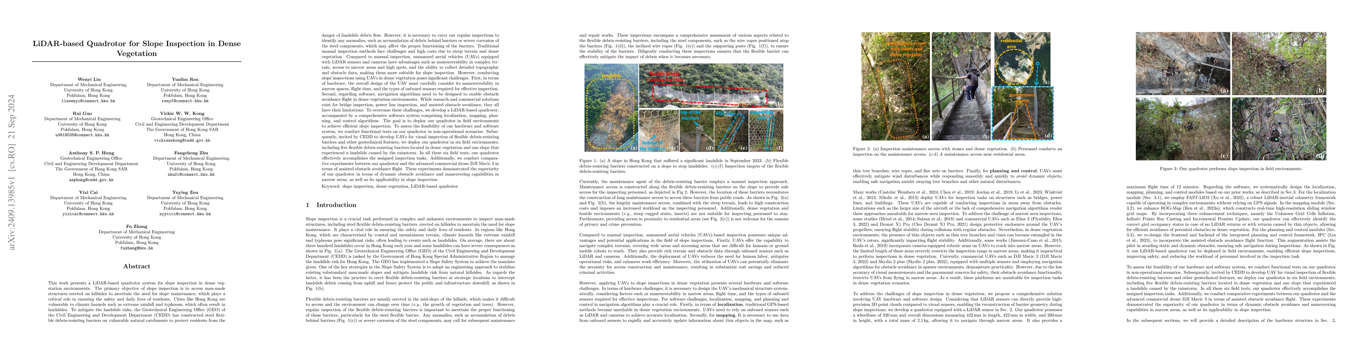
This work presents a LiDAR-based quadrotor system for slope inspection in dense vegetation environments. Cities like Hong Kong are vulnerable to climate hazards, which often result in landslides. To m...
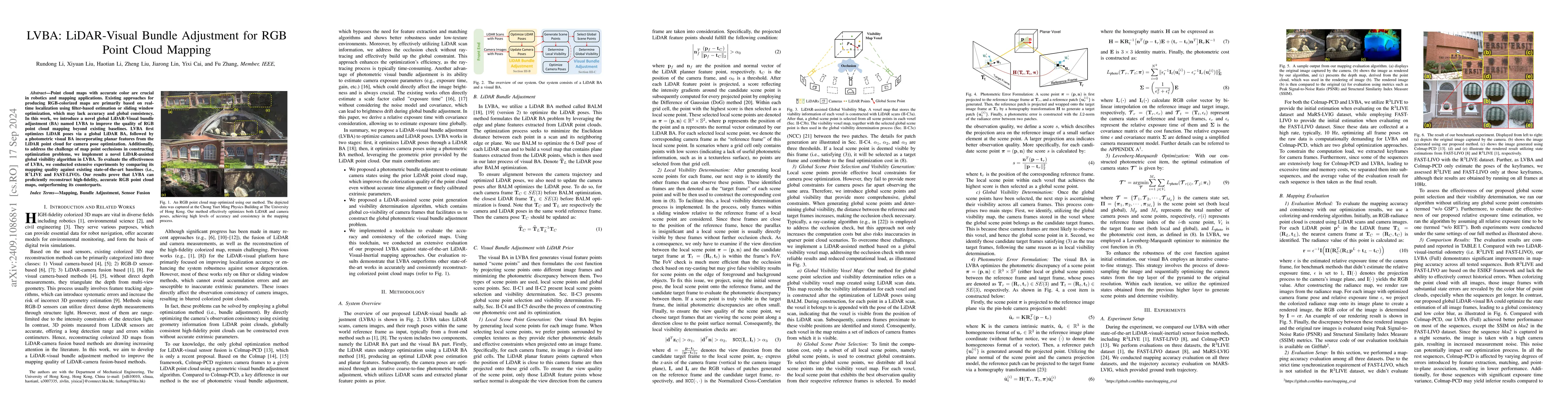
Point cloud maps with accurate color are crucial in robotics and mapping applications. Existing approaches for producing RGB-colorized maps are primarily based on real-time localization using filter-b...
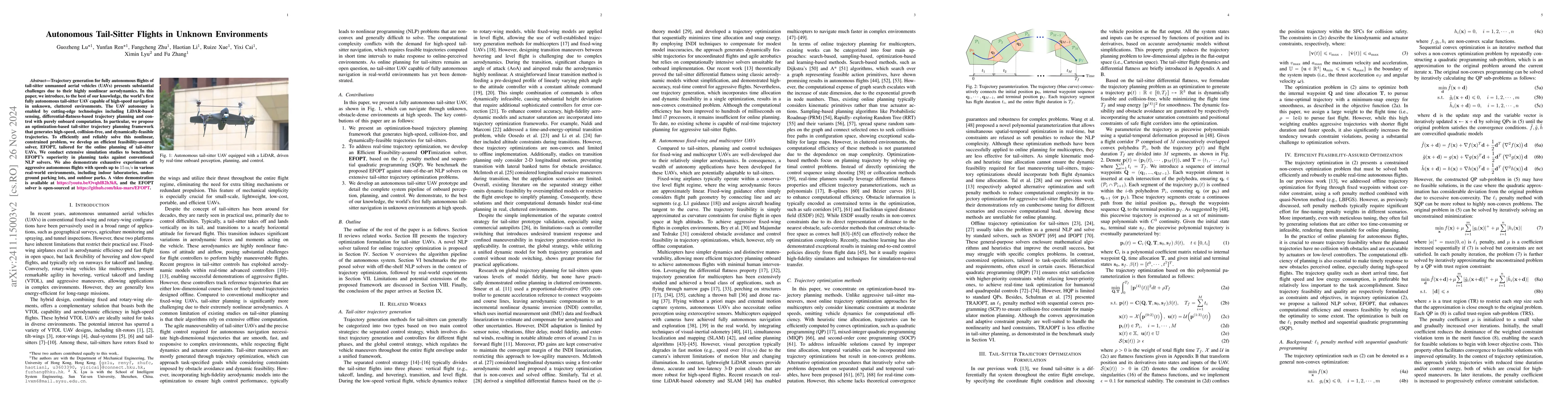
Trajectory generation for fully autonomous flights of tail-sitter unmanned aerial vehicles (UAVs) presents substantial challenges due to their highly nonlinear aerodynamics. In this paper, we introduc...
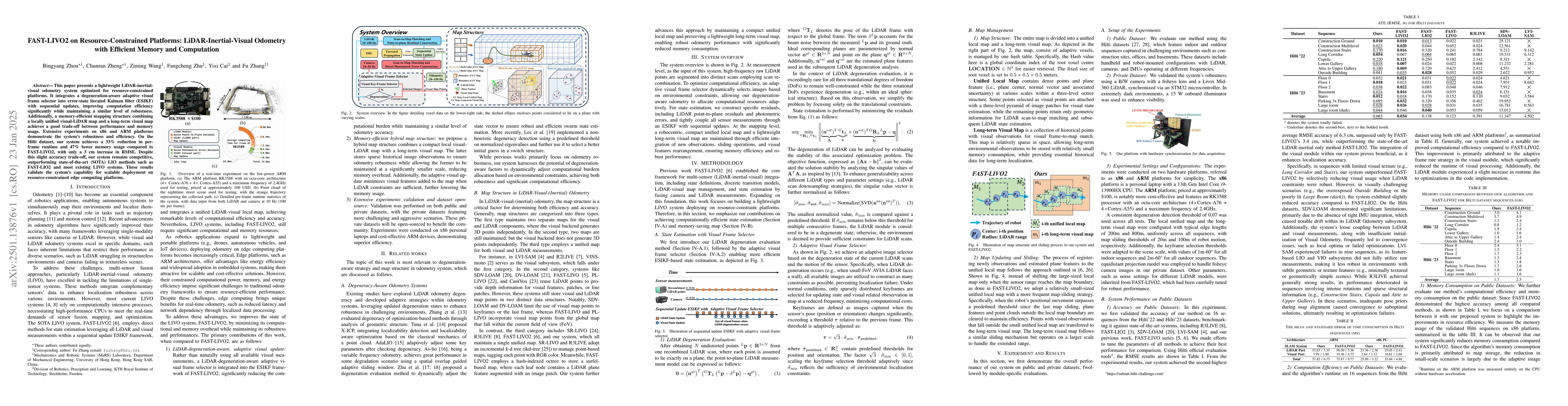
This paper presents a lightweight LiDAR-inertial-visual odometry system optimized for resource-constrained platforms. It integrates a degeneration-aware adaptive visual frame selector into error-state...
Point cloud bundle adjustment is critical in large-scale point cloud mapping. However, it is both computationally and memory intensive, with its complexity growing cubically as the number of scan pose...
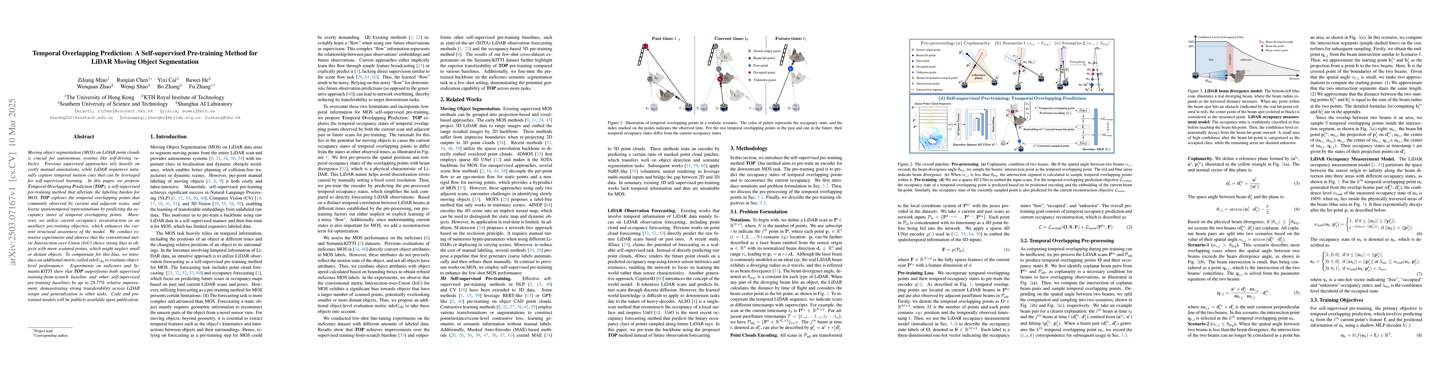
Moving object segmentation (MOS) on LiDAR point clouds is crucial for autonomous systems like self-driving vehicles. Previous supervised approaches rely heavily on costly manual annotations, while LiD...
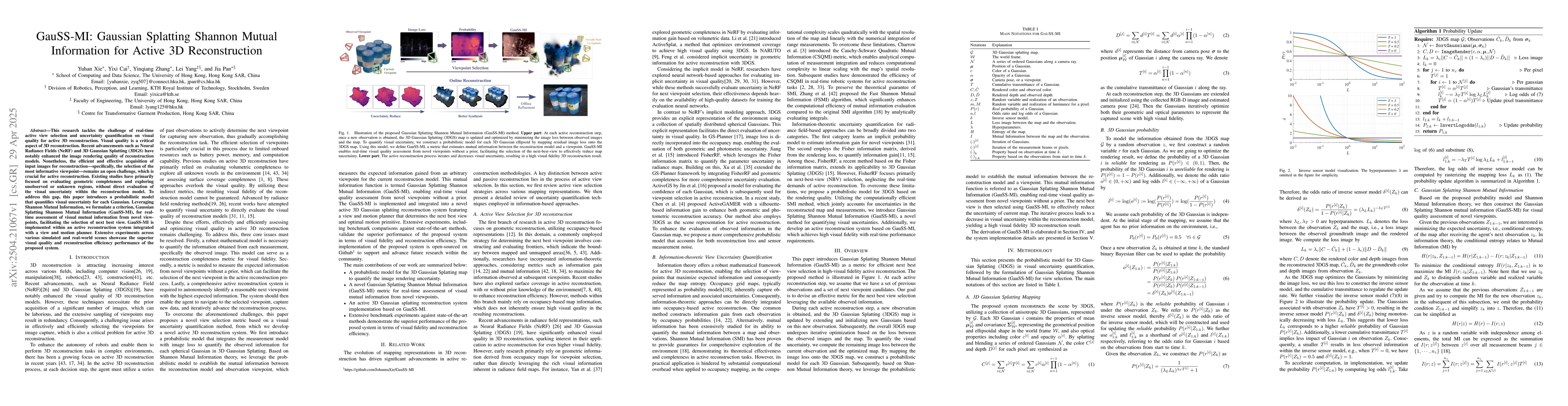
This research tackles the challenge of real-time active view selection and uncertainty quantification on visual quality for active 3D reconstruction. Visual quality is a critical aspect of 3D reconstr...
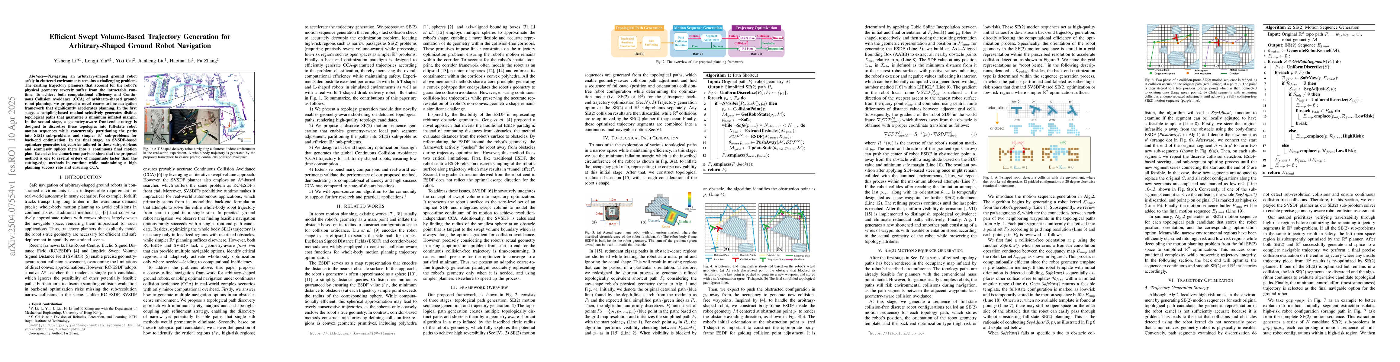
Navigating an arbitrary-shaped ground robot safely in cluttered environments remains a challenging problem. The existing trajectory planners that account for the robot's physical geometry severely suf...
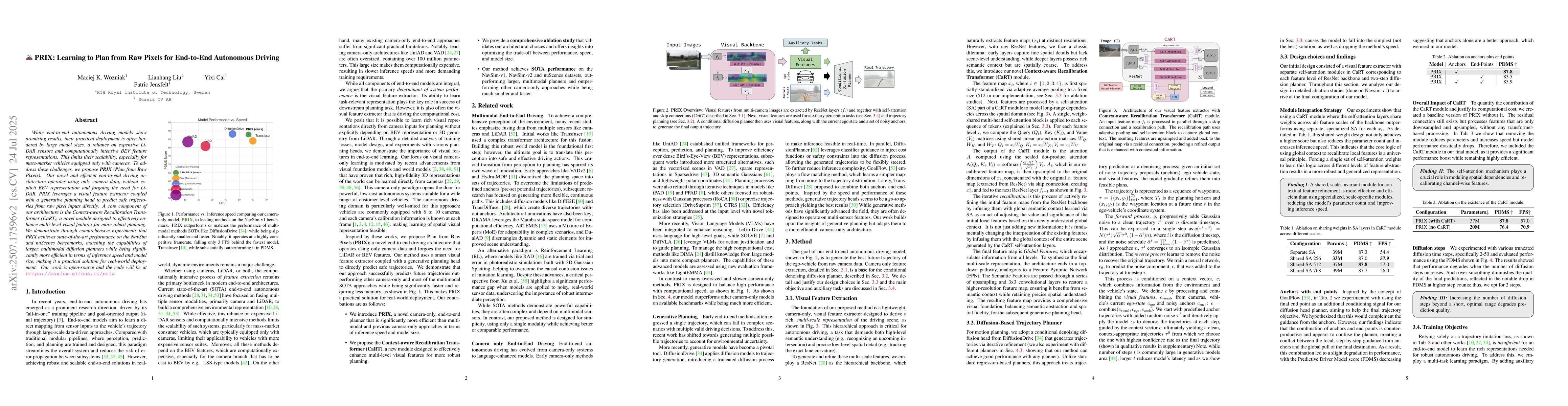
While end-to-end autonomous driving models show promising results, their practical deployment is often hindered by large model sizes, a reliance on expensive LiDAR sensors and computationally intensiv...
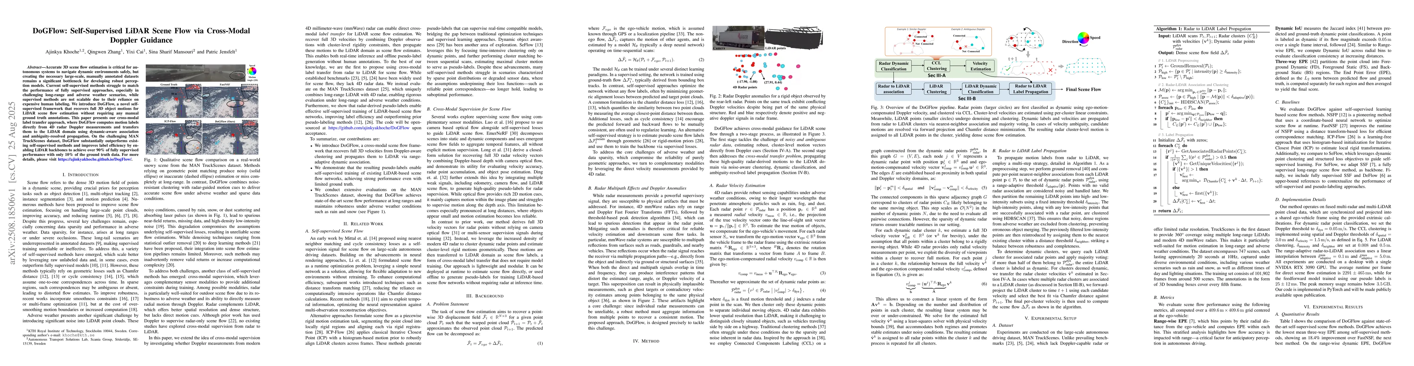
Accurate 3D scene flow estimation is critical for autonomous systems to navigate dynamic environments safely, but creating the necessary large-scale, manually annotated datasets remains a significant ...
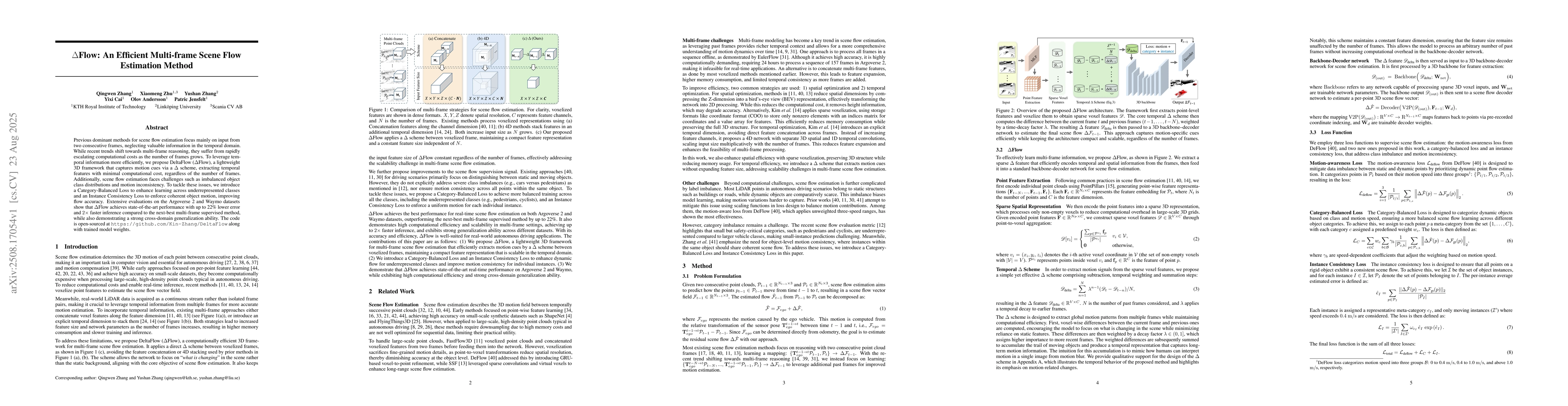
Previous dominant methods for scene flow estimation focus mainly on input from two consecutive frames, neglecting valuable information in the temporal domain. While recent trends shift towards multi-f...
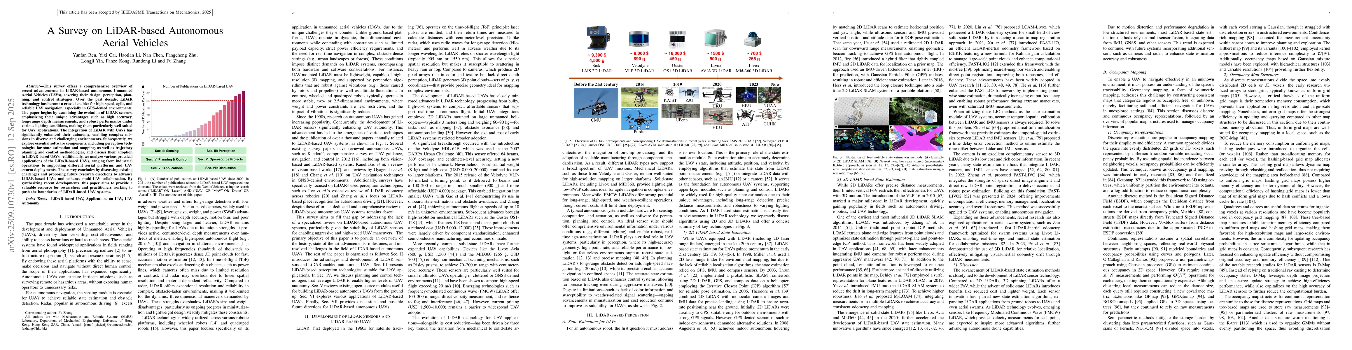
This survey offers a comprehensive overview of recent advancements in LiDAR-based autonomous Unmanned Aerial Vehicles (UAVs), covering their design, perception, planning, and control strategies. Over ...
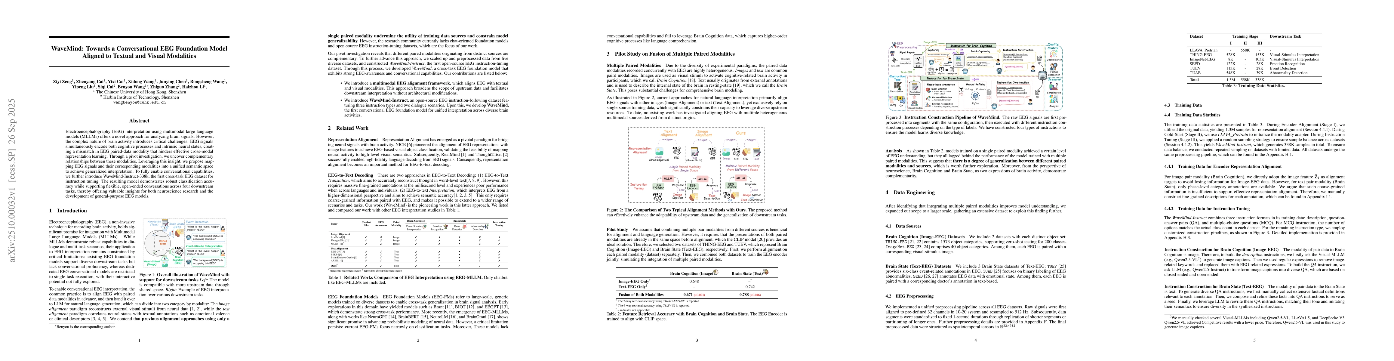
Electroencephalography (EEG) interpretation using multimodal large language models (MLLMs) offers a novel approach for analyzing brain signals. However, the complex nature of brain activity introduces...
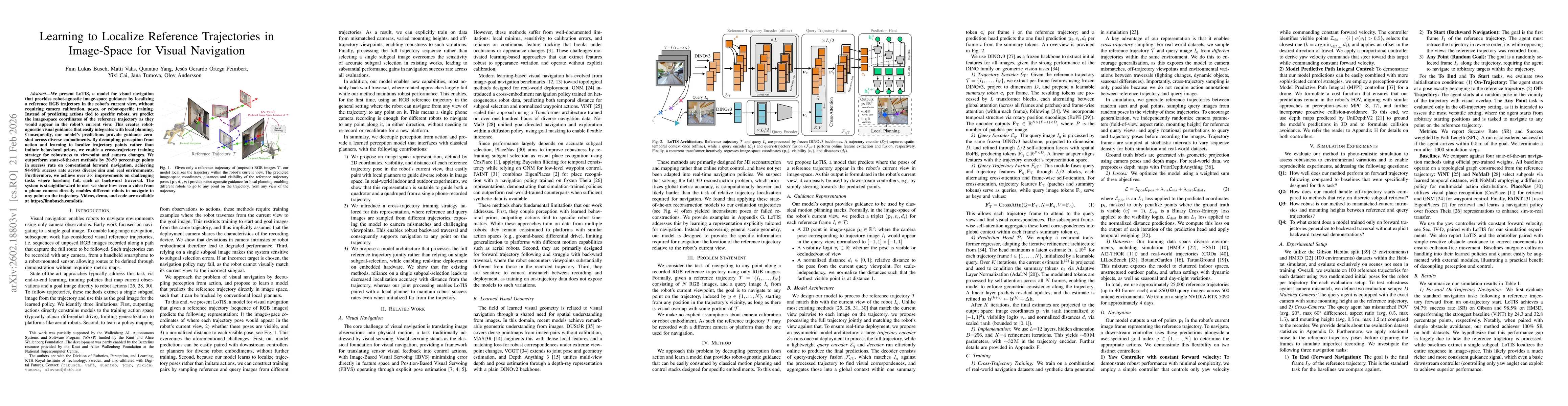
We present LoTIS, a model for visual navigation that provides robot-agnostic image-space guidance by localizing a reference RGB trajectory in the robot's current view, without requiring camera calibra...
Determining the occupancy status of locations in the environment is a fundamental task for safety-critical robotic applications. Traditional occupancy grid mapping methods subdivide the environment in...
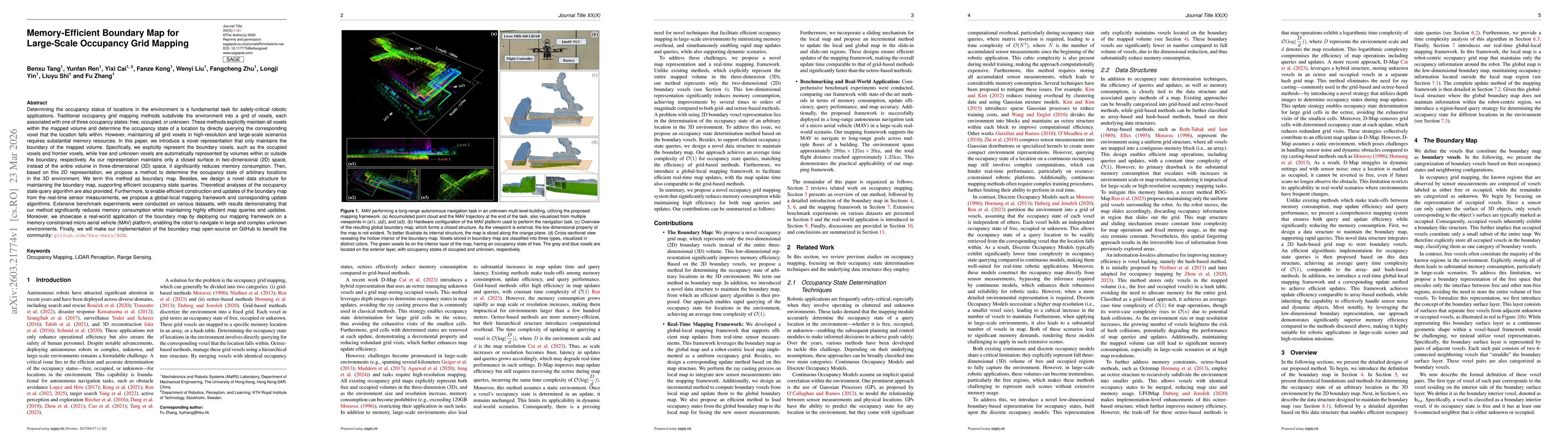
Efficient and scalable 3D occupancy mapping is essential for autonomous robot applications in unknown environments. However, traditional occupancy grid representations suffer from two fundamental limi...
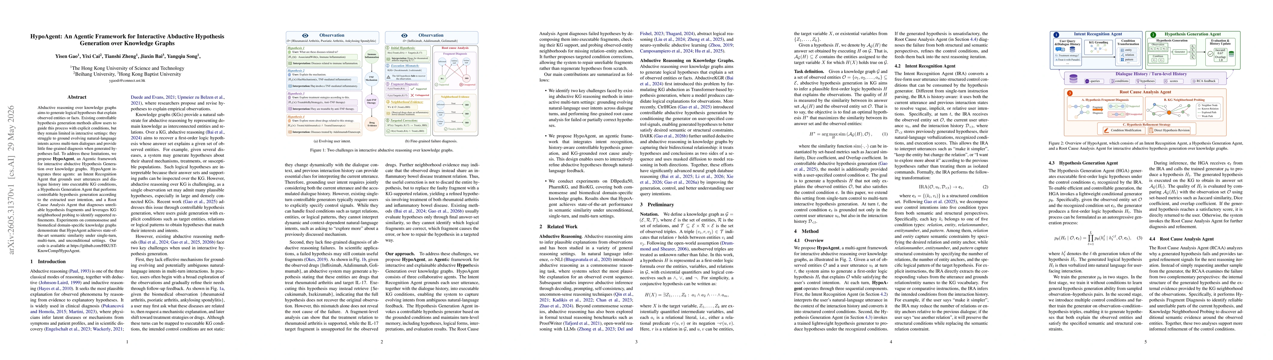
Abductive reasoning over knowledge graphs aims to generate logical hypotheses that explain observed entities or facts. Existing controllable hypothesis generation methods allow users to guide this pro...
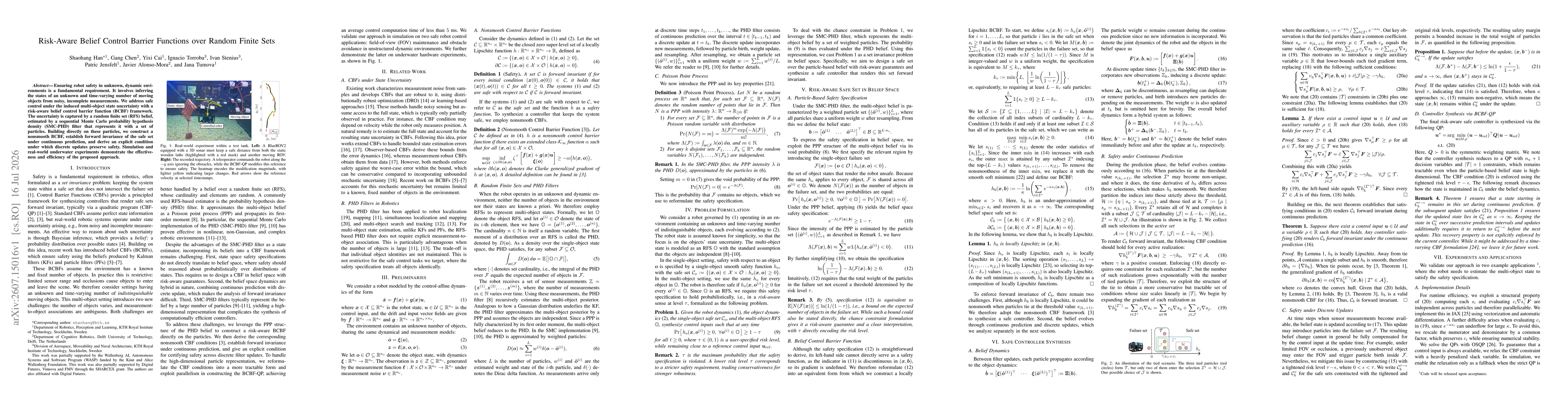
Ensuring robot safety in unknown, dynamic environments is a fundamental requirement. It involves inferring the states of an unknown and time-varying number of moving objects from noisy, incomplete mea...