Academic Profile
Statistics
Similar Authors
Papers on arXiv
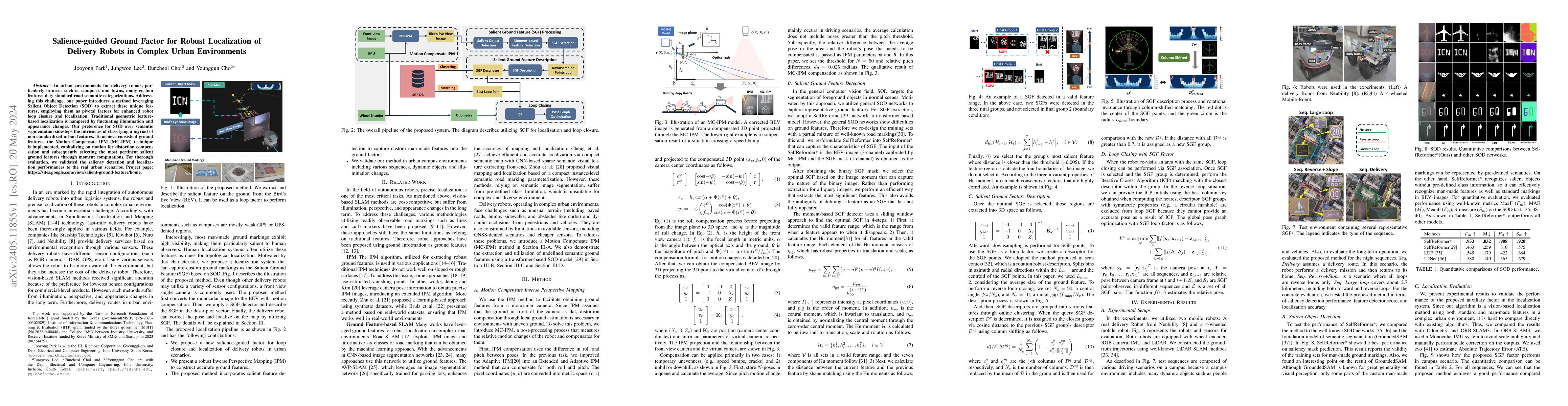
In urban environments for delivery robots, particularly in areas such as campuses and towns, many custom features defy standard road semantic categorizations. Addressing this challenge, our paper in...
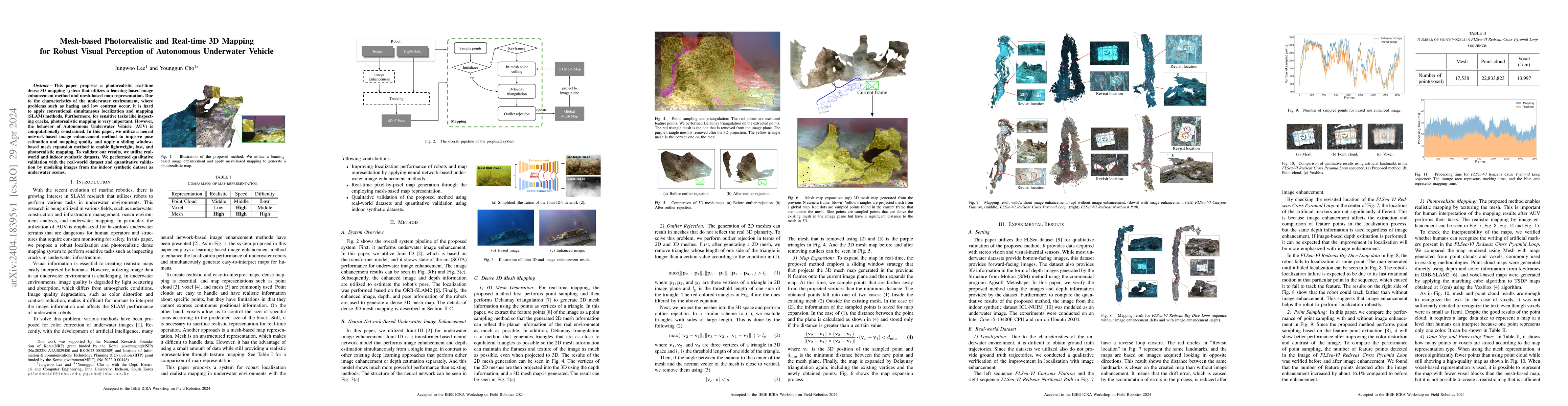
This paper proposes a photorealistic real-time dense 3D mapping system that utilizes a learning-based image enhancement method and mesh-based map representation. Due to the characteristics of the un...
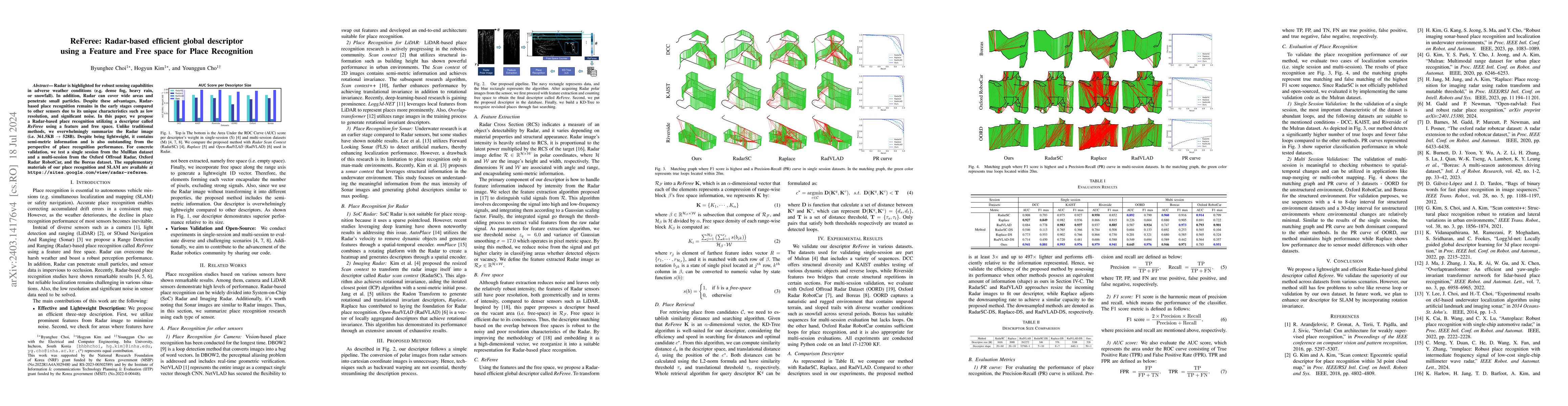
Radar is highlighted for robust sensing capabilities in adverse weather conditions (e.g. dense fog, heavy rain, or snowfall). In addition, Radar can cover wide areas and penetrate small particles. D...
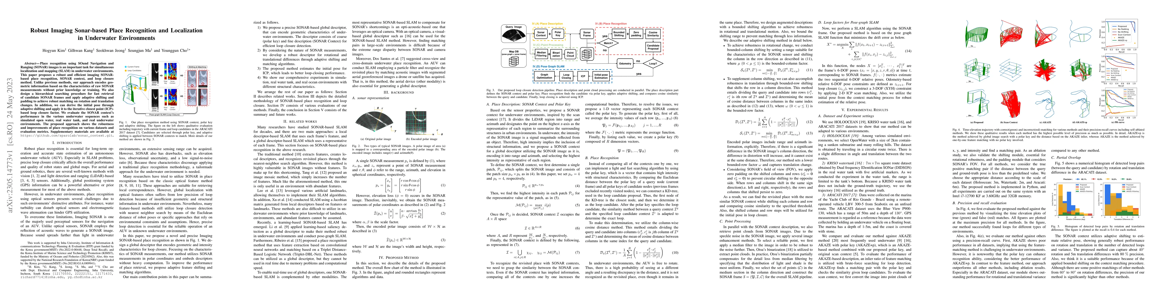
Place recognition using SOund Navigation and Ranging (SONAR) images is an important task for simultaneous localization and mapping(SLAM) in underwater environments. This paper proposes a robust and ...
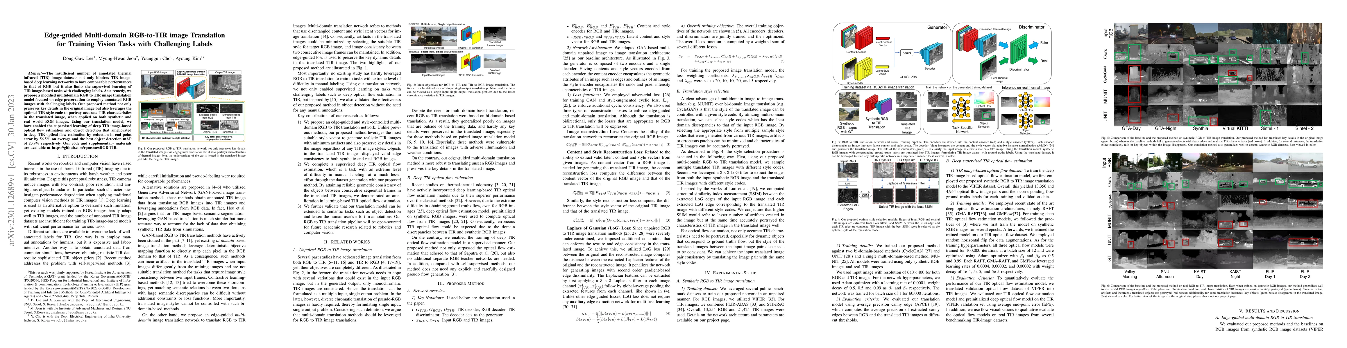
The insufficient number of annotated thermal infrared (TIR) image datasets not only hinders TIR image-based deep learning networks to have comparable performances to that of RGB but it also limits t...
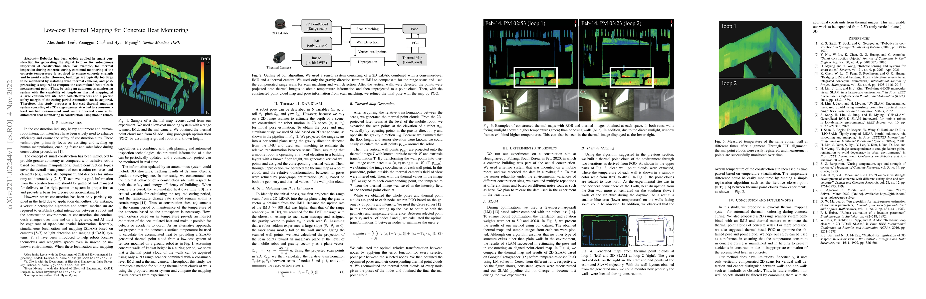
Robotics has been widely applied in smart construction for generating the digital twin or for autonomous inspection of construction sites. For example, for thermal inspection during concrete curing,...
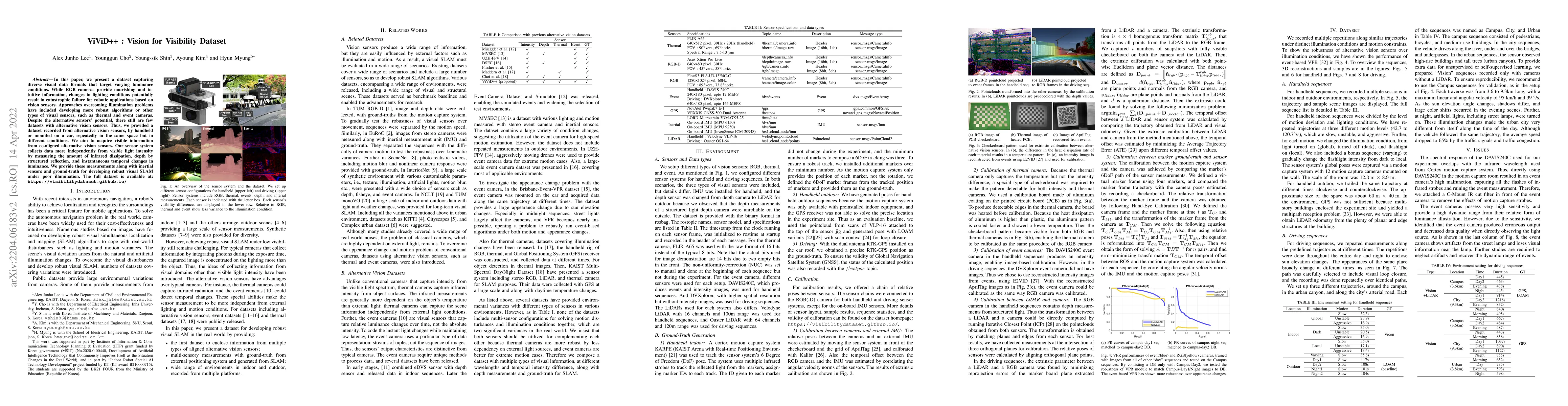
In this paper, we present a dataset capturing diverse visual data formats that target varying luminance conditions. While RGB cameras provide nourishing and intuitive information, changes in lightin...
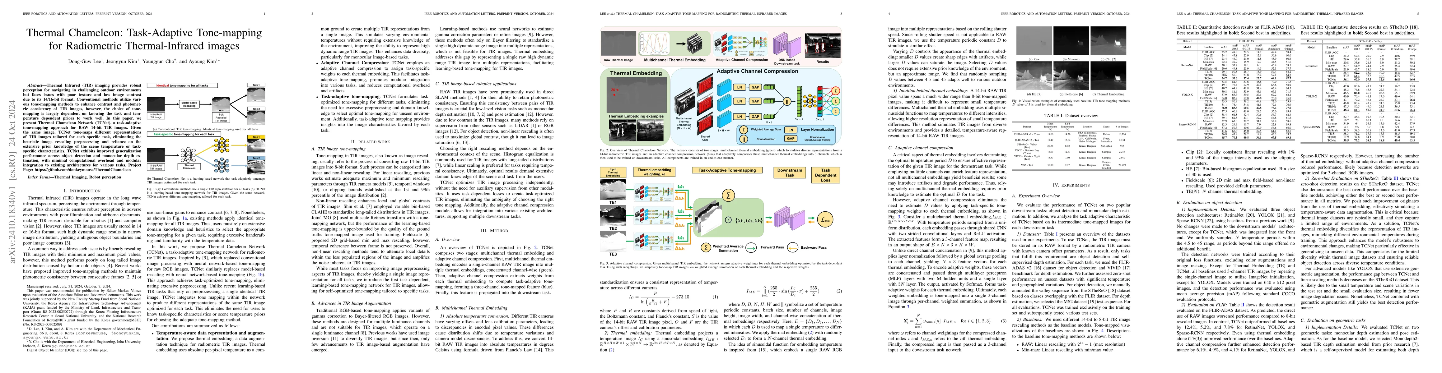
Thermal Infrared (TIR) imaging provides robust perception for navigating in challenging outdoor environments but faces issues with poor texture and low image contrast due to its 14/16-bit format. Conv...
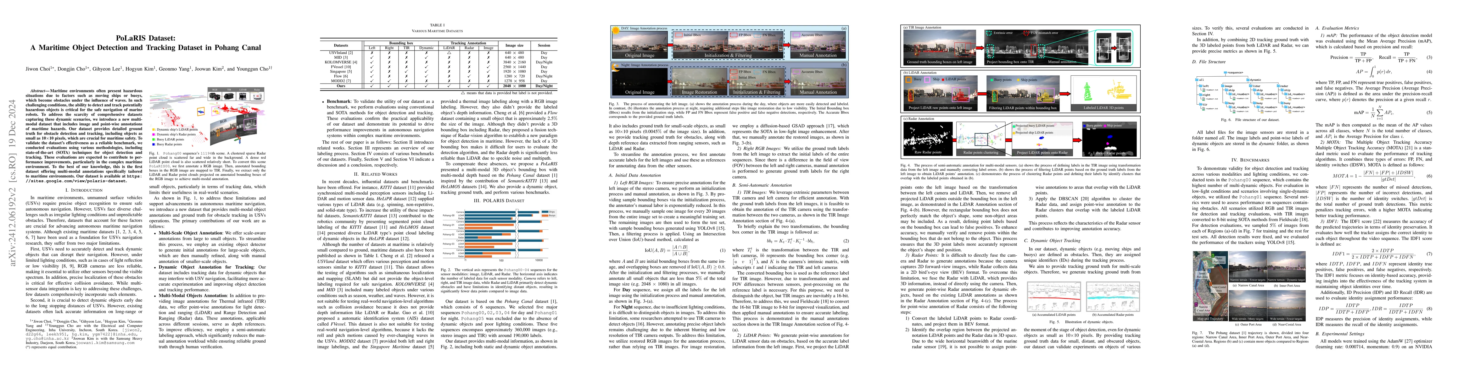
Maritime environments often present hazardous situations due to factors such as moving ships or buoys, which become obstacles under the influence of waves. In such challenging conditions, the ability ...
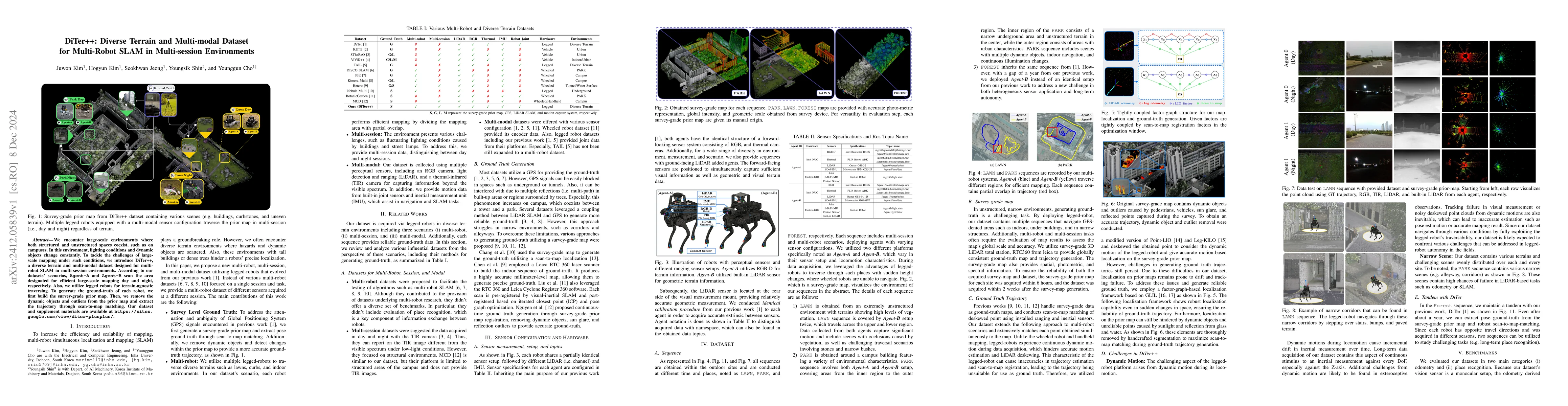
We encounter large-scale environments where both structured and unstructured spaces coexist, such as on campuses. In this environment, lighting conditions and dynamic objects change constantly. To tac...
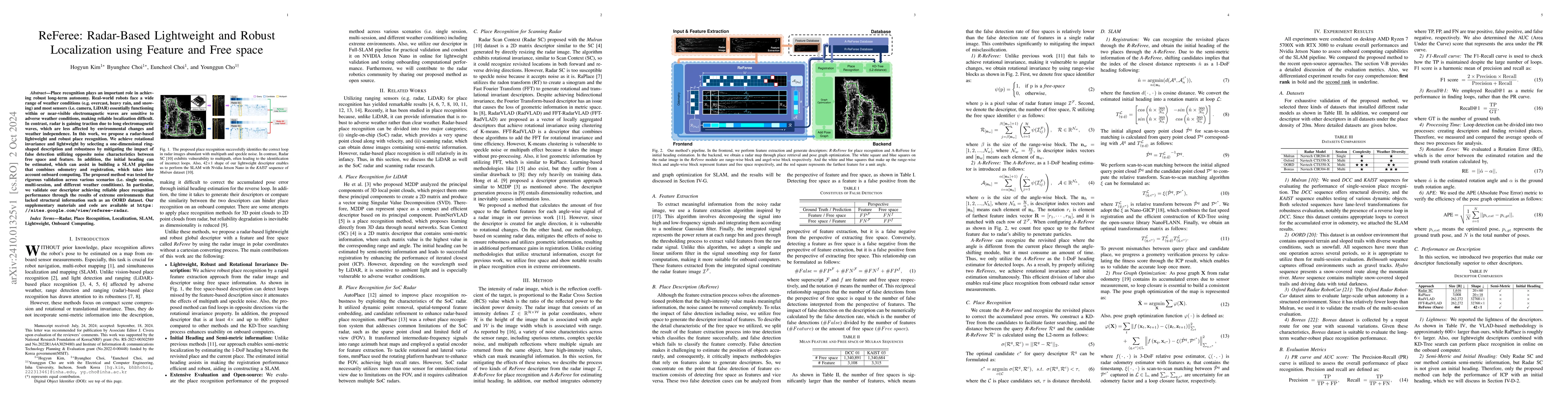
Place recognition plays an important role in achieving robust long-term autonomy. Real-world robots face a wide range of weather conditions (e.g. overcast, heavy rain, and snowing) and most sensors (i...
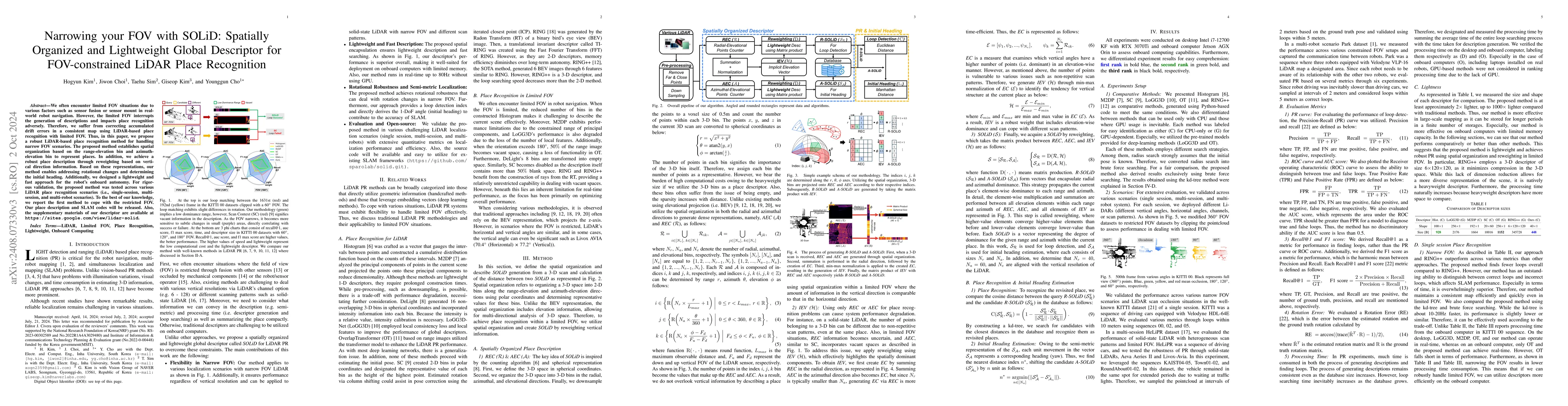
We often encounter limited FOV situations due to various factors such as sensor fusion or sensor mount in real-world robot navigation. However, the limited FOV interrupts the generation of description...
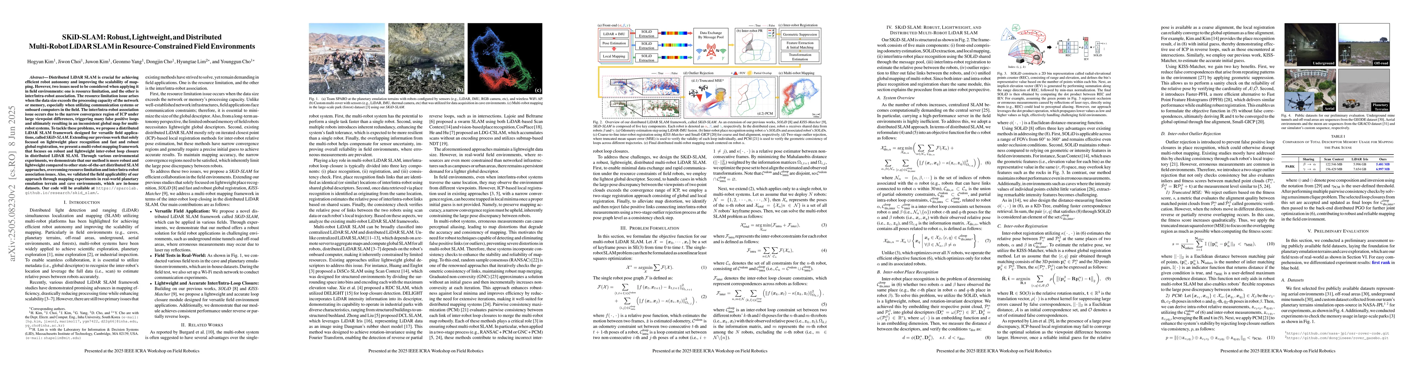
Distributed LiDAR SLAM is crucial for achieving efficient robot autonomy and improving the scalability of mapping. However, two issues need to be considered when applying it in field environments: one...
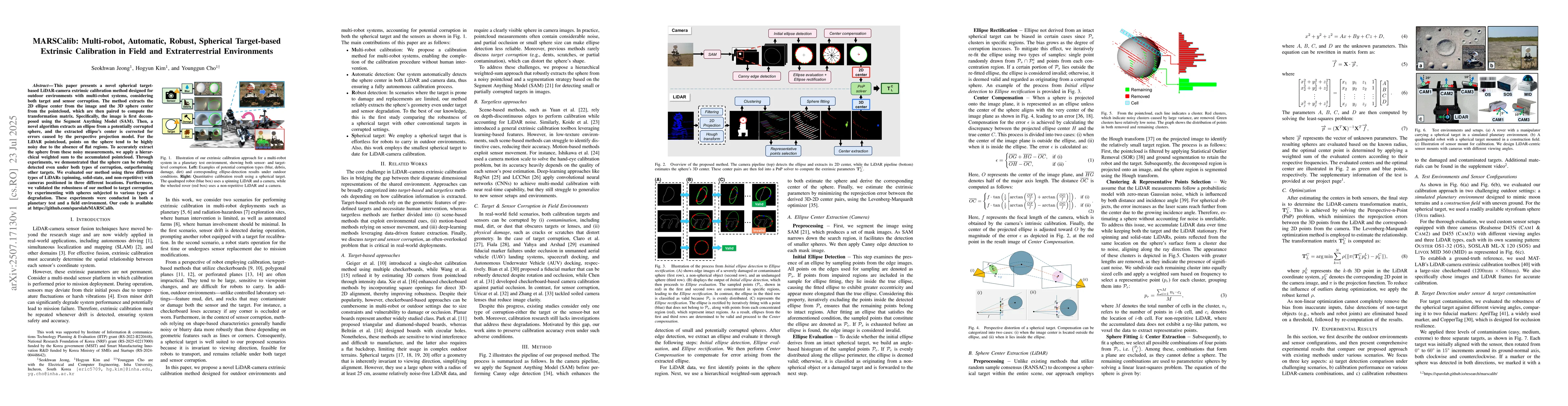
This paper presents a novel spherical target-based LiDAR-camera extrinsic calibration method designed for outdoor environments with multi-robot systems, considering both target and sensor corruption. ...
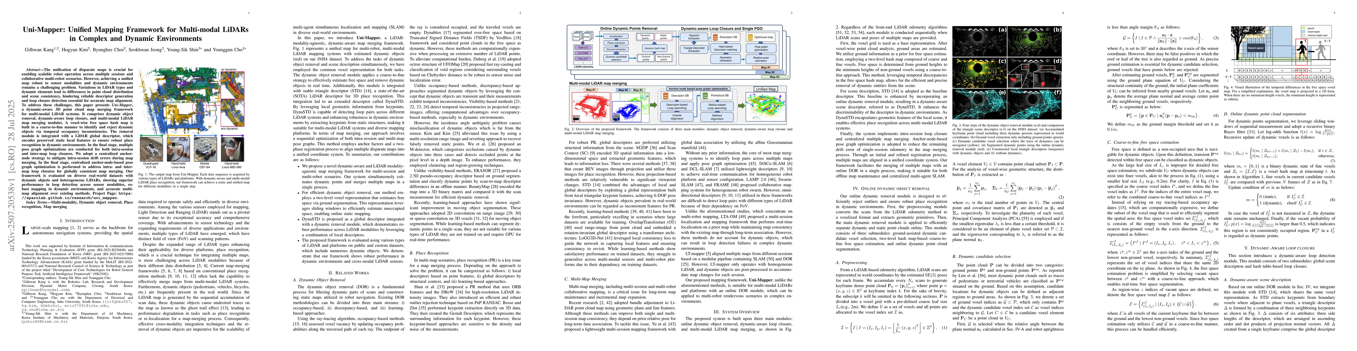
The unification of disparate maps is crucial for enabling scalable robot operation across multiple sessions and collaborative multi-robot scenarios. However, achieving a unified map robust to sensor m...
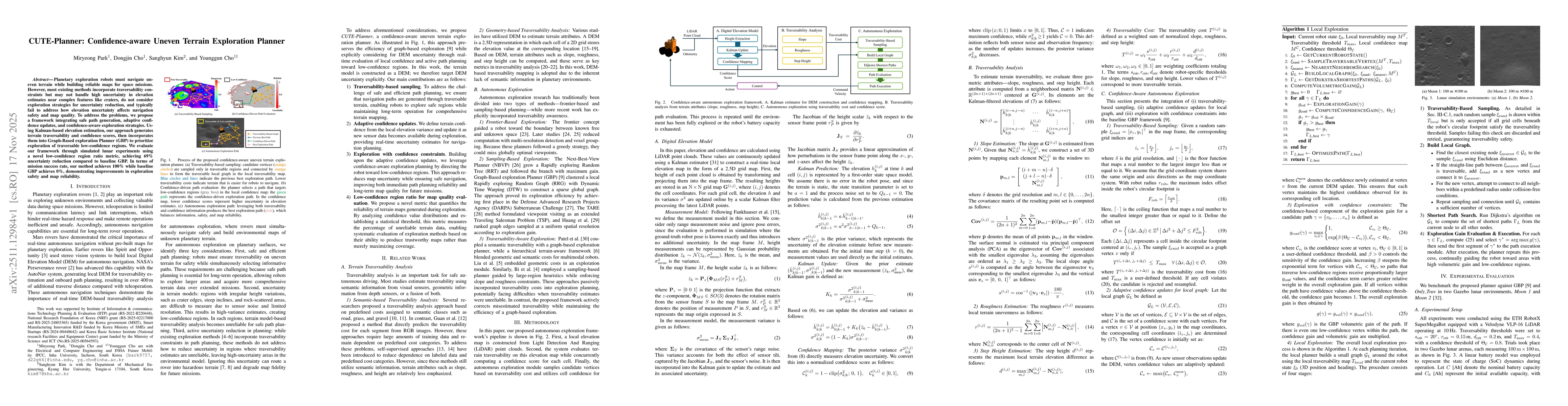
Planetary exploration robots must navigate uneven terrain while building reliable maps for space missions. However, most existing methods incorporate traversability constraints but may not handle high...
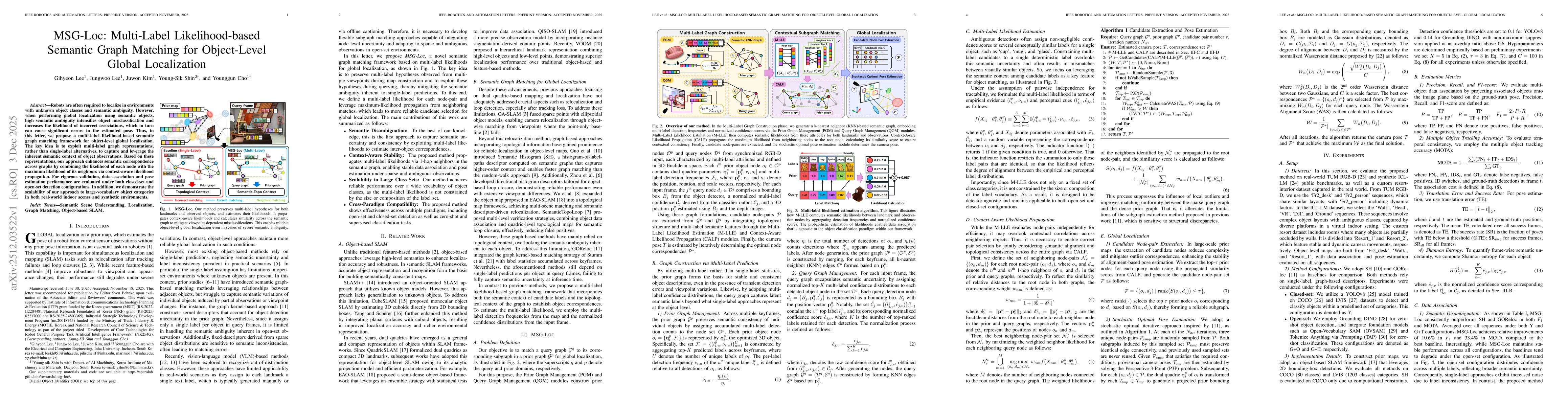
Robots are often required to localize in environments with unknown object classes and semantic ambiguity. However, when performing global localization using semantic objects, high semantic ambiguity i...
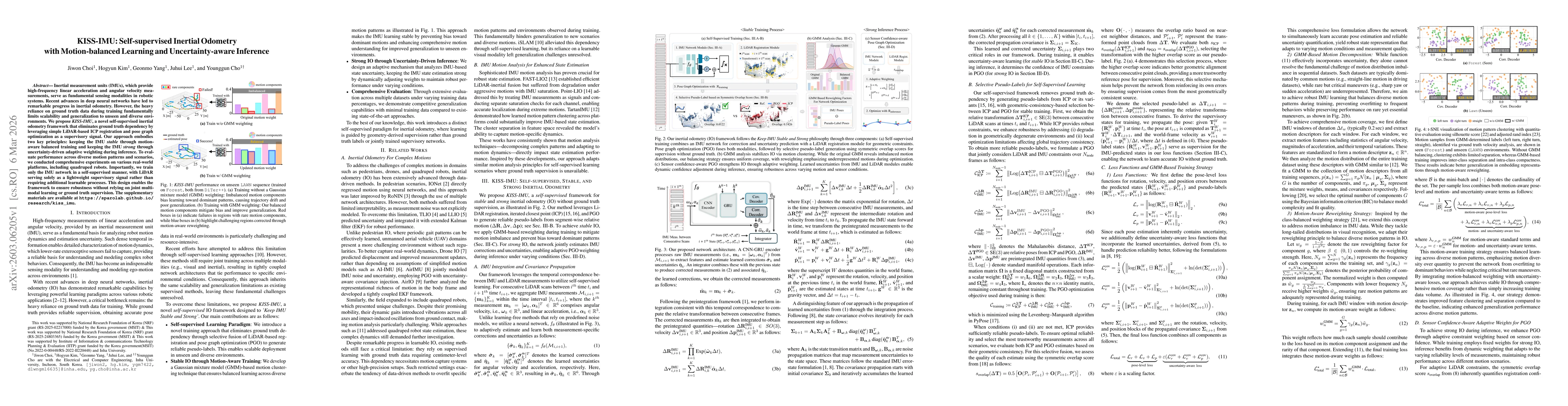
Inertial measurement units (IMUs), which provide high-frequency linear acceleration and angular velocity measurements, serve as fundamental sensing modalities in robotic systems. Recent advances in de...
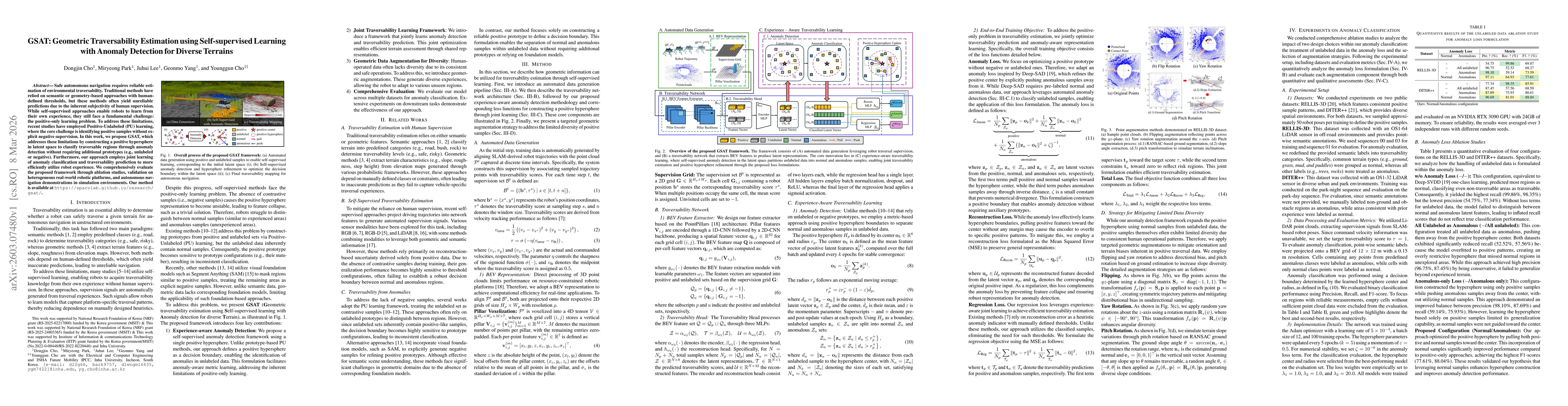
Safe autonomous navigation requires reliable estimation of environmental traversability. Traditional methods have relied on semantic or geometry-based approaches with human-defined thresholds, but the...
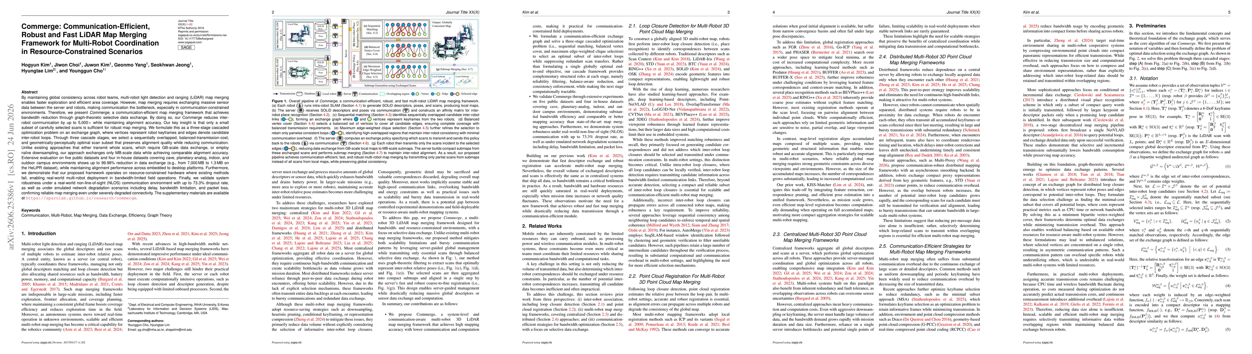
By maintaining global consistency across robot teams, multi-robot LiDAR map merging enables faster exploration and efficient area coverage. However, map merging requires exchanging massive sensor data...
This paper proposes a robust image processing framework for underwater robot-based construction environment monitoring, targeting complex degradations observed in real marine environments. Unlike conv...