Academic Profile
Statistics
Similar Authors
Papers on arXiv
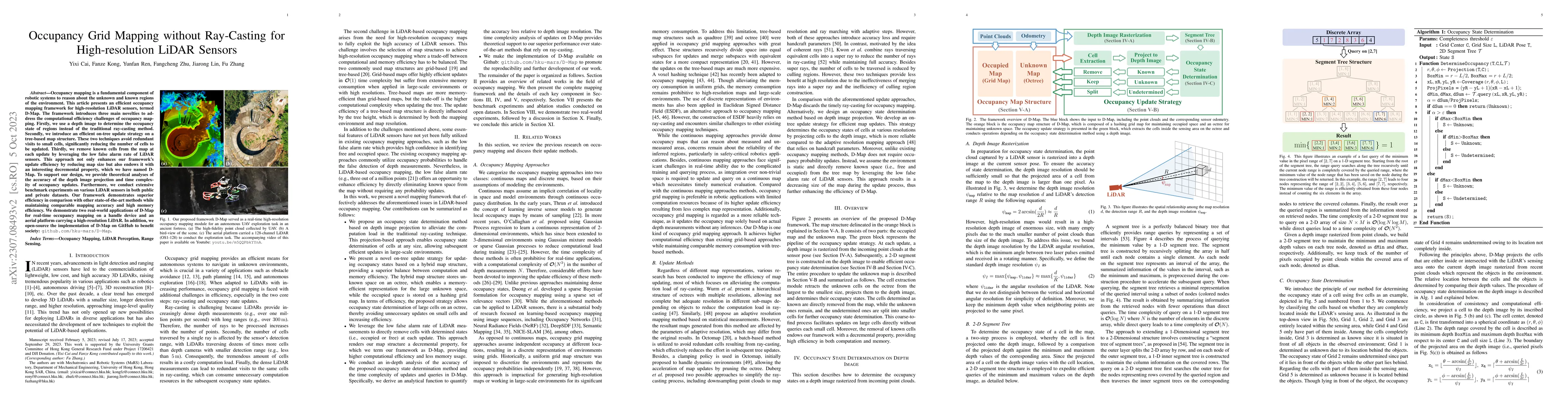
Occupancy mapping is a fundamental component of robotic systems to reason about the unknown and known regions of the environment. This article presents an efficient occupancy mapping framework for h...
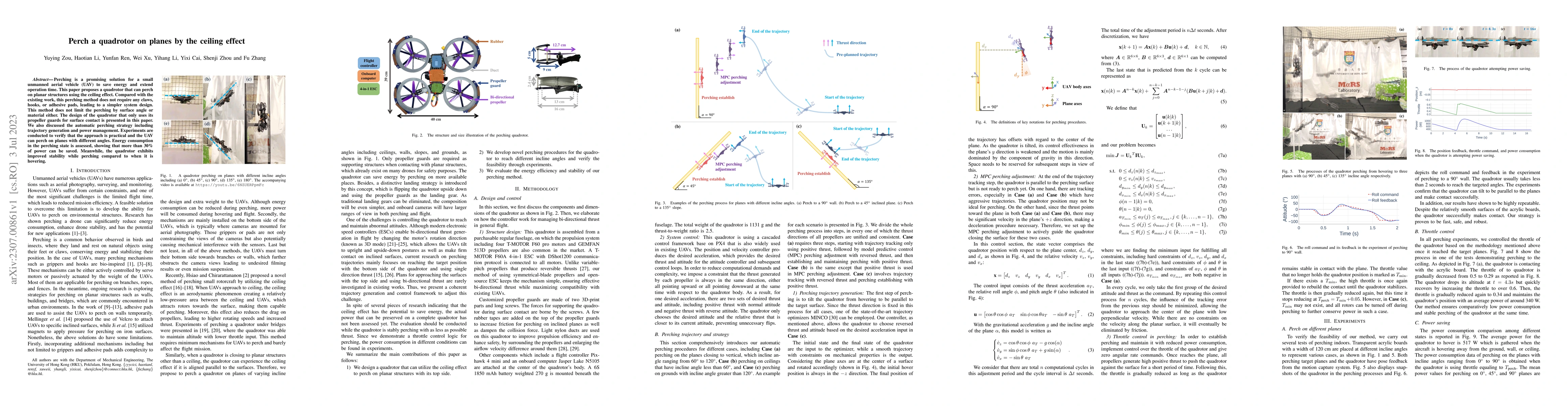
Perching is a promising solution for a small unmanned aerial vehicle (UAV) to save energy and extend operation time. This paper proposes a quadrotor that can perch on planar structures using the cei...
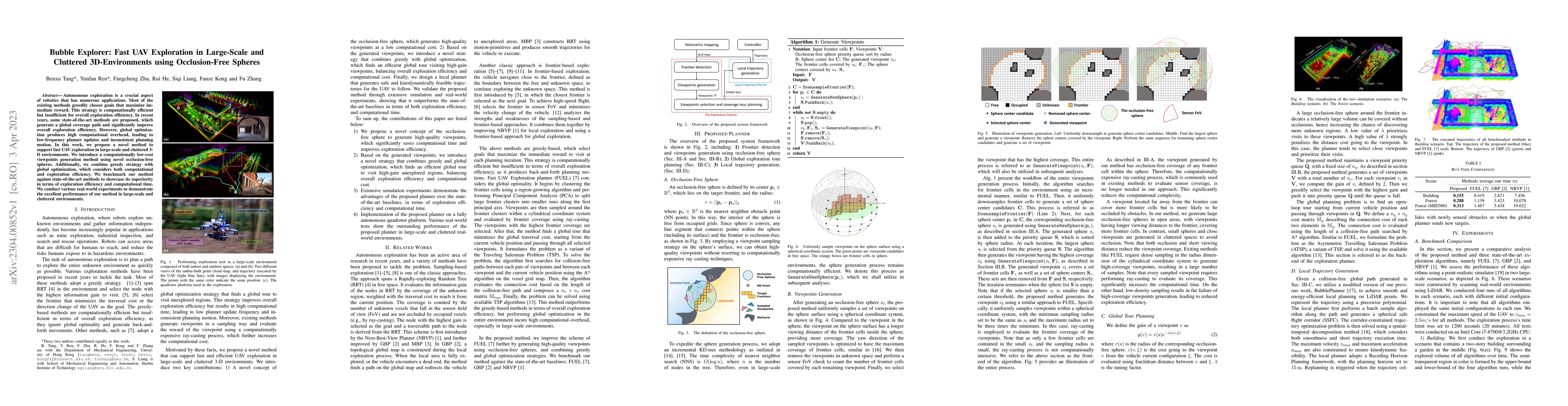
Autonomous exploration is a crucial aspect of robotics that has numerous applications. Most of the existing methods greedily choose goals that maximize immediate reward. This strategy is computation...
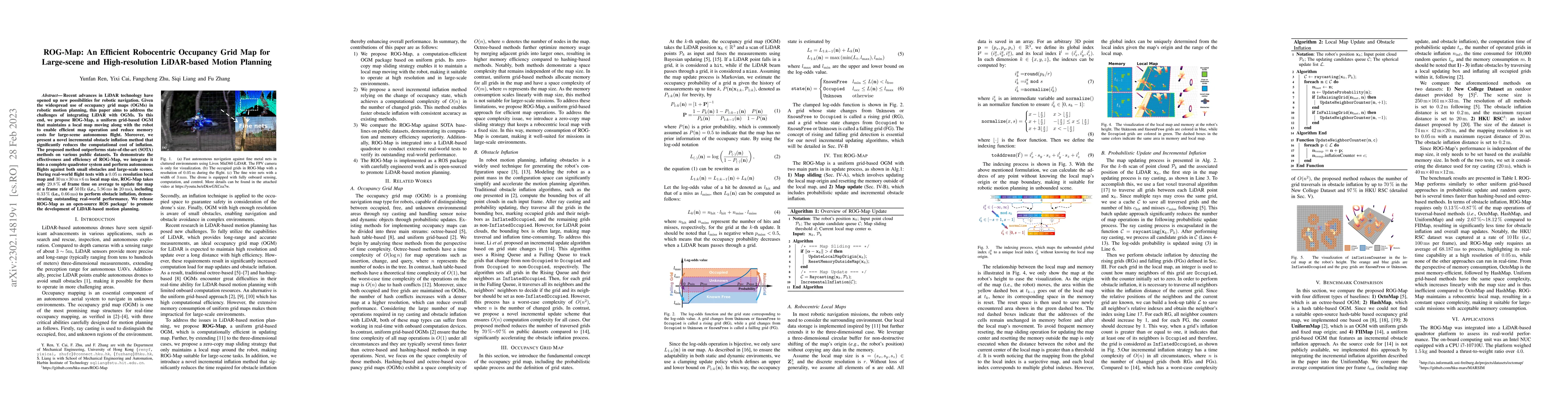
Recent advances in LiDAR technology have opened up new possibilities for robotic navigation. Given the widespread use of occupancy grid maps (OGMs) in robotic motion planning, this paper aims to add...
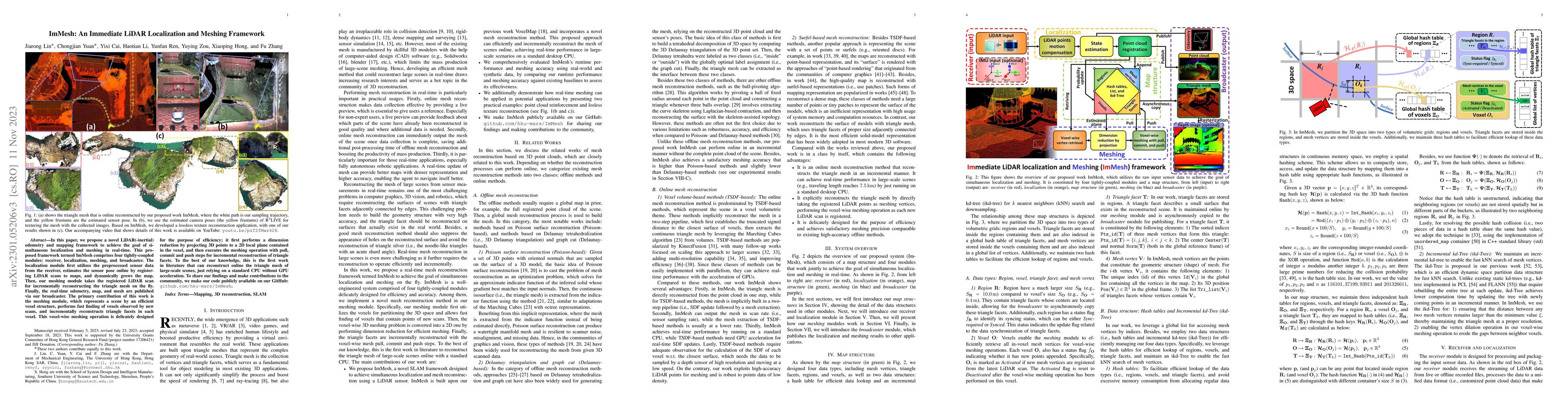
In this paper, we propose a novel LiDAR(-inertial) odometry and mapping framework to achieve the goal of simultaneous localization and meshing in real-time. This proposed framework termed ImMesh com...
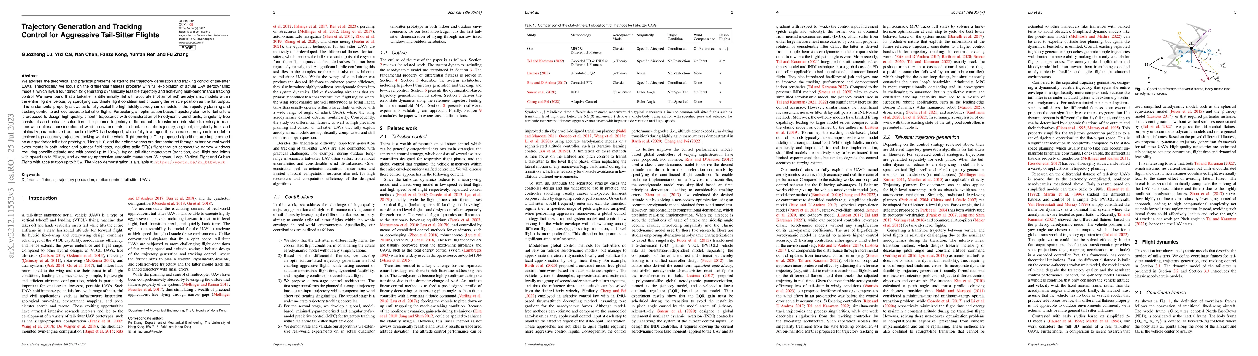
We address the theoretical and practical problems related to the trajectory generation and tracking control of tail-sitter UAVs. Theoretically, we focus on the differential flatness property with fu...
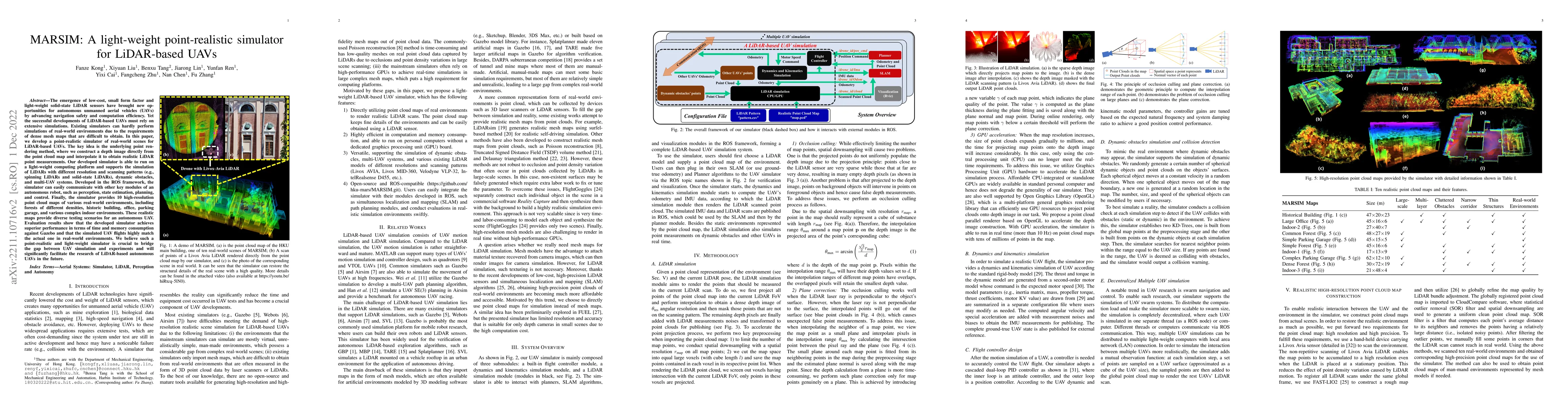
The emergence of low-cost, small form factor and light-weight solid-state LiDAR sensors have brought new opportunities for autonomous unmanned aerial vehicles (UAVs) by advancing navigation safety a...
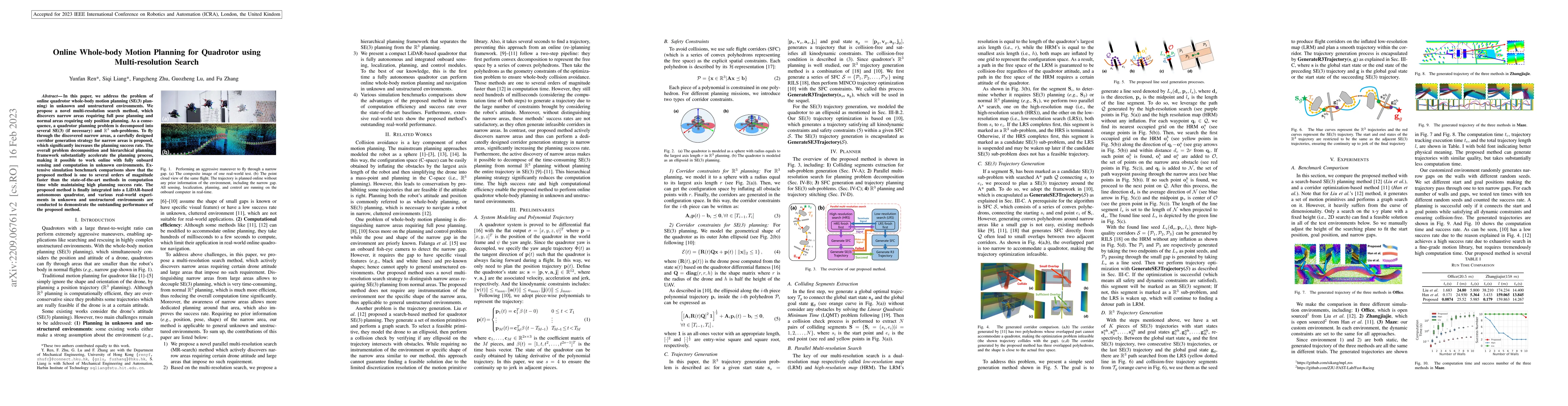
In this paper, we address the problem of online quadrotor whole-body motion planning (SE(3) planning) in unknown and unstructured environments. We propose a novel multi-resolution search method, whi...
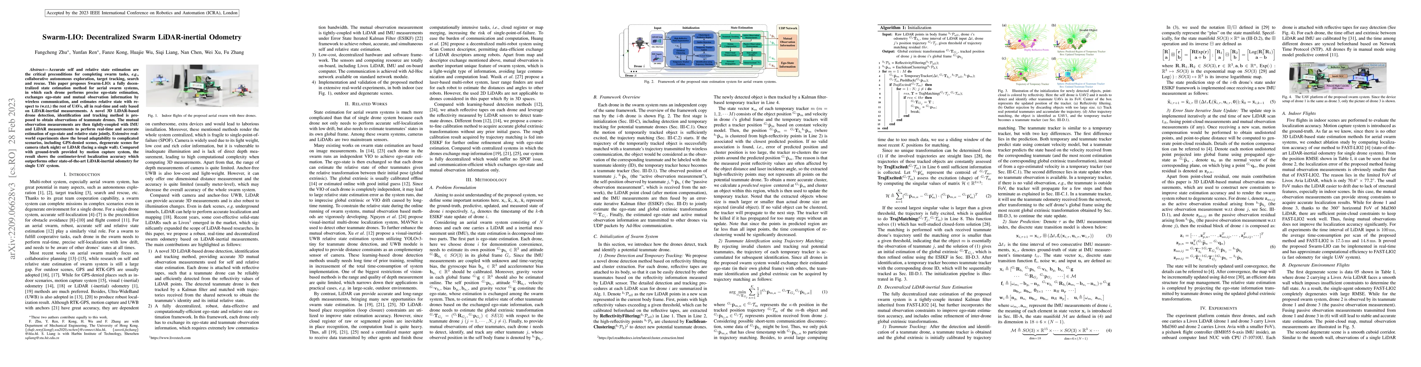
Accurate self and relative state estimation are the critical preconditions for completing swarm tasks, e.g., collaborative autonomous exploration, target tracking, search and rescue. This paper prop...
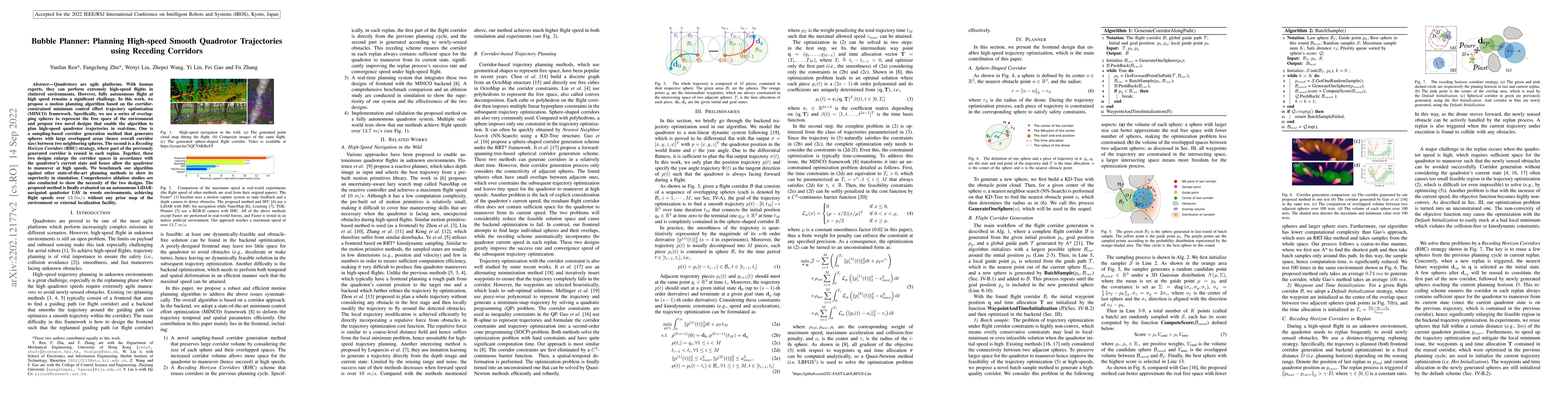
Quadrotors are agile platforms. With human experts, they can perform extremely high-speed flights in cluttered environments. However, fully autonomous flight at high speed remains a significant chal...
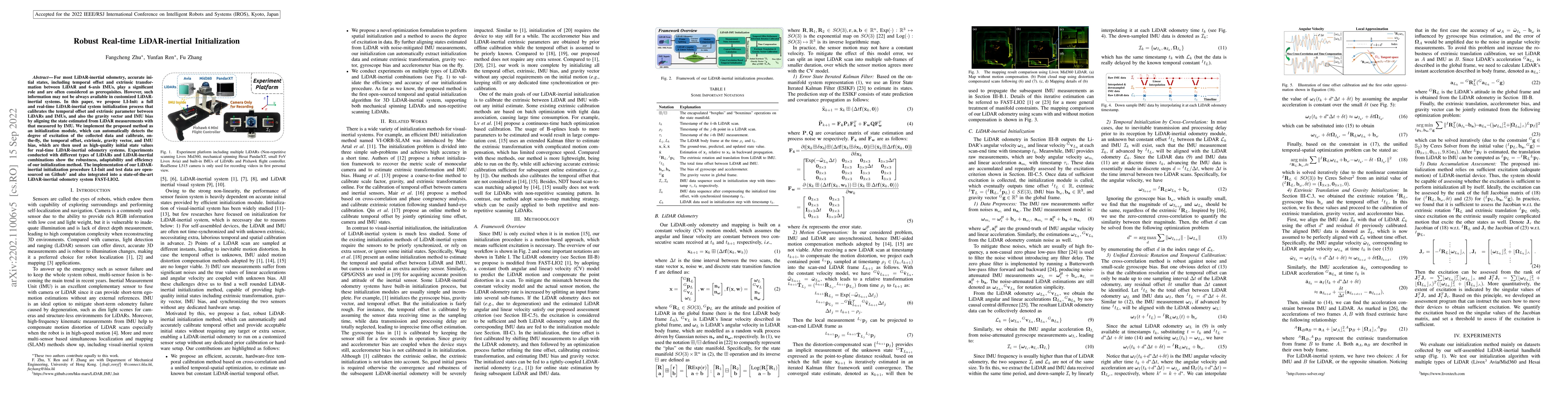
For most LiDAR-inertial odometry, accurate initial states, including temporal offset and extrinsic transformation between LiDAR and 6-axis IMUs, play a significant role and are often considered as p...
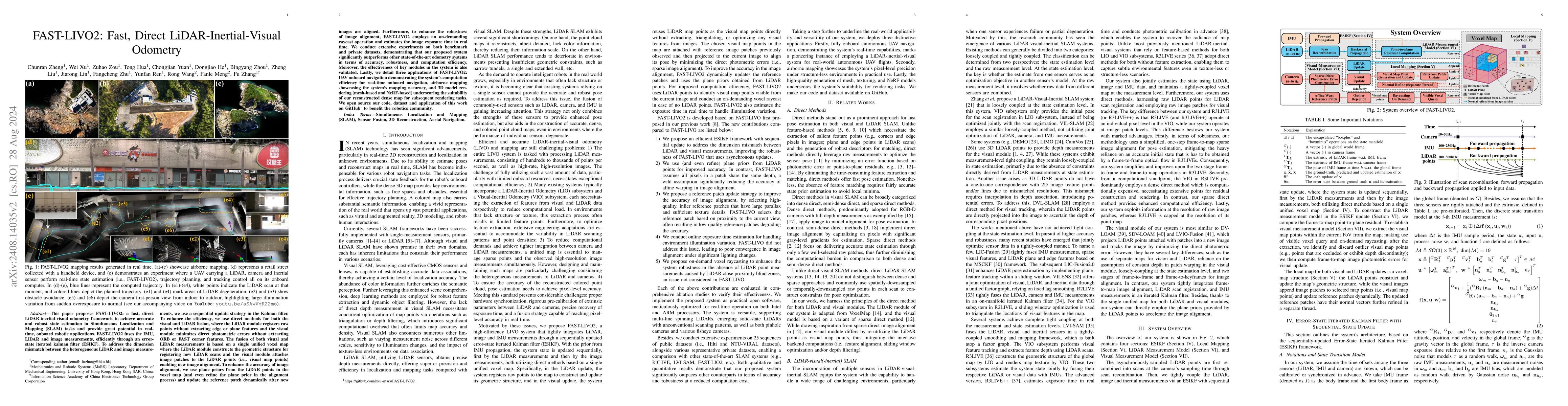
This paper proposes FAST-LIVO2: a fast, direct LiDAR-inertial-visual odometry framework to achieve accurate and robust state estimation in SLAM tasks and provide great potential in real-time, onboard ...
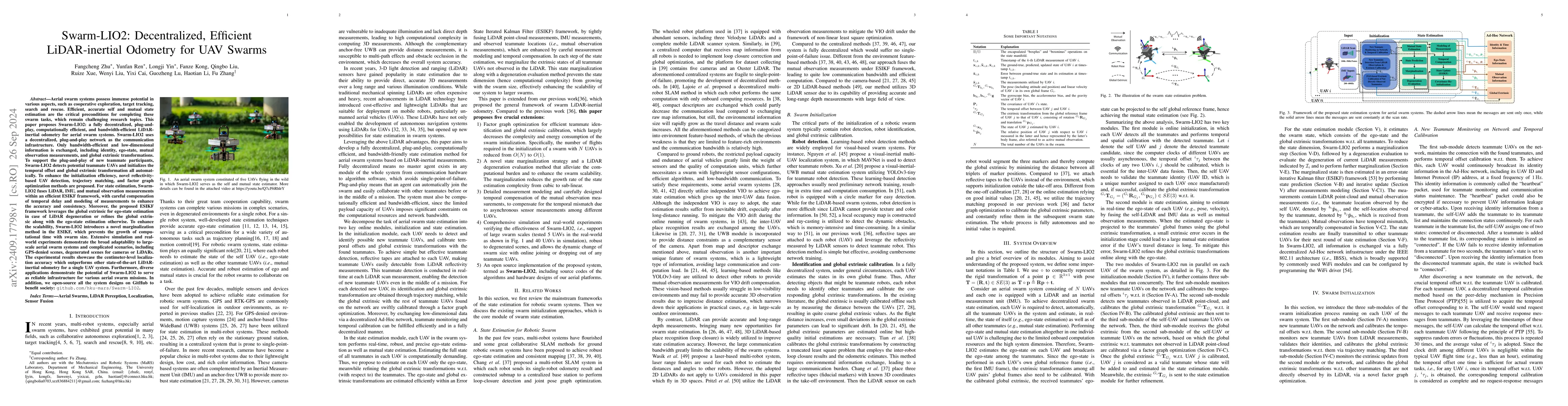
Aerial swarm systems possess immense potential in various aspects, such as cooperative exploration, target tracking, search and rescue. Efficient, accurate self and mutual state estimation are the cri...
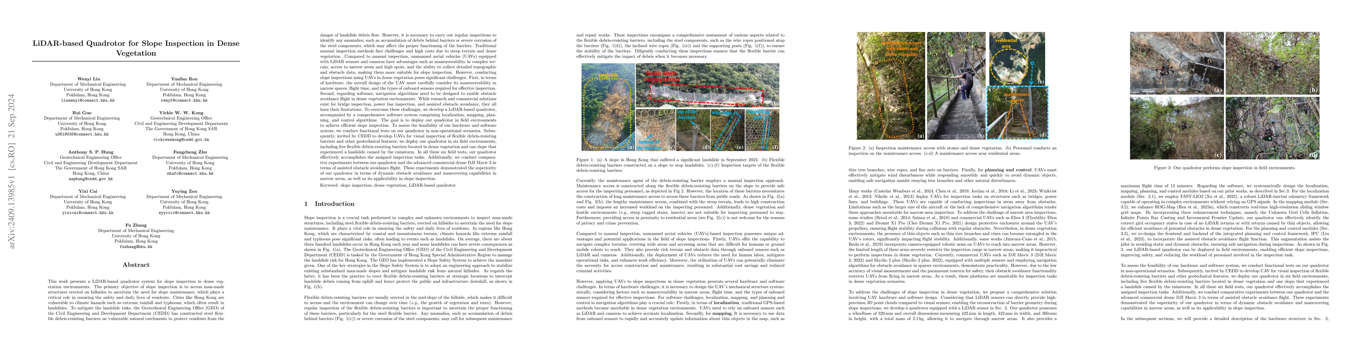
This work presents a LiDAR-based quadrotor system for slope inspection in dense vegetation environments. Cities like Hong Kong are vulnerable to climate hazards, which often result in landslides. To m...
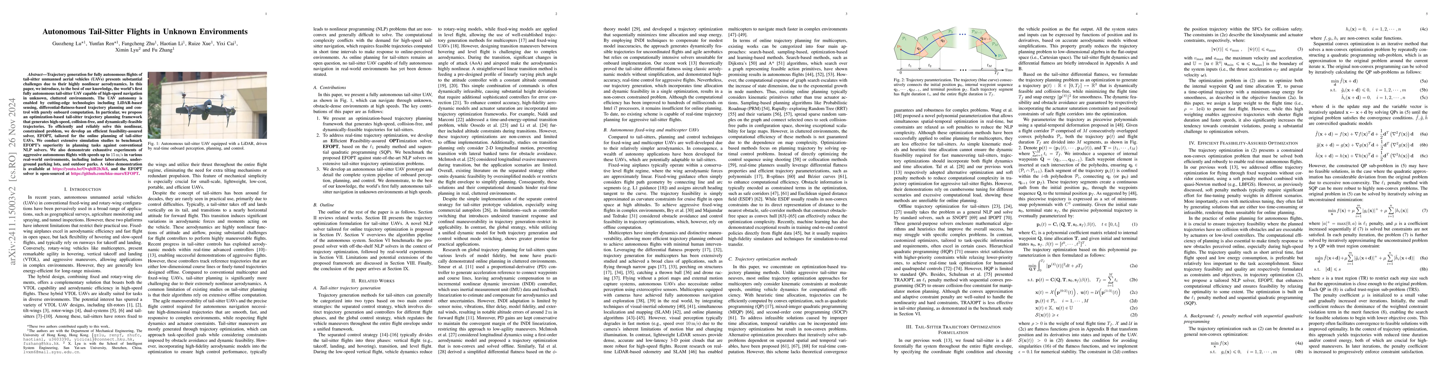
Trajectory generation for fully autonomous flights of tail-sitter unmanned aerial vehicles (UAVs) presents substantial challenges due to their highly nonlinear aerodynamics. In this paper, we introduc...
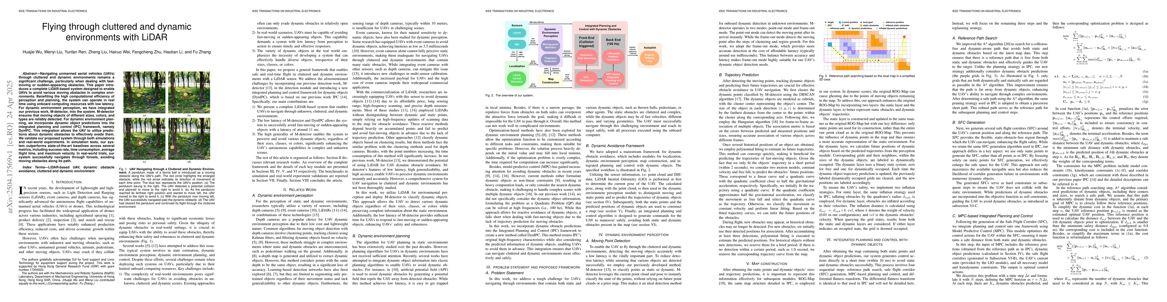
Navigating unmanned aerial vehicles (UAVs) through cluttered and dynamic environments remains a significant challenge, particularly when dealing with fast-moving or sudden-appearing obstacles. This pa...
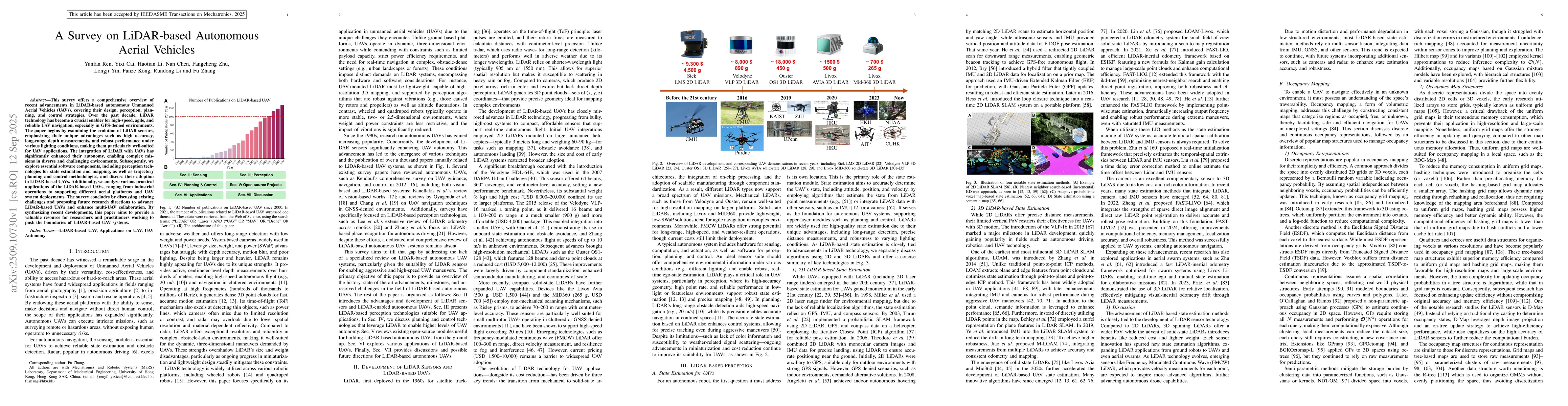
This survey offers a comprehensive overview of recent advancements in LiDAR-based autonomous Unmanned Aerial Vehicles (UAVs), covering their design, perception, planning, and control strategies. Over ...
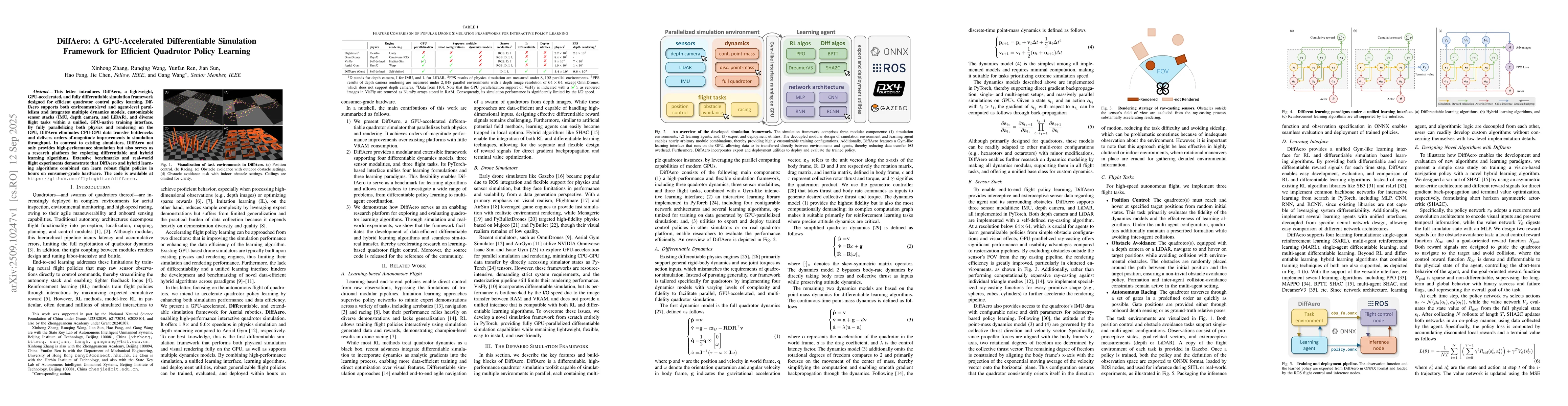
This letter introduces DiffAero, a lightweight, GPU-accelerated, and fully differentiable simulation framework designed for efficient quadrotor control policy learning. DiffAero supports both environm...
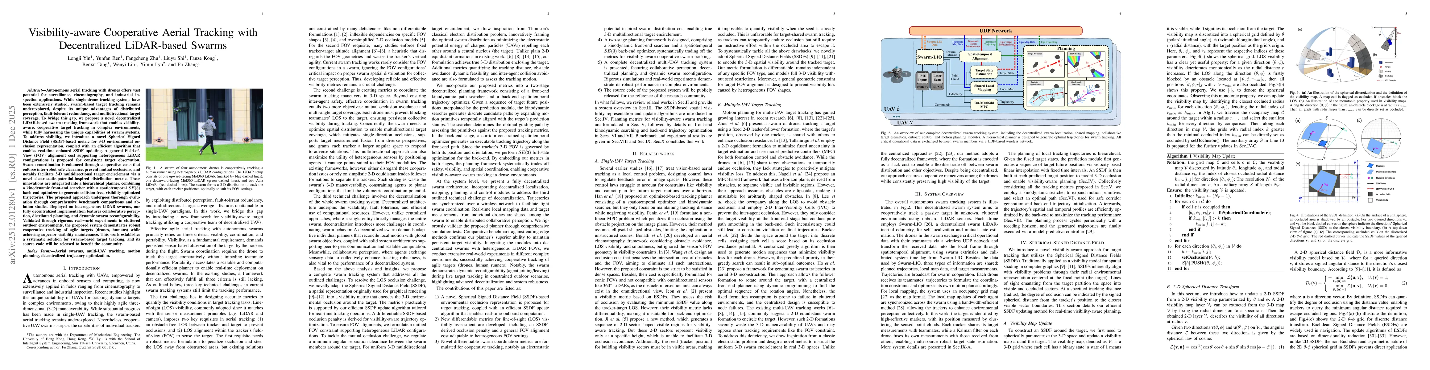
Autonomous aerial tracking with drones offers vast potential for surveillance, cinematography, and industrial inspection applications. While single-drone tracking systems have been extensively studied...
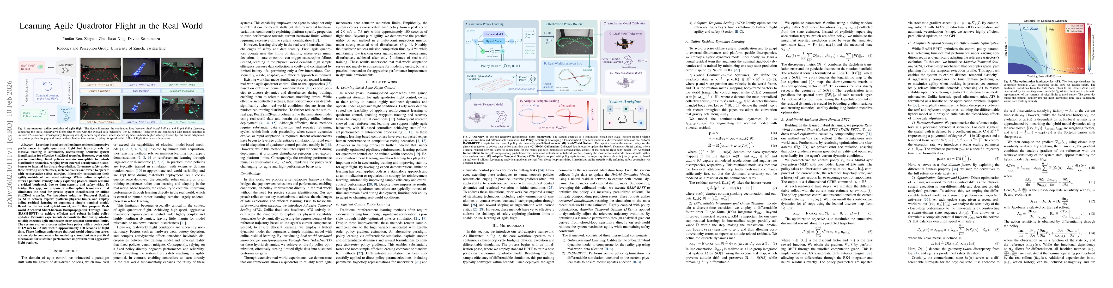
Learning-based controllers have achieved impressive performance in agile quadrotor flight but typically rely on massive training in simulation, necessitating accurate system identification for effecti...
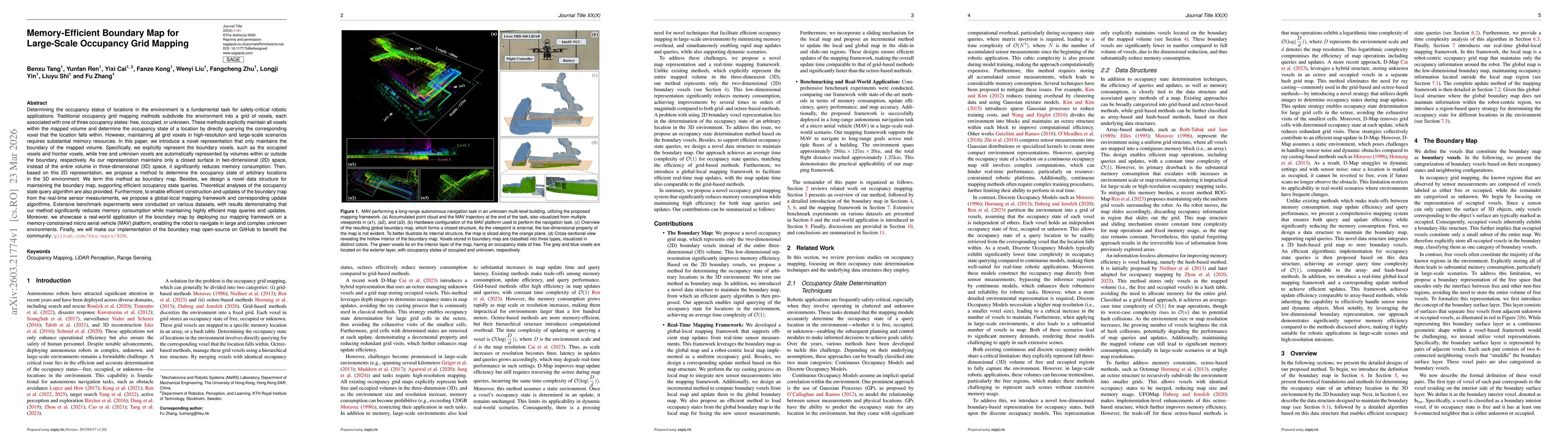
Determining the occupancy status of locations in the environment is a fundamental task for safety-critical robotic applications. Traditional occupancy grid mapping methods subdivide the environment in...
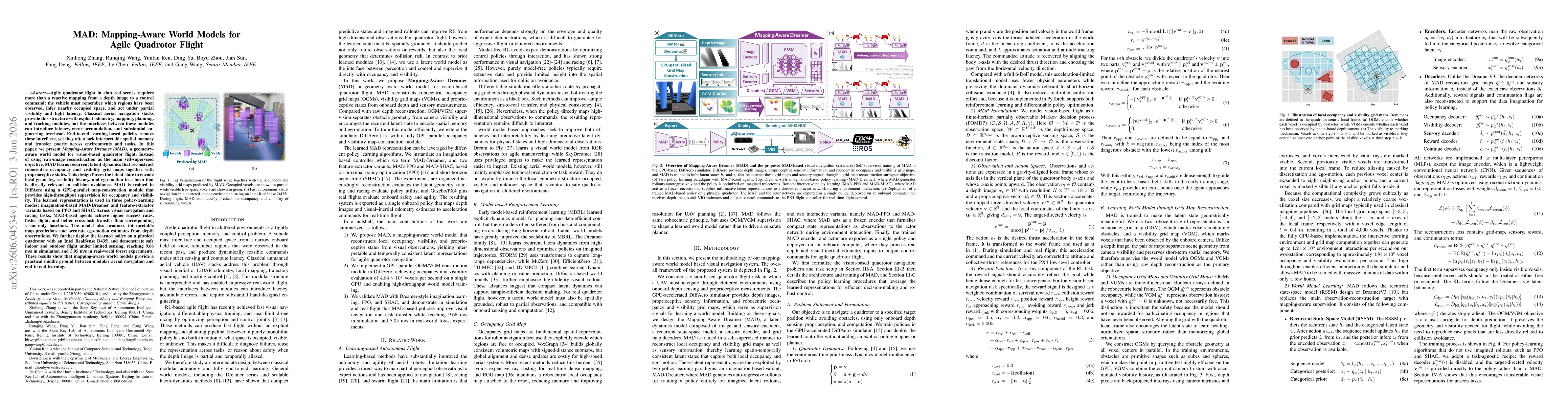
Agile quadrotor flight in cluttered scenes requires more than a reactive mapping from a depth image to a control command: the vehicle must remember which regions have been observed, infer nearby occup...
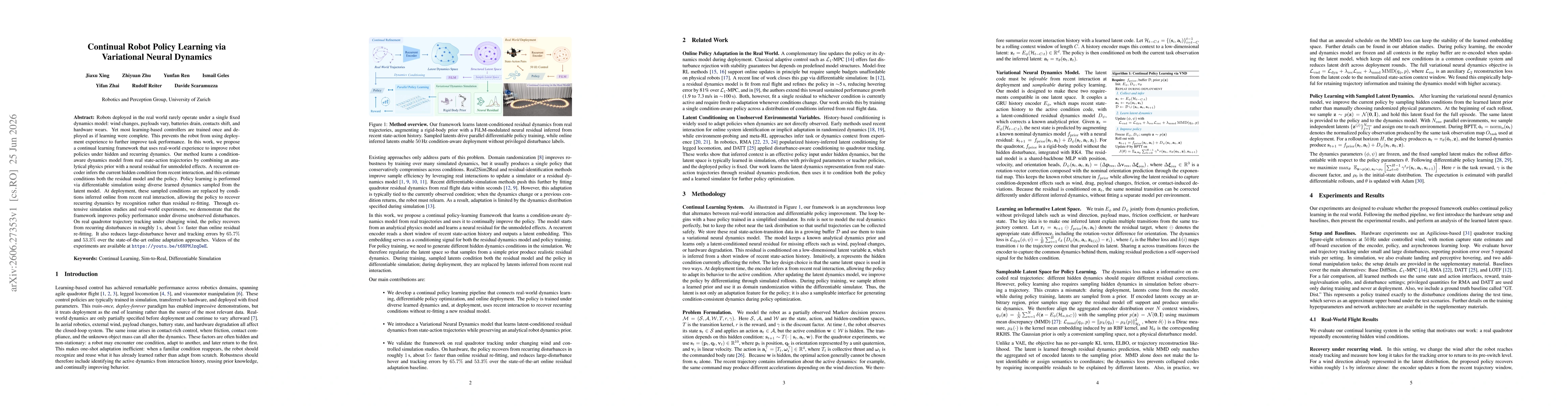
Robots deployed in the real world rarely operate under a single fixed dynamics model: wind changes, payloads vary, batteries drain, contacts shift, and hardware wears. Yet most learning-based controll...
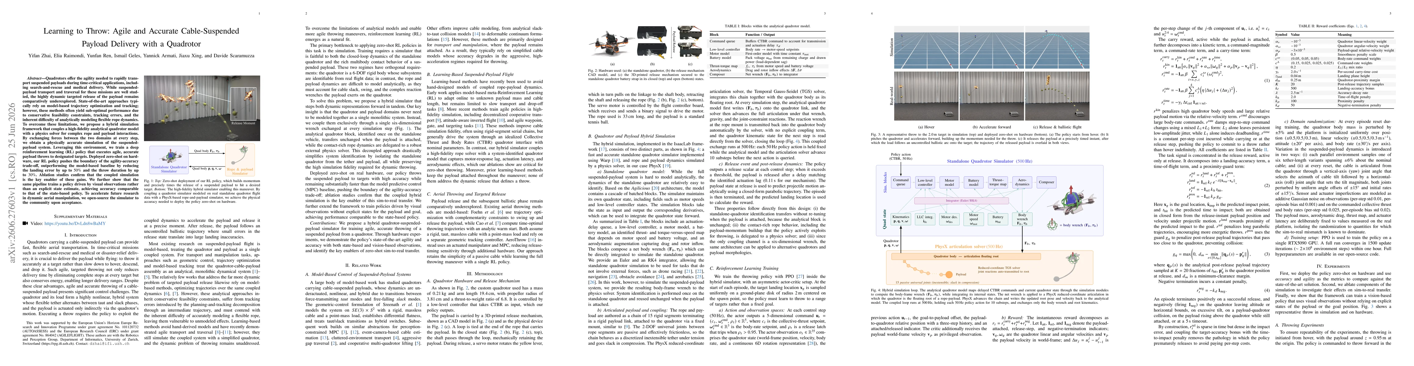
Quadrotors offer the agility needed to rapidly transport suspended payloads during time-critical applications, including search-and-rescue and medical delivery. While suspended-payload transport and t...