Academic Profile
Statistics
Similar Authors
Papers on arXiv
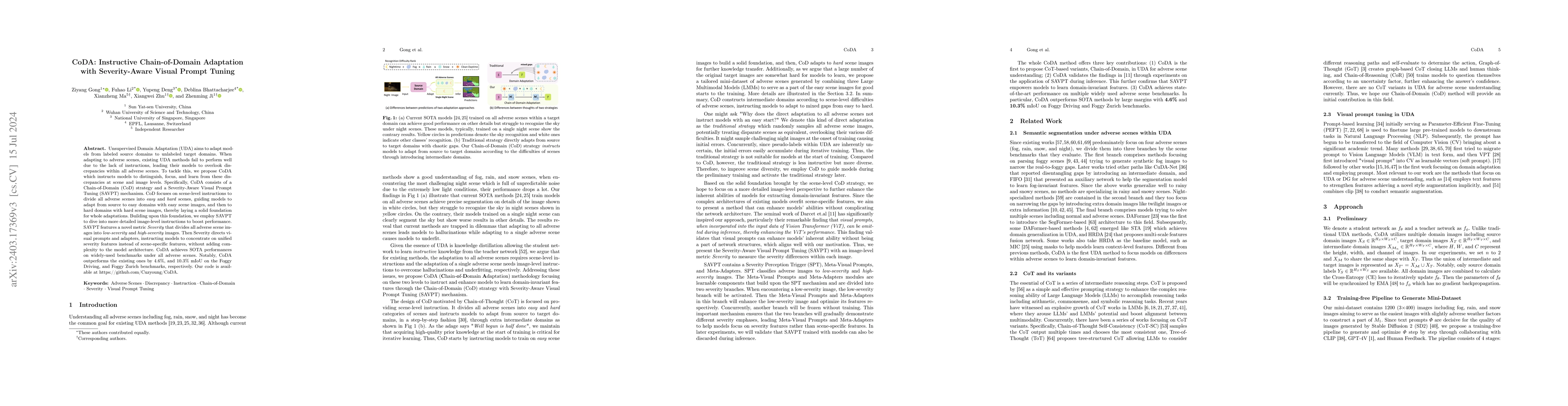
Unsupervised Domain Adaptation (UDA) aims to adapt models from labeled source domains to unlabeled target domains. When adapting to adverse scenes, existing UDA methods fail to perform well due to the...
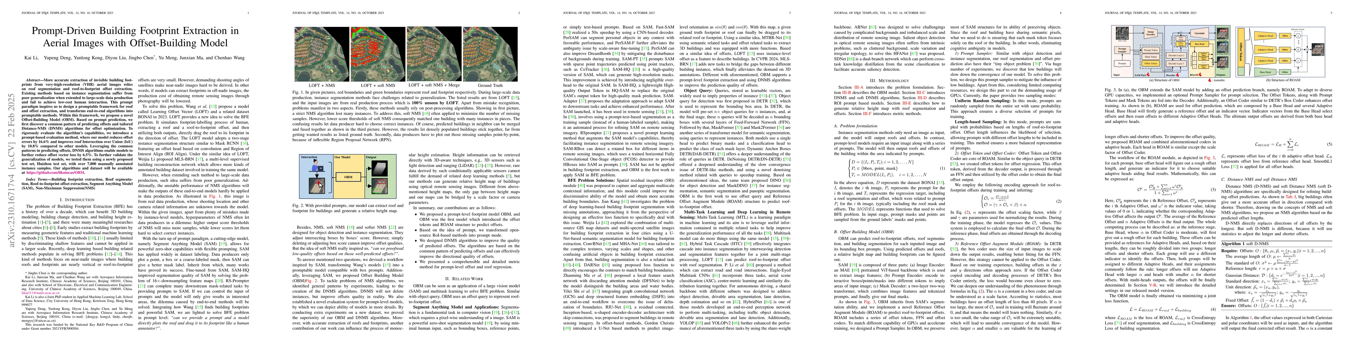
More accurate extraction of invisible building footprints from very-high-resolution (VHR) aerial images relies on roof segmentation and roof-to-footprint offset extraction. Existing state-of-the-art...
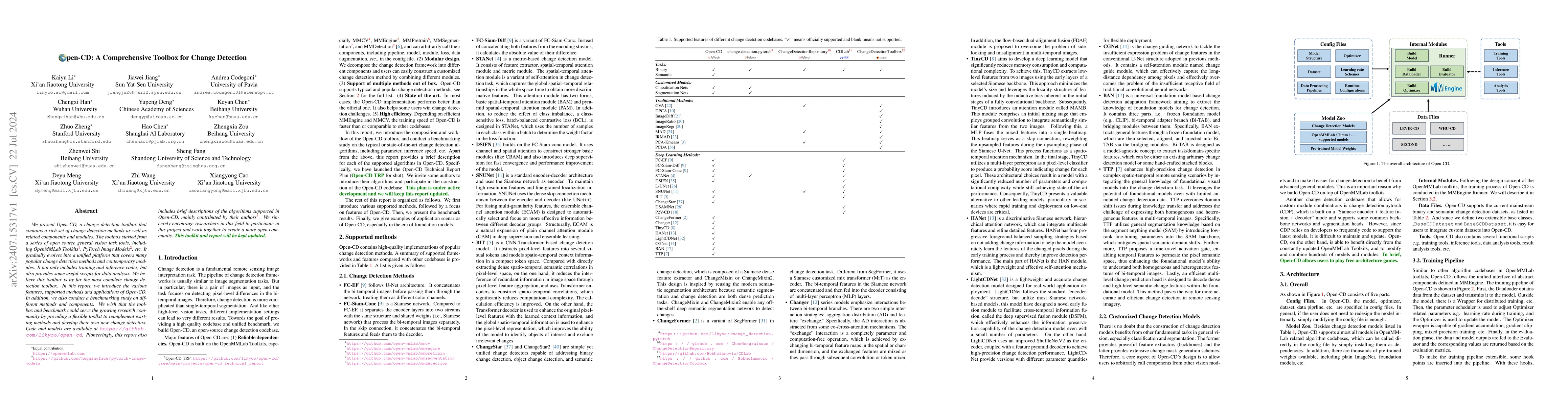
We present Open-CD, a change detection toolbox that contains a rich set of change detection methods as well as related components and modules. The toolbox started from a series of open source general ...
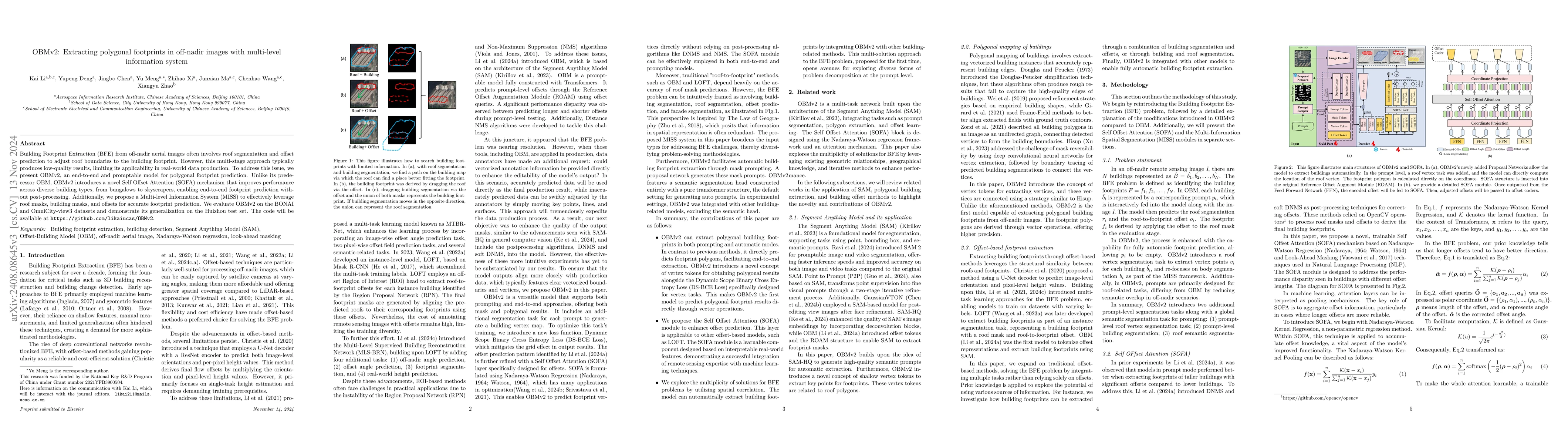
Building Footprint Extraction (BFE) in off-nadir aerial images often relies on roof segmentation and roof-to-footprint offset prediction, then drugging roof-to-footprint via the offset. However, the r...
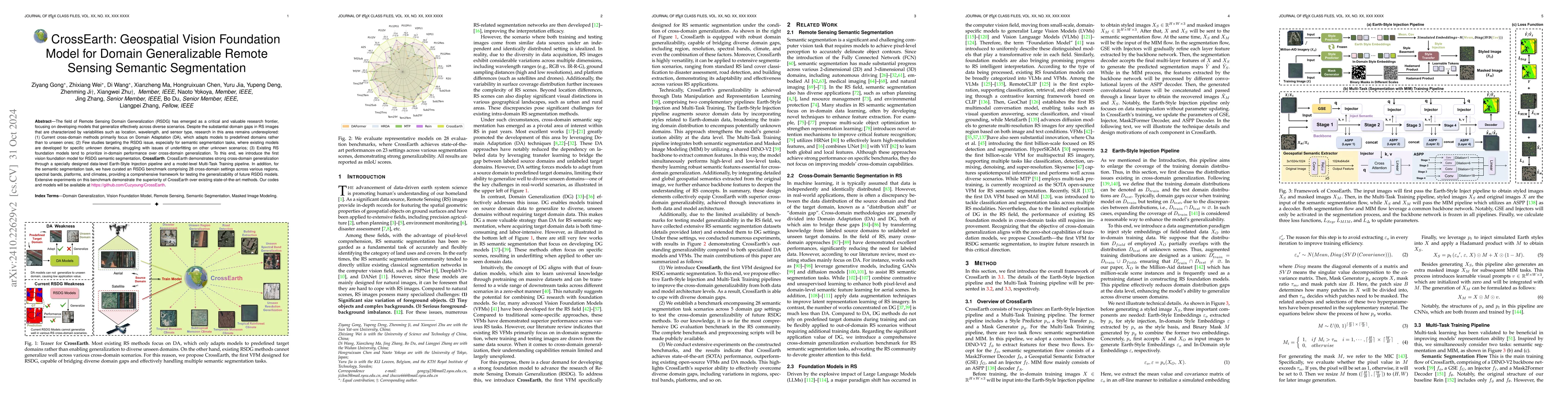
The field of Remote Sensing Domain Generalization (RSDG) has emerged as a critical and valuable research frontier, focusing on developing models that generalize effectively across diverse scenarios. D...
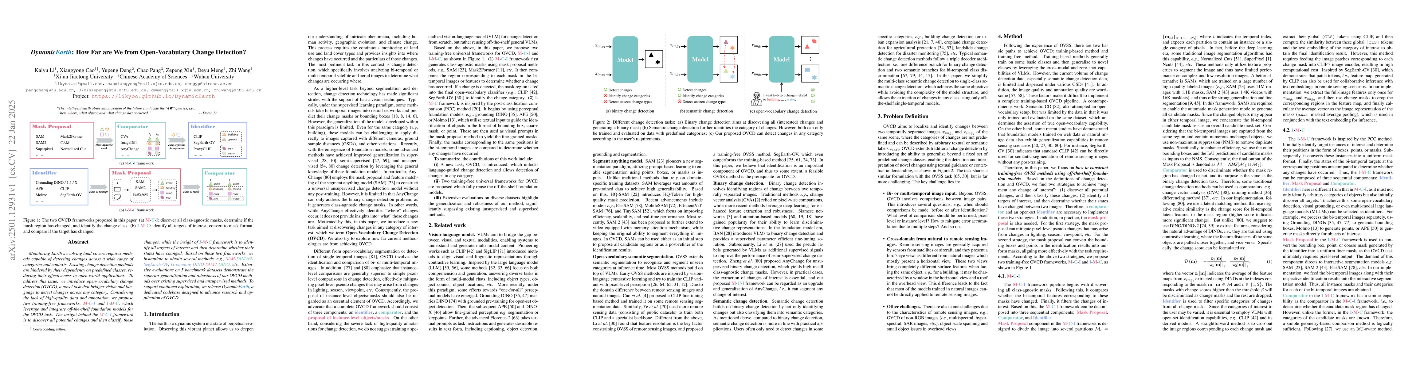
Monitoring Earth's evolving land covers requires methods capable of detecting changes across a wide range of categories and contexts. Existing change detection methods are hindered by their dependency...
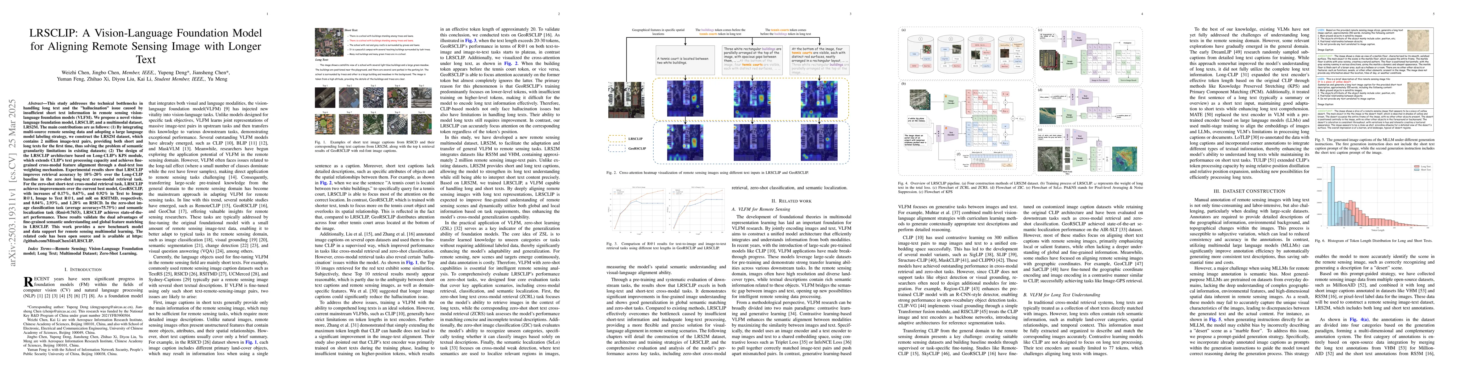
This study addresses the technical bottlenecks in handling long text and the "hallucination" issue caused by insufficient short text information in remote sensing vision-language foundation models (VL...
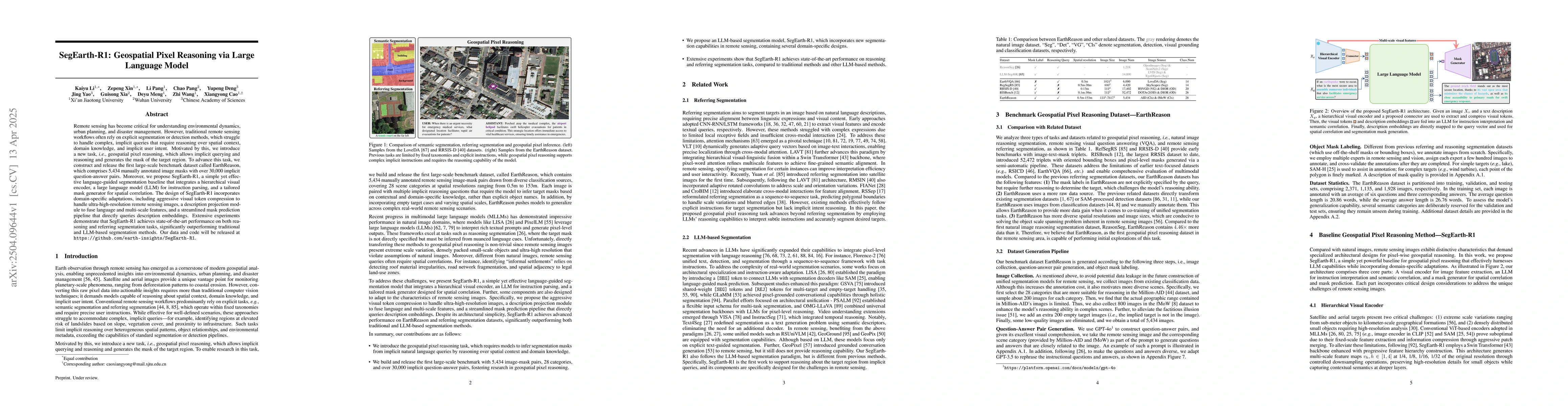
Remote sensing has become critical for understanding environmental dynamics, urban planning, and disaster management. However, traditional remote sensing workflows often rely on explicit segmentation ...
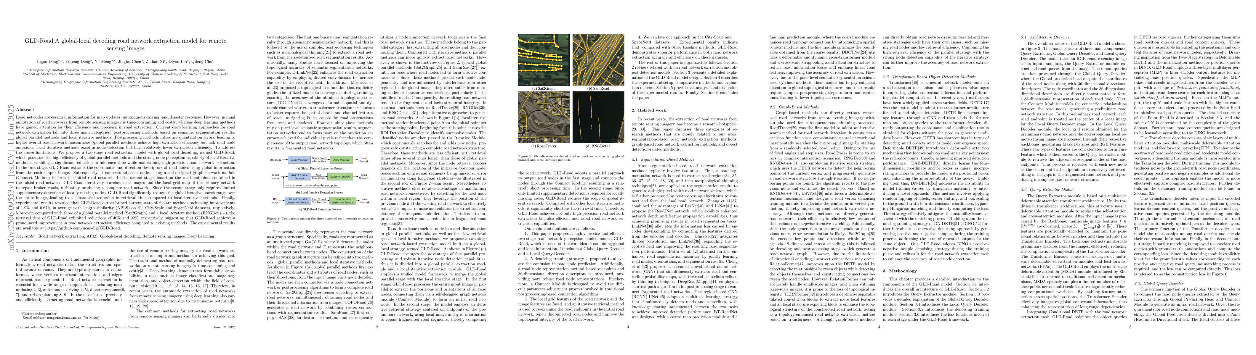
Road networks are crucial for mapping, autonomous driving, and disaster response. While manual annotation is costly, deep learning offers efficient extraction. Current methods include postprocessing (...
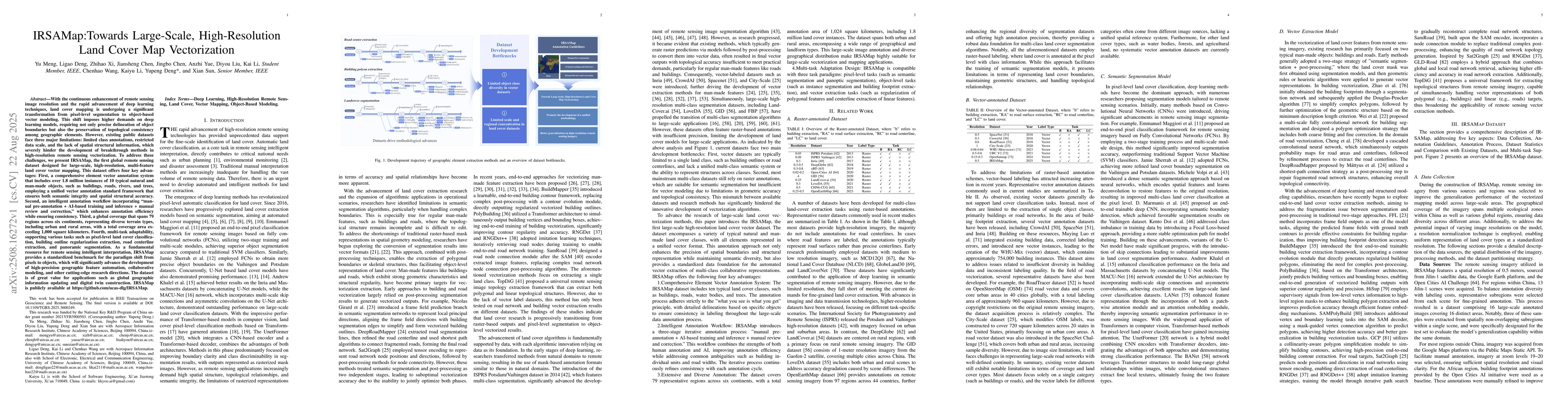
With the enhancement of remote sensing image resolution and the rapid advancement of deep learning, land cover mapping is transitioning from pixel-level segmentation to object-based vector modeling. T...
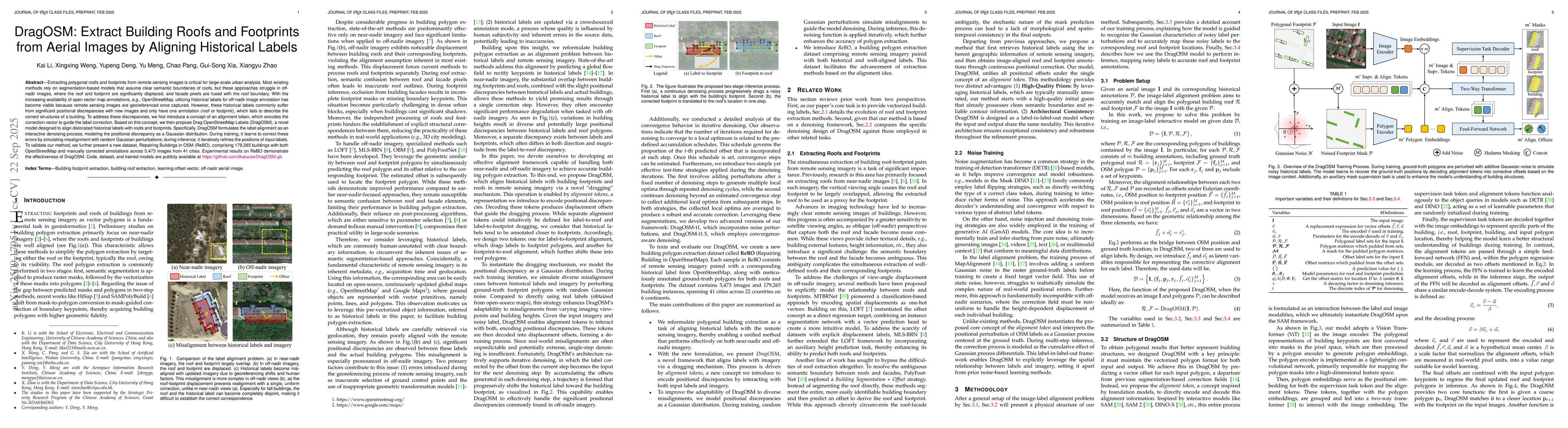
Extracting polygonal roofs and footprints from remote sensing images is critical for large-scale urban analysis. Most existing methods rely on segmentation-based models that assume clear semantic boun...
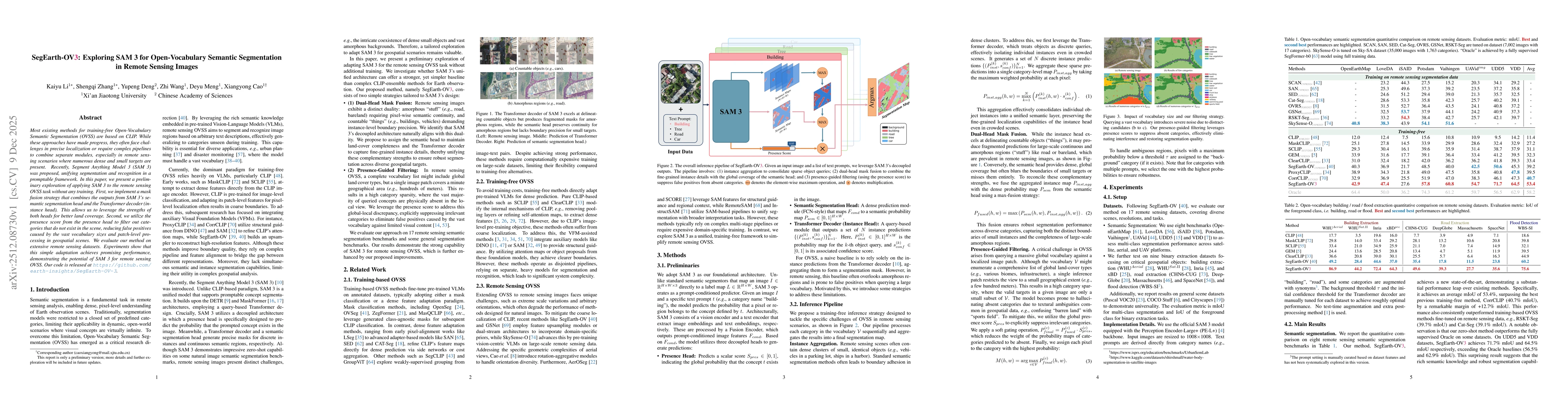
Most existing methods for training-free Open-Vocabulary Semantic Segmentation (OVSS) are based on CLIP. While these approaches have made progress, they often face challenges in precise localization or...