Academic Profile
Statistics
Similar Authors
Papers on arXiv
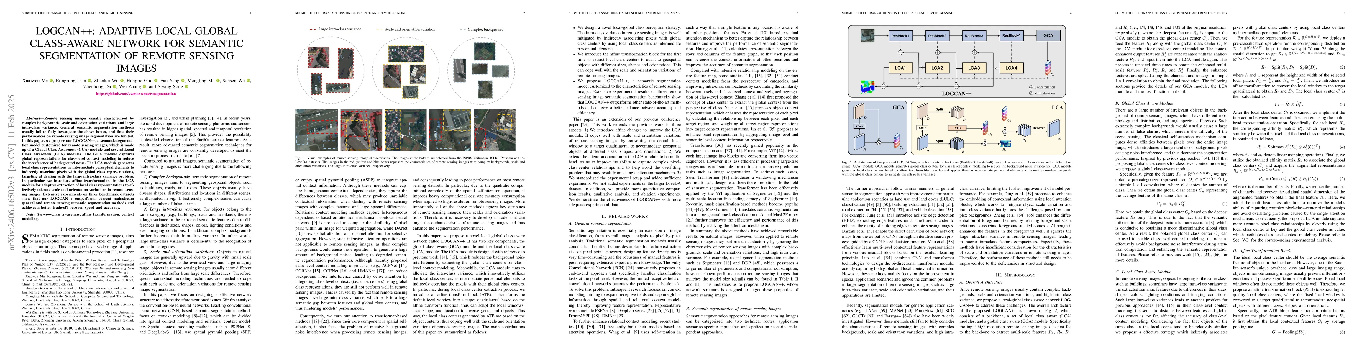
Remote sensing images usually characterized by complex backgrounds, scale and orientation variations, and large intra-class variance. General semantic segmentation methods usually fail to fully invest...
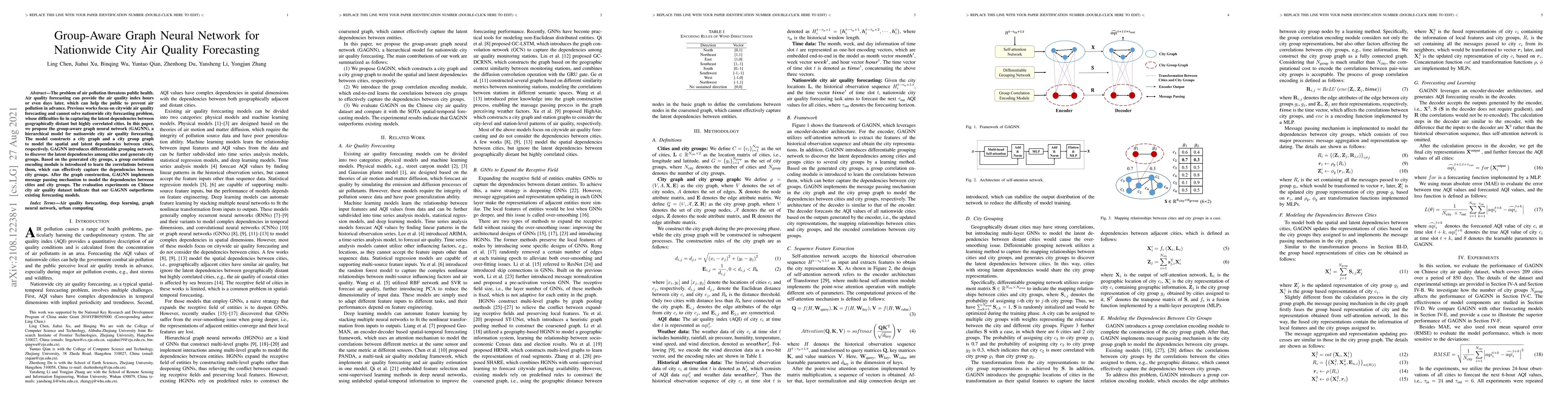
The problem of air pollution threatens public health. Air quality forecasting can provide the air quality index hours or even days later, which can help the public to prevent air pollution in advanc...
The reconstruction of Earth's history faces significant challenges due to the nonunique interpretations often derived from rock records. The problem has long been recognized but there are no systemati...
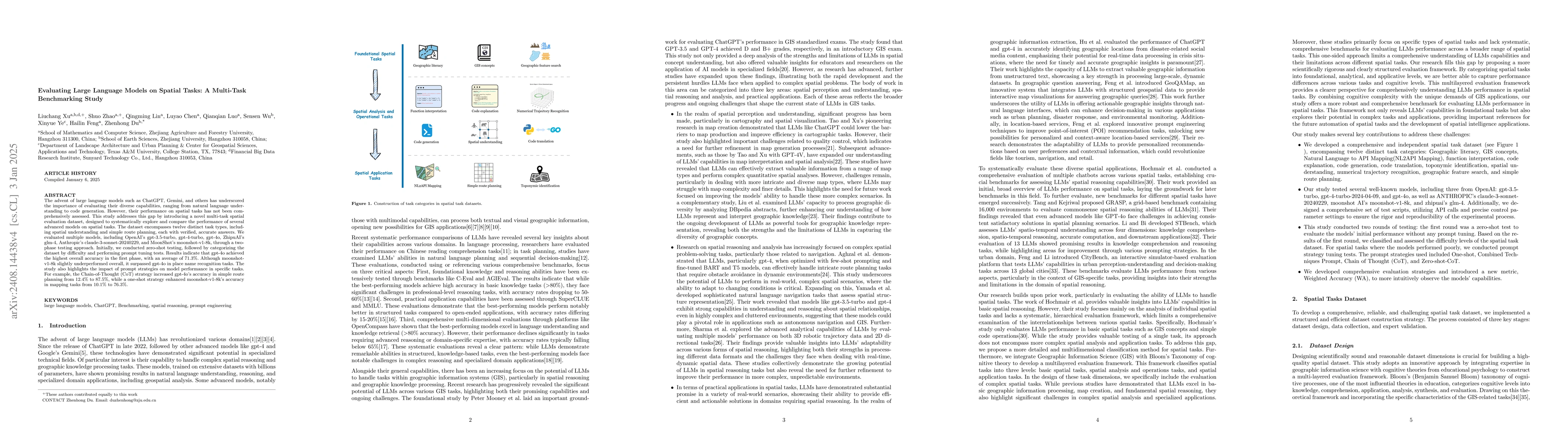
The advent of large language models such as ChatGPT, Gemini, and others has underscored the importance of evaluating their diverse capabilities, ranging from natural language understanding to code gen...
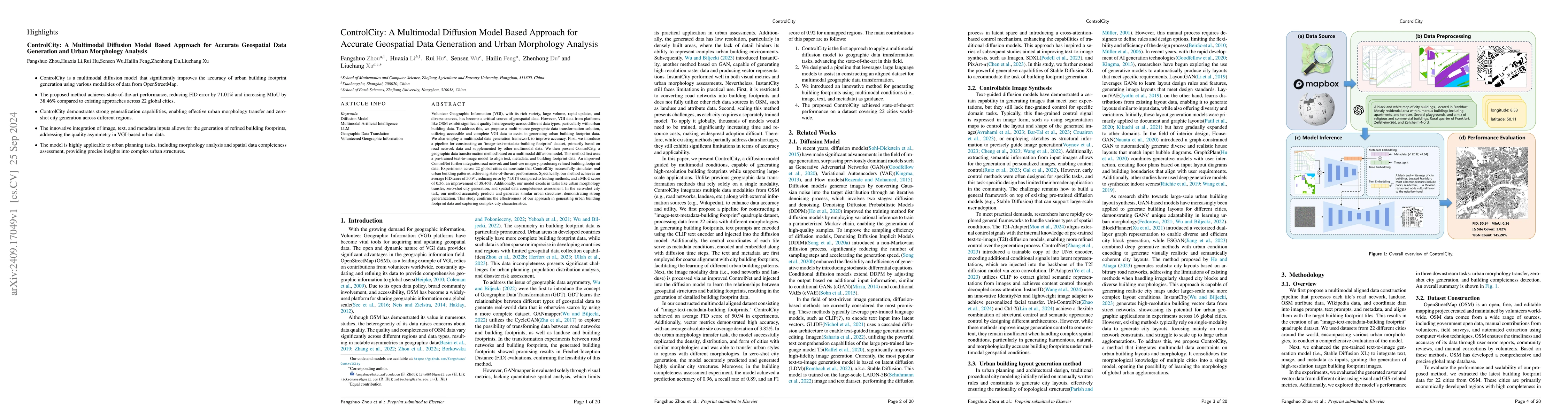
Volunteer Geographic Information (VGI), with its rich variety, large volume, rapid updates, and diverse sources, has become a critical source of geospatial data. However, VGI data from platforms like ...
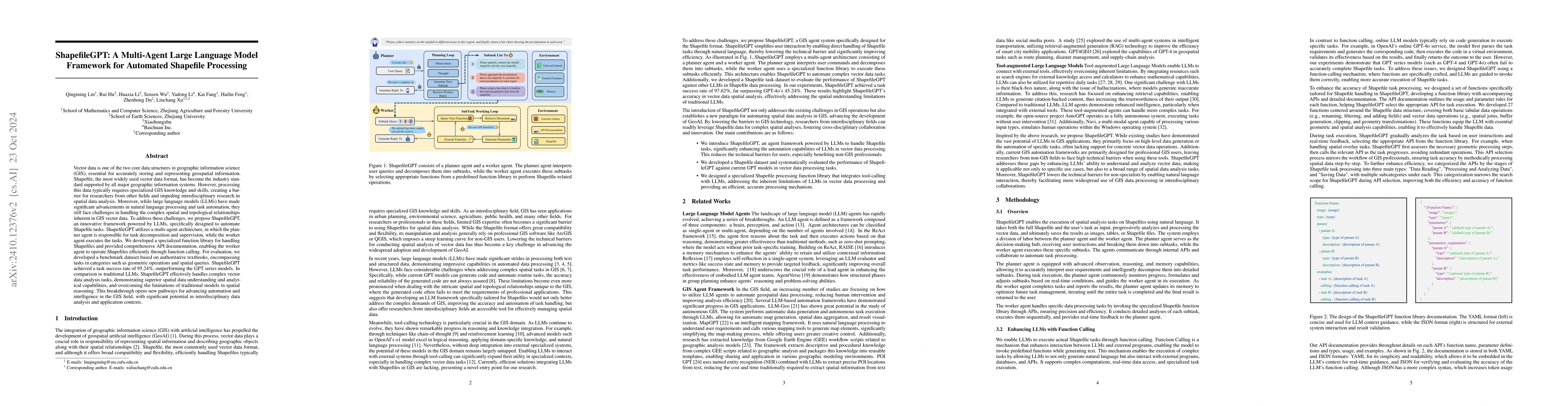
Vector data is one of the two core data structures in geographic information science (GIS), essential for accurately storing and representing geospatial information. Shapefile, the most widely used ve...
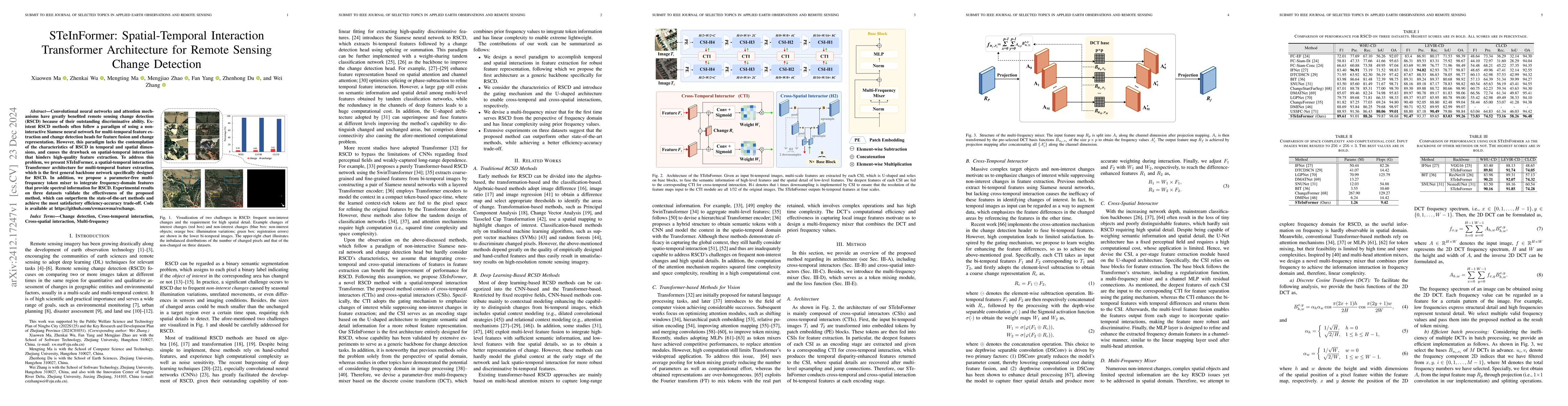
Convolutional neural networks and attention mechanisms have greatly benefited remote sensing change detection (RSCD) because of their outstanding discriminative ability. Existent RSCD methods often fo...
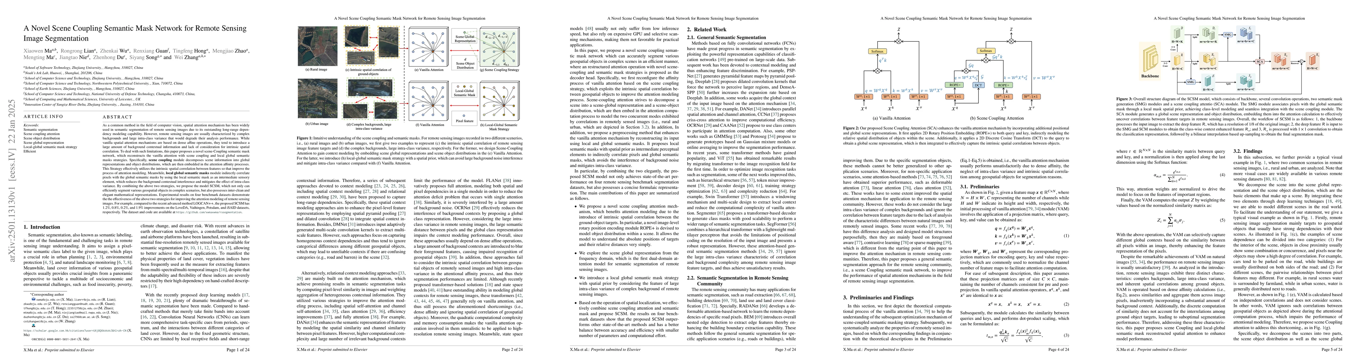
As a common method in the field of computer vision, spatial attention mechanism has been widely used in semantic segmentation of remote sensing images due to its outstanding long-range dependency mode...
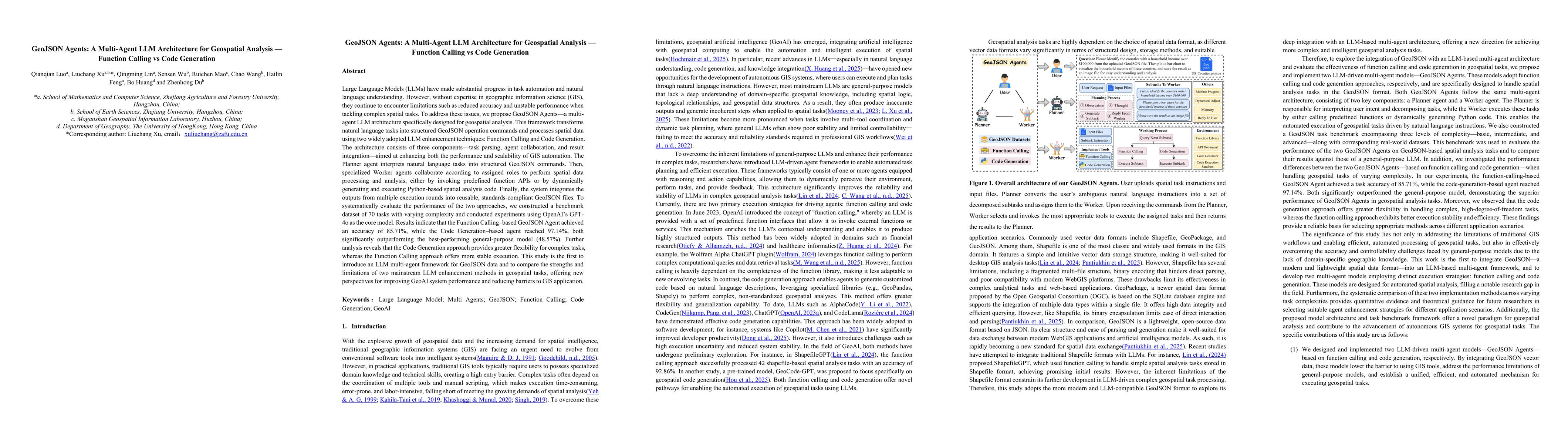
LLMs have made substantial progress in task automation and natural language understanding.However,without expertise in GIS,they continue to encounter limitations.To address these issues, we propose Ge...
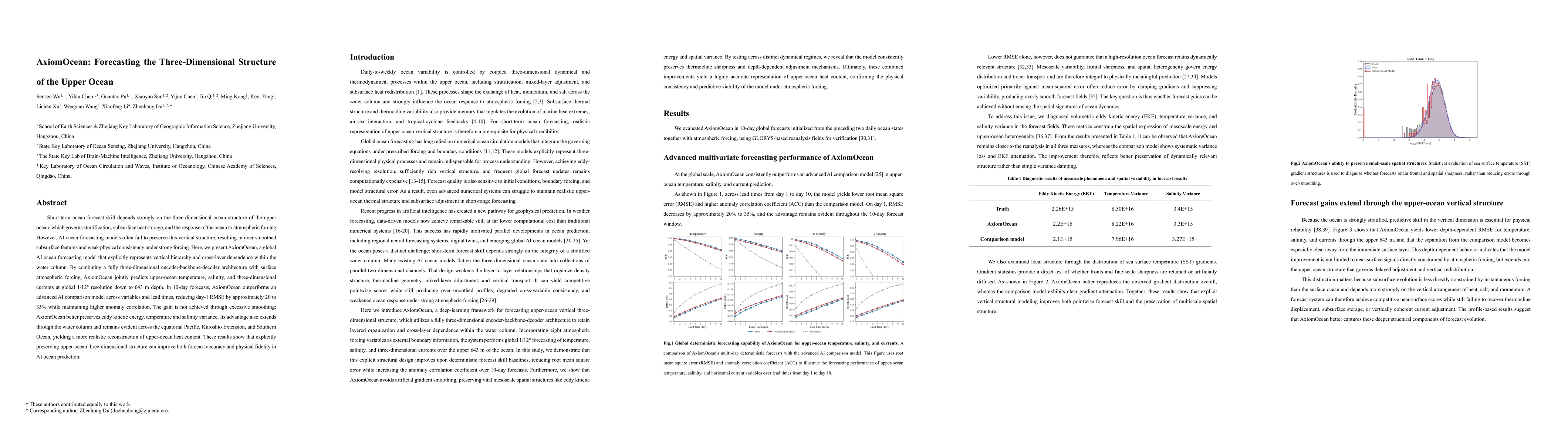
Short-term ocean forecast skill depends strongly on the three-dimensional ocean structure of the upper ocean, which governs stratification, subsurface heat storage, and the response of the ocean to at...