LLMs have made substantial progress in task automation and natural language
understanding.However,without expertise in GIS,they continue to encounter
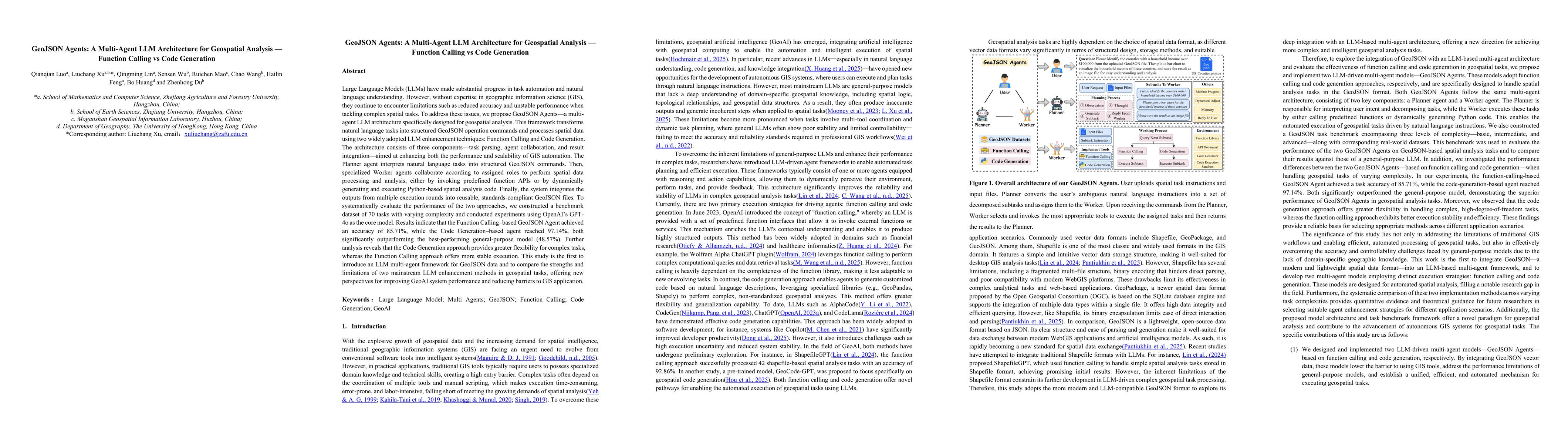
limitations.To address these issues, we propose GeoJSON Agents-a multi-agent
LLM architecture.This framework transforms natural language tasks into
structured GeoJSON operation commands and processes spatial data using two
widely adopted LLM enhancement techniques:Function Calling and Code
Generation.The architecture consists of three components-task parsing,agent
collaboration,and result integration-aimed at enhancing both the performance
and scalability of GIS automation.The Planner agent interprets natural language
tasks into structured GeoJSON commands.Then,specialized Worker agents
collaborate according to assigned roles to perform spatial data processing and
analysis,either by invoking predefined function APIs or by dynamically
generating and executing Python-based spatial analysis code.Finally,the system
integrates the outputs from multiple execution rounds into
reusable,standards-compliant GeoJSON files.To systematically evaluate the
performance of the two approaches,we constructed a benchmark dataset of 70
tasks with varying complexity and conducted experiments using OpenAI's GPT-4o
as the core model.Results indicate that the Function Calling-based GeoJSON
Agent achieved an accuracy of 85.71%,while the Code Generation-based agent
reached 97.14%,both significantly outperforming the best-performing
general-purpose model (48.57%).Further analysis reveals that the Code
Generation provides greater flexibility,whereas the Function Calling approach
offers more stable execution.This study is the first to introduce an LLM
multi-agent framework for GeoJSON data and to compare the strengths and
limitations of two mainstream LLM enhancement methods,offering new perspectives
for improving GeoAI system performance.
Discussion 0