Academic Profile
Statistics
Similar Authors
Papers on arXiv
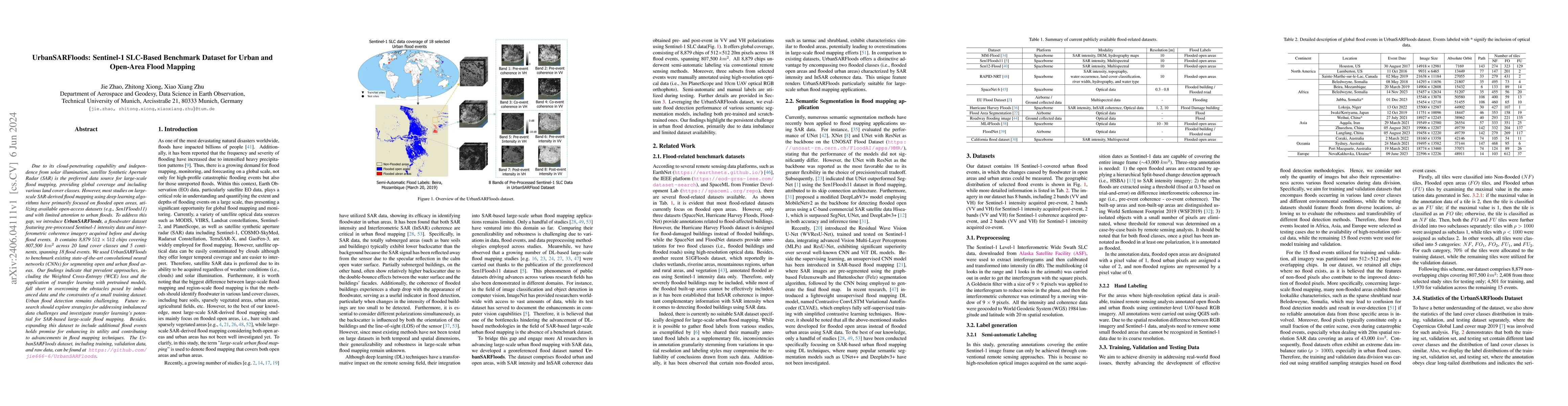
Due to its cloud-penetrating capability and independence from solar illumination, satellite Synthetic Aperture Radar (SAR) is the preferred data source for large-scale flood mapping, providing globa...
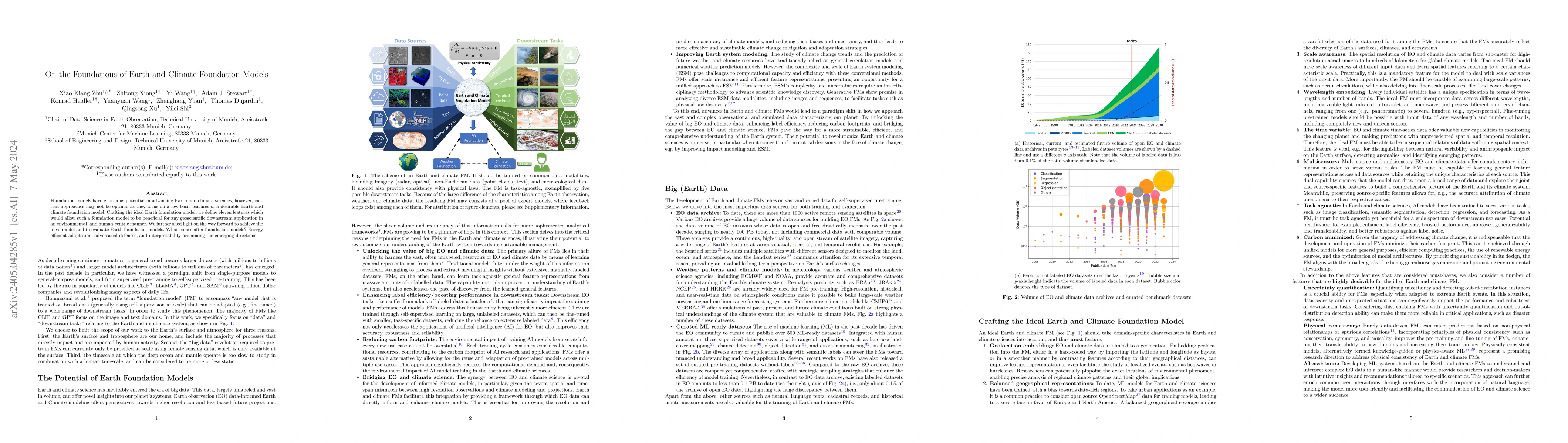
Foundation models have enormous potential in advancing Earth and climate sciences, however, current approaches may not be optimal as they focus on a few basic features of a desirable Earth and clima...
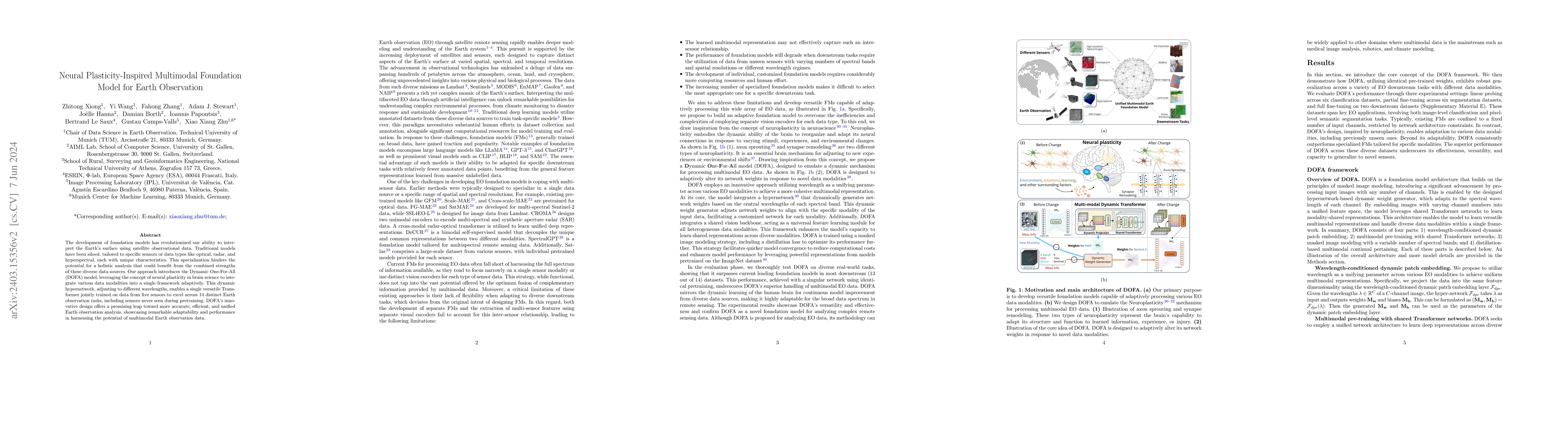
The development of foundation models has revolutionized our ability to interpret the Earth's surface using satellite observational data. Traditional models have been siloed, tailored to specific sen...

Wildfire forecasting is notoriously hard due to the complex interplay of different factors such as weather conditions, vegetation types and human activities. Deep learning models show promise in dea...
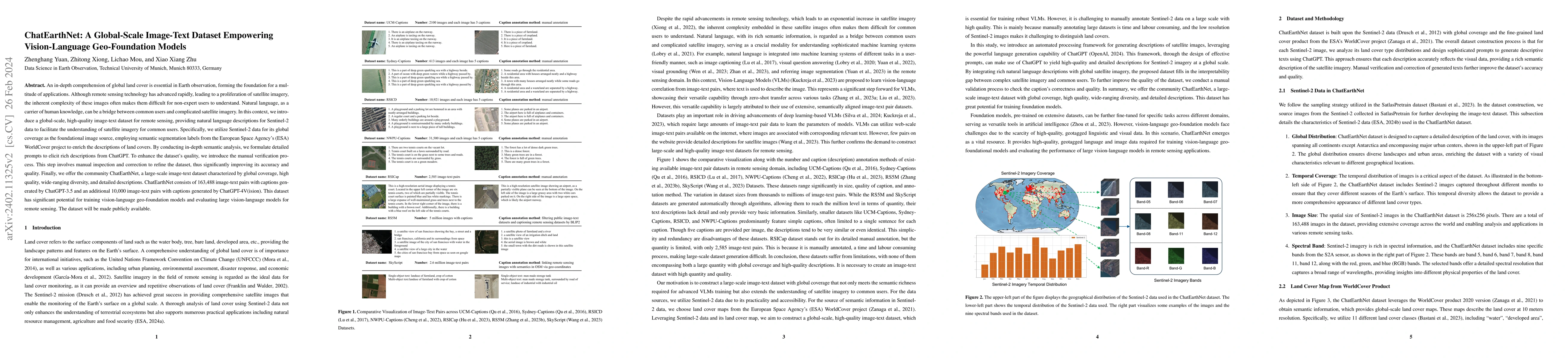
An in-depth comprehension of global land cover is essential in Earth observation, forming the foundation for a multitude of applications. Although remote sensing technology has advanced rapidly, lea...
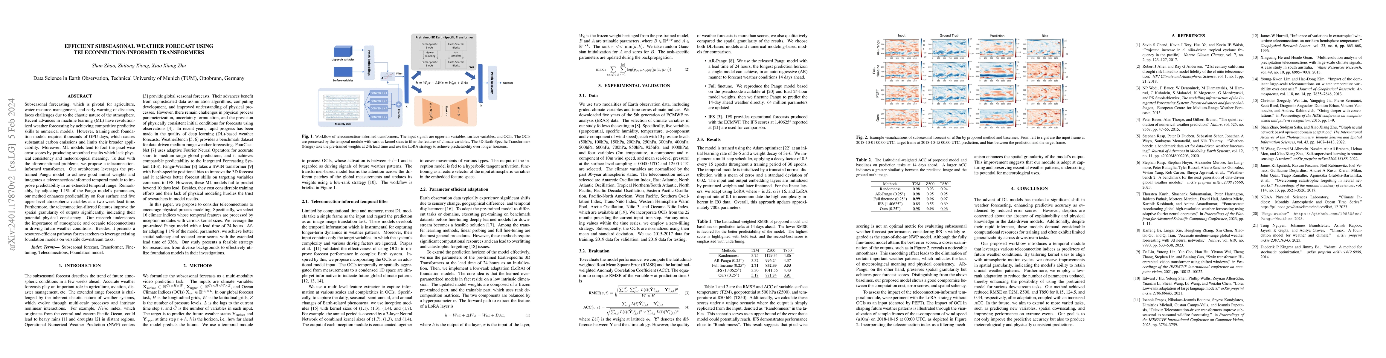
Subseasonal forecasting, which is pivotal for agriculture, water resource management, and early warning of disasters, faces challenges due to the chaotic nature of the atmosphere. Recent advances in...
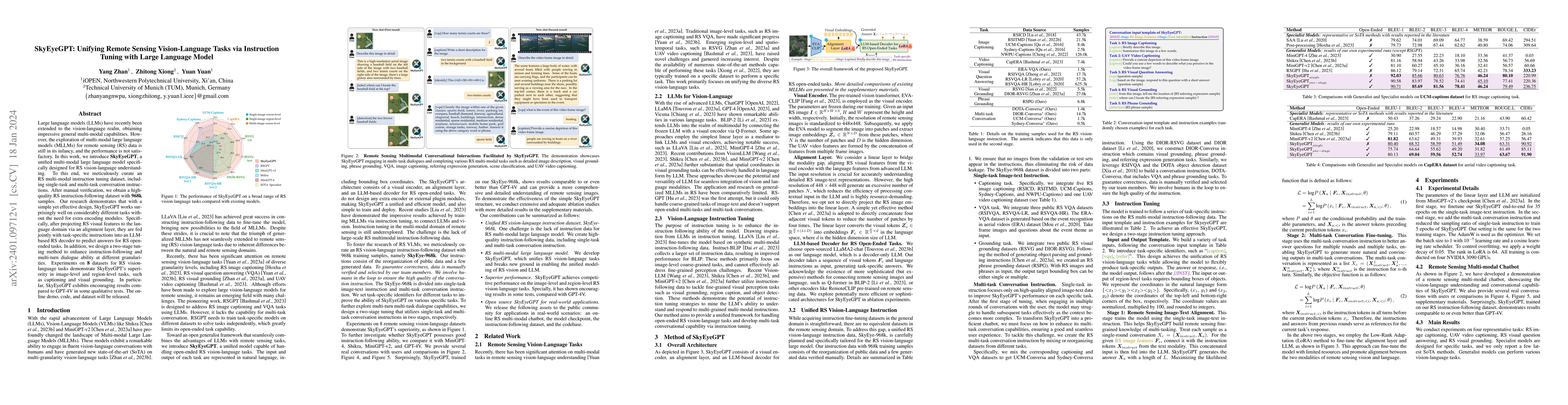
Large language models (LLMs) have recently been extended to the vision-language realm, obtaining impressive general multi-modal capabilities. However, the exploration of multi-modal large language m...
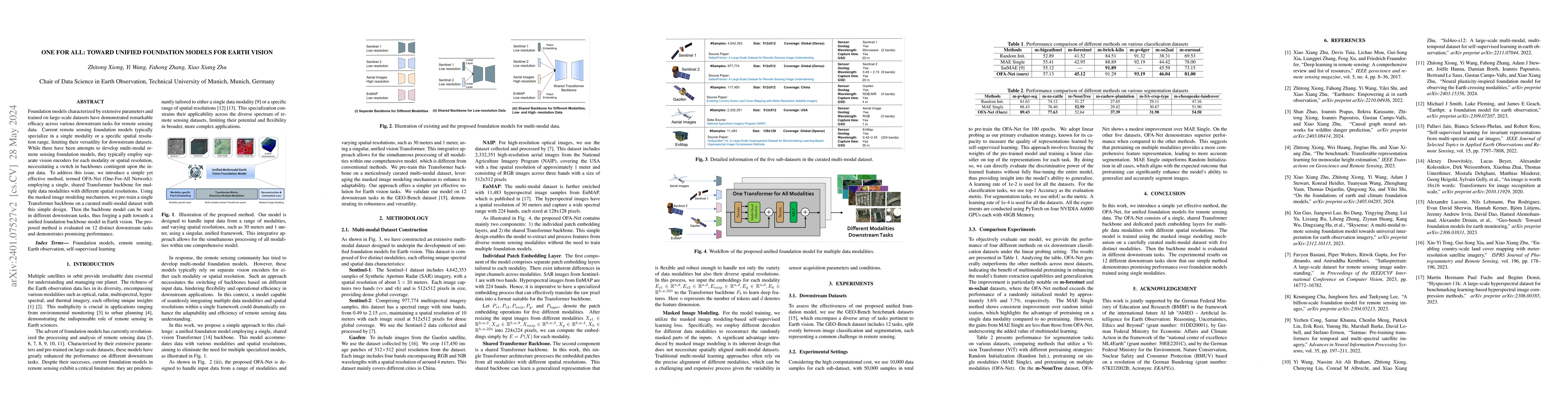
Foundation models characterized by extensive parameters and trained on large-scale datasets have demonstrated remarkable efficacy across various downstream tasks for remote sensing data. Current rem...
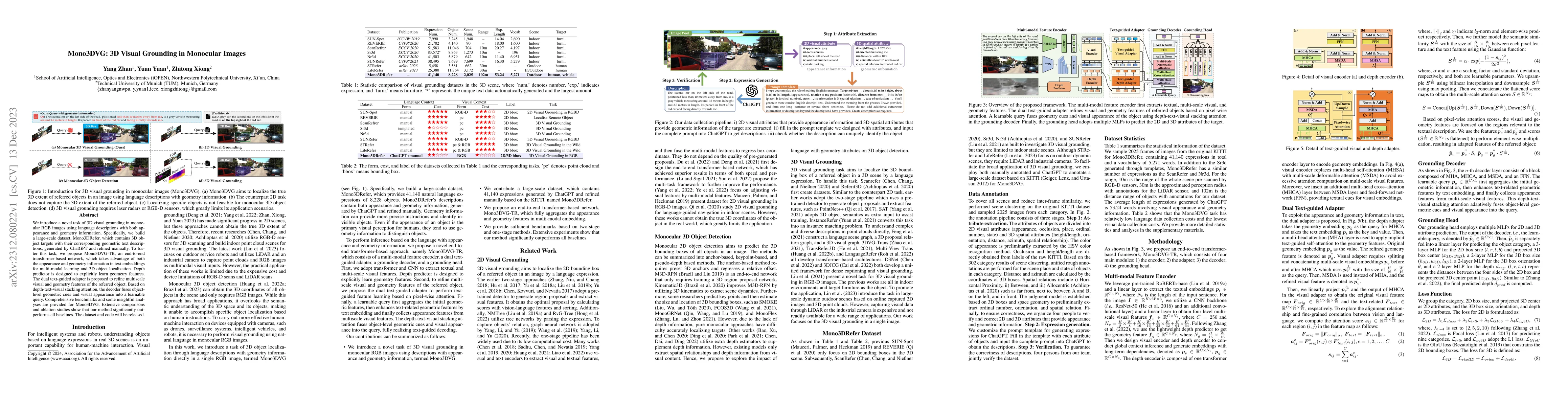
We introduce a novel task of 3D visual grounding in monocular RGB images using language descriptions with both appearance and geometry information. Specifically, we build a large-scale dataset, Mono...
3D geo-information is of great significance for understanding the living environment; however, 3D perception from remote sensing data, especially on a large scale, is restricted. To tackle this prob...
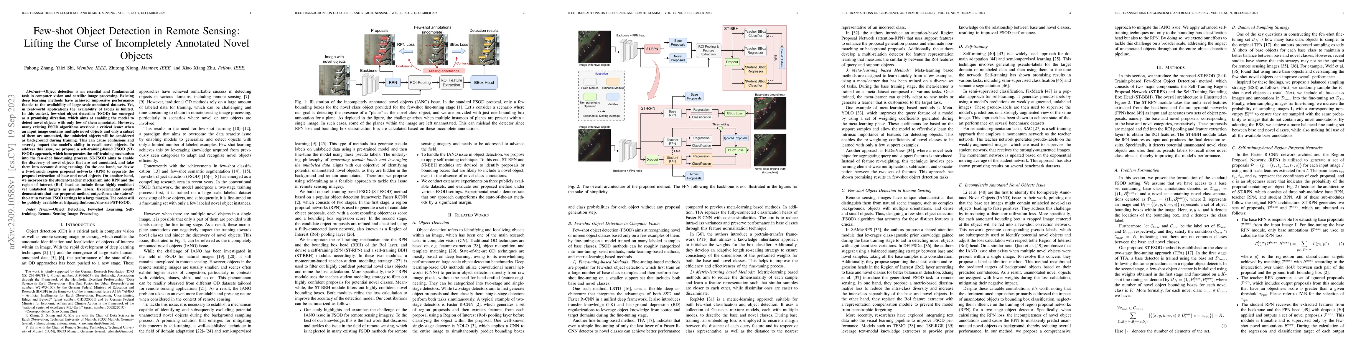
Object detection is an essential and fundamental task in computer vision and satellite image processing. Existing deep learning methods have achieved impressive performance thanks to the availabilit...
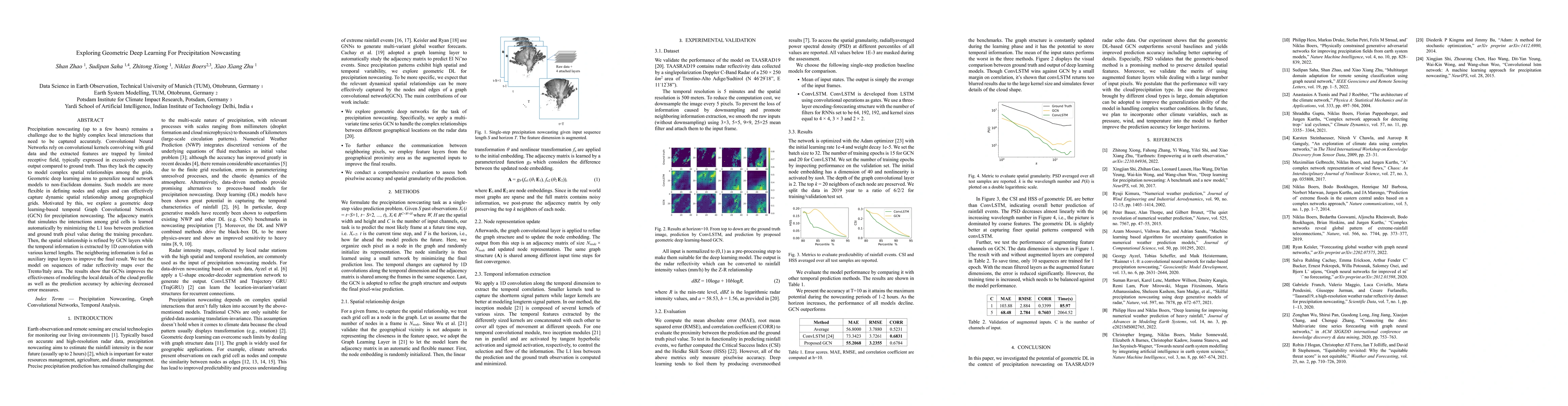
Precipitation nowcasting (up to a few hours) remains a challenge due to the highly complex local interactions that need to be captured accurately. Convolutional Neural Networks rely on convolutional...
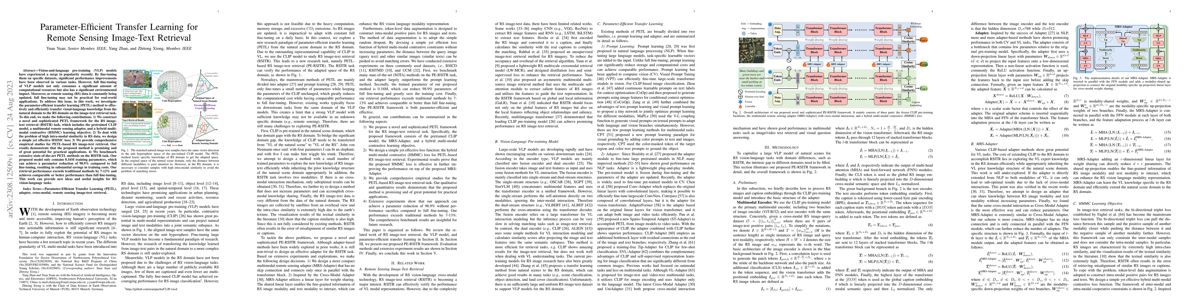
Vision-and-language pre-training (VLP) models have experienced a surge in popularity recently. By fine-tuning them on specific datasets, significant performance improvements have been observed in va...
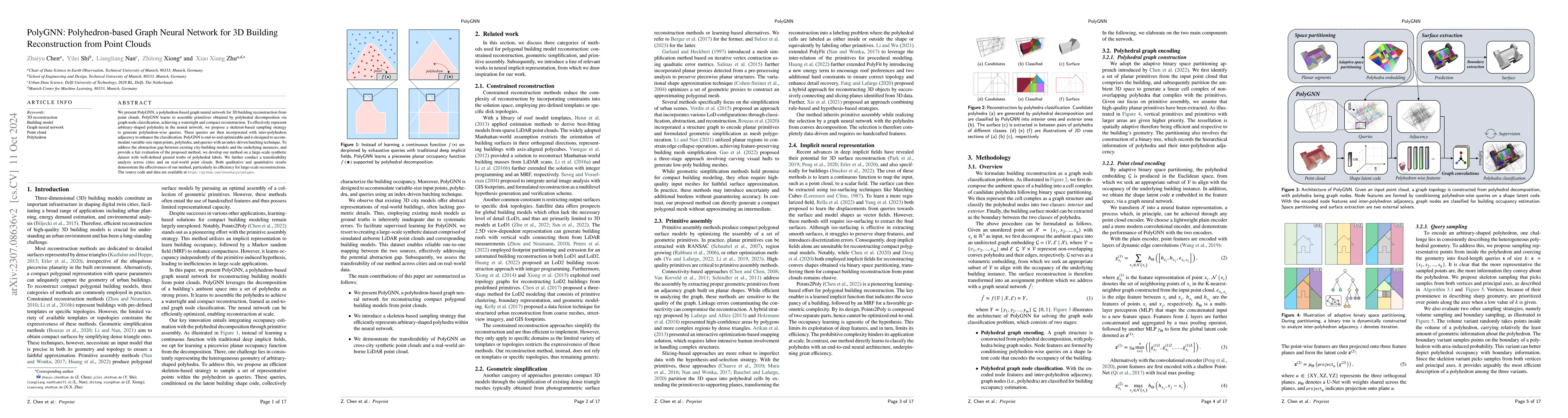
We present PolyGNN, a polyhedron-based graph neural network for 3D building reconstruction from point clouds. PolyGNN learns to assemble primitives obtained by polyhedral decomposition via graph nod...
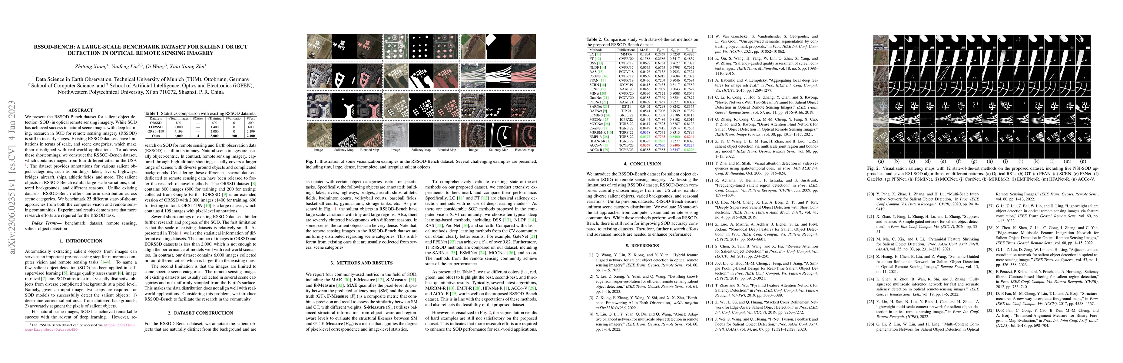
We present the RSSOD-Bench dataset for salient object detection (SOD) in optical remote sensing imagery. While SOD has achieved success in natural scene images with deep learning, research in SOD fo...
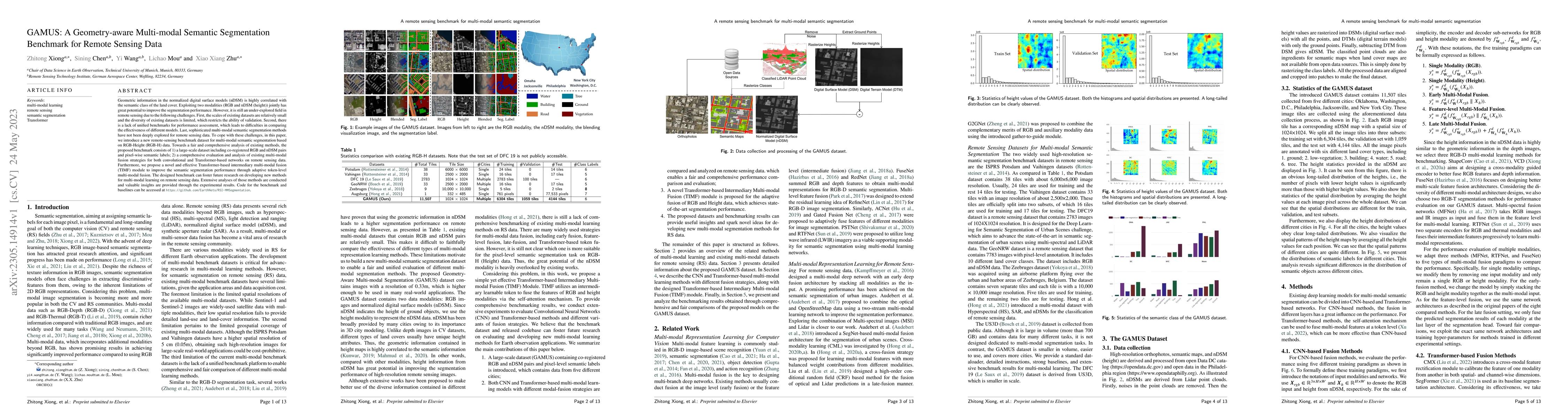
Geometric information in the normalized digital surface models (nDSM) is highly correlated with the semantic class of the land cover. Exploiting two modalities (RGB and nDSM (height)) jointly has gr...
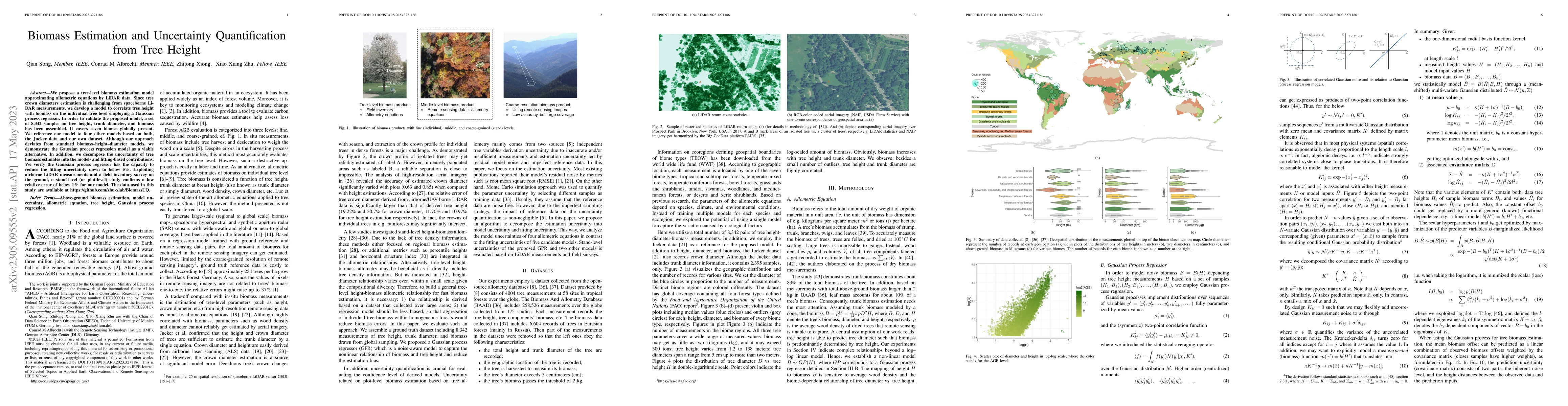
We propose a tree-level biomass estimation model approximating allometric equations by LiDAR data. Since tree crown diameters estimation is challenging from spaceborne LiDAR measurements, we develop...
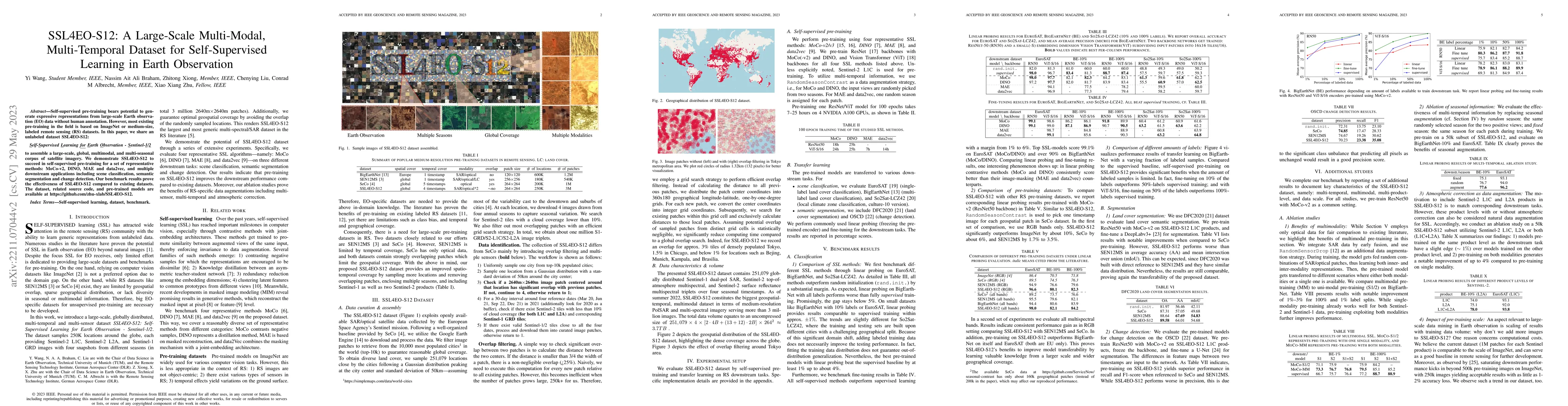
Self-supervised pre-training bears potential to generate expressive representations without human annotation. Most pre-training in Earth observation (EO) are based on ImageNet or medium-size, labele...
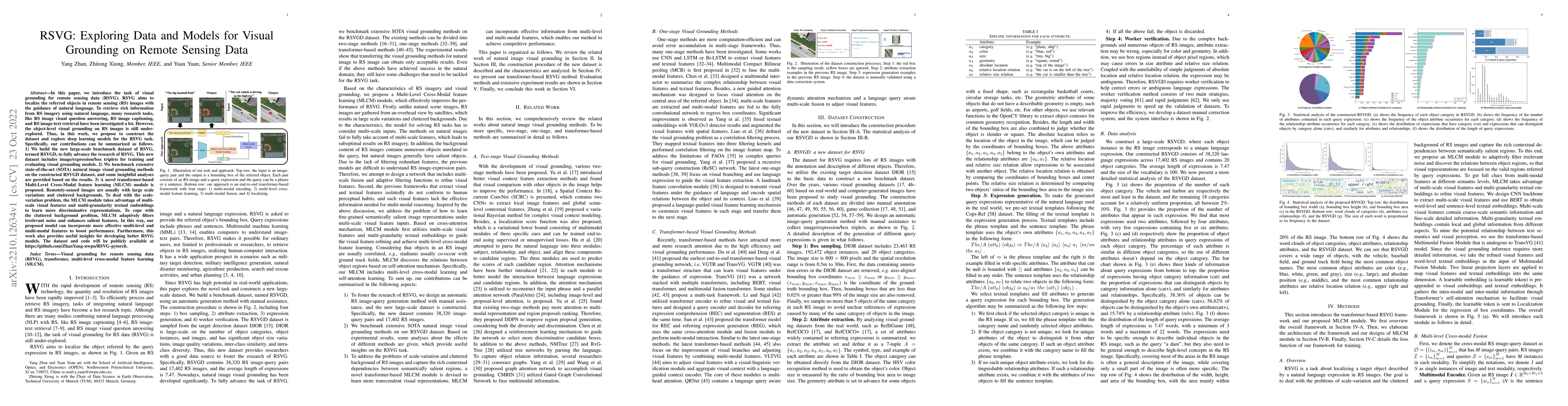
In this paper, we introduce the task of visual grounding for remote sensing data (RSVG). RSVG aims to localize the referred objects in remote sensing (RS) images with the guidance of natural languag...
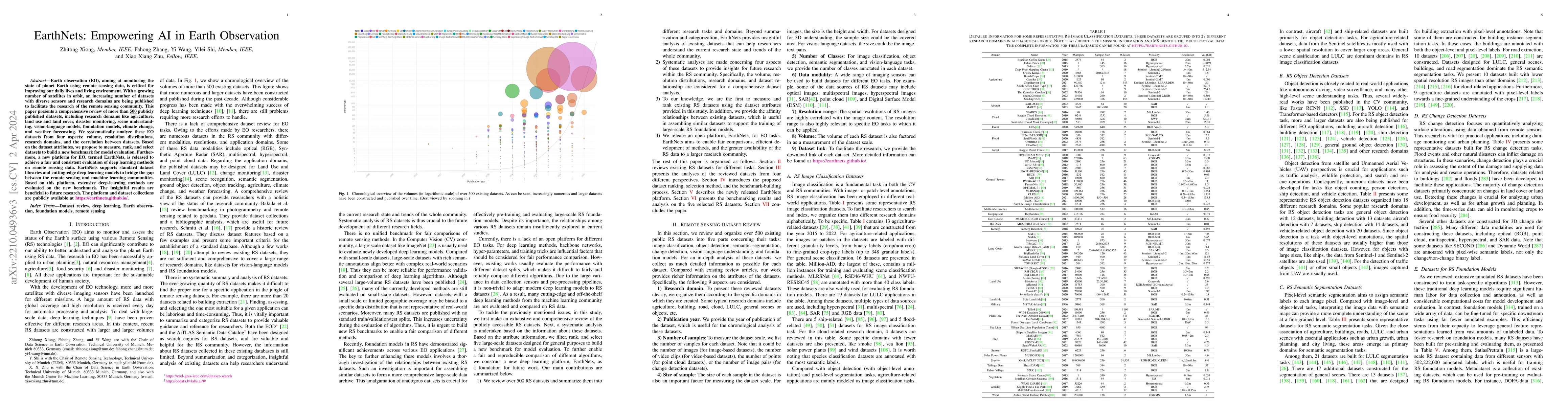
Earth observation (EO), aiming at monitoring the state of planet Earth using remote sensing data, is critical for improving our daily lives and living environment. With a growing number of satellite...
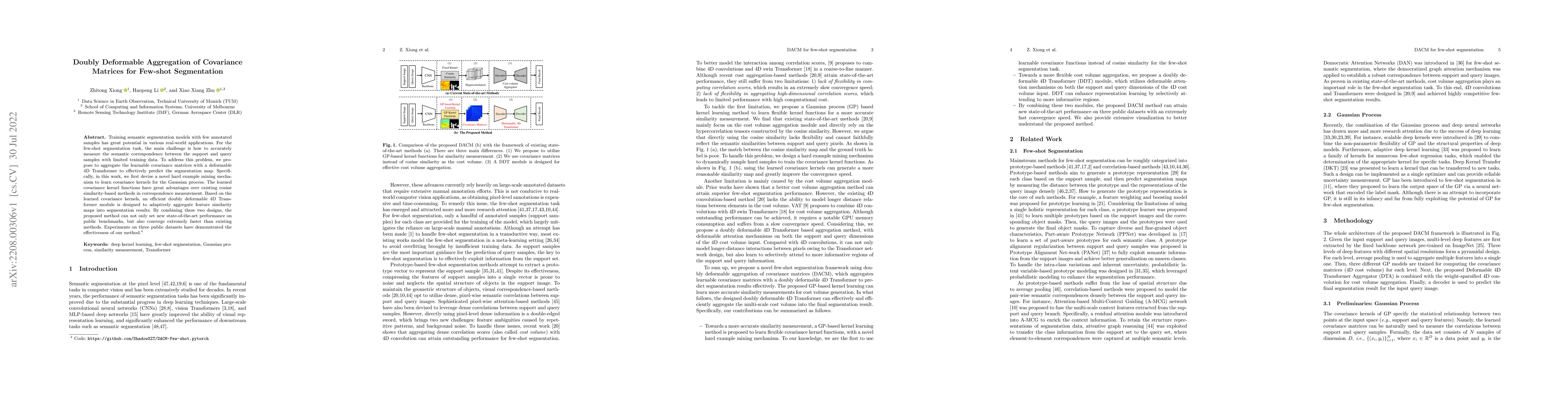
Training semantic segmentation models with few annotated samples has great potential in various real-world applications. For the few-shot segmentation task, the main challenge is how to accurately m...
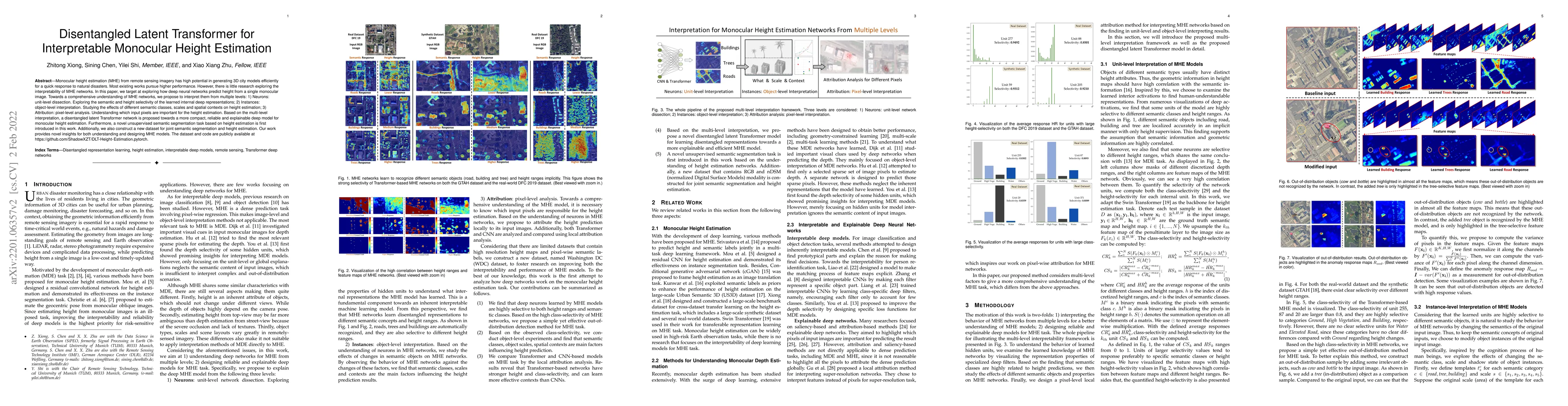
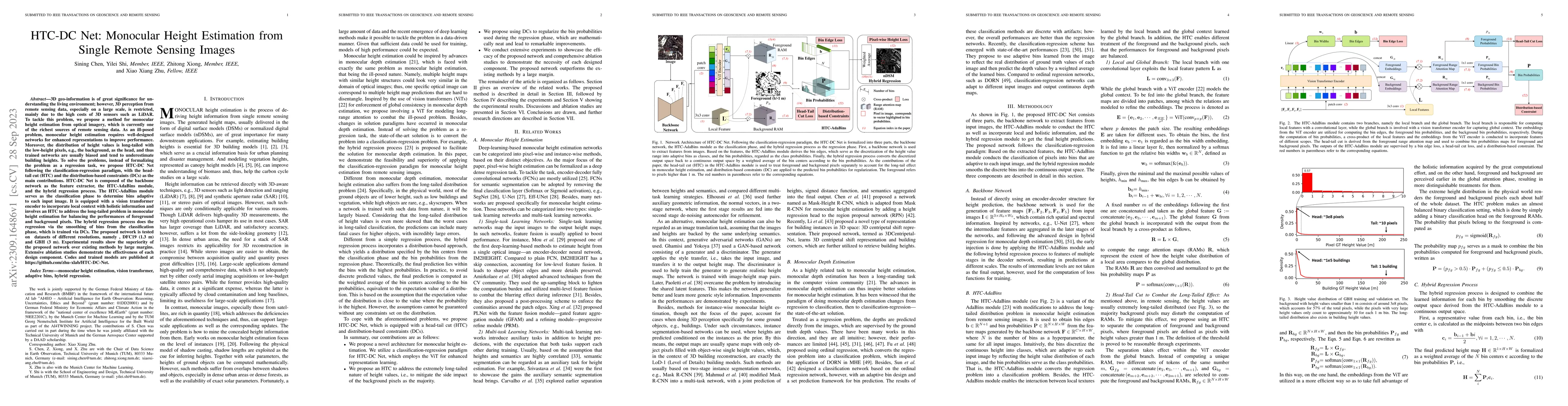
Monocular height estimation (MHE) from remote sensing imagery has high potential in generating 3D city models efficiently for a quick response to natural disasters. Most existing works pursue higher...
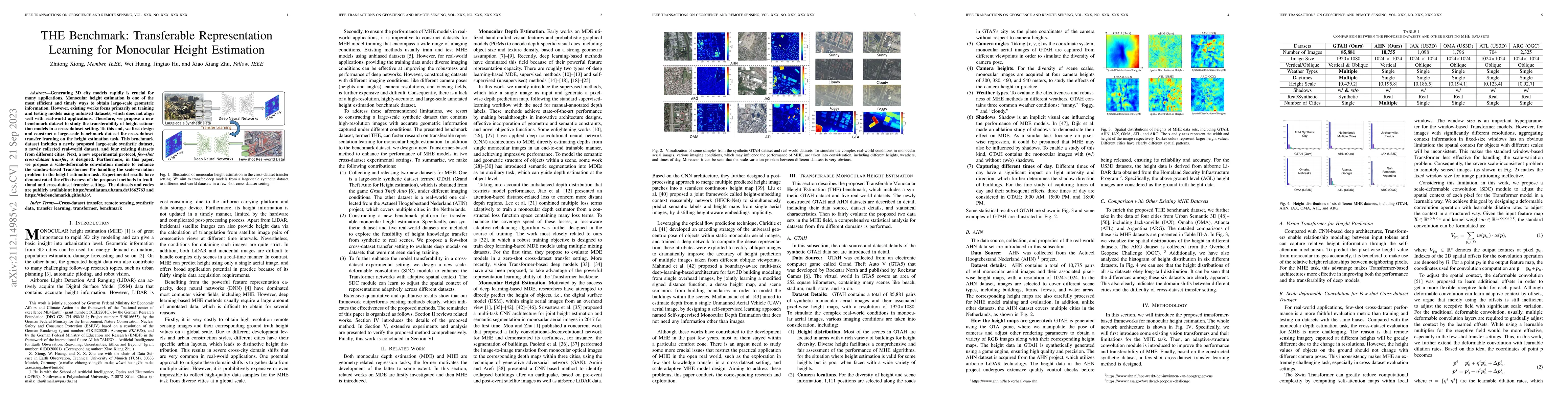
Generating 3D city models rapidly is crucial for many applications. Monocular height estimation is one of the most efficient and timely ways to obtain large-scale geometric information. However, exi...
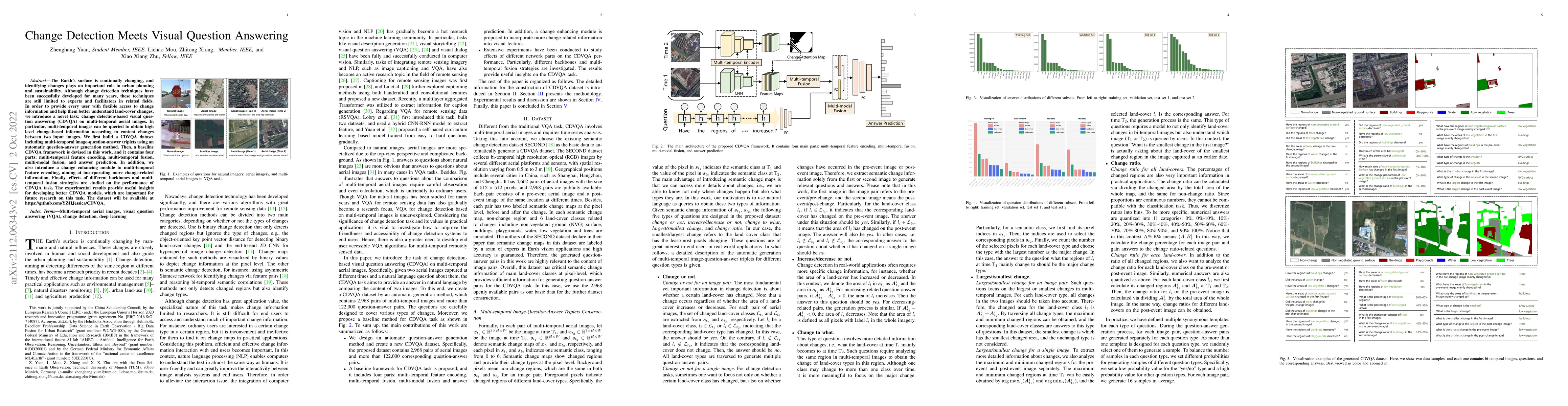
The Earth's surface is continually changing, and identifying changes plays an important role in urban planning and sustainability. Although change detection techniques have been successfully develop...
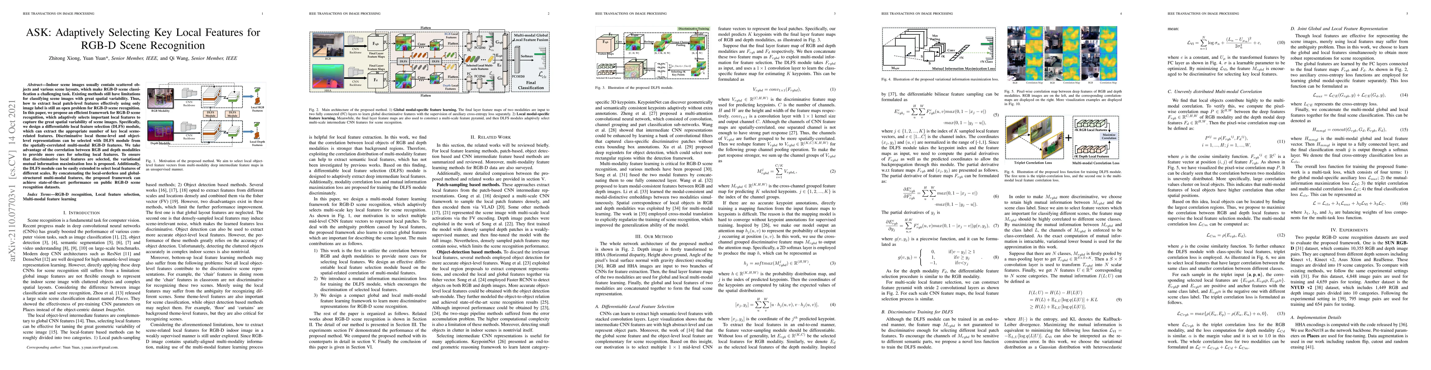
Indoor scene images usually contain scattered objects and various scene layouts, which make RGB-D scene classification a challenging task. Existing methods still have limitations for classifying sce...
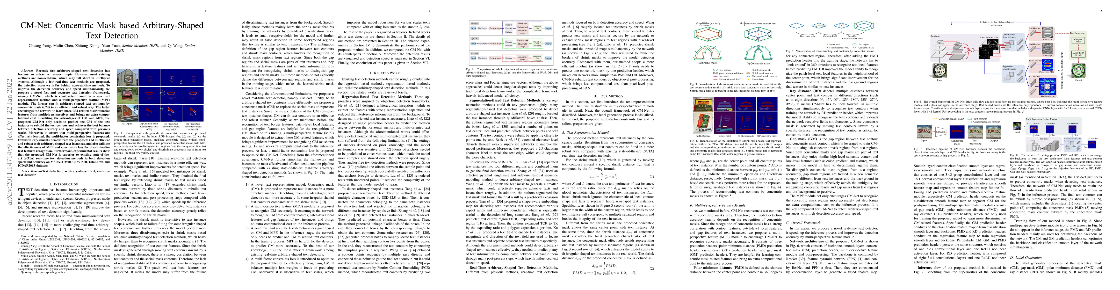
Recently fast arbitrary-shaped text detection has become an attractive research topic. However, most existing methods are non-real-time, which may fall short in intelligent systems. Although a few r...
Although traffic sign detection has been studied for years and great progress has been made with the rise of deep learning technique, there are still many problems remaining to be addressed. For com...
Earth Observation (EO) data analysis has been significantly revolutionized by deep learning (DL), with applications typically limited to grid-like data structures. Graph Neural Networks (GNNs) emerge ...
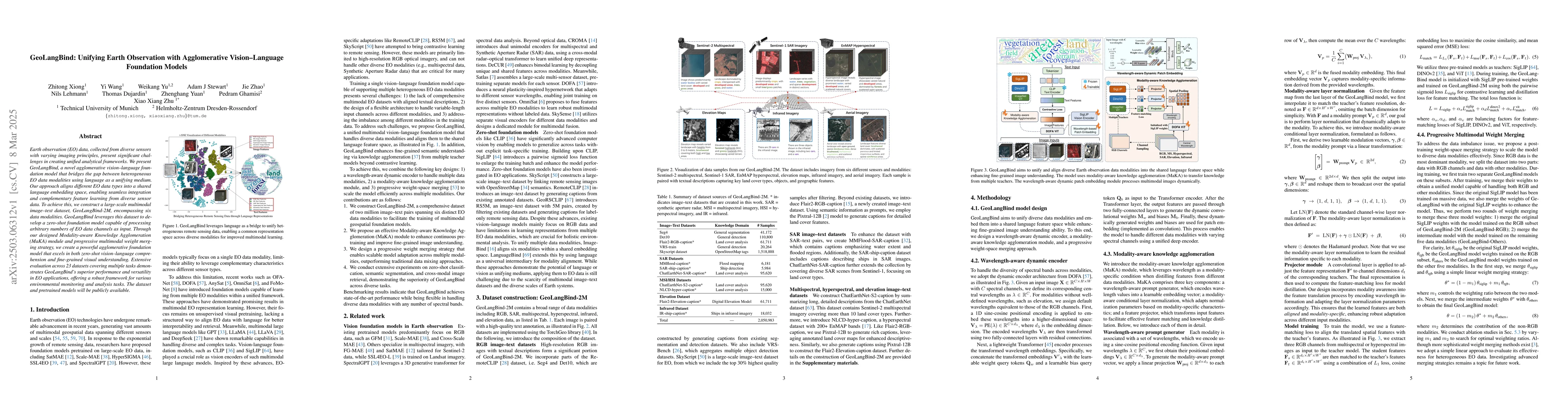
Earth observation (EO) data, collected from diverse sensors with varying imaging principles, present significant challenges in creating unified analytical frameworks. We present GeoLangBind, a novel a...
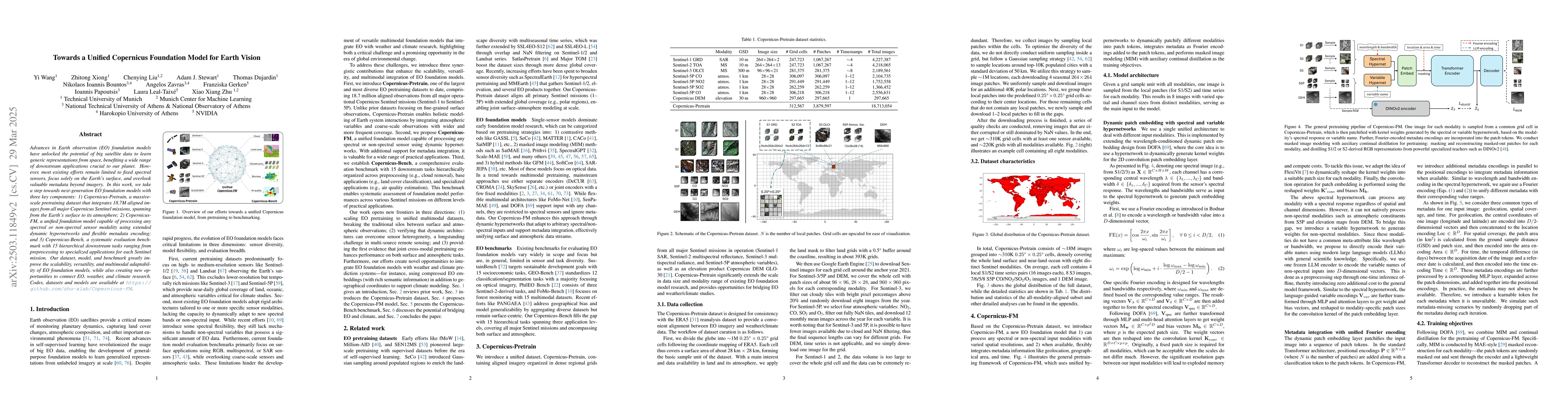
Advances in Earth observation (EO) foundation models have unlocked the potential of big satellite data to learn generic representations from space, benefiting a wide range of downstream applications c...
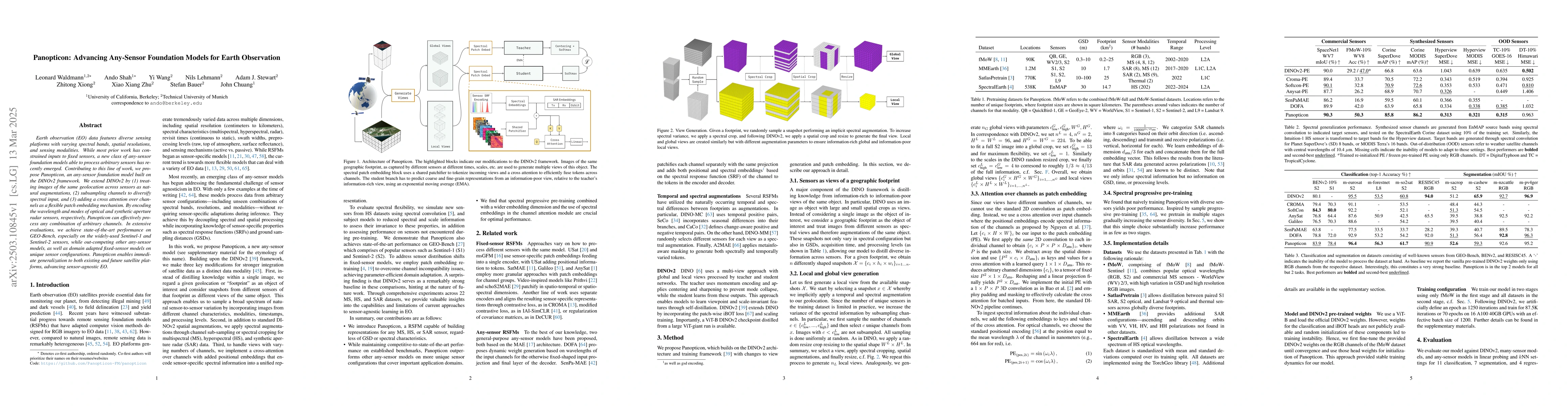
Earth observation (EO) data features diverse sensing platforms with varying spectral bands, spatial resolutions, and sensing modalities. While most prior work has constrained inputs to fixed sensors, ...
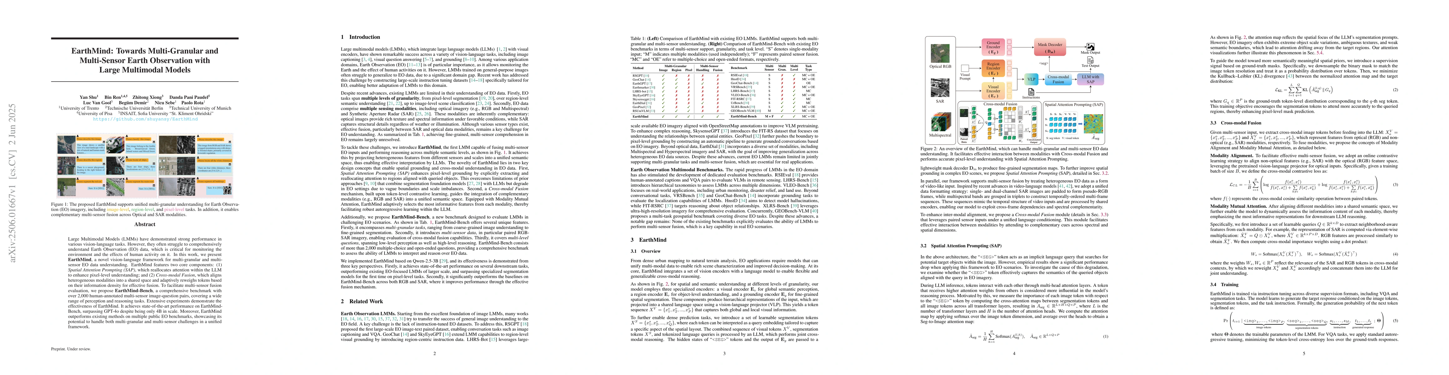
Large Multimodal Models (LMMs) have demonstrated strong performance in various vision-language tasks. However, they often struggle to comprehensively understand Earth Observation (EO) data, which is c...
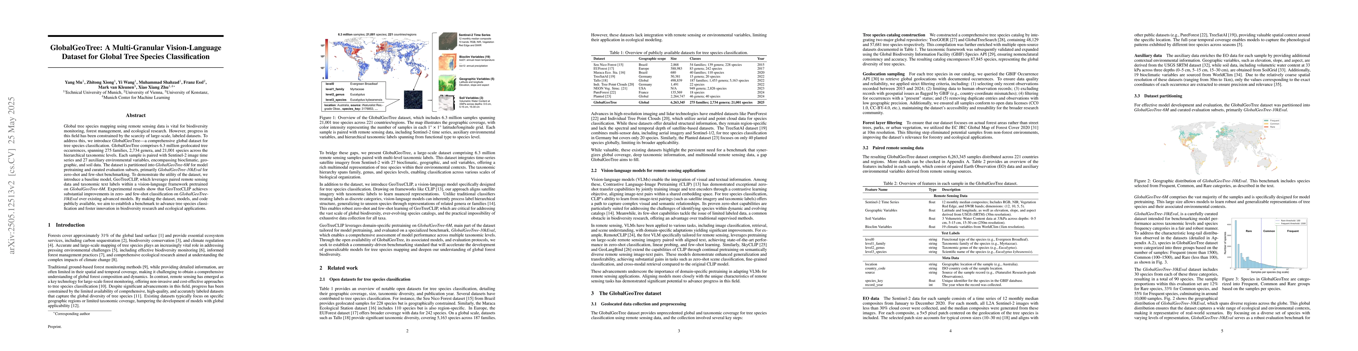
Global tree species mapping using remote sensing data is vital for biodiversity monitoring, forest management, and ecological research. However, progress in this field has been constrained by the scar...
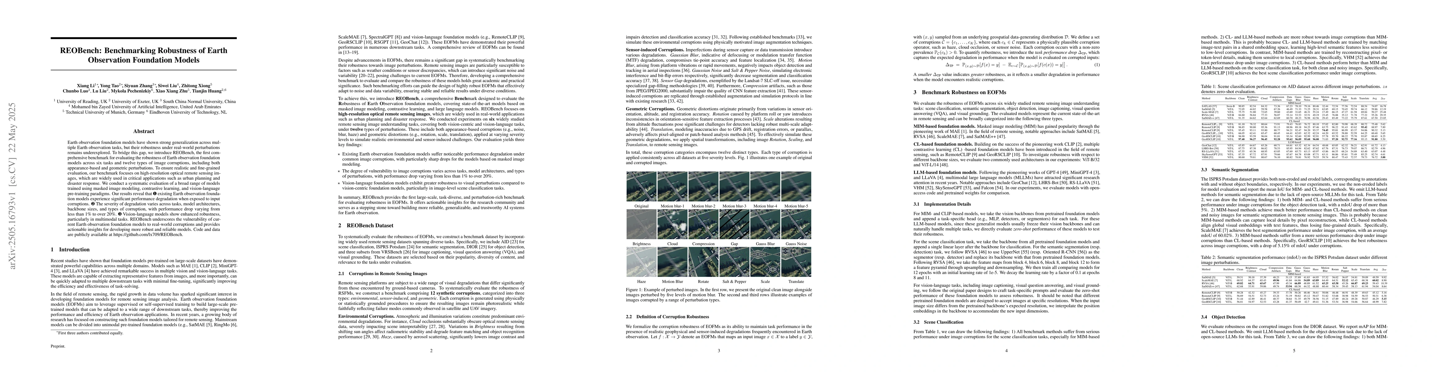
Earth observation foundation models have shown strong generalization across multiple Earth observation tasks, but their robustness under real-world perturbations remains underexplored. To bridge this ...
The performance of deep learning models in remote sensing (RS) strongly depends on the availability of high-quality labeled data. However, collecting large-scale annotations is costly and time-consumi...
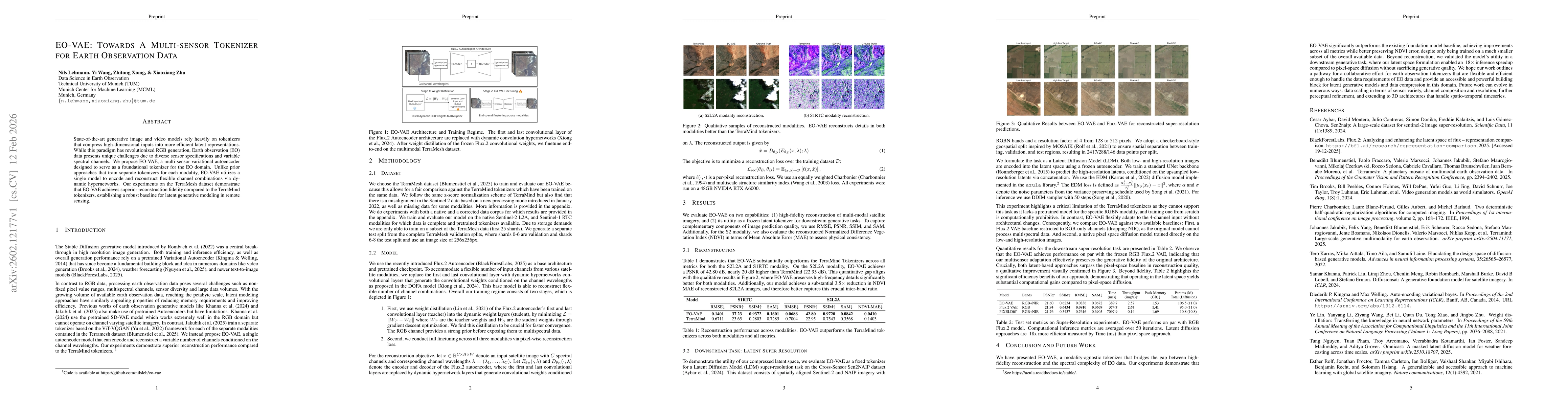
State-of-the-art generative image and video models rely heavily on tokenizers that compress high-dimensional inputs into more efficient latent representations. While this paradigm has revolutionized R...
Vision-language models (VLMs) have shown promise in earth observation (EO), yet they struggle with tasks that require grounding complex spatial reasoning in precise pixel-level visual representations....
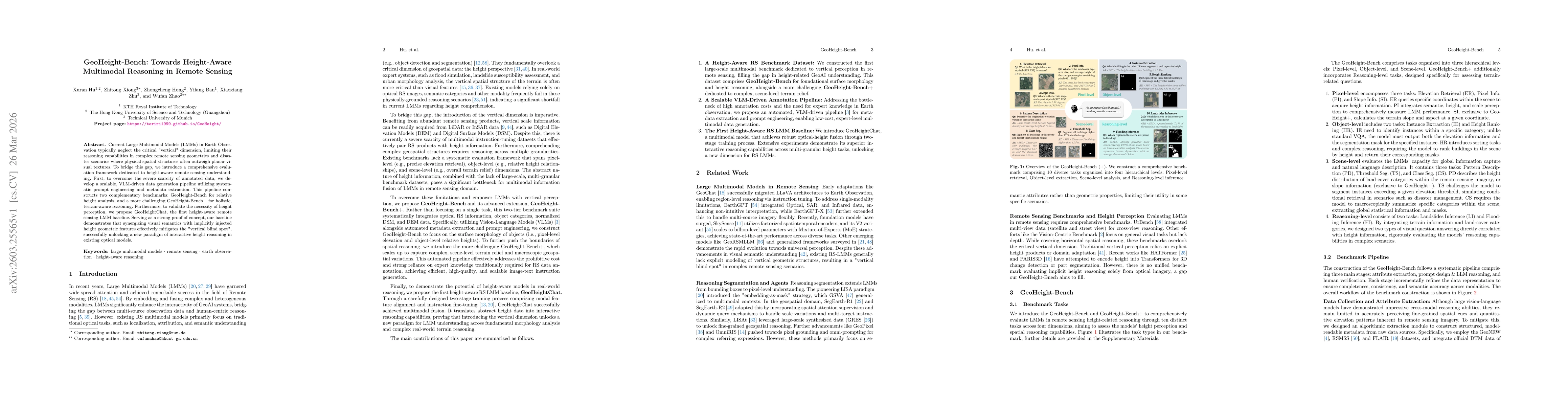
Current Large Multimodal Models (LMMs) in Earth Observation typically neglect the critical "vertical" dimension, limiting their reasoning capabilities in complex remote sensing geometries and disaster...