A Clustering Algorithm to Organize Satellite Hotspot Data for the Purpose of Tracking Bushfires Remotely
Publication
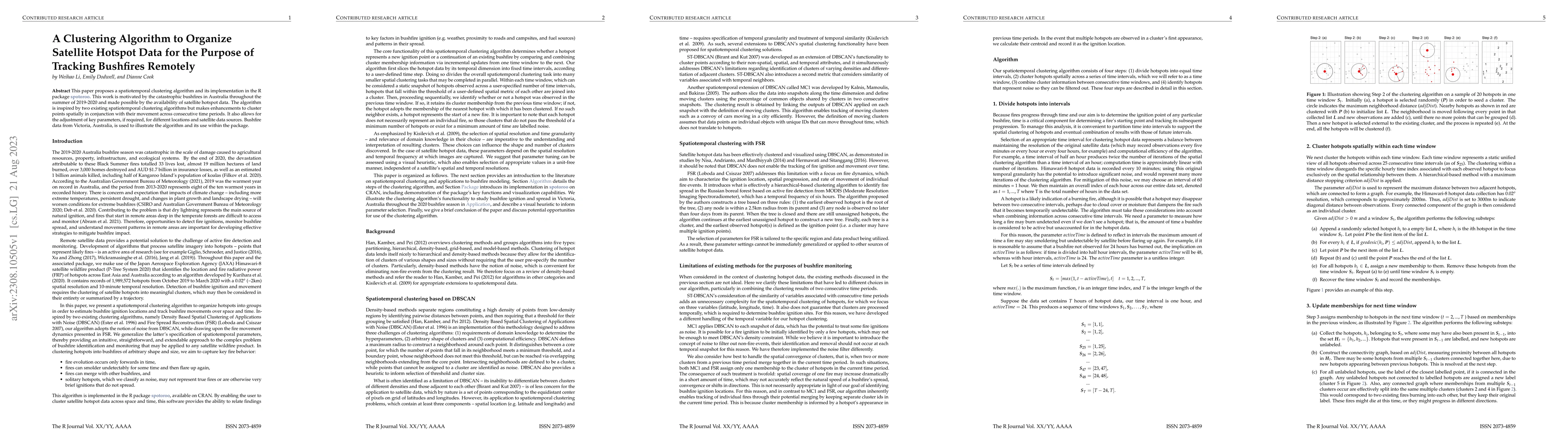
Metrics
AI Quick Summary
This paper introduces a new spatiotemporal clustering algorithm implemented in the R package spotoroo to organize satellite hotspot data for tracking bushfires. The algorithm enhances existing methods by clustering data spatially and temporally, and is demonstrated using bushfire data from Victoria, Australia.
Paper Preview
Abstract
This paper proposes a spatiotemporal clustering algorithm and its implementation in the R package spotoroo. This work is motivated by the catastrophic bushfires in Australia throughout the summer of 2019-2020 and made possible by the availability of satellite hotspot data. The algorithm is inspired by two existing spatiotemporal clustering algorithms but makes enhancements to cluster points spatially in conjunction with their movement across consecutive time periods. It also allows for the adjustment of key parameters, if required, for different locations and satellite data sources. Bushfire data from Victoria, Australia, is used to illustrate the algorithm and its use within the package.
AI Key Findings
Get AI-generated insights about this paper's methodology, results, significance, and more — seven facets brought into focus.
Impact
Paper Details
Authors
PDF Preview
Key Terms
Citation Network
Current paper (gray), citations (green), references (blue)
Display is limited for performance on very large graphs.
Discussion 0