Publication
Metrics
AI Quick Summary
This study uses GIS and MCDA to identify potential observatory sites in Turkey, evaluating factors like cloud cover and elevation. The analysis highlights a prime region from southwest to northeast, with a secondary focus in the southeast, pending on-site validation.
Paper Preview
Abstract
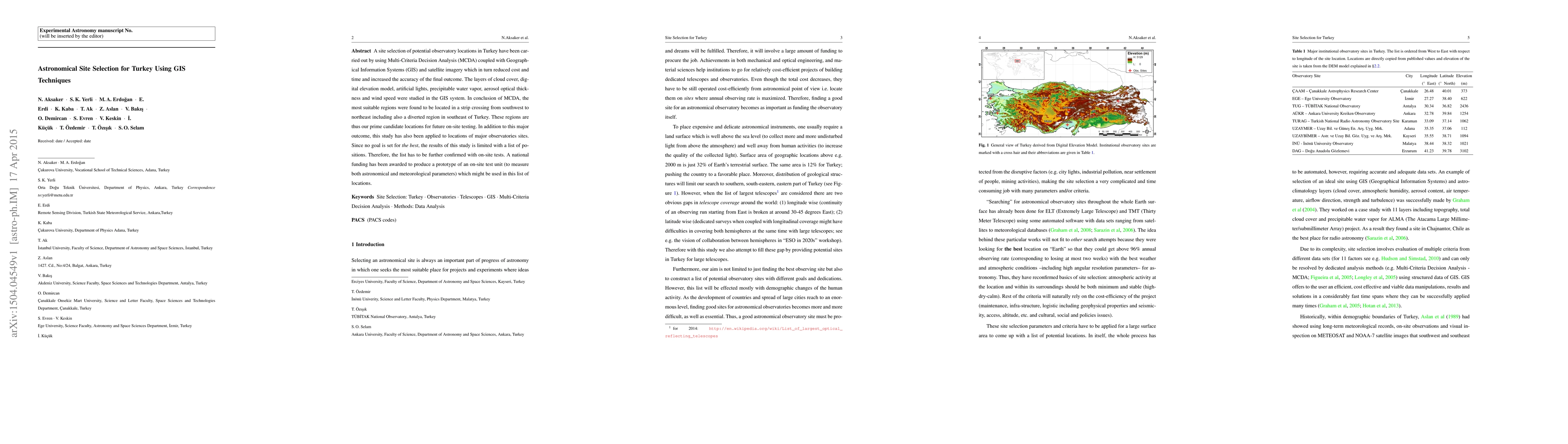
A site selection of potential observatory locations in Turkey have been carried out by using Multi-Criteria Decision Analysis (MCDA) coupled with Geographical Information Systems (GIS) and satellite imagery which in turn reduced cost and time and increased the accuracy of the final outcome. The layers of cloud cover, digital elevation model, artificial lights, precipitable water vapor, aerosol optical thickness and wind speed were studied in the GIS system. In conclusion of MCDA, the most suitable regions were found to be located in a strip crossing from southwest to northeast including also a diverted region in southeast of Turkey. These regions are thus our prime candidate locations for future on-site testing. In addition to this major outcome, this study has also been applied to locations of major observatories sites. Since no goal is set for \textit{the best}, the results of this study is limited with a list of positions. Therefore, the list has to be further confirmed with on-site tests. A national funding has been awarded to produce a prototype of an on-site test unit (to measure both astronomical and meteorological parameters) which might be used in this list of locations.
AI Key Findings
Get AI-generated insights about this paper's methodology, results, significance, and more — seven facets brought into focus.
Impact
Paper Details
PDF Preview
Key Terms
Citation Network
Current paper (gray), citations (green), references (blue)
Display is limited for performance on very large graphs.
Discussion 0