Publication
Metrics
AI Quick Summary
This study analyzes cloud cover over Indonesia using satellite data from 1996 to 2010 to identify suitable sites for a multi-wavelength astronomical observatory. Regions in East Nusa Tenggara show the highest clear sky fraction, potentially exceeding 70 percent annually.
Paper Preview
Abstract
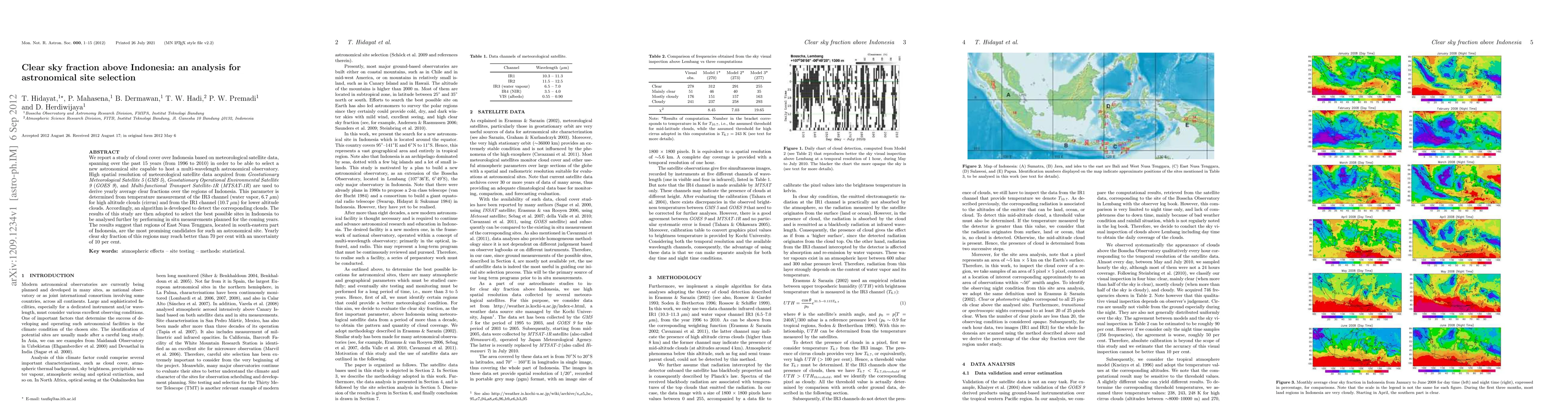
We report a study of cloud cover over Indonesia based on meteorological satellite data, spanning over the past 15 years (from 1996 to 2010) in order to be able to select a new astronomical site capable to host a multi-wavelength astronomical observatory. High spatial resolution of meteorological satellite data acquired from {\it Geostationary Meteorological Satellite 5} ({\it GMS 5}), {\it Geostationary Operational Environmental Satellite 9} ({\it GOES 9}), and {\it Multi-functional Transport Satellite-1R} ({\it MTSAT-1R}) are used to derive yearly average clear fractions over the regions of Indonesia. This parameter is determined from temperature measurement of the IR3 channel (water vapor, 6.7 $\mu$m) for high altitude clouds (cirrus) and from the IR1 channel (10.7 $\mu$m) for lower altitude clouds. Accordingly, an algorithm is developed to detect the corresponding clouds. The results of this study are then adopted to select the best possible sites in Indonesia to be analysed further by performing in situ measurements planned for the coming years. The results suggest that regions of East Nusa Tenggara, located in south-eastern part of Indonesia, are the most promising candidates for such an astronomical site. Yearly clear sky fraction of this regions may reach better than 70 per cent with an uncertainty of 10 per cent.
AI Key Findings
Get AI-generated insights about this paper's methodology, results, significance, and more — seven facets brought into focus.
Impact
Paper Details
PDF Preview
Key Terms
Citation Network
Current paper (gray), citations (green), references (blue)
Display is limited for performance on very large graphs.
Discussion 0