01
MethodologyHow they did it
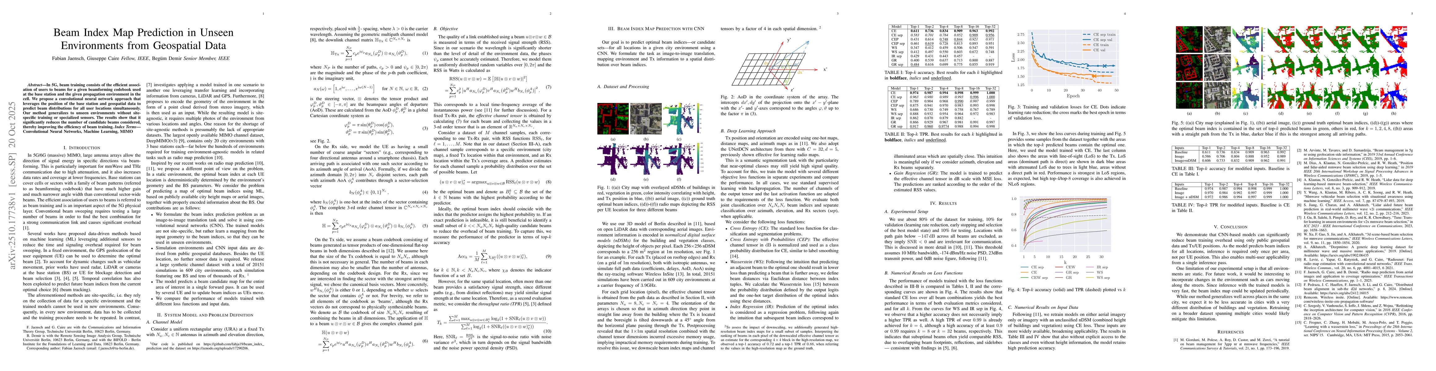
The research employs a convolutional neural network (CNN) to predict beam index maps using geospatial data and base station positions, leveraging a 3D channel model and ray-tracing simulations for training.
Discussion 0