CHMv2: Improvements in Global Canopy Height Mapping using DINOv3
Publication
Metrics
Paper Preview
Abstract
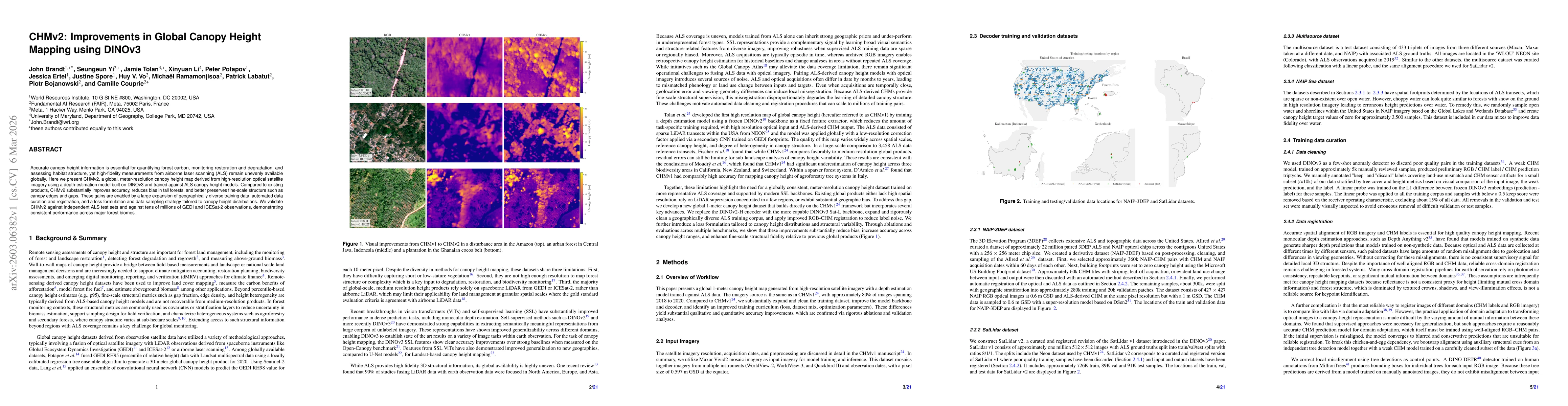
Accurate canopy height information is essential for quantifying forest carbon, monitoring restoration and degradation, and assessing habitat structure, yet high-fidelity measurements from airborne laser scanning (ALS) remain unevenly available globally. Here we present CHMv2, a global, meter-resolution canopy height map derived from high-resolution optical satellite imagery using a depth-estimation model built on DINOv3 and trained against ALS canopy height models. Compared to existing products, CHMv2 substantially improves accuracy, reduces bias in tall forests, and better preserves fine-scale structure such as canopy edges and gaps. These gains are enabled by a large expansion of geographically diverse training data, automated data curation and registration, and a loss formulation and data sampling strategy tailored to canopy height distributions. We validate CHMv2 against independent ALS test sets and against tens of millions of GEDI and ICESat-2 observations, demonstrating consistent performance across major forest biomes.
AI Key Findings
Get AI-generated insights about this paper's methodology, results, significance, and more — seven facets brought into focus.
Discussion 0