Depth Any Canopy: Leveraging Depth Foundation Models for Canopy Height Estimation
Publication
Metrics
AI Quick Summary
This paper proposes Depth Any Canopy, a method leveraging monocular depth foundation models to estimate canopy height from single-view imagery efficiently. The approach fine-tunes the Depth Anything v2 model, achieving state-of-the-art performance with lower computational costs and environmental impact.
Paper Preview
Abstract
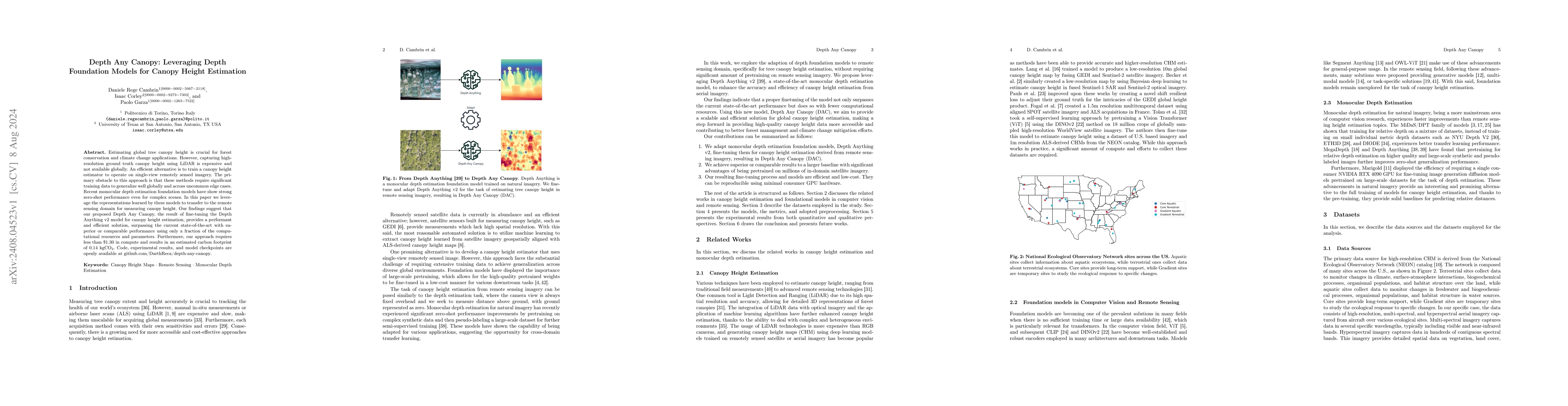
Estimating global tree canopy height is crucial for forest conservation and climate change applications. However, capturing high-resolution ground truth canopy height using LiDAR is expensive and not available globally. An efficient alternative is to train a canopy height estimator to operate on single-view remotely sensed imagery. The primary obstacle to this approach is that these methods require significant training data to generalize well globally and across uncommon edge cases. Recent monocular depth estimation foundation models have show strong zero-shot performance even for complex scenes. In this paper we leverage the representations learned by these models to transfer to the remote sensing domain for measuring canopy height. Our findings suggest that our proposed Depth Any Canopy, the result of fine-tuning the Depth Anything v2 model for canopy height estimation, provides a performant and efficient solution, surpassing the current state-of-the-art with superior or comparable performance using only a fraction of the computational resources and parameters. Furthermore, our approach requires less than \$1.30 in compute and results in an estimated carbon footprint of 0.14 kgCO2. Code, experimental results, and model checkpoints are openly available at https://github.com/DarthReca/depth-any-canopy.
AI Key Findings
Get AI-generated insights about this paper's methodology, results, significance, and more — seven facets brought into focus.
Impact
Paper Details
Authors
PDF Preview
Key Terms
Citation Network
Current paper (gray), citations (green), references (blue)
Display is limited for performance on very large graphs.
Discussion 0