Convolutional Neural Processes for Inpainting Satellite Images
Publication
Metrics
AI Quick Summary
This paper proposes convolutional neural processes (ConvNPs) for inpainting missing values in satellite images, framing each image as a unique 2D regression task. ConvNPs outperform traditional methods and state-of-the-art deep learning models in filling in missing data from LANDSAT 7 satellite images, demonstrating effectiveness on both in-distribution and out-of-distribution test cases.
Paper Preview
Abstract
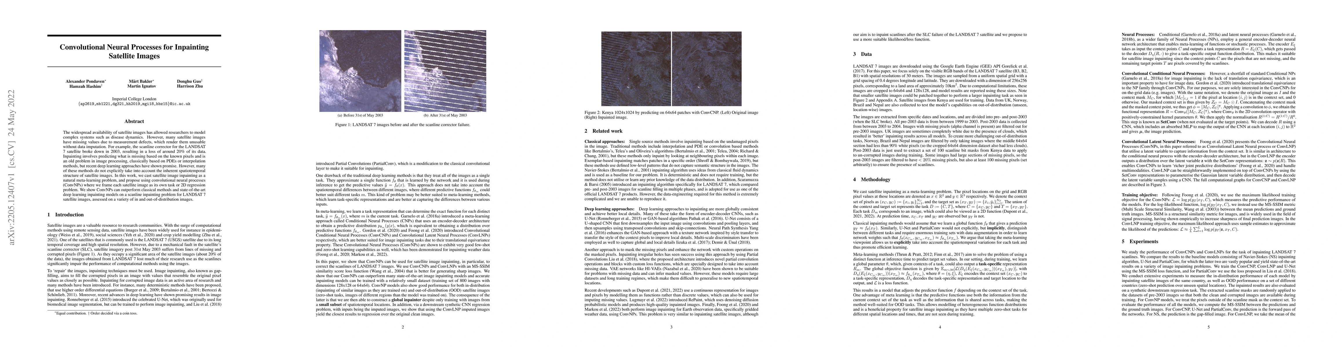
The widespread availability of satellite images has allowed researchers to model complex systems such as disease dynamics. However, many satellite images have missing values due to measurement defects, which render them unusable without data imputation. For example, the scanline corrector for the LANDSAT 7 satellite broke down in 2003, resulting in a loss of around 20\% of its data. Inpainting involves predicting what is missing based on the known pixels and is an old problem in image processing, classically based on PDEs or interpolation methods, but recent deep learning approaches have shown promise. However, many of these methods do not explicitly take into account the inherent spatiotemporal structure of satellite images. In this work, we cast satellite image inpainting as a natural meta-learning problem, and propose using convolutional neural processes (ConvNPs) where we frame each satellite image as its own task or 2D regression problem. We show ConvNPs can outperform classical methods and state-of-the-art deep learning inpainting models on a scanline inpainting problem for LANDSAT 7 satellite images, assessed on a variety of in and out-of-distribution images.
AI Key Findings
Get AI-generated insights about this paper's methodology, results, significance, and more — seven facets brought into focus.
Impact
Paper Details
Authors
PDF Preview
Key Terms
Citation Network
Current paper (gray), citations (green), references (blue)
Display is limited for performance on very large graphs.
Discussion 0