DynamicEarthNet: Daily Multi-Spectral Satellite Dataset for Semantic Change Segmentation
Publication
Metrics
AI Quick Summary
DynamicEarthNet is a novel daily multi-spectral satellite dataset featuring observations from Planet Labs, paired with pixel-wise semantic segmentation labels for 7 land use classes. It aims to facilitate research in time-series land use change detection and introduces a new evaluation metric, SCS, for this purpose.
Paper Preview
Abstract
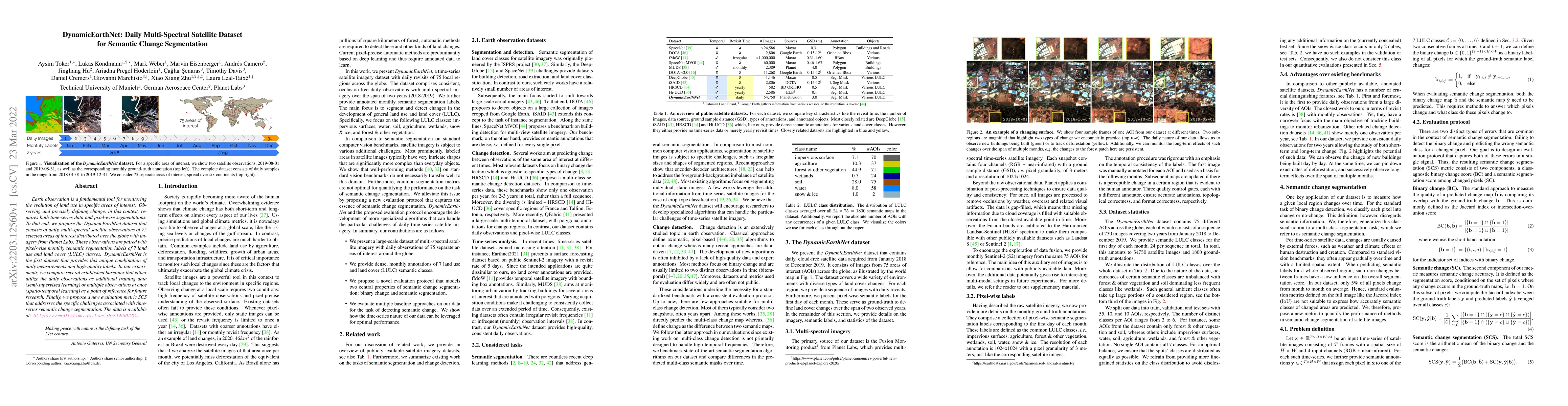
Earth observation is a fundamental tool for monitoring the evolution of land use in specific areas of interest. Observing and precisely defining change, in this context, requires both time-series data and pixel-wise segmentations. To that end, we propose the DynamicEarthNet dataset that consists of daily, multi-spectral satellite observations of 75 selected areas of interest distributed over the globe with imagery from Planet Labs. These observations are paired with pixel-wise monthly semantic segmentation labels of 7 land use and land cover (LULC) classes. DynamicEarthNet is the first dataset that provides this unique combination of daily measurements and high-quality labels. In our experiments, we compare several established baselines that either utilize the daily observations as additional training data (semi-supervised learning) or multiple observations at once (spatio-temporal learning) as a point of reference for future research. Finally, we propose a new evaluation metric SCS that addresses the specific challenges associated with time-series semantic change segmentation. The data is available at: https://mediatum.ub.tum.de/1650201.
AI Key Findings
Get AI-generated insights about this paper's methodology, results, significance, and more — seven facets brought into focus.
Impact
Paper Details
Authors
PDF Preview
Key Terms
Citation Network
Current paper (gray), citations (green), references (blue)
Display is limited for performance on very large graphs.
Discussion 0