ArxivLens

Publication

Published: Apr 08, 2026
Categories: stat.ME

Metrics

Source: ArXiv

Quick Answers

What methodology did the authors use?

RMT-based pipeline that orders spatial locations via a Hilbert space‑filling curve, computes Bergsma’s non‑Gaussian correlation, applies SVD to trim dominant singular values (temporal signals), and then derives a Pearson correlation matrix of the trimmed data as the core spatial association. More in Methodology →

What are the key results?

The trimmed correlation matrix reveals distinct spatial anomalies in India’s diurnal temperature range, highlighting topography‑driven cold spots, urban heat islands, and mesoclimate zones. — Temporal analysis shows a dramatic shift in spatial dependence around the late 1960s, confirmed by changes in the Spatial Bergsma statistic. More in Key Results →

Why is this work significant?

By separating temporal co‑evolution from genuine spatial dependence, the method uncovers subtle climate patterns that inform predictive modelling, resilience planning, and policy design under climate change. More in Significance →

What are the main limitations?

The trimming threshold relies on empirical permutation tests and may be sensitive to the chosen number of singular values. — The RMT assumptions (i.i.d. observations) and use of linear/Bergsma correlations may not capture all non‑linear spatial dynamics. More in Limitations →

Paper Preview

Abstract

Spatial time series (STS) data are fundamental to climate science, yet conventional approaches often conflate temporal co-evolution with genuine spatial dependence, obscuring subtle but critical climatic anomalies. We introduce a Random Matrix Theory (RMT)-based framework to isolate "core spatial association" by suitably trimming out strong but routine temporal signals while preserving spatial signals. Our pipeline introduces Hilbert space filling curve technique and Bergsma's correlation measure of statistical dependence, to climate modelling. Applied to the diurnal temperature range (DTR) data of India (1951-2022), the method reveals distinct spatial anomalies shaped by topography, mesoclimate, and urbanization. The approach uncovers temporal evolution in spatial dependence and demonstrates how regional climate variability is structured by both physical geography and anthropogenic influences. Beyond the Indian application, the framework is broadly applicable to diverse spatio-temporal datasets, offering a robust statistical foundation for predictive modelling, resilience planning, and policy design in the context of accelerating climate change.
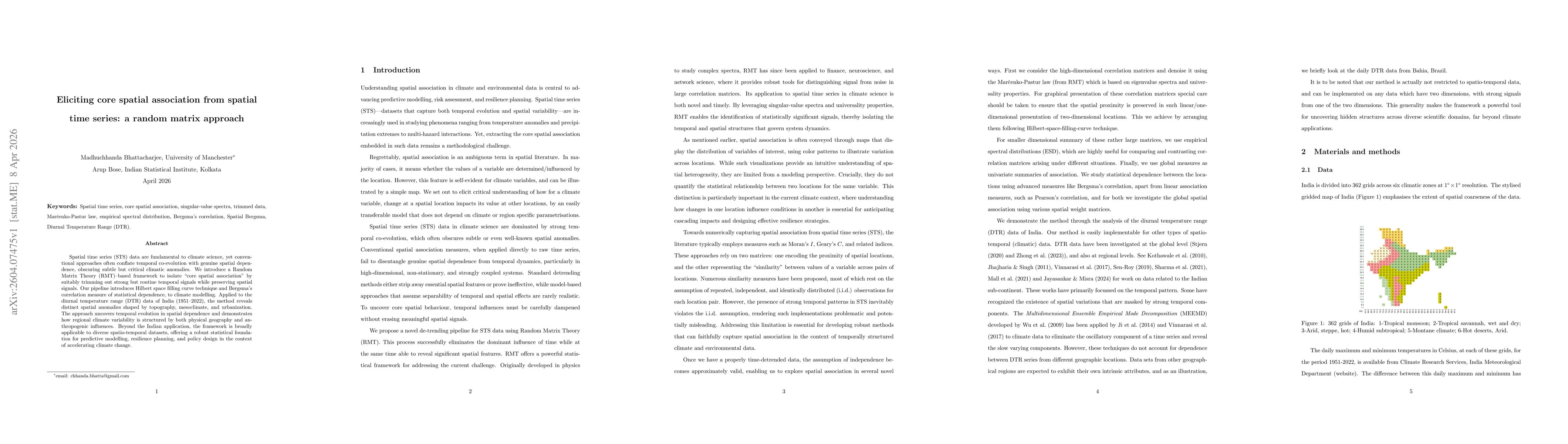
Key Findings, in focus

Seven facets of this paper, analysed and brought into focus by AI.

AI-generated · verify against source Generated Apr 11, 2026
In focus · one-line synthesis

By separating temporal co‑evolution from genuine spatial dependence, the method uncovers subtle climate patterns that inform predictive modelling, resilience planning, and policy design under climate change.

01
MethodologyHow they did it

RMT-based pipeline that orders spatial locations via a Hilbert space‑filling curve, computes Bergsma’s non‑Gaussian correlation, applies SVD to trim dominant singular values (temporal signals), and then derives a Pearson correlation matrix of the trimmed data as the core spatial association.

02
ResultsWhat they found
  • The trimmed correlation matrix reveals distinct spatial anomalies in India’s diurnal temperature range, highlighting topography‑driven cold spots, urban heat islands, and mesoclimate zones.
  • Temporal analysis shows a dramatic shift in spatial dependence around the late 1960s, confirmed by changes in the Spatial Bergsma statistic.
  • Core spatial association is modulated by large‑scale teleconnections: ENSO reduces variability during El Niño, while the Indian Ocean Dipole weakens intra‑regional dependence during positive phases.
03
SignificanceWhy it matters

By separating temporal co‑evolution from genuine spatial dependence, the method uncovers subtle climate patterns that inform predictive modelling, resilience planning, and policy design under climate change.

04
Technical ContributionsWhat's new technically

Introduction of an RMT‑based denoising and trimming procedure for high‑dimensional spatial‑temporal correlation matrices, coupled with Hilbert‑curve ordering and Bergsma correlation, yielding a low‑dimensional core spatial association matrix.

05
NoveltyWhat sets it apart

First application of Random Matrix Theory to disentangle temporal and spatial signals in spatial time series, providing a robust, model‑free summary (Spatial Bergsma statistic) that captures both spatial patterns and their temporal evolution.

06
LimitationsWhat to be cautious about
  • The trimming threshold relies on empirical permutation tests and may be sensitive to the chosen number of singular values.
  • The RMT assumptions (i.i.d. observations) and use of linear/Bergsma correlations may not capture all non‑linear spatial dynamics.
07
Future WorkWhere it goes next
  • Extend the framework to multi‑variable and compound‑hazard datasets, integrating dynamical climate model outputs.
  • Develop automated, data‑driven criteria for selecting the optimal number of singular values to trim.

Paper Details

Paper ID: 2604.07475
Comments: 26 Pages, 9 figures
Categories:
stat.ME

How to Cite This Paper

Reference manager: RIS EndNote


Discussion 0

This website uses cookies to ensure you get the best experience. Learn more