Summary
This chapter deepens cartographic communication through a cartographic multirepresentation exercise. Using a single dataset on World population data, the chapter presents a series of 13 different maps to illustrate how mapping is primarily a matter of choices and methods.
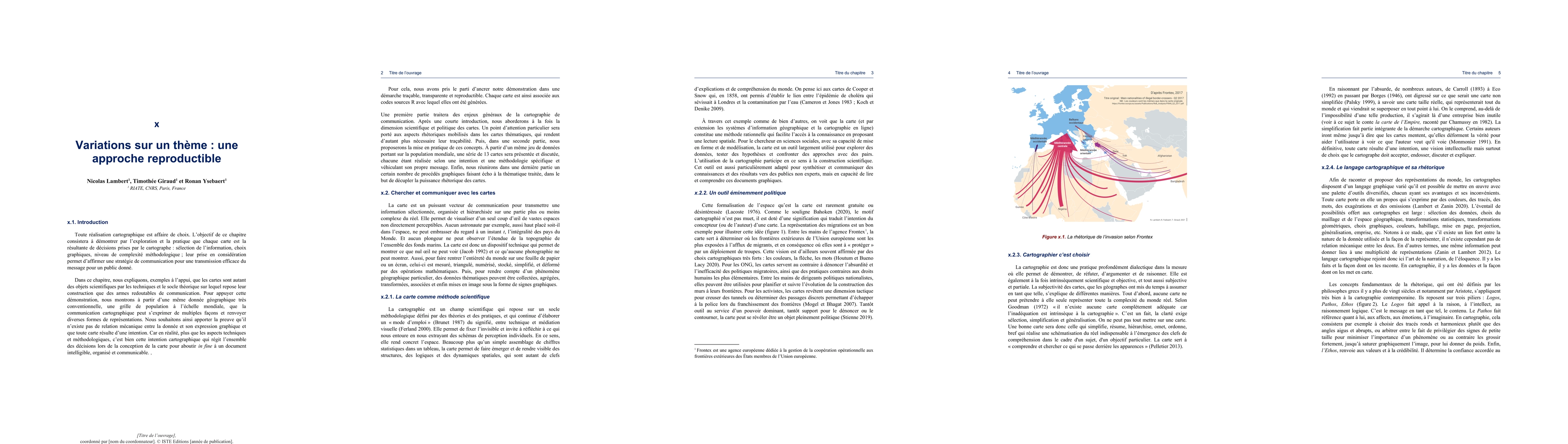
AI Key Findings
Get AI-generated insights about this paper's methodology, results, and significance.
Paper Details
PDF Preview
Key Terms
exercise
(0.372)
primarily
(0.310)
choices
(0.310)
mapping
(0.263)
illustrate
(0.249)
maps
(0.247)
communication
(0.244)
population
(0.241)
Citation Network
Current paper (gray), citations (green), references (blue)
Display is limited for performance on very large graphs.
Current Paper
Citations
References
Click to view
Similar Papers
Found 4 papersAm\'elioration de la qualit\'e d'images avec un algorithme d'optimisation inspir\'ee par la nature
Olivier Parisot, Thomas Tamisier
No citations found for this paper.
Comments (0)