Exploring UAV Networking from the Terrain Information Completeness Perspective: A Tutorial
Publication
Metrics
AI Quick Summary
This paper offers a tutorial on how the completeness of terrain information influences unmanned aerial vehicle (UAV) networking. It explores UAV-aided map construction and dynamic trajectory design when terrain data is complete, and discusses methods for handling incomplete terrain data using blockage probability models and stochastic geometry. It also examines real-time search methods in terrain-information-less scenarios and their trade-offs in multi-user settings.
Paper Preview
Abstract
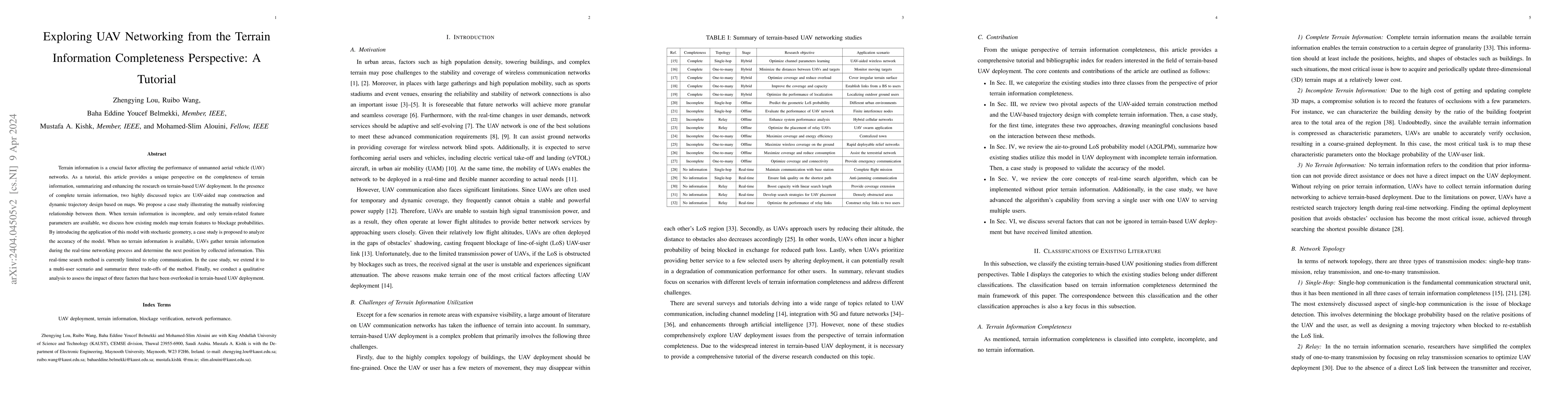
Terrain information is a crucial factor affecting the performance of unmanned aerial vehicle (UAV) networks. As a tutorial, this article provides a unique perspective on the completeness of terrain information, summarizing and enhancing the research on terrain-based UAV deployment. In the presence of complete terrain information, two highly discussed topics are UAV-aided map construction and dynamic trajectory design based on maps. We propose a case study illustrating the mutually reinforcing relationship between them. When terrain information is incomplete, and only terrain-related feature parameters are available, we discuss how existing models map terrain features to blockage probabilities. By introducing the application of this model with stochastic geometry, a case study is proposed to analyze the accuracy of the model. When no terrain information is available, UAVs gather terrain information during the real-time networking process and determine the next position by collected information. This real-time search method is currently limited to relay communication. In the case study, we extend it to a multi-user scenario and summarize three trade-offs of the method. Finally, we conduct a qualitative analysis to assess the impact of three factors that have been overlooked in terrain-based UAV deployment.
AI Key Findings
Get AI-generated insights about this paper's methodology, results, significance, and more — seven facets brought into focus.
Impact
Paper Details
Authors
PDF Preview
Key Terms
Citation Network
Current paper (gray), citations (green), references (blue)
Display is limited for performance on very large graphs.
Discussion 0