Exploring Wilderness Characteristics Using Explainable Machine Learning in Satellite Imagery
Publication
Metrics
AI Quick Summary
This paper applies explainable machine learning to satellite imagery to identify and analyze wilderness characteristics in Fennoscandia. The study uses an interpretable neural network to create high-resolution sensitivity maps, enhancing conservation efforts and providing insights into ecological functions.
Paper Preview
Abstract
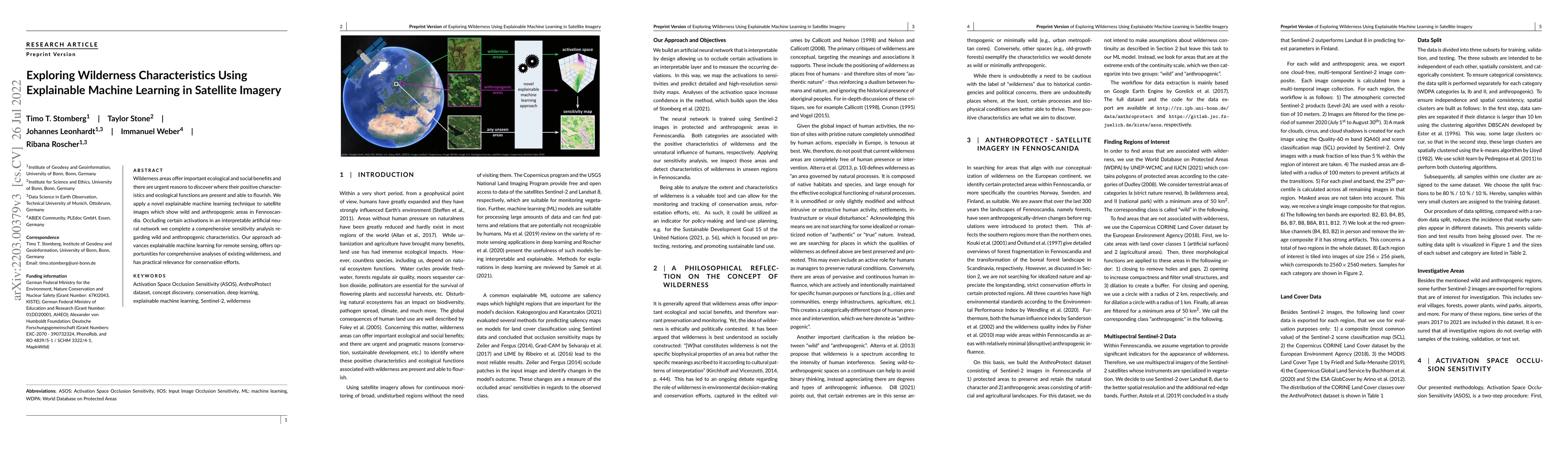
Wilderness areas offer important ecological and social benefits and there are urgent reasons to discover where their positive characteristics and ecological functions are present and able to flourish. We apply a novel explainable machine learning technique to satellite images which show wild and anthropogenic areas in Fennoscandia. Occluding certain activations in an interpretable artificial neural network we complete a comprehensive sensitivity analysis regarding wild and anthropogenic characteristics. This enables us to predict detailed and high-resolution sensitivity maps highlighting these characteristics. Our artificial neural network provides an interpretable activation space increasing confidence in our method. Within the activation space, regions are semantically arranged. Our approach advances explainable machine learning for remote sensing, offers opportunities for comprehensive analyses of existing wilderness, and has practical relevance for conservation efforts.
AI Key Findings
Get AI-generated insights about this paper's methodology, results, significance, and more — seven facets brought into focus.
Impact
Paper Details
Authors
PDF Preview
Key Terms
Citation Network
Current paper (gray), citations (green), references (blue)
Display is limited for performance on very large graphs.
Discussion 0