Academic Profile
Statistics
Similar Authors
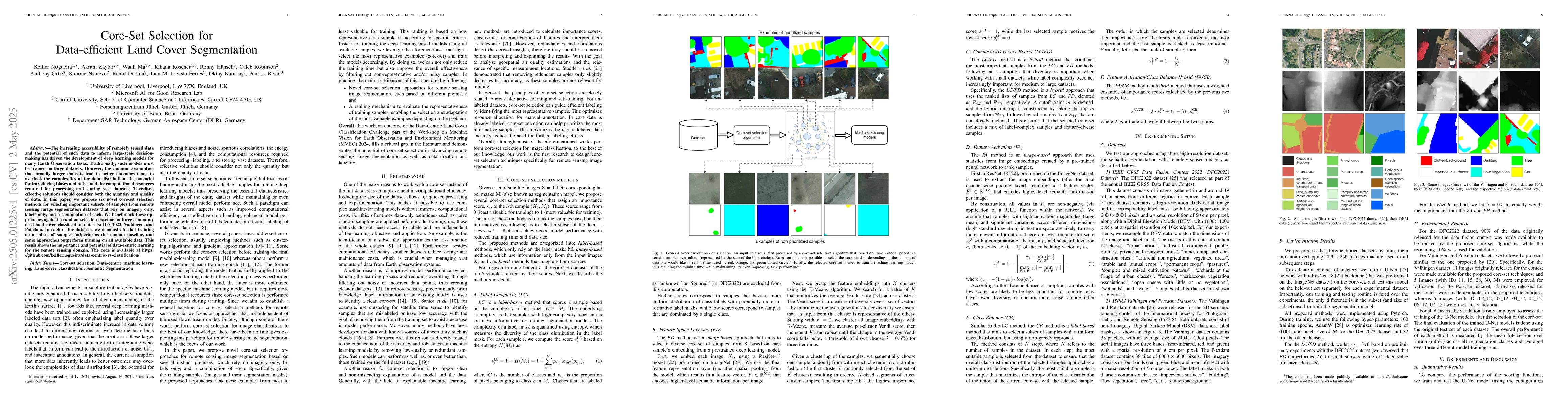
Papers on arXiv
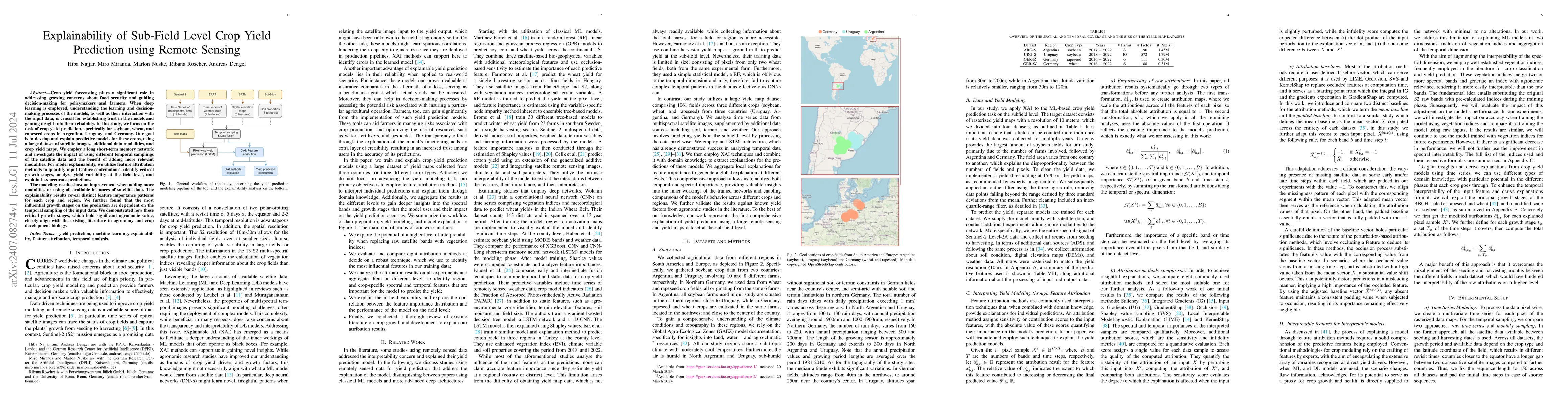
Crop yield forecasting plays a significant role in addressing growing concerns about food security and guiding decision-making for policymakers and farmers. When deep learning is employed, understandi...
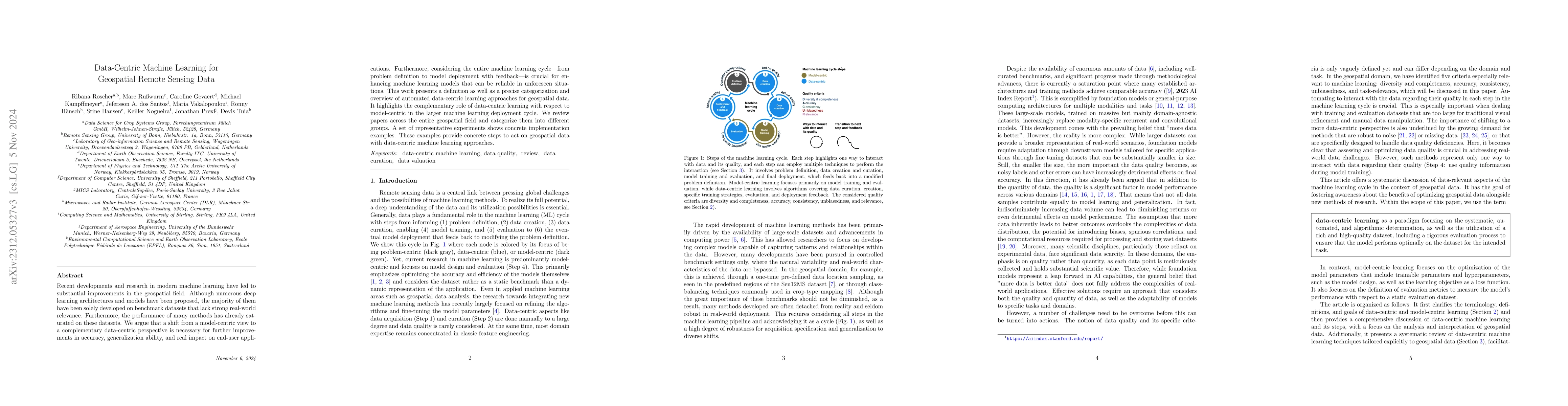
Recent developments and research in modern machine learning have led to substantial improvements in the geospatial field. Although numerous deep learning architectures and models have been proposed,...
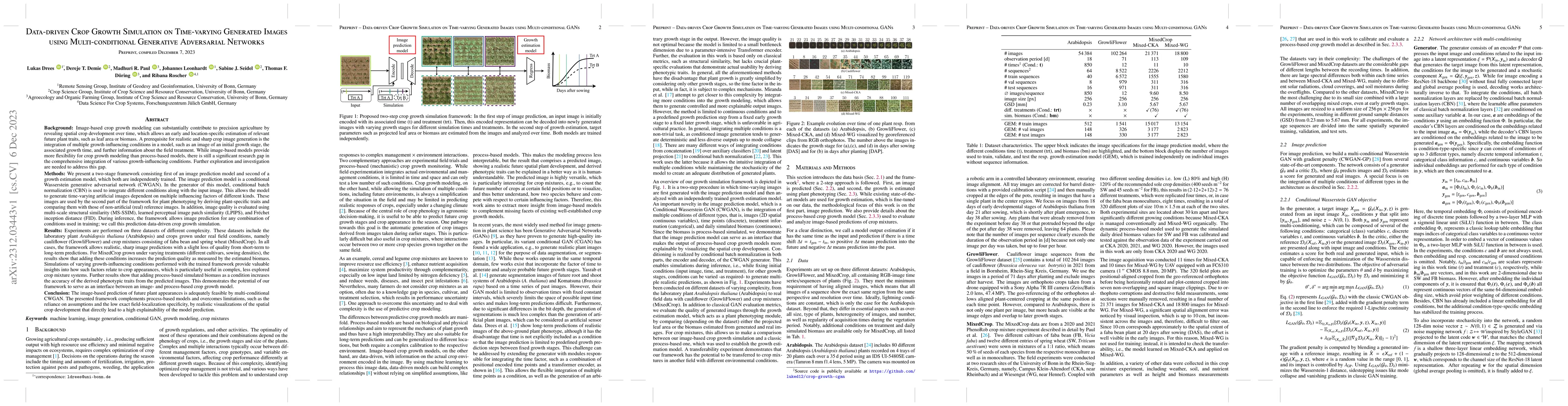
Image-based crop growth modeling can substantially contribute to precision agriculture by revealing spatial crop development over time, which allows an early and location-specific estimation of rele...
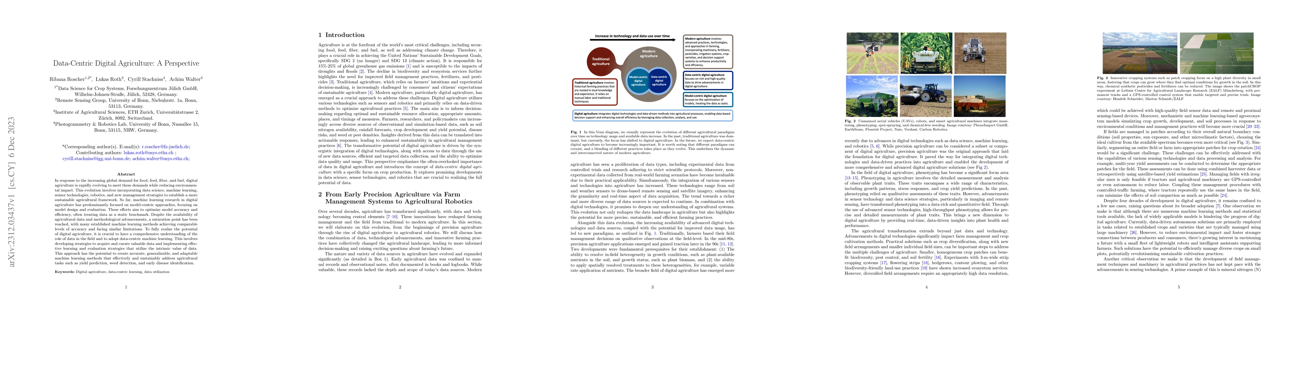
In response to the increasing global demand for food, feed, fiber, and fuel, digital agriculture is rapidly evolving to meet these demands while reducing environmental impact. This evolution involve...
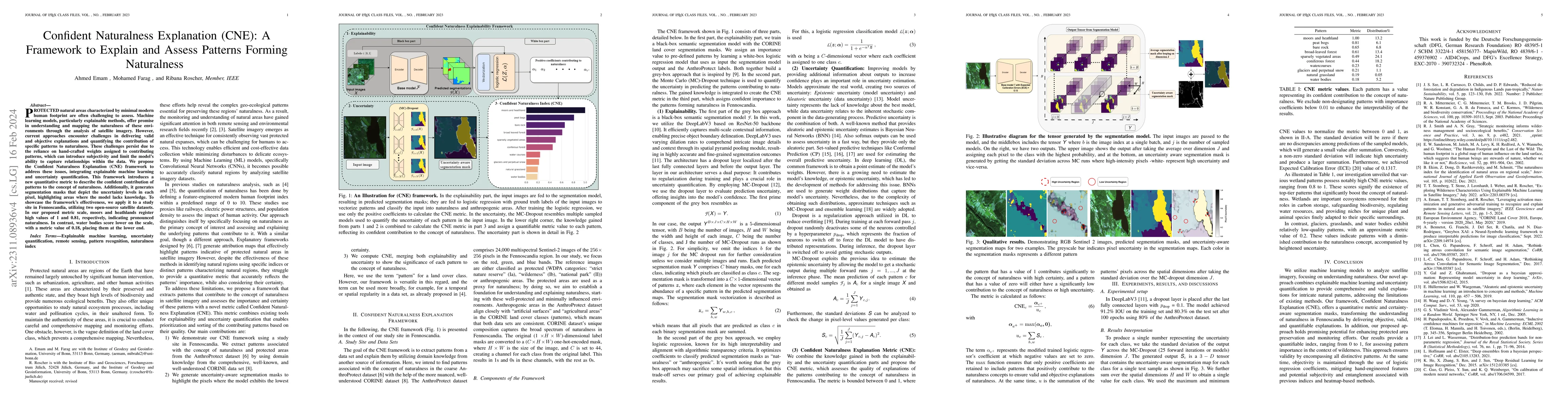
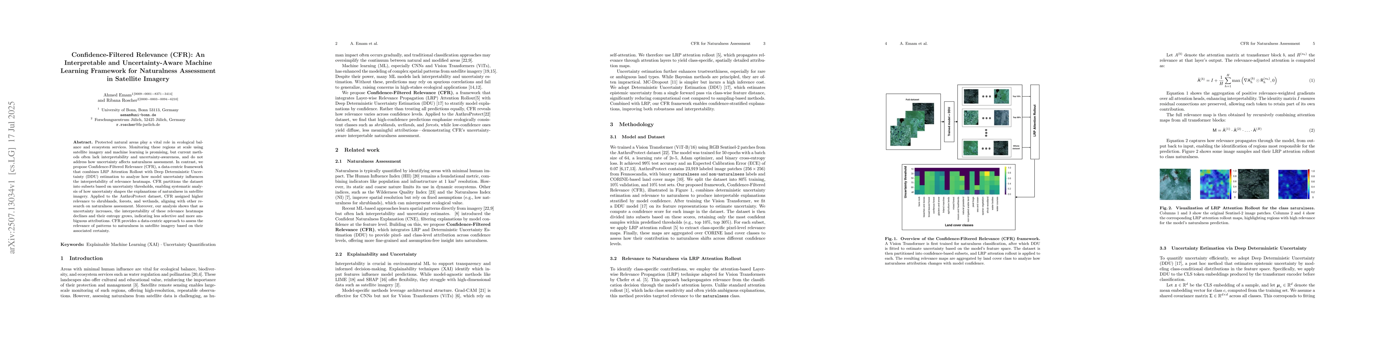
Protected natural areas are regions that have been minimally affected by human activities such as urbanization, agriculture, and other human interventions. To better understand and map the naturalne...
Natural protected areas are vital for biodiversity, climate change mitigation, and supporting ecological processes. Despite their significance, comprehensive mapping is hindered by a lack of underst...
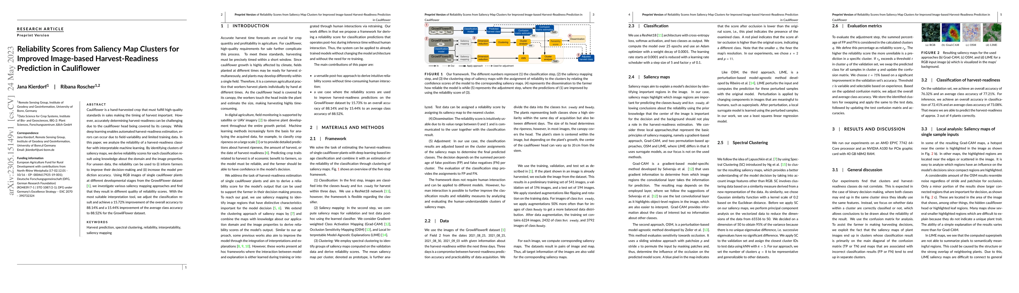
Cauliflower is a hand-harvested crop that must fulfill high-quality standards in sales making the timing of harvest important. However, accurately determining harvest-readiness can be challenging du...
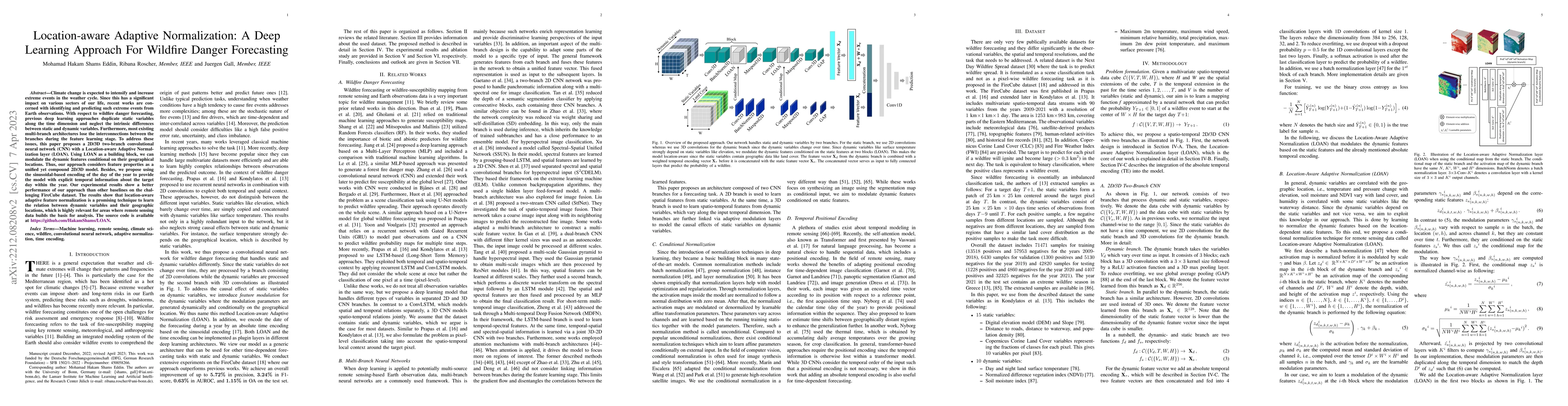
Climate change is expected to intensify and increase extreme events in the weather cycle. Since this has a significant impact on various sectors of our life, recent works are concerned with identify...
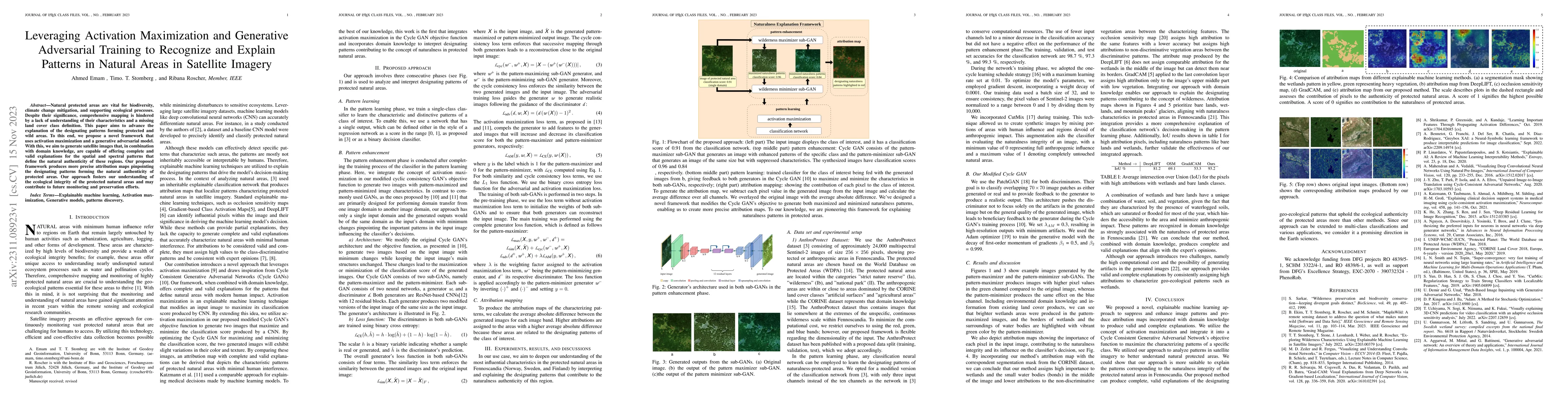
Antrophonegic pressure (i.e. human influence) on the environment is one of the largest causes of the loss of biological diversity. Wilderness areas, in contrast, are home to undisturbed ecological p...
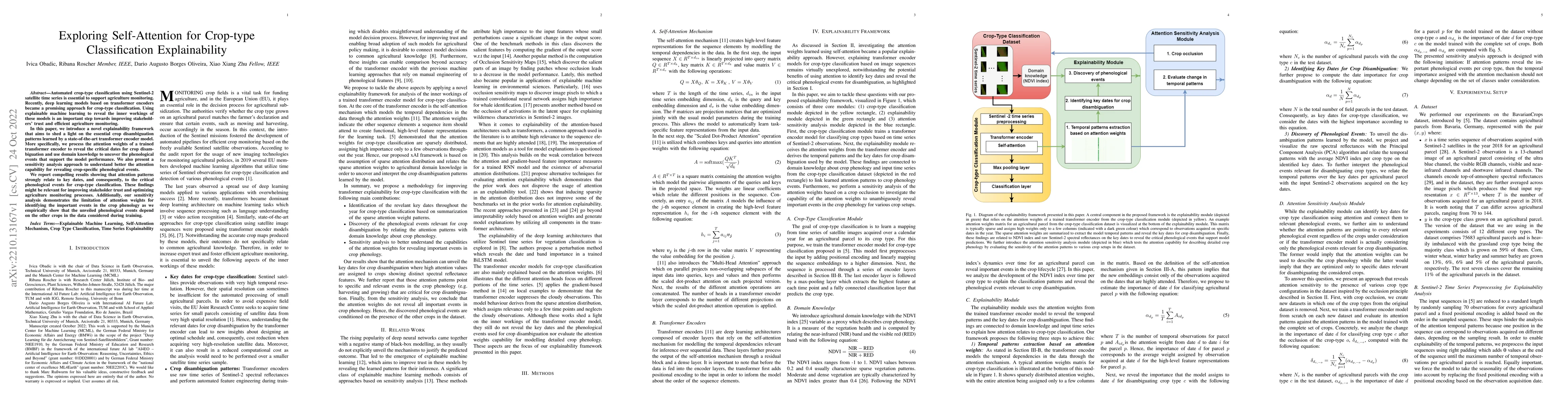
Automated crop-type classification using Sentinel-2 satellite time series is essential to support agriculture monitoring. Recently, deep learning models based on transformer encoders became a promis...
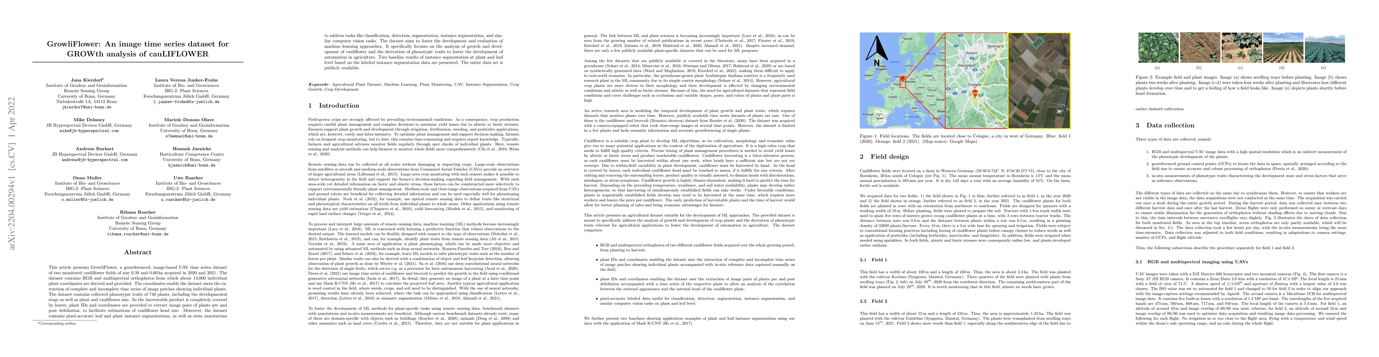
This article presents GrowliFlower, a georeferenced, image-based UAV time series dataset of two monitored cauliflower fields of size 0.39 and 0.60 ha acquired in 2020 and 2021. The dataset contains ...
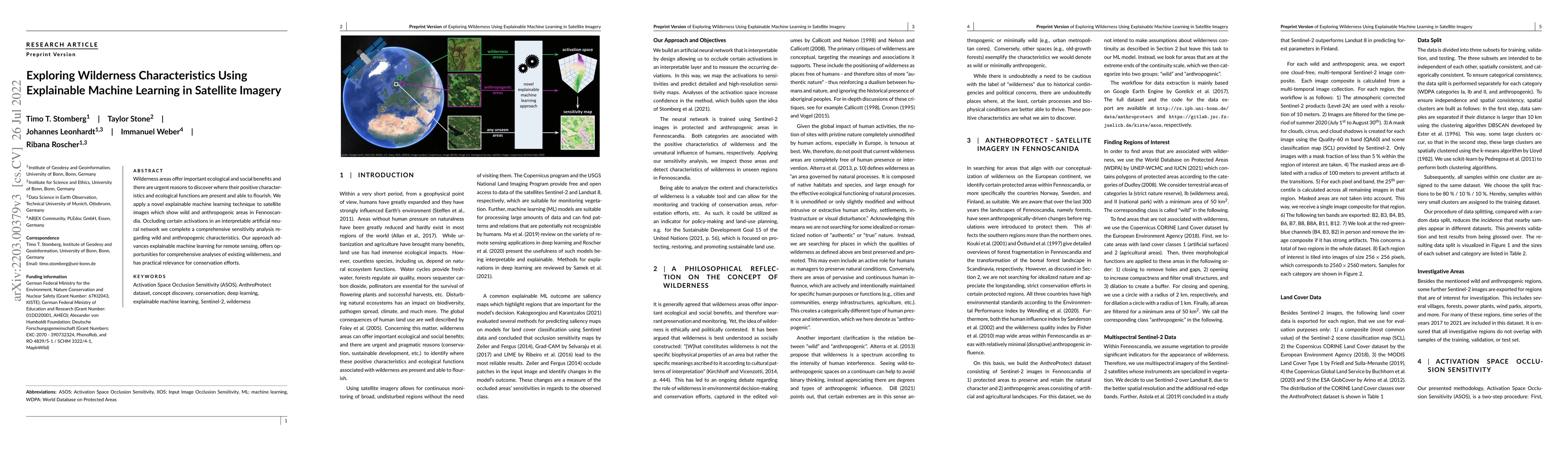
Wilderness areas offer important ecological and social benefits and there are urgent reasons to discover where their positive characteristics and ecological functions are present and able to flouris...
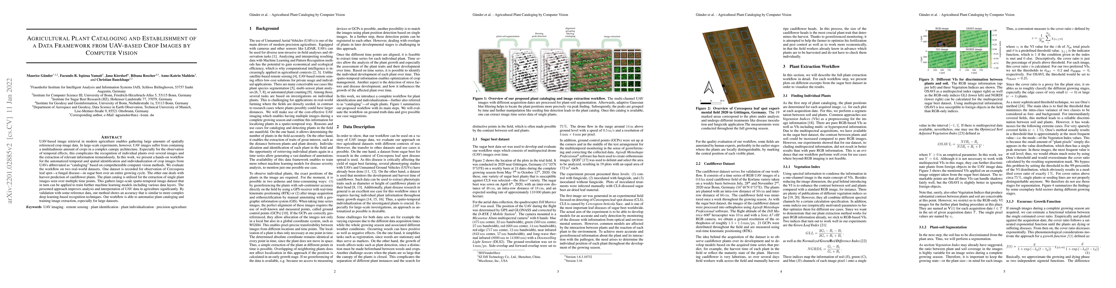
UAV-based image retrieval in modern agriculture enables gathering large amounts of spatially referenced crop image data. In large-scale experiments, however, UAV images suffer from containing a mult...
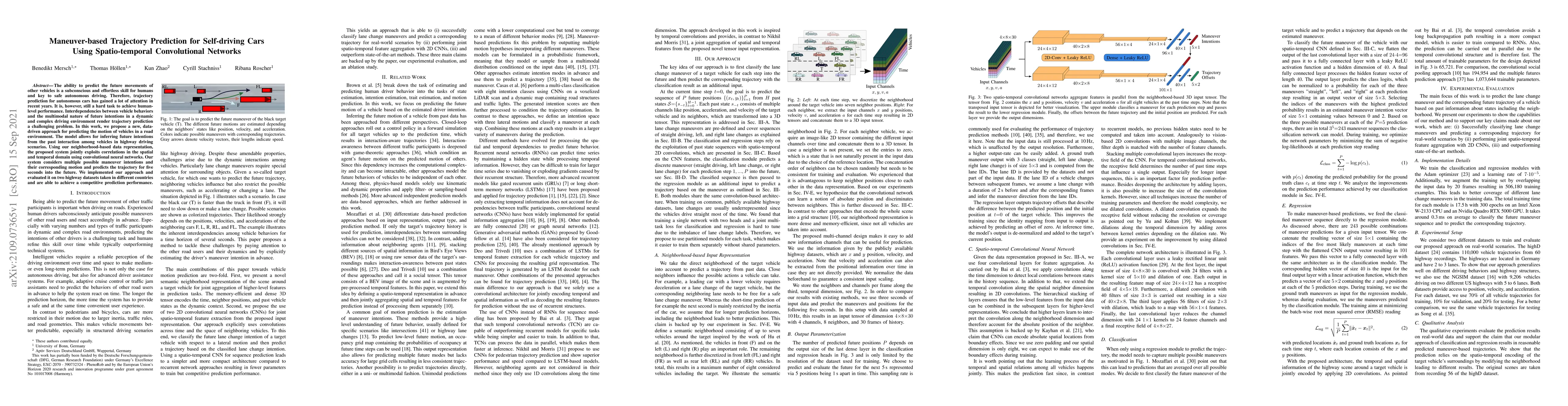
The ability to predict the future movements of other vehicles is a subconscious and effortless skill for humans and key to safe autonomous driving. Therefore, trajectory prediction for autonomous ca...
Due to their increasing spread, confidence in neural network predictions became more and more important. However, basic neural networks do not deliver certainty estimates or suffer from over or unde...
The need for accurate yield estimates for viticulture is becoming more important due to increasing competition in the wine market worldwide. One of the most promising methods to estimate the harvest...
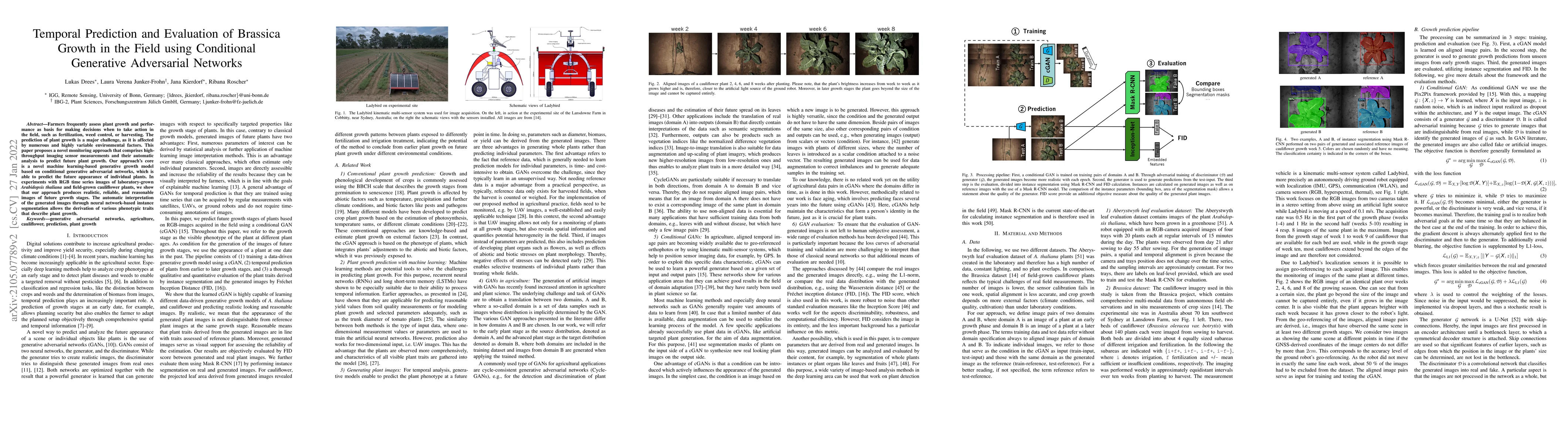
Farmers frequently assess plant growth and performance as basis for making decisions when to take action in the field, such as fertilization, weed control, or harvesting. The prediction of plant gro...
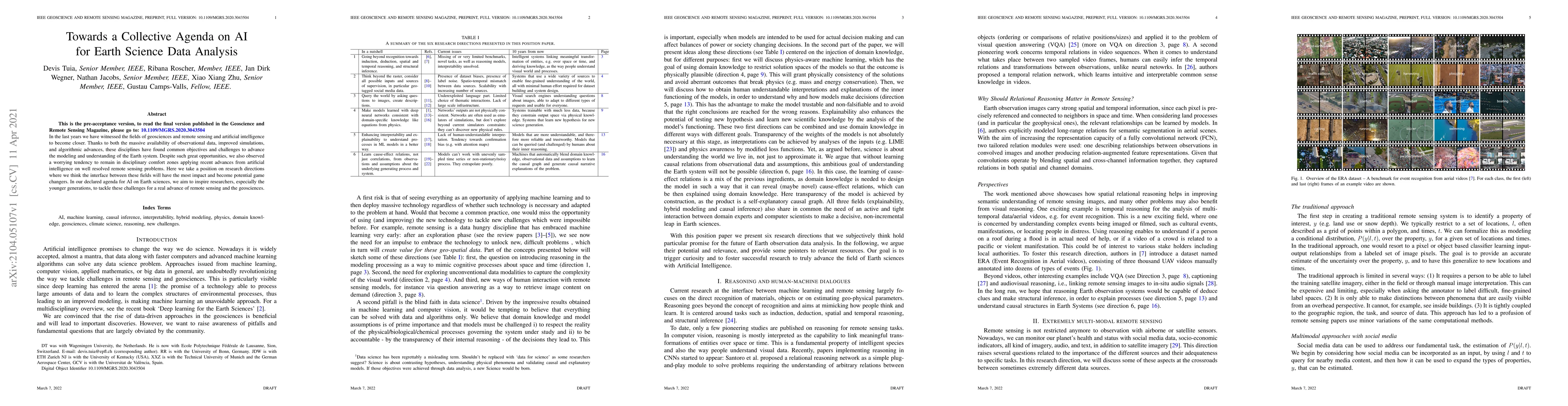
In the last years we have witnessed the fields of geosciences and remote sensing and artificial intelligence to become closer. Thanks to both the massive availability of observational data, improved...
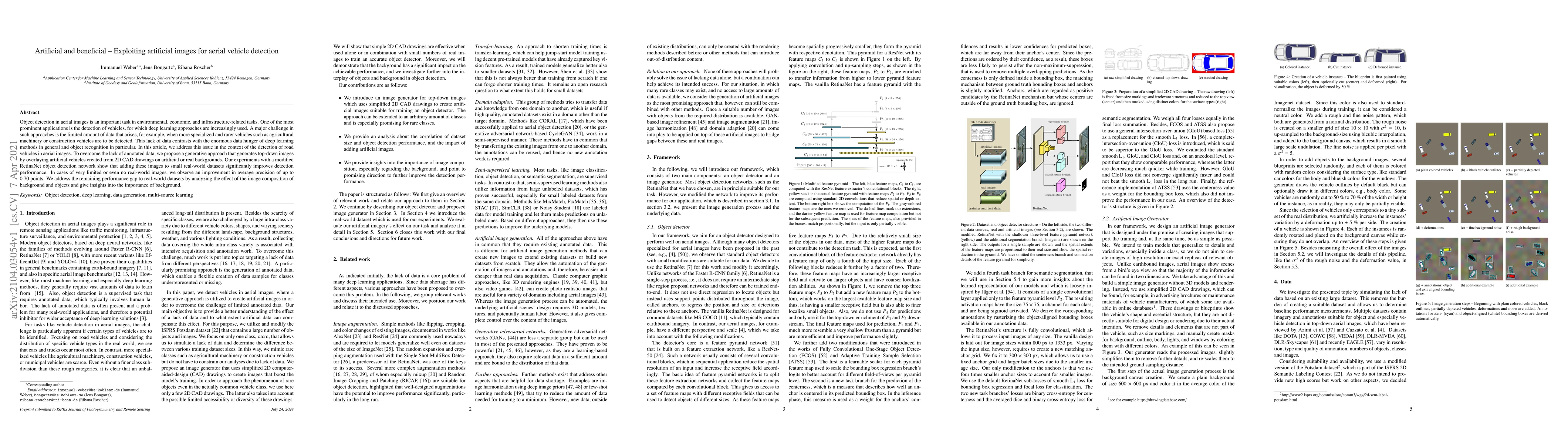
Object detection in aerial images is an important task in environmental, economic, and infrastructure-related tasks. One of the most prominent applications is the detection of vehicles, for which de...
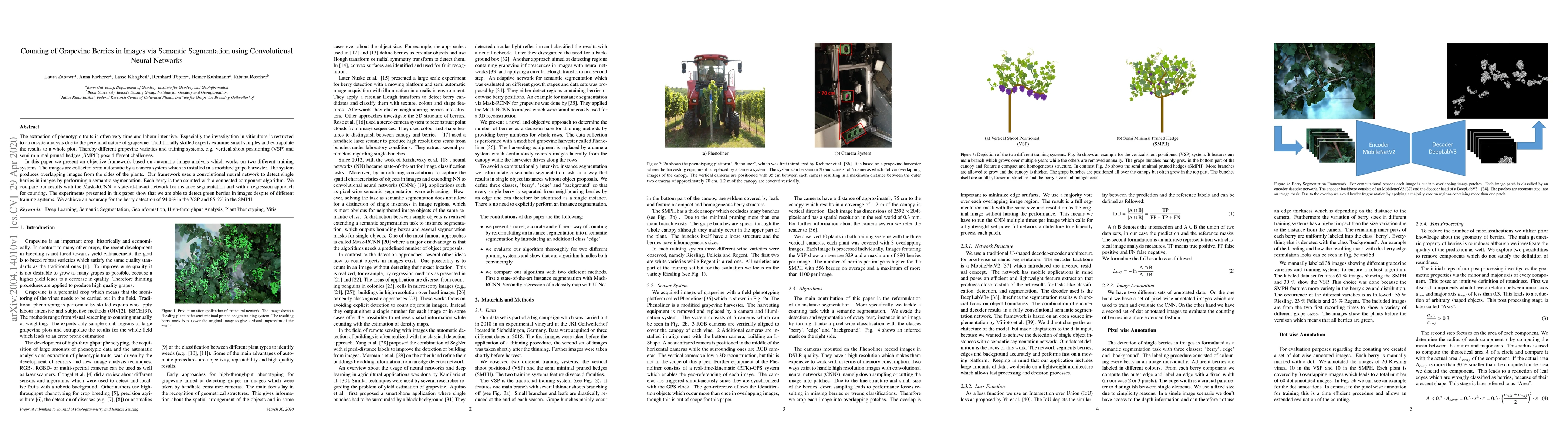
The extraction of phenotypic traits is often very time and labour intensive. Especially the investigation in viticulture is restricted to an on-site analysis due to the perennial nature of grapevine...
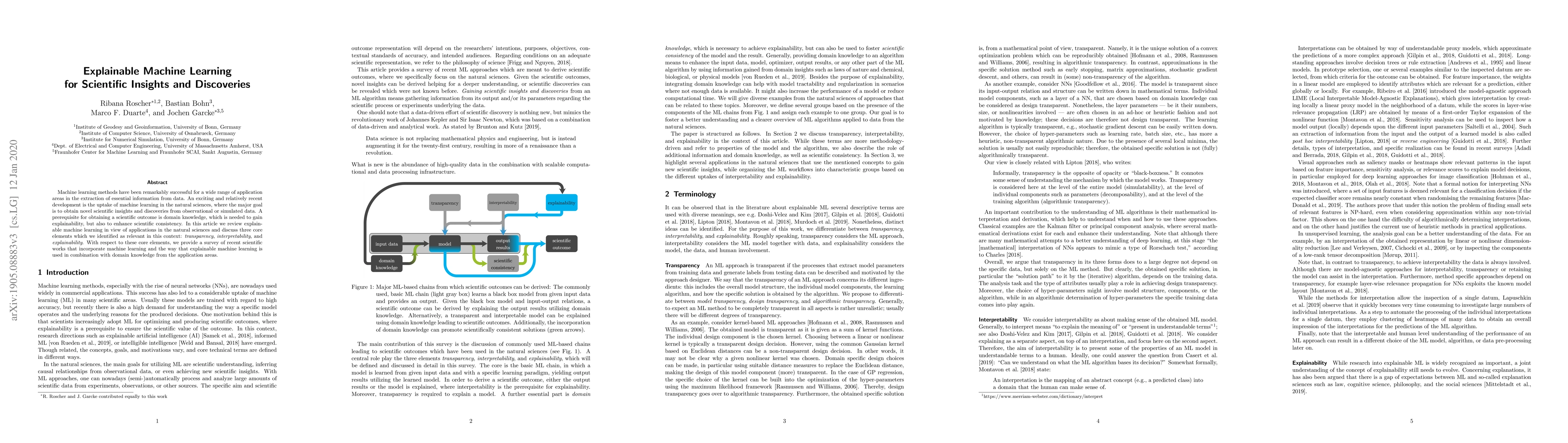
Machine learning methods have been remarkably successful for a wide range of application areas in the extraction of essential information from data. An exciting and relatively recent development is ...
The increasing accessibility of remotely sensed data and the potential of such data to inform large-scale decision-making has driven the development of deep learning models for many Earth Observation ...
Protected natural areas play a vital role in ecological balance and ecosystem services. Monitoring these regions at scale using satellite imagery and machine learning is promising, but current methods...
Pollinator insects such as honeybees and bumblebees are vital to global food production and ecosystem stability, yet their populations are declining due to anthropogenic and environmental stressors. S...
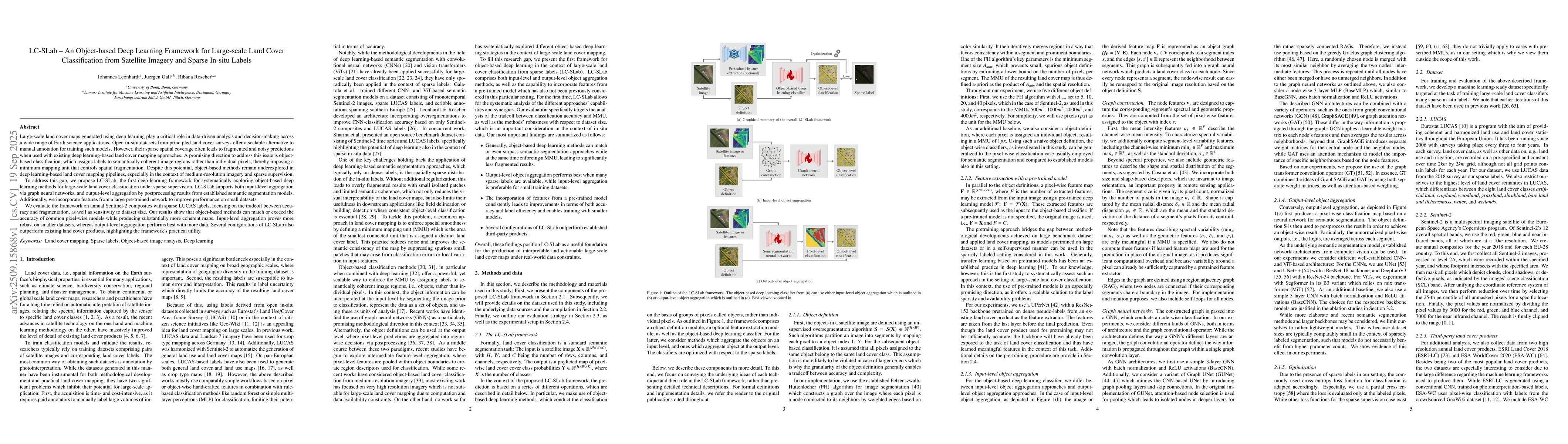
Large-scale land cover maps generated using deep learning play a critical role across a wide range of Earth science applications. Open in-situ datasets from principled land cover surveys offer a scala...
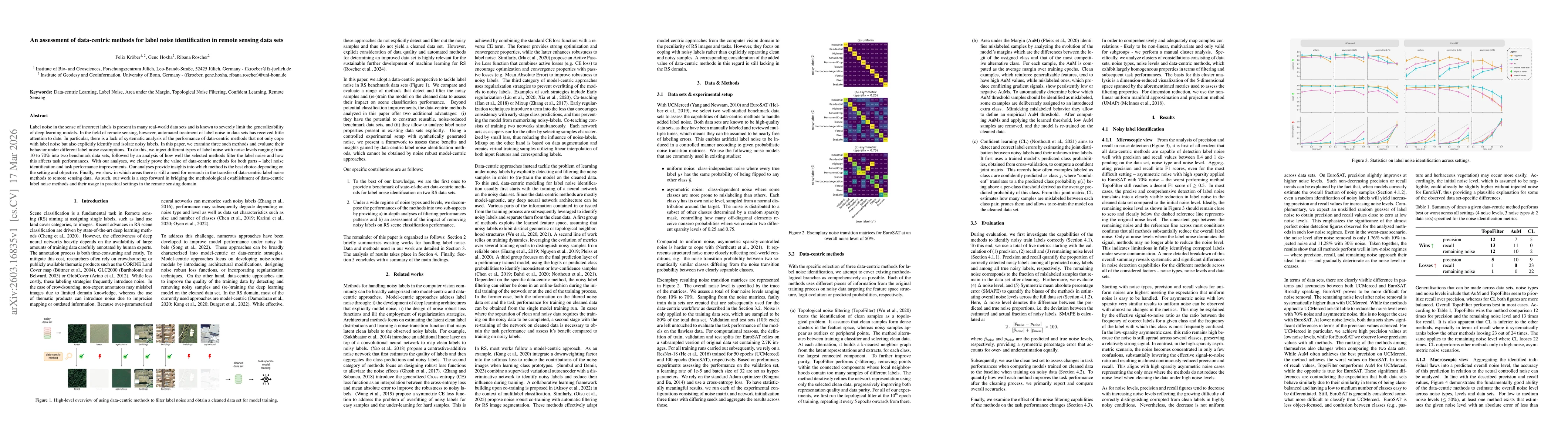
Label noise in the sense of incorrect labels is present in many real-world data sets and is known to severely limit the generalizability of deep learning models. In the field of remote sensing, howeve...
In this manuscript we release two datasets for visual sensing of tomato plants grown in commercial-like settings and acquired using a robot. The first is BUTom21 which consists of still images and man...