Publication
Metrics
Quick Actions
AI Quick Summary
This paper presents a deep learning framework for multiscale building segmentation using high-resolution UAV and satellite imagery, leveraging feature-augmented inputs and a Res-U-Net architecture to achieve high accuracy. The model, trained with optimized strategies, outperforms existing benchmarks with 96.5% overall accuracy and an F1-score of 0.86.
Quick Answers
What methodology did the authors use?
The study presents a deep learning framework for multiscale building segmentation using RGB aerial and satellite imagery. It introduces feature-augmented inputs derived from RGB channels, including PCA, VDVI, MBI, and Sobel edge filters, to guide a Res-U-Net architecture for learning complex spatial patterns. More in Methodology →
What are the key results?
The model achieved an overall accuracy of 96.5%, an F1-score of 0.86, and an IoU of 0.80 on a held-out WorldView-3 image, outperforming existing RGB-based benchmarks. — Three composite band combinations (CB0, CB1, CB2) were evaluated, with CB0 showing the highest accuracy and IoU, indicating the advantage of raw RGB feature combinations. More in Key Results →
Why is this work significant?
This research demonstrates the effectiveness of combining multi-resolution imagery, feature augmentation, and optimized training strategies for robust building segmentation in remote sensing applications, which can significantly improve urban planning and disaster management. More in Significance →
What are the main limitations?
The study faced challenges in accurately segmenting buildings under shadows, a common issue in building segmentation tasks. — The model's performance on satellite imagery, particularly with contrast equalization, resulted in overestimation of building segmentation with high true and false positives. More in Limitations →
Abstract
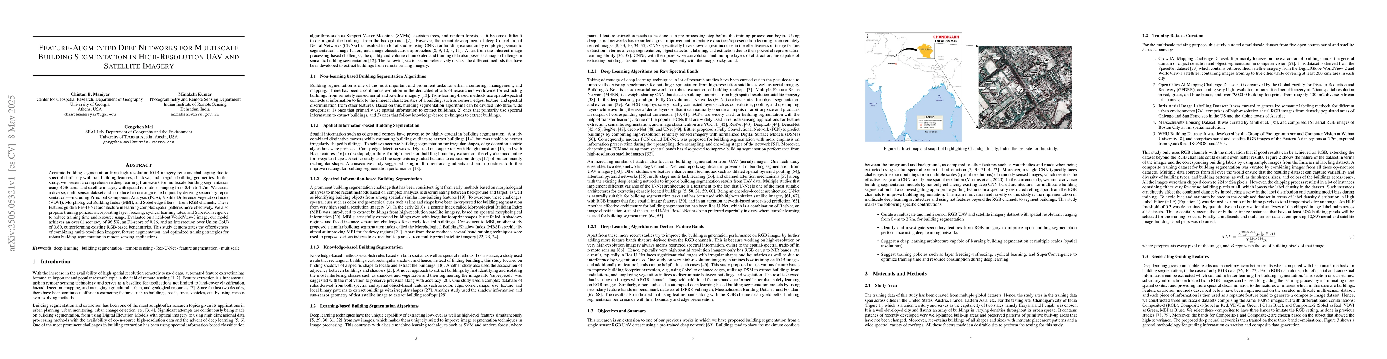
Accurate building segmentation from high-resolution RGB imagery remains challenging due to spectral similarity with non-building features, shadows, and irregular building geometries. In this study, we present a comprehensive deep learning framework for multiscale building segmentation using RGB aerial and satellite imagery with spatial resolutions ranging from 0.4m to 2.7m. We curate a diverse, multi-sensor dataset and introduce feature-augmented inputs by deriving secondary representations including Principal Component Analysis (PCA), Visible Difference Vegetation Index (VDVI), Morphological Building Index (MBI), and Sobel edge filters from RGB channels. These features guide a Res-U-Net architecture in learning complex spatial patterns more effectively. We also propose training policies incorporating layer freezing, cyclical learning rates, and SuperConvergence to reduce training time and resource usage. Evaluated on a held-out WorldView-3 image, our model achieves an overall accuracy of 96.5%, an F1-score of 0.86, and an Intersection over Union (IoU) of 0.80, outperforming existing RGB-based benchmarks. This study demonstrates the effectiveness of combining multi-resolution imagery, feature augmentation, and optimized training strategies for robust building segmentation in remote sensing applications.
AI Key Findings
Generated May 24, 2025
Methodology — What approach did the authors take?
The study presents a deep learning framework for multiscale building segmentation using RGB aerial and satellite imagery. It introduces feature-augmented inputs derived from RGB channels, including PCA, VDVI, MBI, and Sobel edge filters, to guide a Res-U-Net architecture for learning complex spatial patterns.
Key Results — What are the main findings?
- The model achieved an overall accuracy of 96.5%, an F1-score of 0.86, and an IoU of 0.80 on a held-out WorldView-3 image, outperforming existing RGB-based benchmarks.
- Three composite band combinations (CB0, CB1, CB2) were evaluated, with CB0 showing the highest accuracy and IoU, indicating the advantage of raw RGB feature combinations.
- The model successfully segmented buildings in the presence of spectrally similar features like cemented roads and parking lots, as well as spatially similar features like roads, open grounds, and vegetation patches resembling buildings.
Significance — Why does this research matter?
This research demonstrates the effectiveness of combining multi-resolution imagery, feature augmentation, and optimized training strategies for robust building segmentation in remote sensing applications, which can significantly improve urban planning and disaster management.
Technical Contribution — What is the technical contribution?
The paper proposes a feature-augmented Res-U-Net architecture and a combined loss function (Combo-Loss) that effectively preserves spatial contextual information, improving building segmentation, especially for irregular shapes and blurred boundaries.
Novelty — What is new about this work?
The novelty lies in the comprehensive approach combining multi-resolution imagery, feature augmentation, and optimized training strategies (cyclical learning rates and SuperConvergence) for robust building segmentation in high-resolution UAV and satellite imagery.
Limitations — What are the limitations of this study?
- The study faced challenges in accurately segmenting buildings under shadows, a common issue in building segmentation tasks.
- The model's performance on satellite imagery, particularly with contrast equalization, resulted in overestimation of building segmentation with high true and false positives.
Future Work — What did the authors propose for future work?
- Investigate methods to better handle buildings under shadows to reduce false negatives.
- Explore additional feature extraction techniques and network architectures to further enhance segmentation performance.
Paper Details
How to Cite This Paper
@article{maniyar2025feature,
title = {Feature-Augmented Deep Networks for Multiscale Building Segmentation in
High-Resolution UAV and Satellite Imagery},
author = {Maniyar, Chintan B. and Mai, Gengchen and Kumar, Minakshi},
year = {2025},
eprint = {2505.05321},
archivePrefix = {arXiv},
primaryClass = {cs.CV},
}
Maniyar, C., Mai, G., & Kumar, M. (2025). Feature-Augmented Deep Networks for Multiscale Building Segmentation in
High-Resolution UAV and Satellite Imagery. arXiv. https://arxiv.org/abs/2505.05321
Maniyar, Chintan B., et al. "Feature-Augmented Deep Networks for Multiscale Building Segmentation in
High-Resolution UAV and Satellite Imagery." arXiv, 2025, arxiv.org/abs/2505.05321.
PDF Preview
Citation Network
Current paper (gray), citations (green), references (blue)
Display is limited for performance on very large graphs.
Similar Papers
Found 4 papersGreenhouse Segmentation on High-Resolution Optical Satellite Imagery using Deep Learning Techniques
Orkhan Baghirli, Imran Ibrahimli, Tarlan Mammadzada
Memory-Constrained Semantic Segmentation for Ultra-High Resolution UAV Imagery
Qi Li, Jiaxin Cai, Yuanlong Yu et al.
Multi-task deep learning for large-scale building detail extraction from high-resolution satellite imagery
Zhen Qian, Min Chen, Zhuo Sun et al.
No citations found for this paper.
Comments (0)