Academic Profile
Statistics
Similar Authors
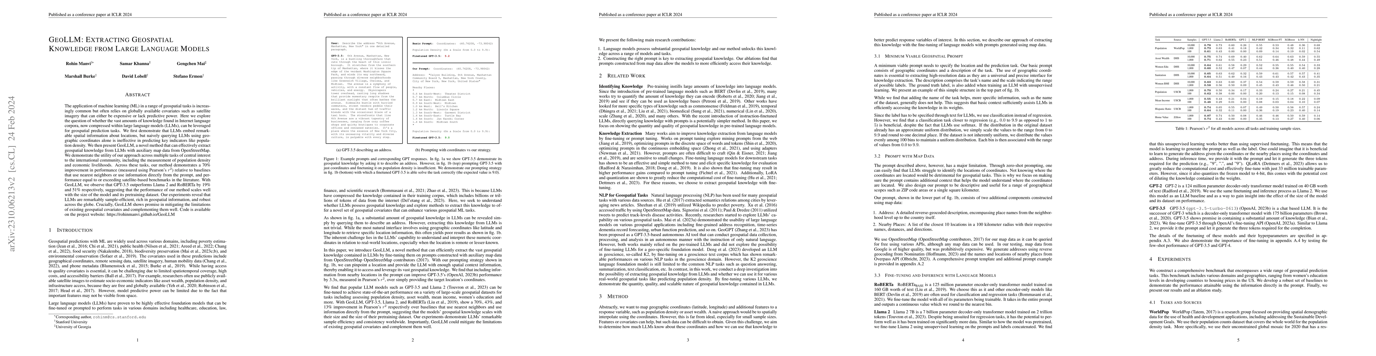
Papers on arXiv
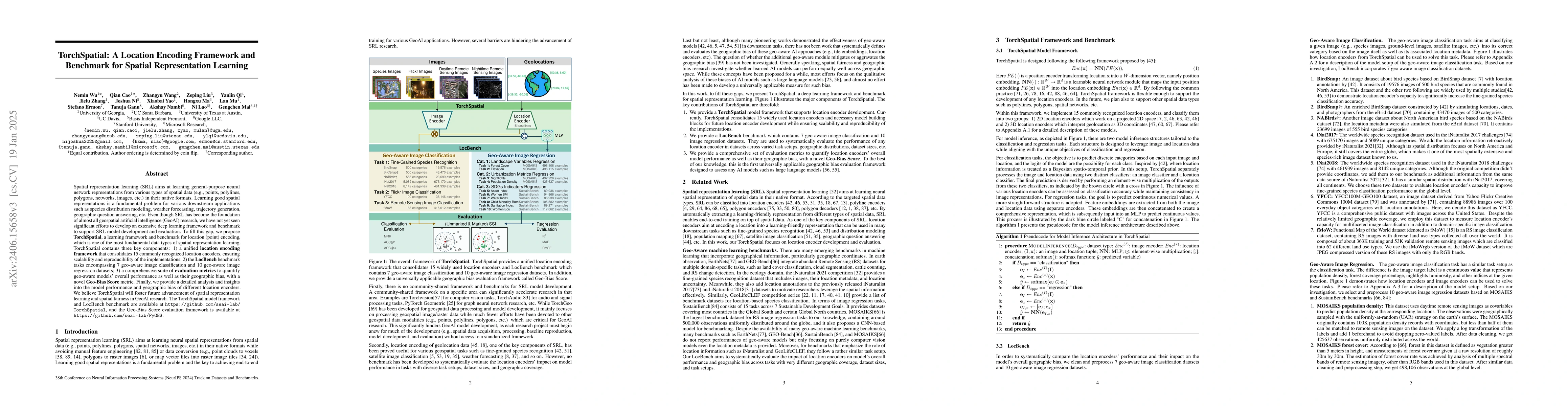
Spatial representation learning (SRL) aims at learning general-purpose neural network representations from various types of spatial data (e.g., points, polylines, polygons, networks, images, etc.) i...
Intuitively, there is a relation between measures of spatial dependence and information theoretical measures of entropy. For instance, we can provide an intuition of why spatial data is special by s...
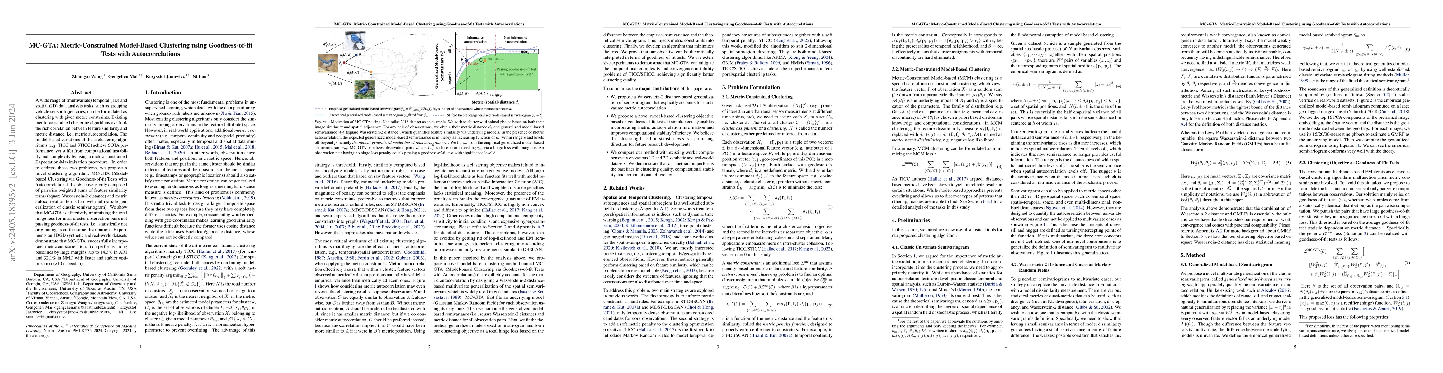
A wide range of (multivariate) temporal (1D) and spatial (2D) data analysis tasks, such as grouping vehicle sensor trajectories, can be formulated as clustering with given metric constraints. Existi...
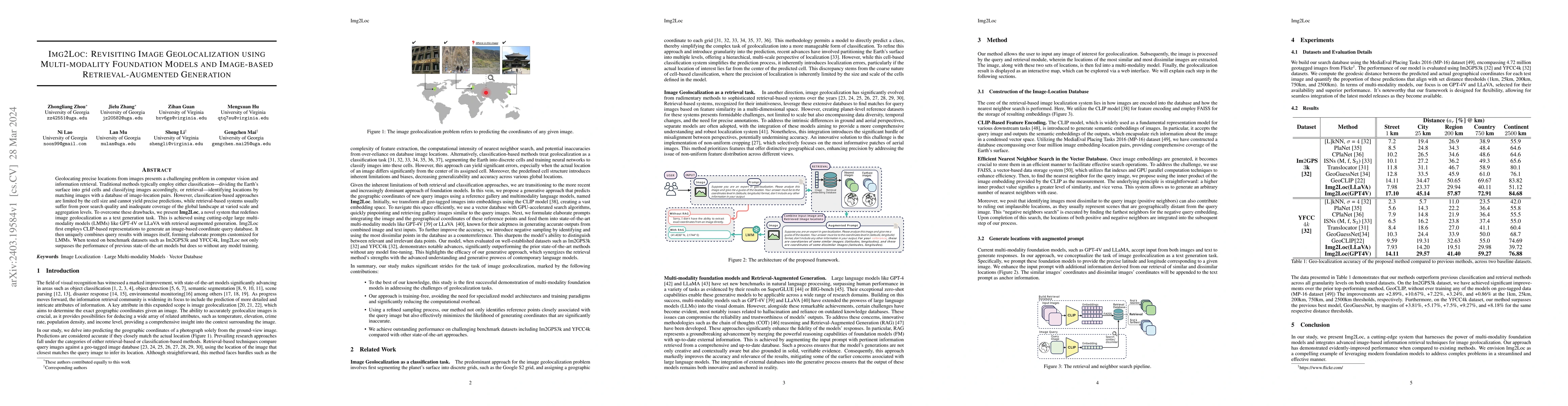
Geolocating precise locations from images presents a challenging problem in computer vision and information retrieval.Traditional methods typically employ either classification, which dividing the E...
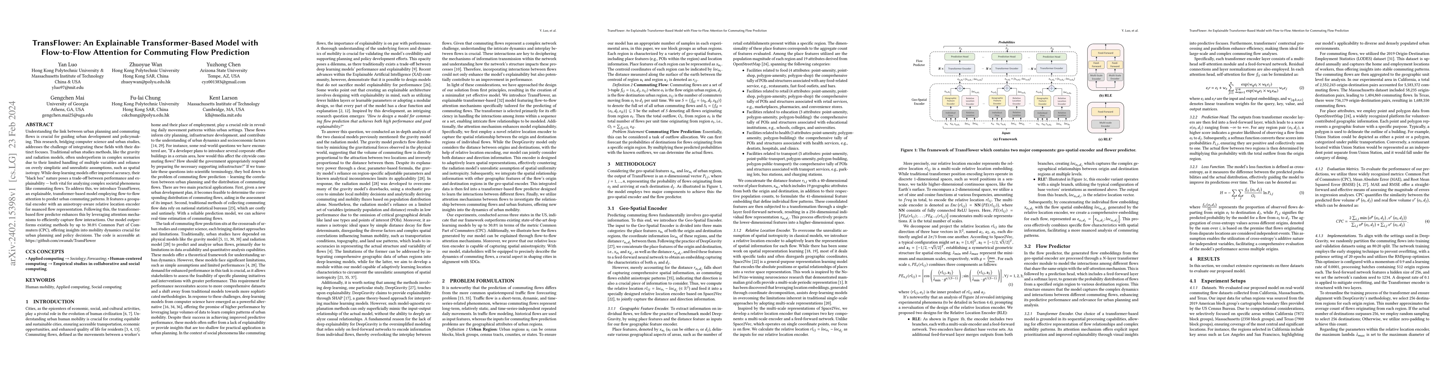
Understanding the link between urban planning and commuting flows is crucial for guiding urban development and policymaking. This research, bridging computer science and urban studies, addresses the...
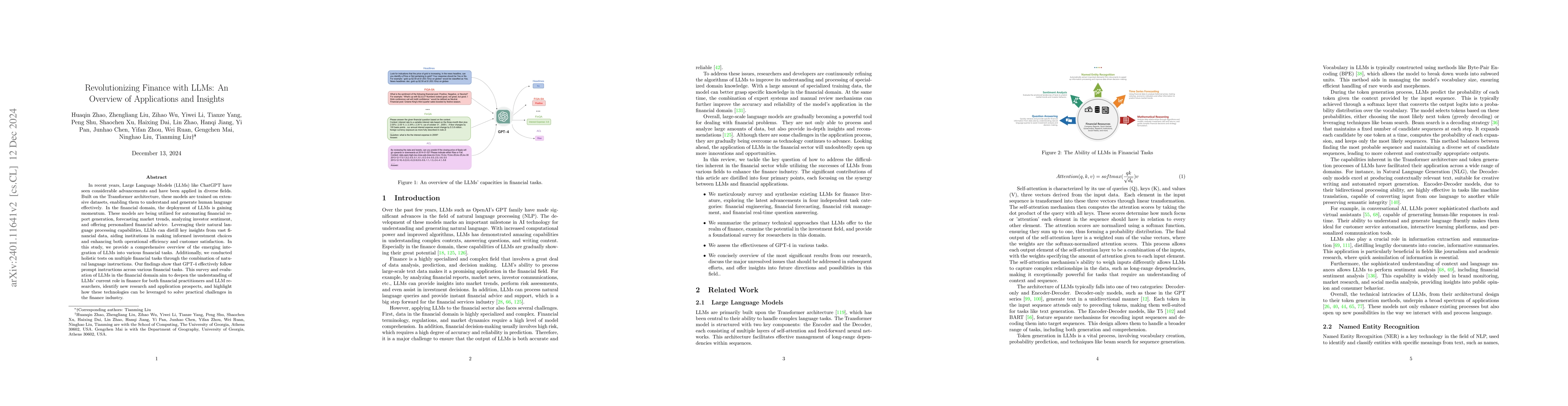
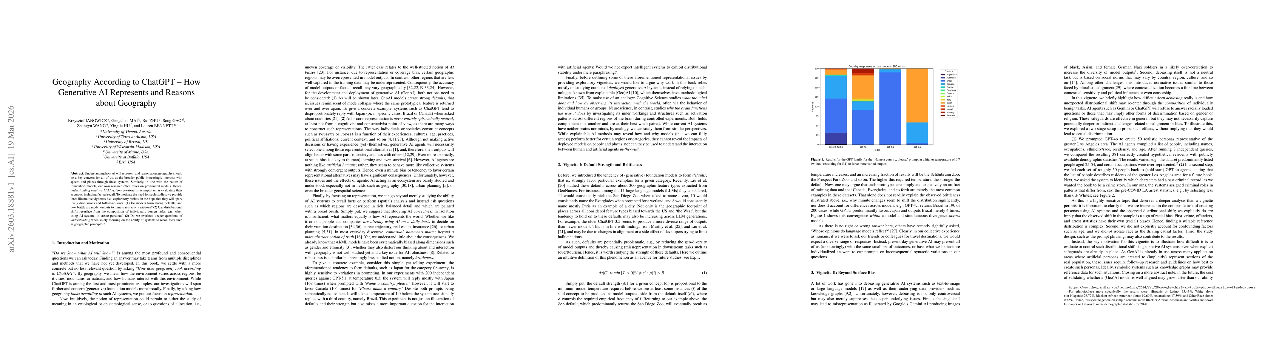
In recent years, Large Language Models (LLMs) like ChatGPT have seen considerable advancements and have been applied in diverse fields. Built on the Transformer architecture, these models are traine...
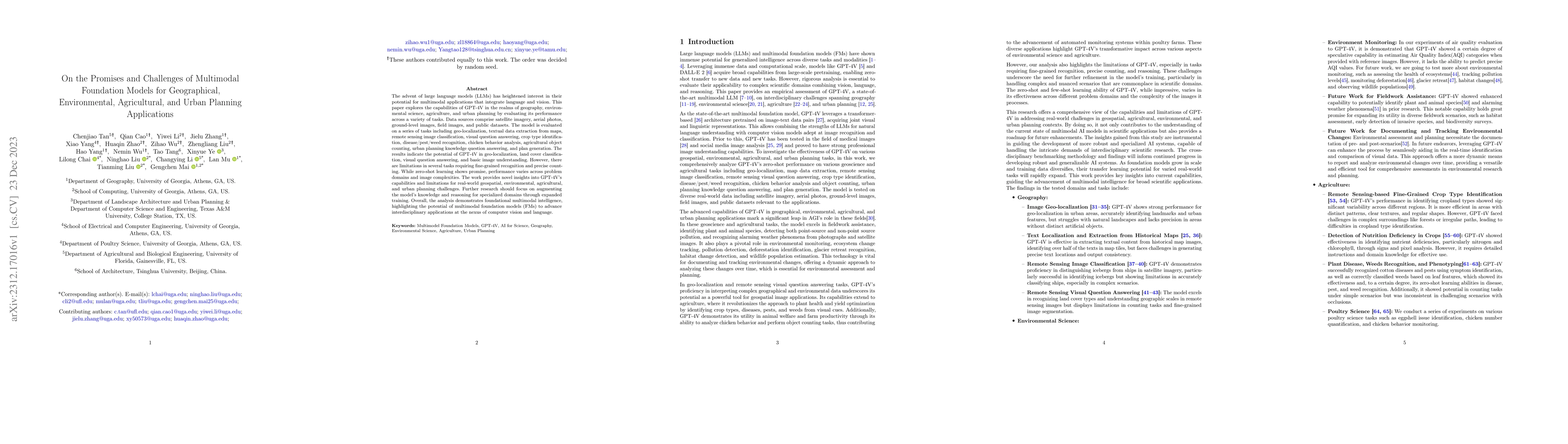
The advent of large language models (LLMs) has heightened interest in their potential for multimodal applications that integrate language and vision. This paper explores the capabilities of GPT-4V i...
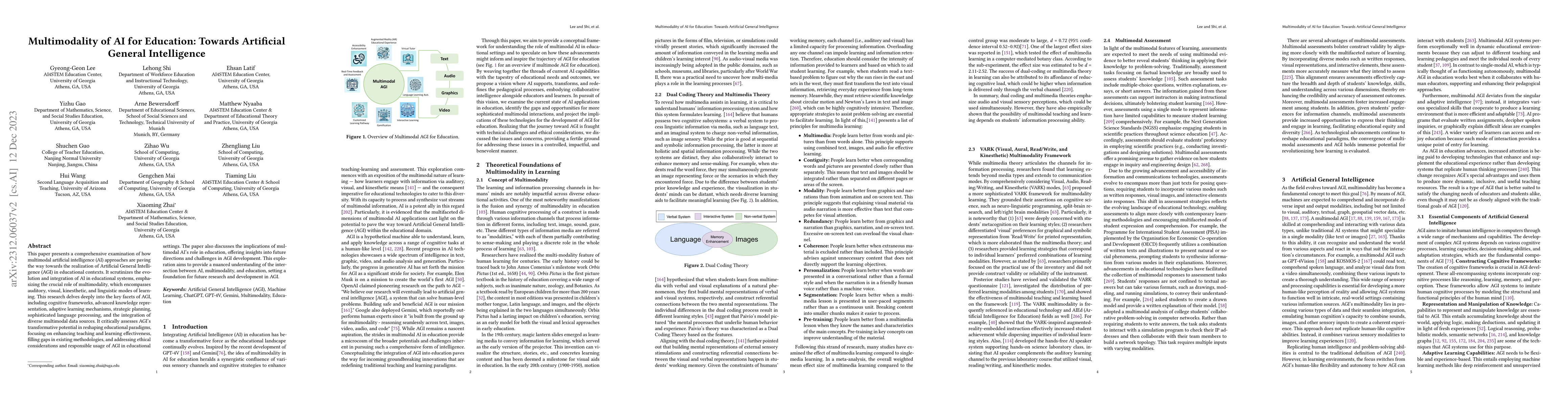
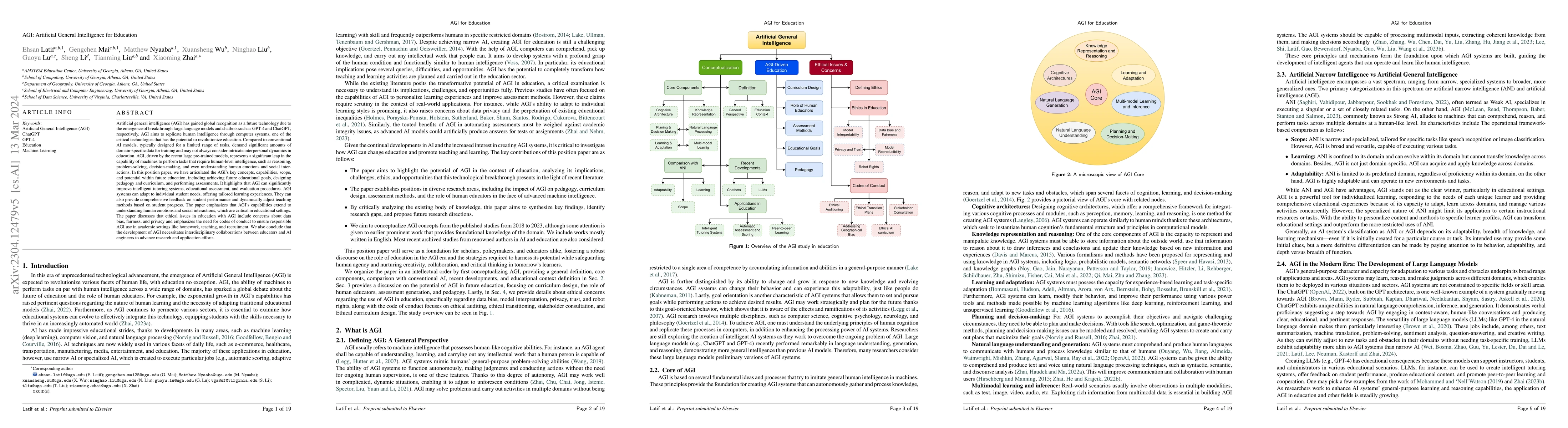
This paper presents a comprehensive examination of how multimodal artificial intelligence (AI) approaches are paving the way towards the realization of Artificial General Intelligence (AGI) in educa...
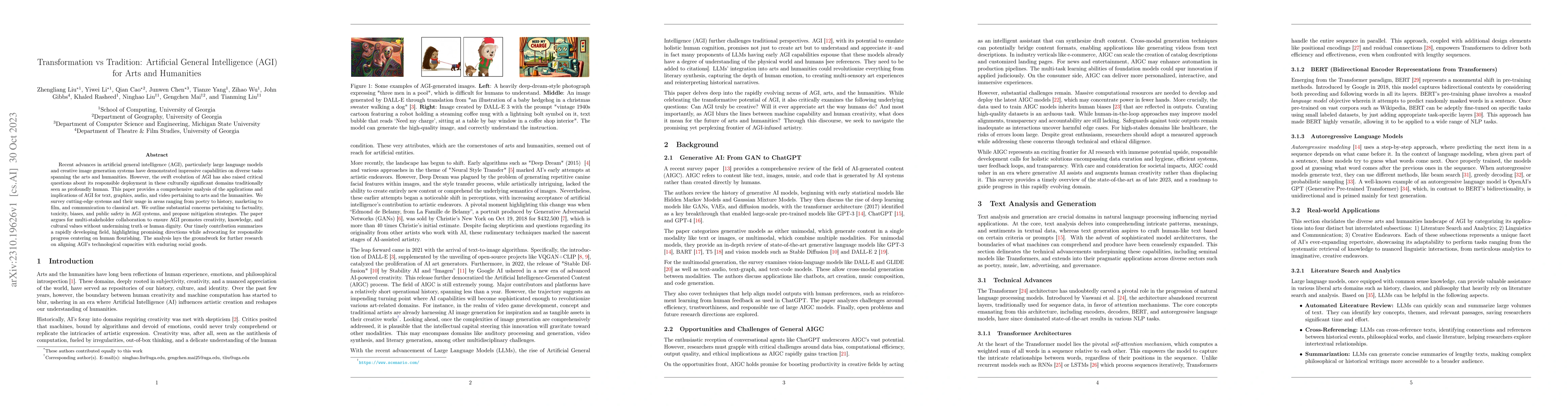
Recent advances in artificial general intelligence (AGI), particularly large language models and creative image generation systems have demonstrated impressive capabilities on diverse tasks spanning...
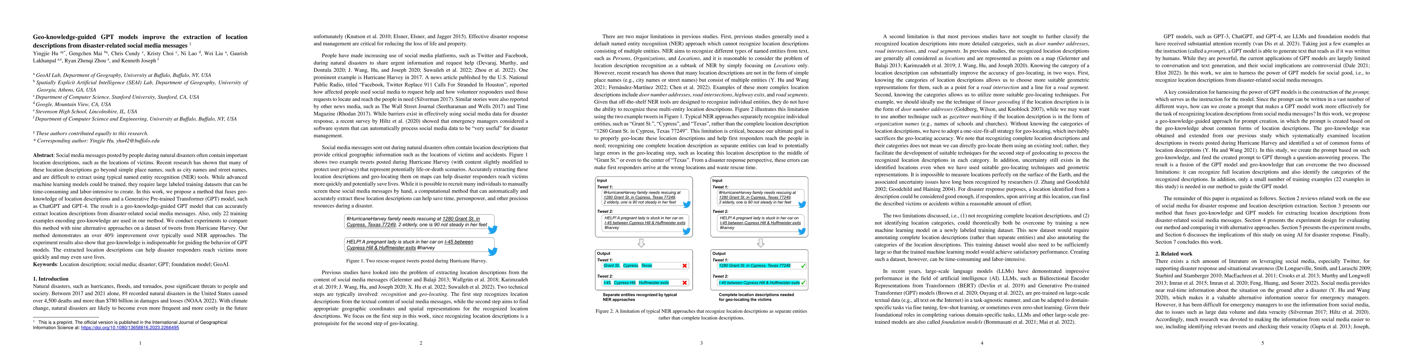
Social media messages posted by people during natural disasters often contain important location descriptions, such as the locations of victims. Recent research has shown that many of these location...
The application of machine learning (ML) in a range of geospatial tasks is increasingly common but often relies on globally available covariates such as satellite imagery that can either be expensiv...
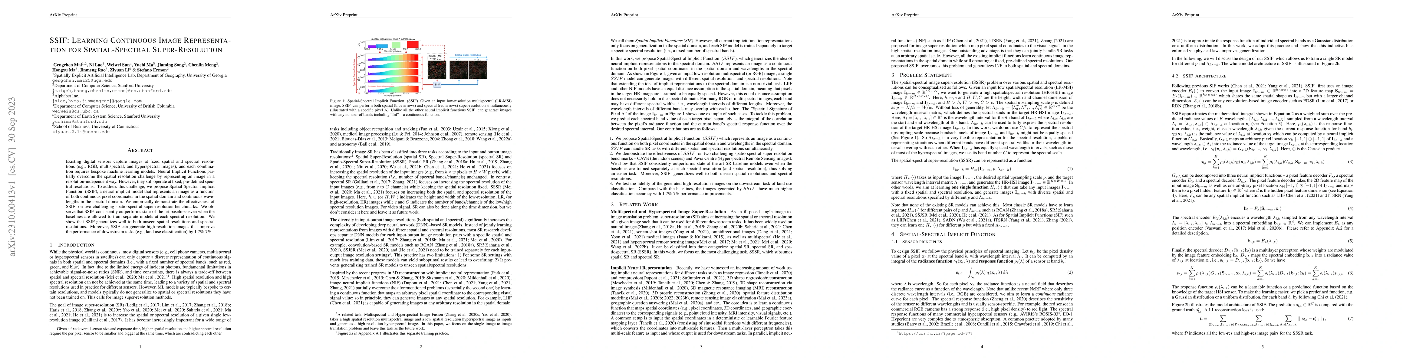
Existing digital sensors capture images at fixed spatial and spectral resolutions (e.g., RGB, multispectral, and hyperspectral images), and each combination requires bespoke machine learning models....
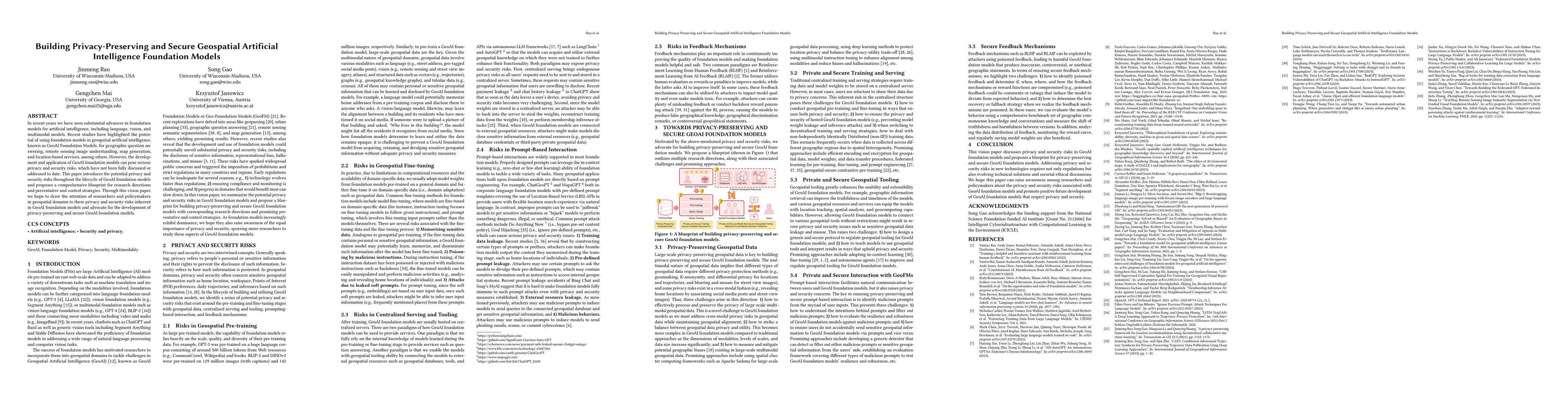
In recent years we have seen substantial advances in foundation models for artificial intelligence, including language, vision, and multimodal models. Recent studies have highlighted the potential o...
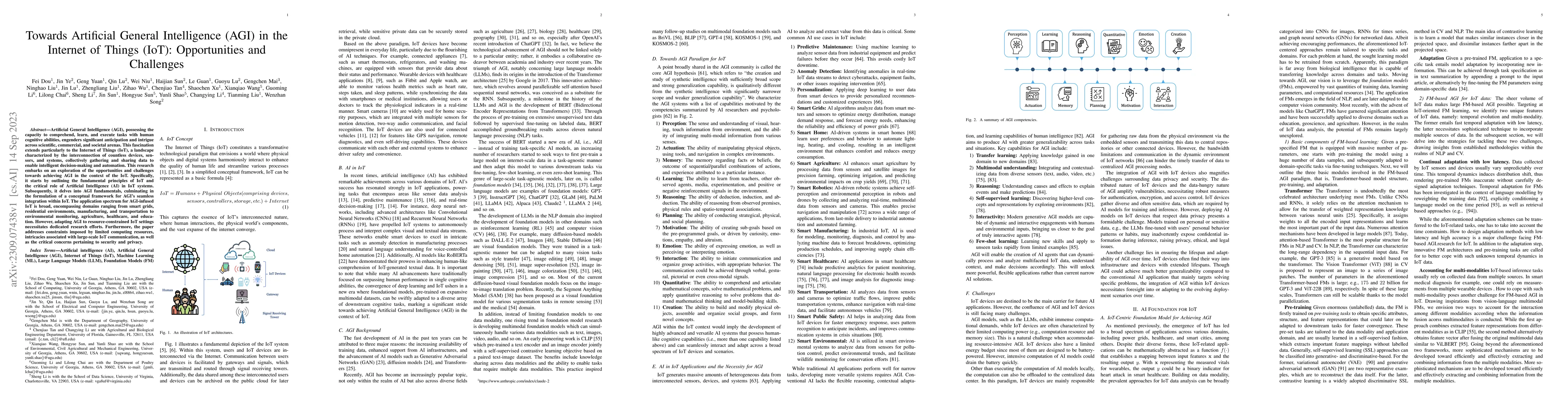
Artificial General Intelligence (AGI), possessing the capacity to comprehend, learn, and execute tasks with human cognitive abilities, engenders significant anticipation and intrigue across scientif...
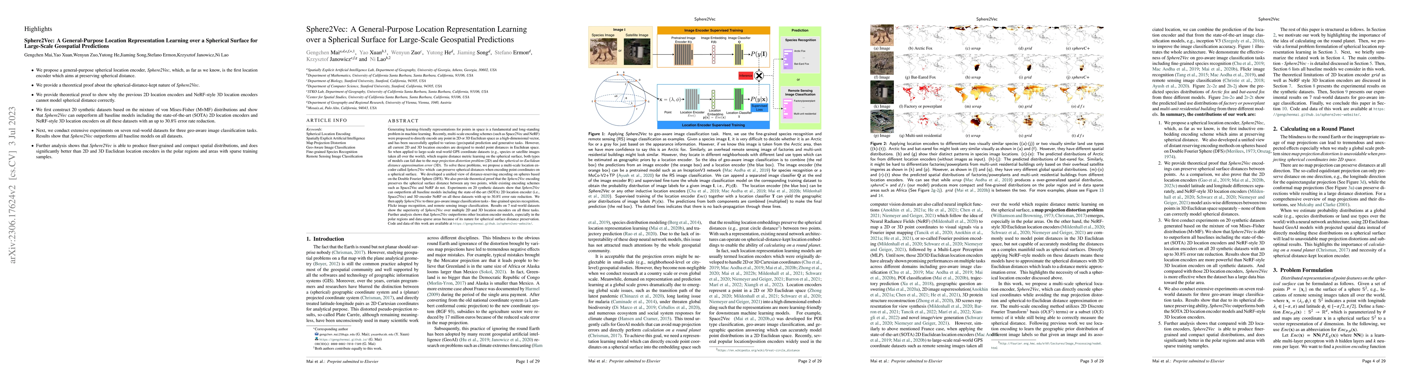
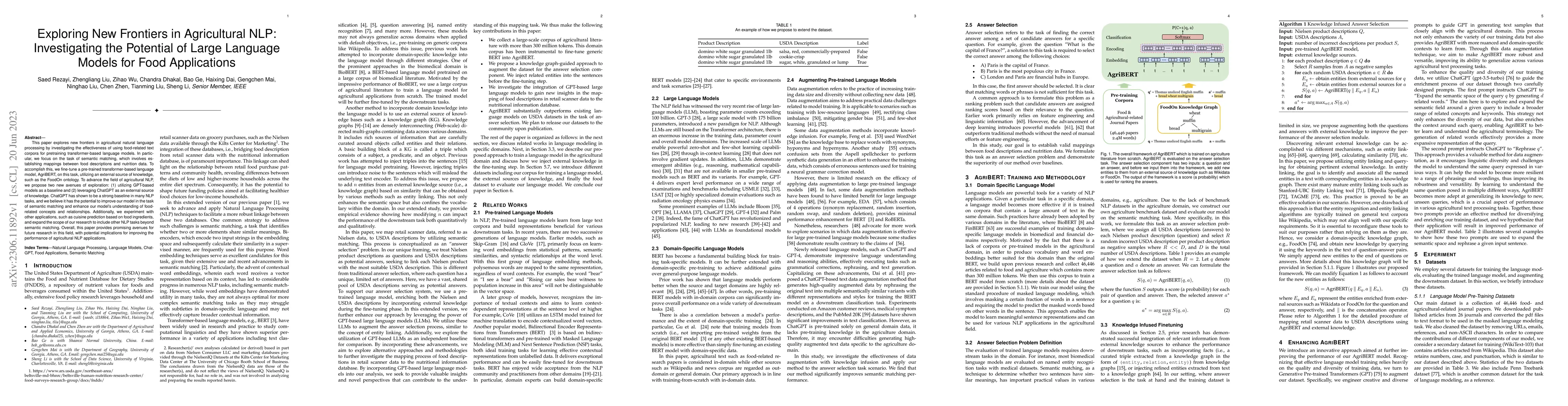
Generating learning-friendly representations for points in space is a fundamental and long-standing problem in ML. Recently, multi-scale encoding schemes (such as Space2Vec and NeRF) were proposed t...
This paper explores new frontiers in agricultural natural language processing by investigating the effectiveness of using food-related text corpora for pretraining transformer-based language models....
In this pioneering study, inspired by AutoGPT, the state-of-the-art open-source application based on the GPT-4 large language model, we develop a novel tool called AD-AutoGPT which can conduct data ...
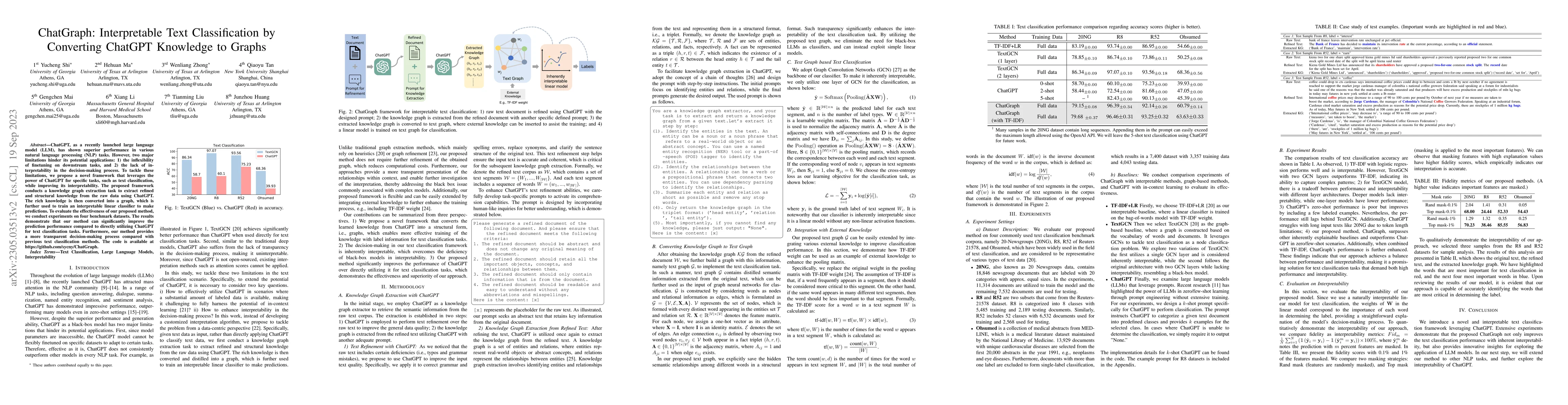
ChatGPT, as a recently launched large language model (LLM), has shown superior performance in various natural language processing (NLP) tasks. However, two major limitations hinder its potential app...
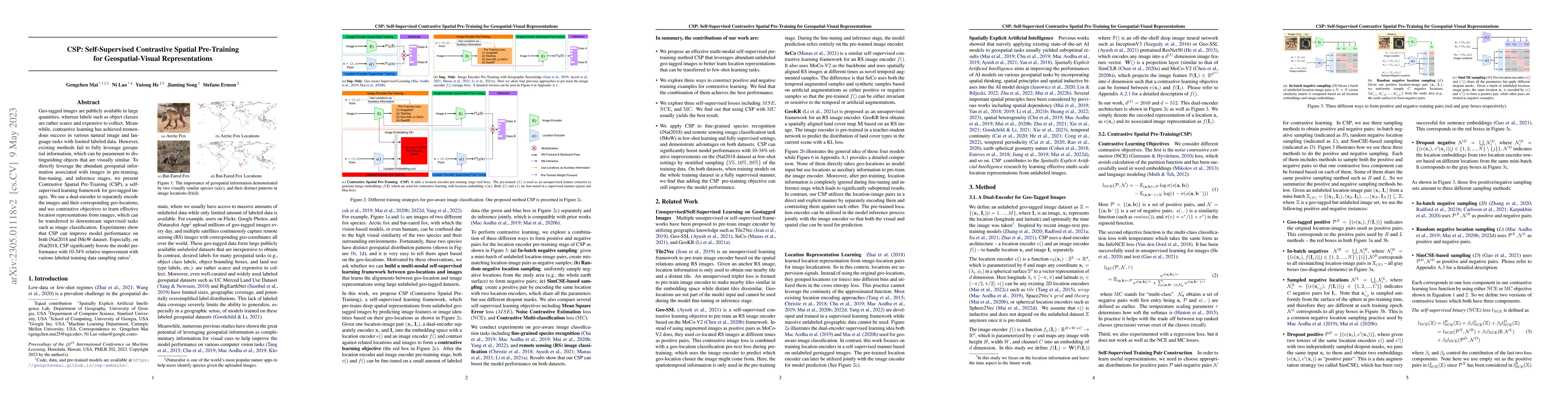
Geo-tagged images are publicly available in large quantities, whereas labels such as object classes are rather scarce and expensive to collect. Meanwhile, contrastive learning has achieved tremendou...
Artificial general intelligence (AGI) has gained global recognition as a future technology due to the emergence of breakthrough large language models and chatbots such as GPT-4 and ChatGPT, respecti...
Recent advancements in foundation models (FMs), such as GPT-4 and LLaMA, have attracted significant attention due to their exceptional performance in zero-shot learning scenarios. Similarly, in the ...
Large pre-trained models, also known as foundation models (FMs), are trained in a task-agnostic manner on large-scale data and can be adapted to a wide range of downstream tasks by fine-tuning, few-...
Artificial General Intelligence (AGI) is poised to revolutionize a variety of sectors, including healthcare, finance, transportation, and education. Within healthcare, AGI is being utilized to analy...
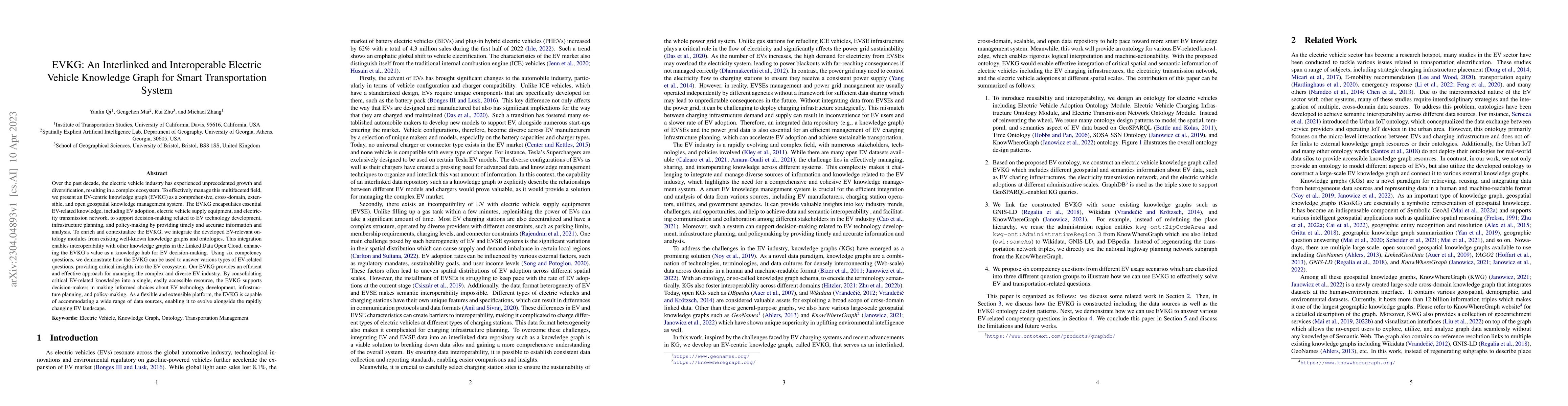
Over the past decade, the electric vehicle industry has experienced unprecedented growth and diversification, resulting in a complex ecosystem. To effectively manage this multifaceted field, we pres...
Neural network representation learning for spatial data is a common need for geographic artificial intelligence (GeoAI) problems. In recent years, many advancements have been made in representation ...
Generating learning-friendly representations for points in a 2D space is a fundamental and long-standing problem in machine learning. Recently, multi-scale encoding schemes (such as Space2Vec) were ...
Narrative cartography is a discipline which studies the interwoven nature of stories and maps. However, conventional geovisualization techniques of narratives often encounter several prominent chall...
Almost all statements in knowledge bases have a temporal scope during which they are valid. Hence, knowledge base completion (KBC) on temporal knowledge bases (TKB), where each statement \textit{may...
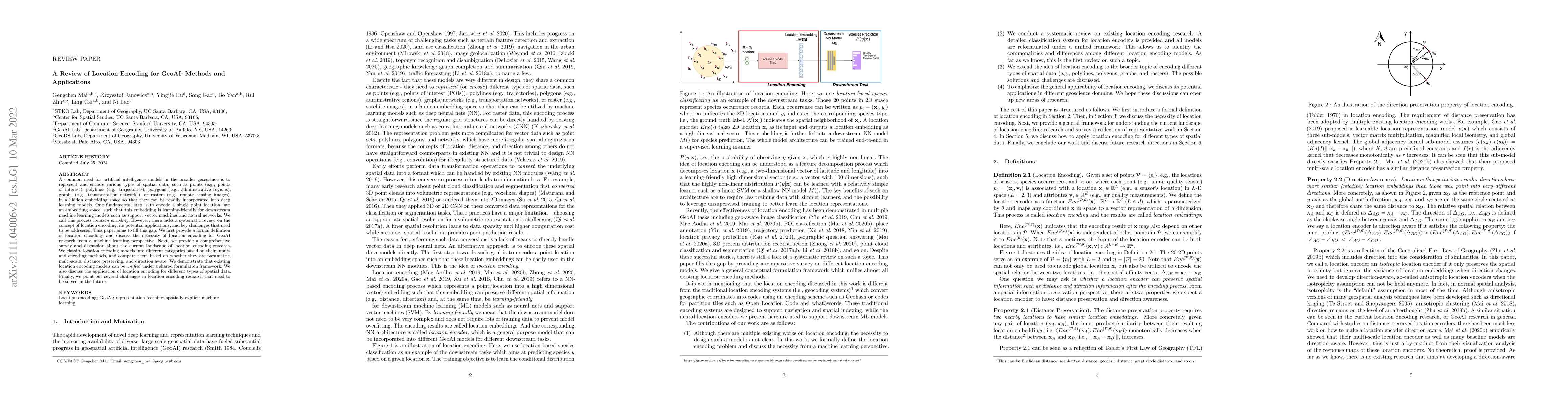
A common need for artificial intelligence models in the broader geoscience is to represent and encode various types of spatial data, such as points (e.g., points of interest), polylines (e.g., traje...
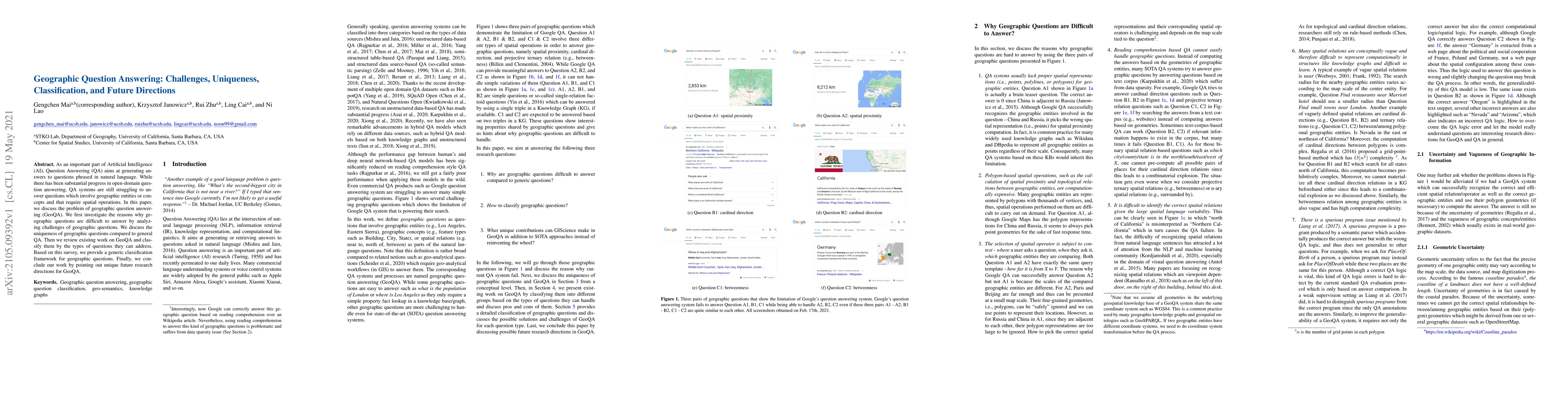
As an important part of Artificial Intelligence (AI), Question Answering (QA) aims at generating answers to questions phrased in natural language. While there has been substantial progress in open-d...
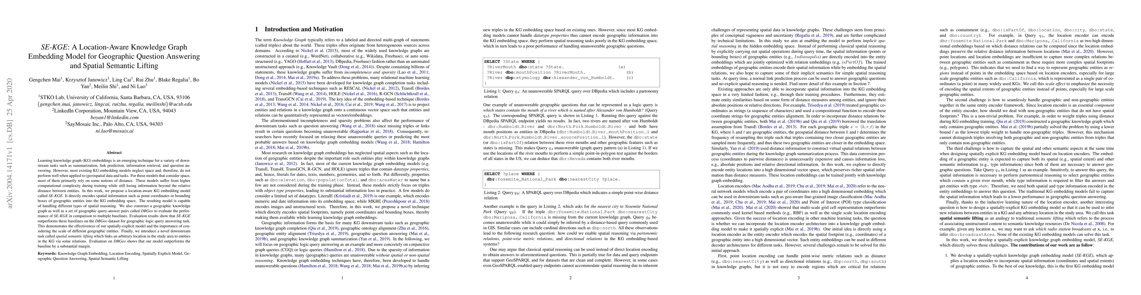
Learning knowledge graph (KG) embeddings is an emerging technique for a variety of downstream tasks such as summarization, link prediction, information retrieval, and question answering. However, mo...
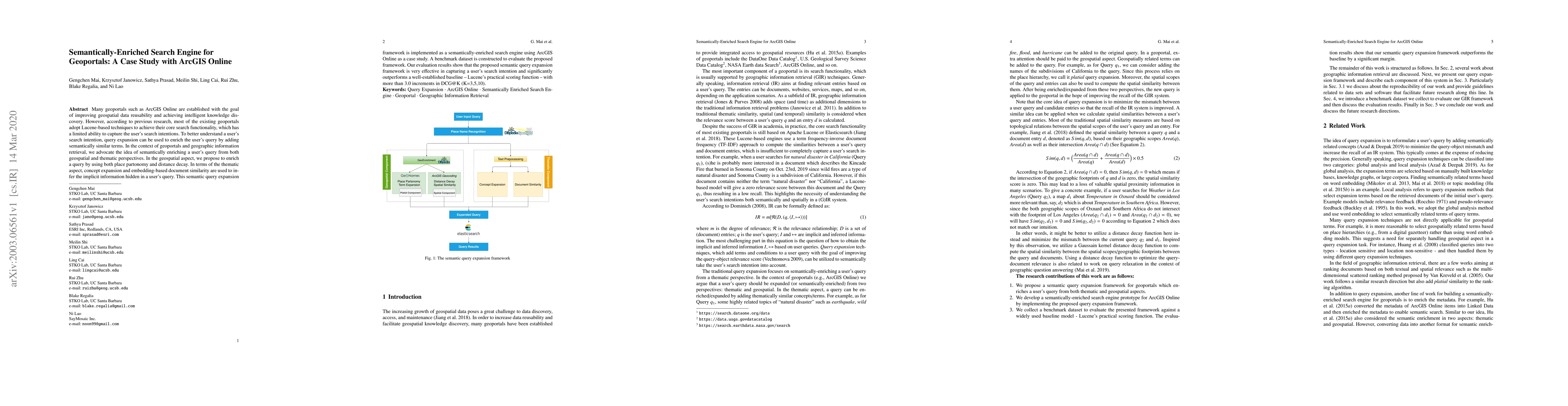
Many geoportals such as ArcGIS Online are established with the goal of improving geospatial data reusability and achieving intelligent knowledge discovery. However, according to previous research, m...
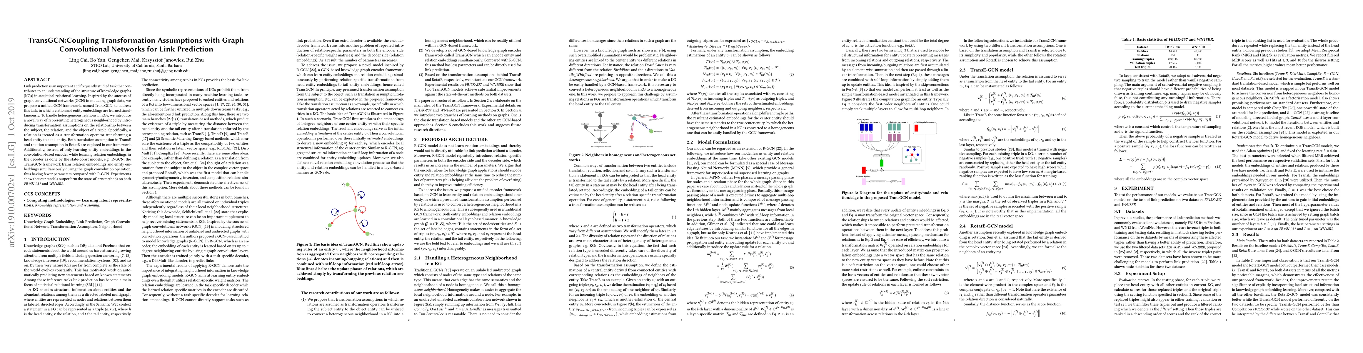
Unsupervised text encoding models have recently fueled substantial progress in NLP. The key idea is to use neural networks to convert words in texts to vector space representations based on word pos...
Link prediction is an important and frequently studied task that contributes to an understanding of the structure of knowledge graphs (KGs) in statistical relational learning. Inspired by the succes...
Recently, several studies have explored methods for using KG embedding to answer logical queries. These approaches either treat embedding learning and query answering as two separated learning tasks...
Nature disasters play a key role in shaping human-urban infrastructure interactions. Effective and efficient response to natural disasters is essential for building resilience and a sustainable urban ...
The emergence of Large Language Models (LLMs) and multimodal foundation models (FMs) has generated heightened interest in their applications that integrate vision and language. This paper investigates...
KnowWhereGraph is one of the largest fully publicly available geospatial knowledge graphs. It includes data from 30 layers on natural hazards (e.g., hurricanes, wildfires), climate variables (e.g., ai...
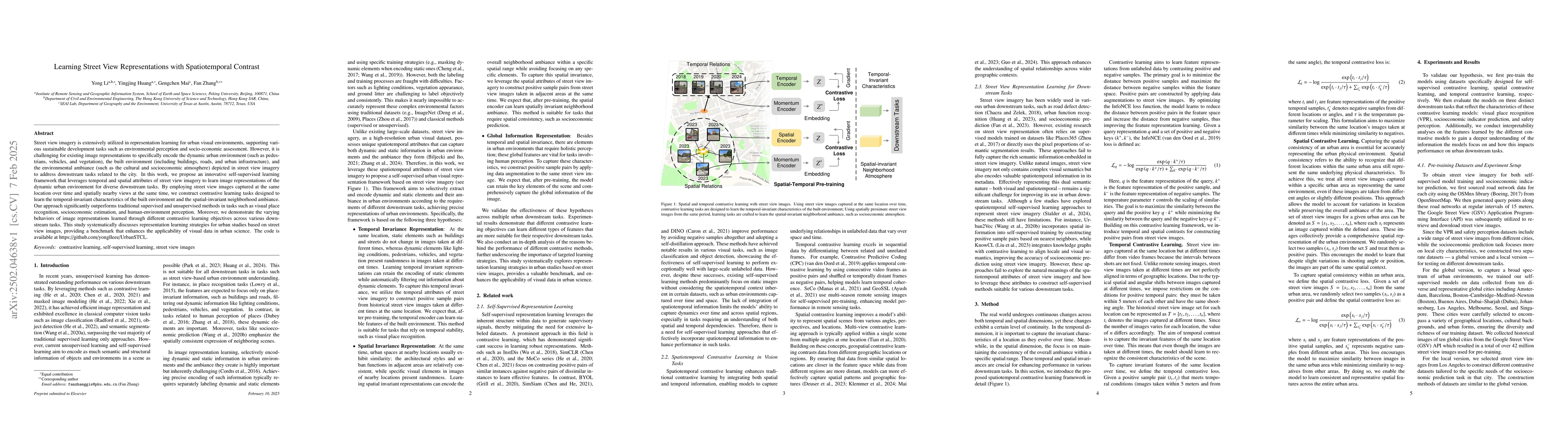
Street view imagery is extensively utilized in representation learning for urban visual environments, supporting various sustainable development tasks such as environmental perception and socio-econom...
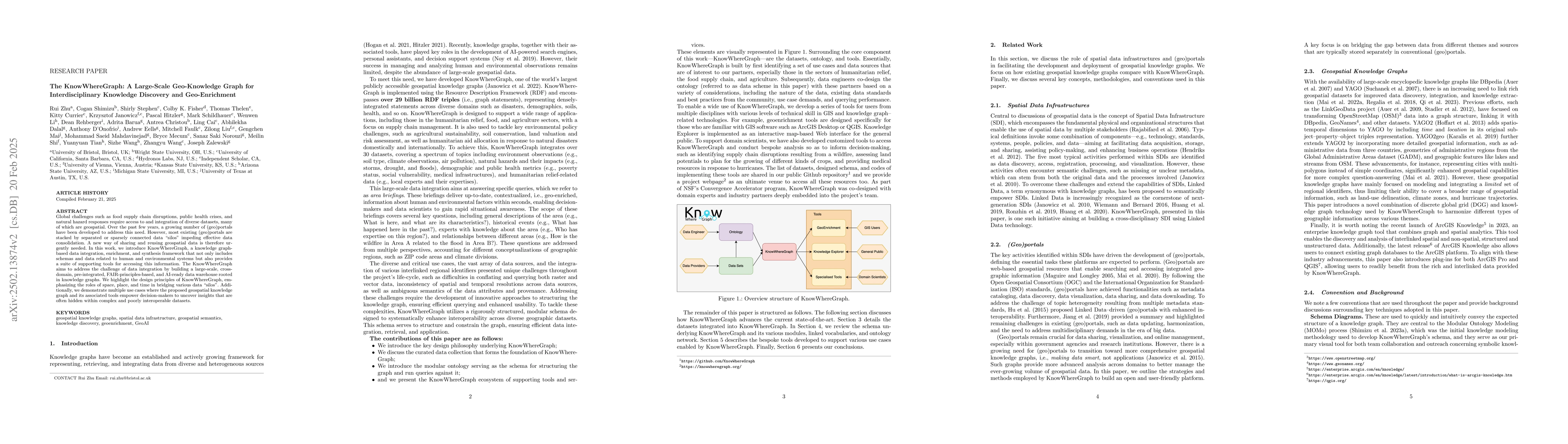
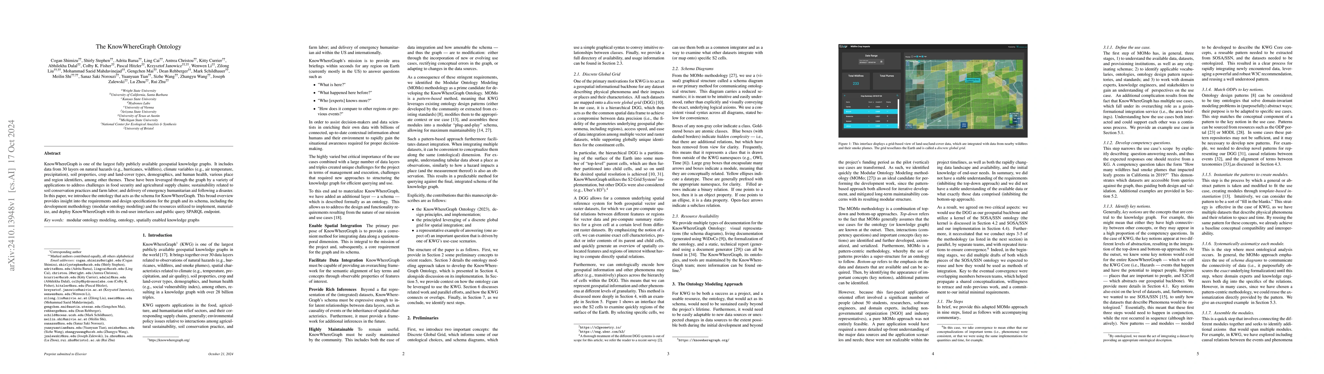
Global challenges such as food supply chain disruptions, public health crises, and natural hazard responses require access to and integration of diverse datasets, many of which are geospatial. Over th...
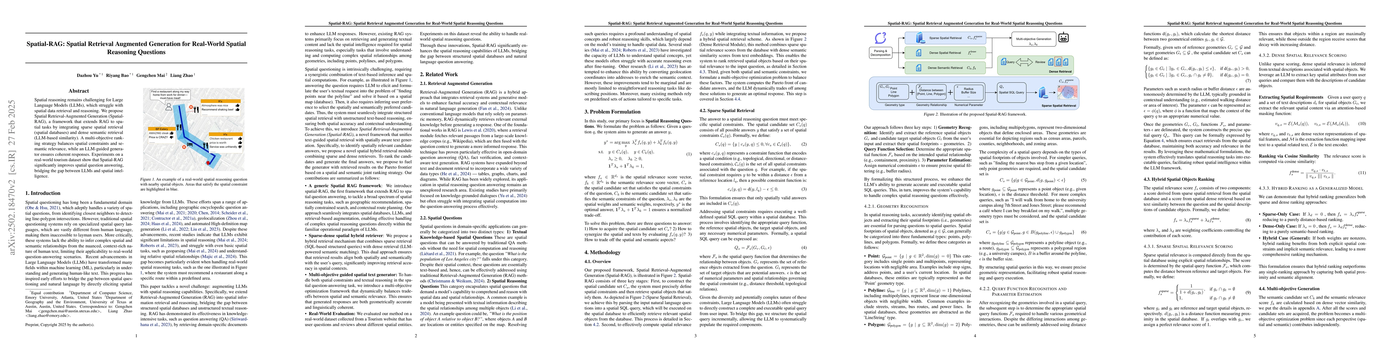
Spatial reasoning remains a challenge for Large Language Models (LLMs), which struggle with spatial data retrieval and reasoning. We propose Spatial Retrieval-Augmented Generation (Spatial-RAG), a fra...
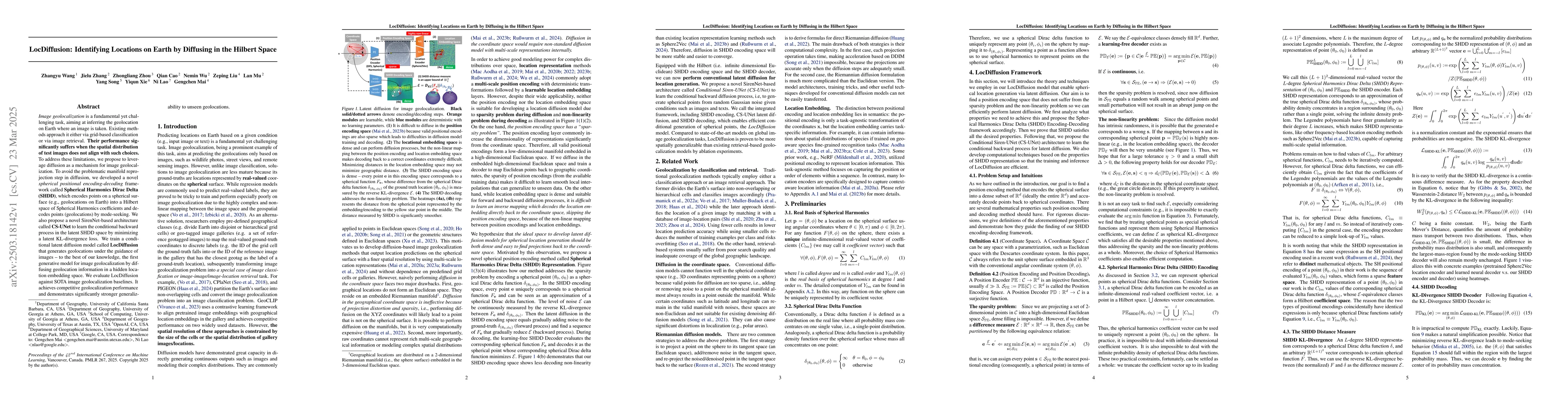
Image geolocalization is a fundamental yet challenging task, aiming at inferring the geolocation on Earth where an image is taken. Existing methods approach it either via grid-based classification or ...
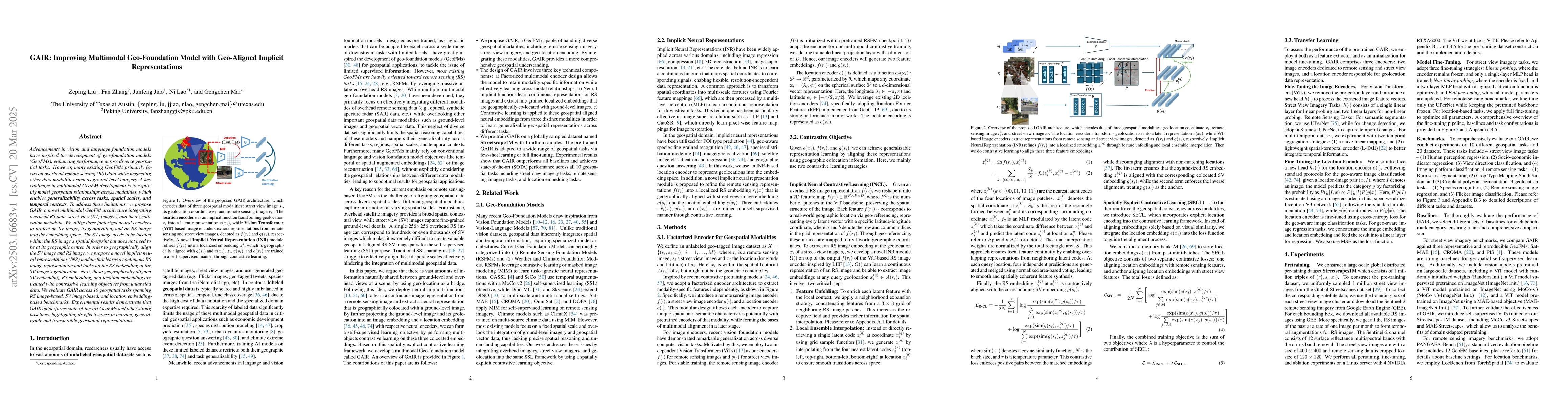
Advancements in vision and language foundation models have inspired the development of geo-foundation models (GeoFMs), enhancing performance across diverse geospatial tasks. However, many existing Geo...
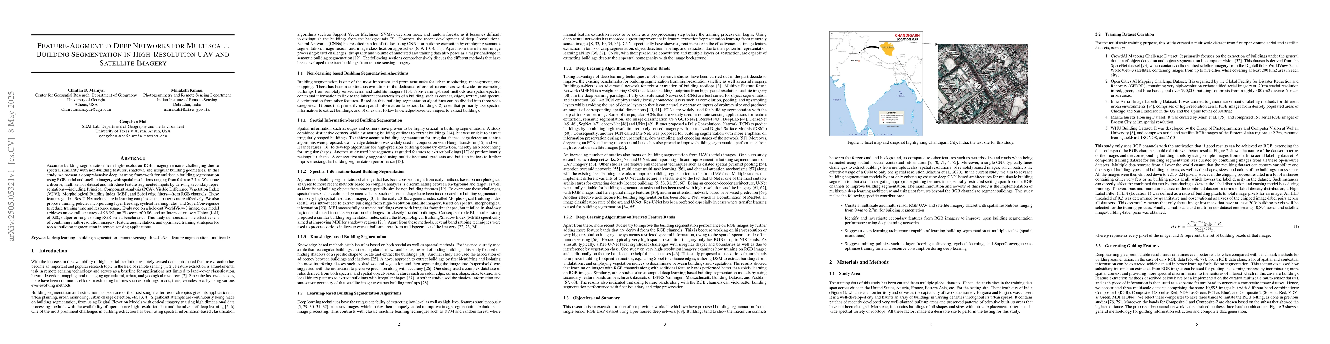
Accurate building segmentation from high-resolution RGB imagery remains challenging due to spectral similarity with non-building features, shadows, and irregular building geometries. In this study, we...
Plankton are small drifting organisms found throughout the world's oceans and can be indicators of ocean health. One component of this plankton community is the zooplankton, which includes gelatinous ...
We present 4KAgent, a unified agentic super-resolution generalist system designed to universally upscale any image to 4K resolution (and even higher, if applied iteratively). Our system can transform ...
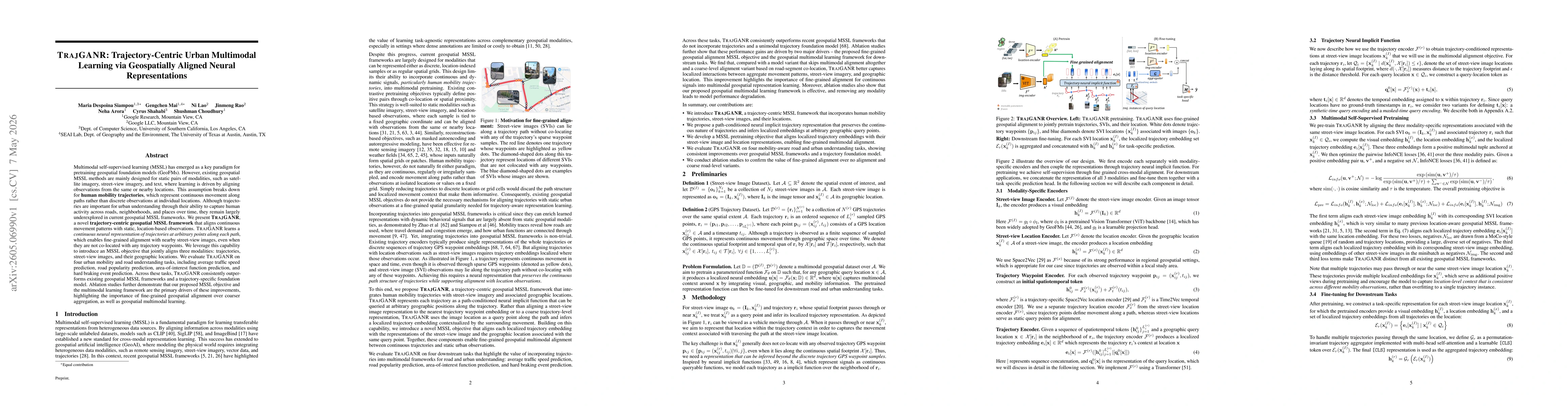
Understanding human mobility is essential for applications in public health, transportation, and urban planning. However, mobility data often suffers from sparsity due to limitations in data collectio...
AI (super) alignment describes the challenge of ensuring (future) AI systems behave in accordance with societal norms and goals. While a quickly evolving literature is addressing biases and inequaliti...
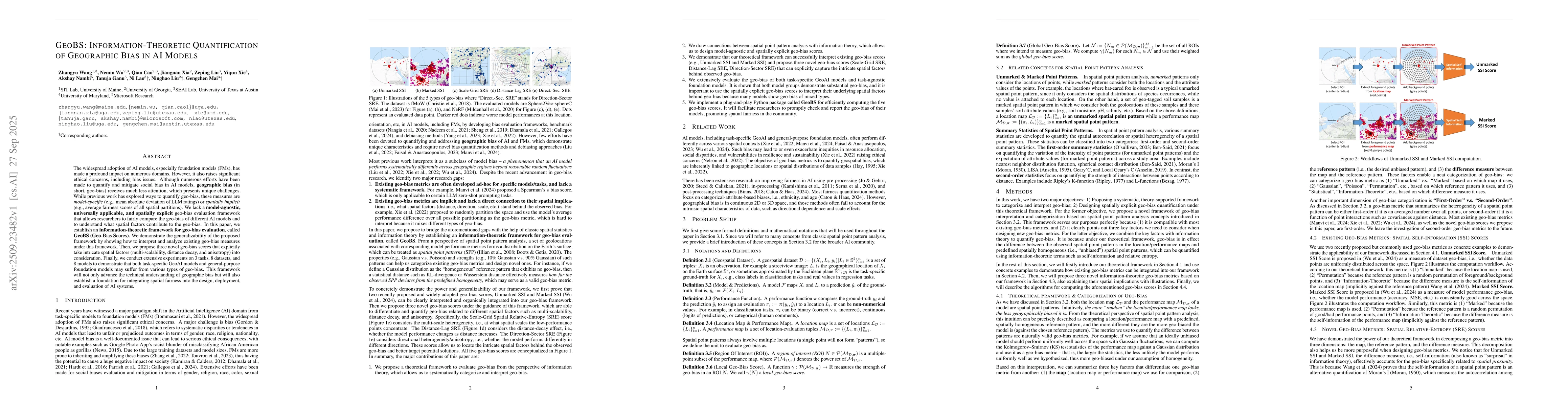
The widespread adoption of AI models, especially foundation models (FMs), has made a profound impact on numerous domains. However, it also raises significant ethical concerns, including bias issues. A...
Digital twins, as precise digital representations of physical systems, have evolved from passive simulation tools into intelligent and autonomous entities through the integration of artificial intelli...
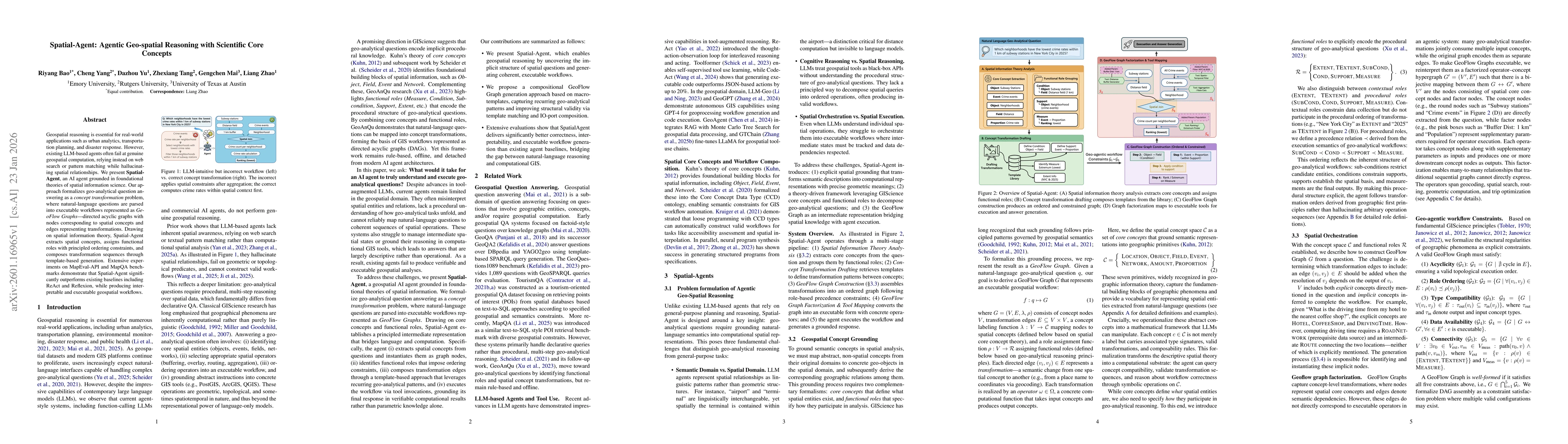
Geospatial reasoning is essential for real-world applications such as urban analytics, transportation planning, and disaster response. However, existing LLM-based agents often fail at genuine geospati...
Understanding how AI will represent and reason about geography should be a key concern for all of us, as the broader public increasingly interacts with spaces and places through these systems. Similar...
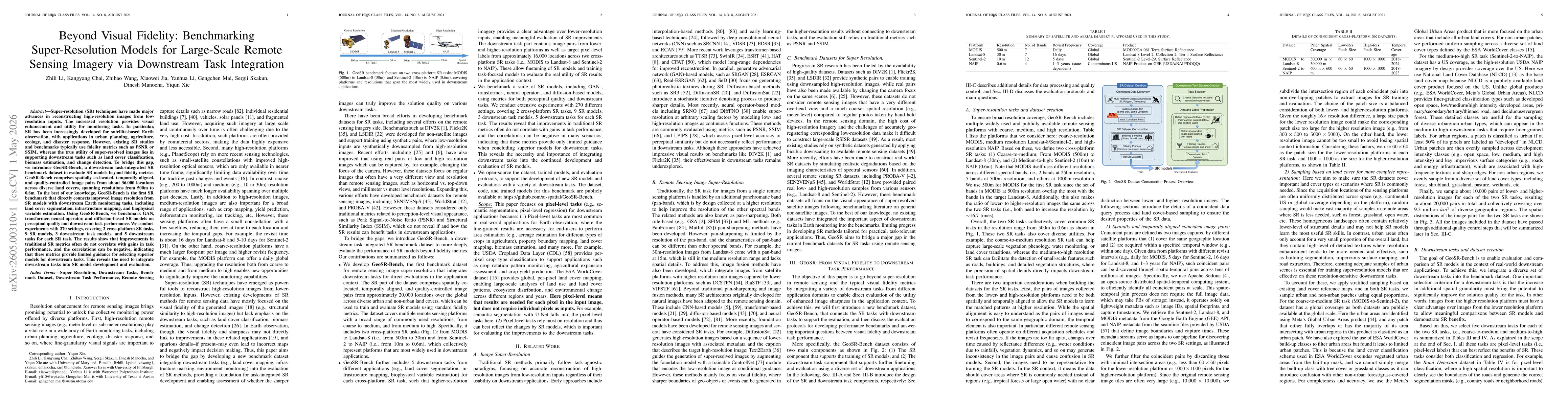
Super-resolution (SR) techniques have made major advances in reconstructing high-resolution images from low-resolution inputs. The increased resolution provides visual enhancement and utility for moni...
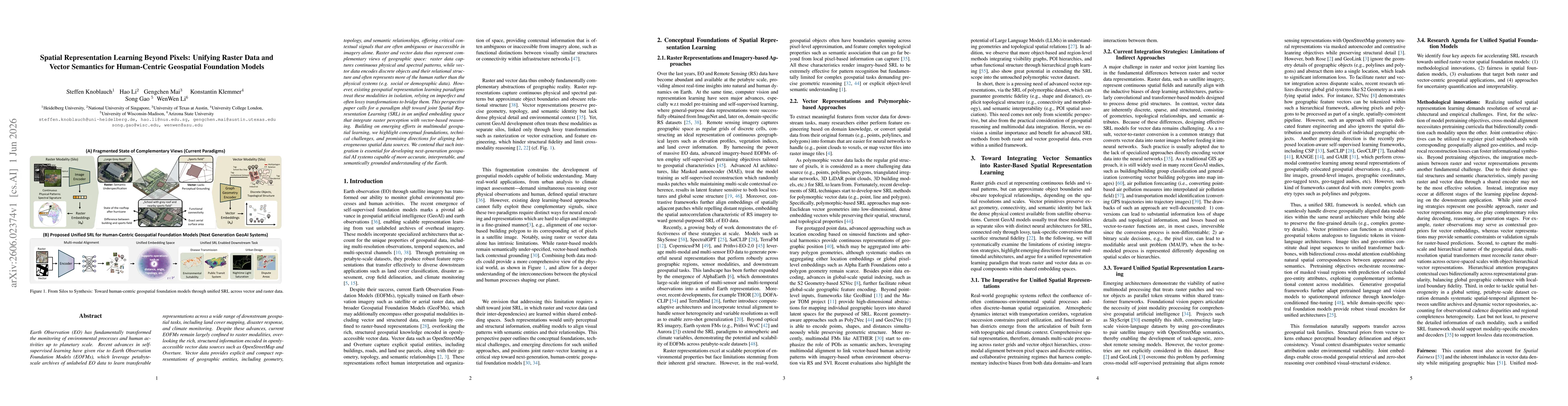
Geospatial foundation models have primarily focused on raster data such as satellite imagery, where self-supervised learning has been widely studied. Vector geospatial data instead represent the world...
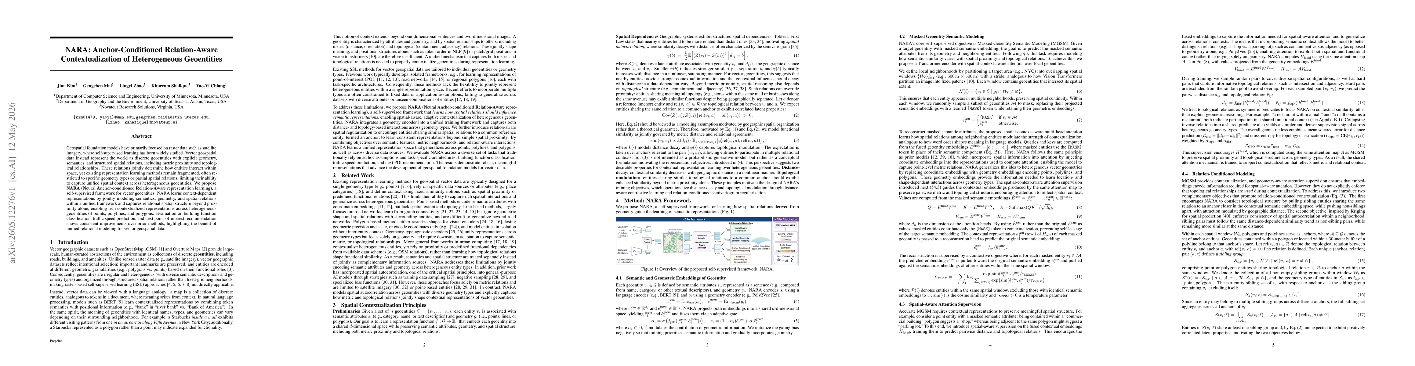
Multimodal self-supervised learning (MSSL) has emerged as a key paradigm for pretraining geospatial foundation models. However, existing geospatial MSSL methods are mainly designed for static pairs of...
Earth Observation (EO) has fundamentally transformed the monitoring of environmental processes and human activities up to planetary scale. Recent advances in self-supervised learning have given rise t...