Authors
Summary
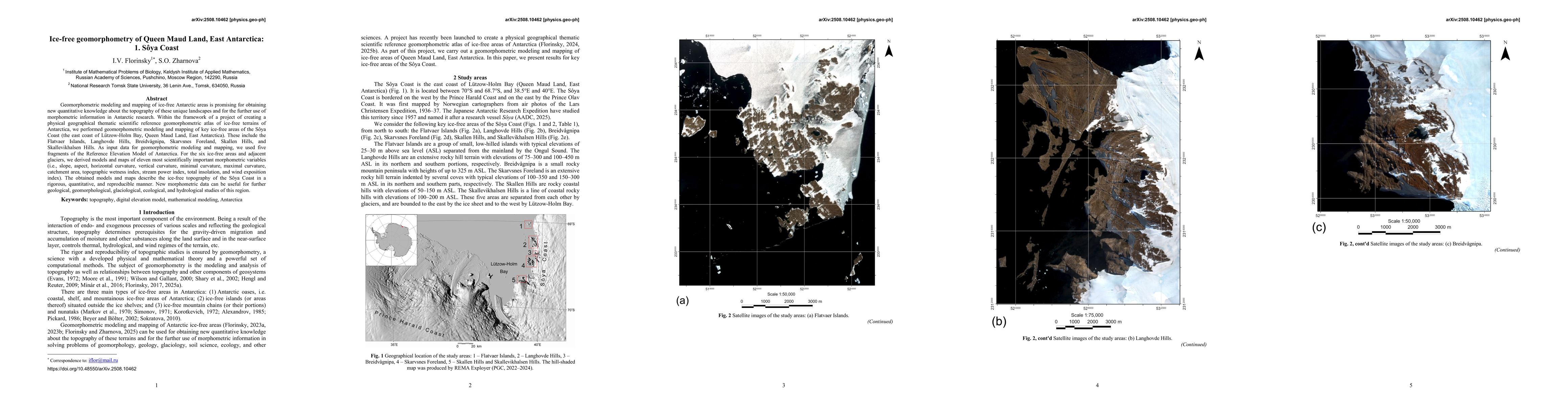
Geomorphometric modeling and mapping of ice-free Antarctic areas is promising for obtaining new quantitative knowledge about the topography of these unique landscapes and for the further use of morphometric information in Antarctic research. Within the framework of a project of creating a physical geographical thematic scientific reference geomorphometric atlas of ice-free terrains of Antarctica, we performed geomorphometric modeling and mapping of key ice-free areas of the S\^oya Coast (the east coast of L\"utzow-Holm Bay, Queen Maud Land, East Antarctica). These include the Flatvaer Islands, Langhovde Hills, Breidv\r{a}gnipa, Skarvsnes Foreland, Skallen Hills, and Skallevikhalsen Hills. As input data for geomorphometric modeling and mapping, we used five fragments of the Reference Elevation Model of Antarctica. For the six ice-free areas and adjacent glaciers, we derived models and maps of eleven most scientifically important morphometric variables (i.e., slope, aspect, horizontal curvature, vertical curvature, minimal curvature, maximal curvature, catchment area, topographic wetness index, stream power index, total insolation, and wind exposition index). The obtained models and maps describe the ice-free topography of the S\^oya Coast in a rigorous, quantitative, and reproducible manner. New morphometric data can be useful for further geological, geomorphological, glaciological, ecological, and hydrological studies of this region.
AI Key Findings
Get AI-generated insights about this paper's methodology, results, and significance.
Paper Details
PDF Preview
Similar Papers
Found 4 papersSources of low-frequency $\delta^{18}$O variability in coastal ice cores from Dronning Maud Land
Stéphane Vannitsem, David Docquier, Sarah Wauthy et al.
Apparent ice accumulation rate in East Antarctica: Relation with temperature and thinning pattern
Radhendushka Srivastava, Debasis Sengupta, Prosenjit Ghosh
Comments (0)