Publication
Metrics
AI Quick Summary
This study employs generative adversarial networks (GANs) to augment the EuroSAT dataset for land use classification, finding that combining GAN-generated images with geometric augmentation enhances model performance. The results suggest that GAN augmentation can improve the generalizability of deep learning models for satellite image classification.
Paper Preview
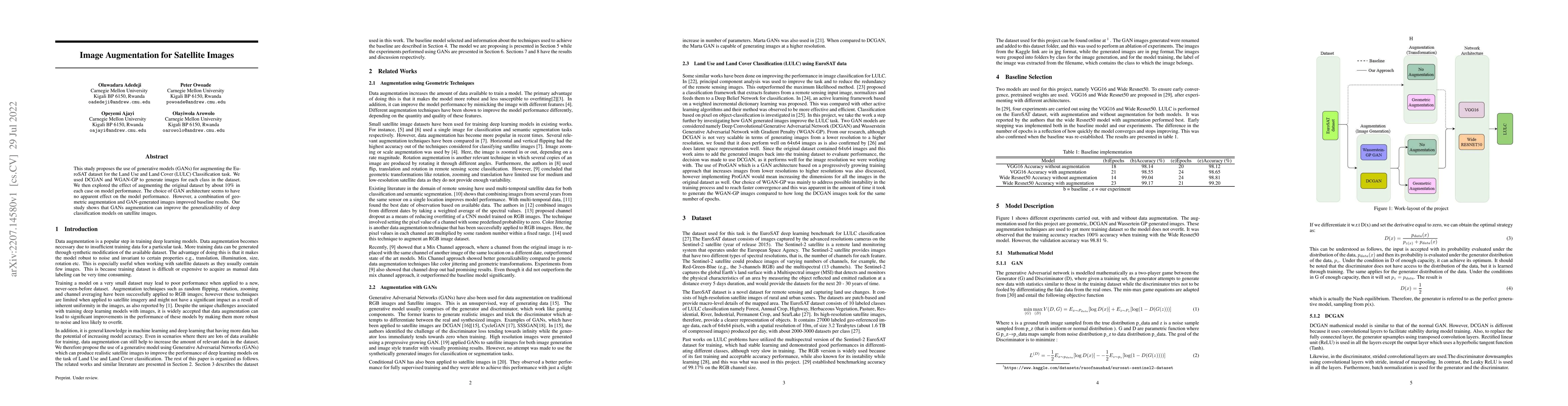
Abstract
This study proposes the use of generative models (GANs) for augmenting the EuroSAT dataset for the Land Use and Land Cover (LULC) Classification task. We used DCGAN and WGAN-GP to generate images for each class in the dataset. We then explored the effect of augmenting the original dataset by about 10% in each case on model performance. The choice of GAN architecture seems to have no apparent effect on the model performance. However, a combination of geometric augmentation and GAN-generated images improved baseline results. Our study shows that GANs augmentation can improve the generalizability of deep classification models on satellite images.
AI Key Findings
Get AI-generated insights about this paper's methodology, results, significance, and more — seven facets brought into focus.
Impact
Paper Details
Authors
PDF Preview
Key Terms
Citation Network
Current paper (gray), citations (green), references (blue)
Display is limited for performance on very large graphs.
Discussion 0