Publication
Metrics
AI Quick Summary
This paper develops a localized method for estimating internal and external planetary potential fields from regional vector satellite data at varying altitudes. It introduces a procedure using spatiospectrally localized bases to mitigate noise amplification and reduce artifacts, enabling high-resolution regional modeling from incomplete and noisy data.
Paper Preview
Abstract
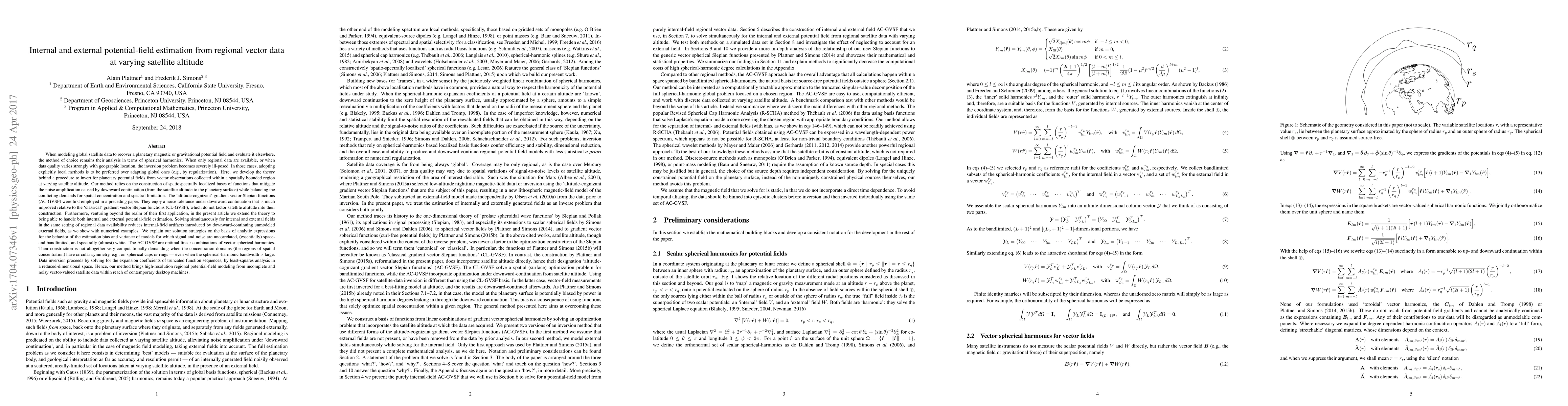
When modeling global satellite data to recover a planetary magnetic or gravitational potential field and evaluate it elsewhere, the method of choice remains their analysis in terms of spherical harmonics. When only regional data are available, or when data quality varies strongly with geographic location, the inversion problem becomes severely ill-posed. In those cases, adopting explicitly local methods is to be preferred over adapting global ones (e.g., by regularization). Here, we develop the theory behind a procedure to invert for planetary potential fields from vector observations collected within a spatially bounded region at varying satellite altitude. Our method relies on the construction of spatiospectrally localized bases of functions that mitigate the noise amplification caused by downward continuation (from the satellite altitude to the planetary surface) while balancing the conflicting demands for spatial concentration and spectral limitation. Solving simultaneously for internal and external fields in the same setting of regional data availability reduces internal-field artifacts introduced by downward-continuing unmodeled external fields, as we show with numerical examples. The AC-GVSF are optimal linear combinations of vector spherical harmonics. Their construction is not altogether very computationally demanding when the concentration domains (the regions of spatial concentration) have circular symmetry, e.g., on spherical caps or rings - even when the spherical-harmonic bandwidth is large. Data inversion proceeds by solving for the expansion coefficients of truncated function sequences, by least-squares analysis in a reduced-dimensional space. Hence, our method brings high-resolution regional potential-field modeling from incomplete and noisy vector-valued satellite data within reach of contemporary desktop machines.
AI Key Findings
Get AI-generated insights about this paper's methodology, results, significance, and more — seven facets brought into focus.
Impact
Paper Details
PDF Preview
Key Terms
Citation Network
Current paper (gray), citations (green), references (blue)
Display is limited for performance on very large graphs.
Discussion 0