Potential-field estimation from satellite data using scalar and vector Slepian functions
Publication
Metrics
AI Quick Summary
This paper proposes two methods for estimating potential fields from satellite data using scalar and vector Slepian functions. The first method uses scalar Slepian functions for radial-component data, while the second method employs vectorial Slepian functions for full gradient data, aiming to improve inversion and model recovery for localized, spatially varying satellite measurements.
Paper Preview
Abstract
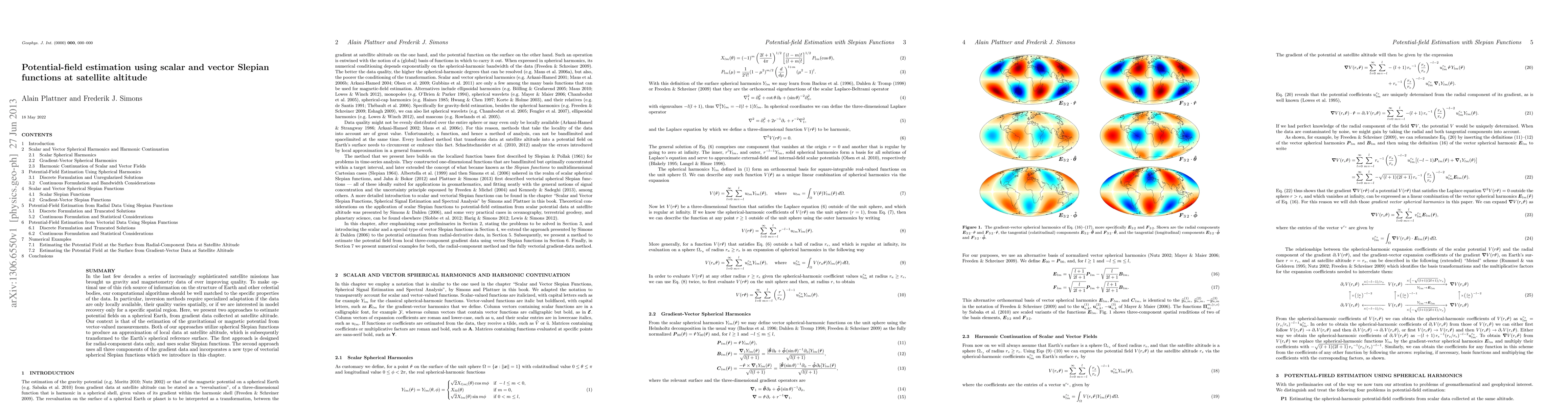
In the last few decades a series of increasingly sophisticated satellite missions has brought us gravity and magnetometry data of ever improving quality. To make optimal use of this rich source of information on the structure of Earth and other celestial bodies, our computational algorithms should be well matched to the specific properties of the data. In particular, inversion methods require specialized adaptation if the data are only locally available, their quality varies spatially, or if we are interested in model recovery only for a specific spatial region. Here, we present two approaches to estimate potential fields on a spherical Earth, from gradient data collected at satellite altitude. Our context is that of the estimation of the gravitational or magnetic potential from vector-valued measurements. Both of our approaches utilize spherical Slepian functions to produce an approximation of local data at satellite altitude, which is subsequently transformed to the Earth's spherical reference surface. The first approach is designed for radial-component data only, and uses scalar Slepian functions. The second approach uses all three components of the gradient data and incorporates a new type of vectorial spherical Slepian functions which we introduce in this chapter.
AI Key Findings
Get AI-generated insights about this paper's methodology, results, significance, and more — seven facets brought into focus.
Impact
Paper Details
PDF Preview
Key Terms
Citation Network
Current paper (gray), citations (green), references (blue)
Display is limited for performance on very large graphs.
Discussion 0