Summary

As a developing country, Fiji is facing rapid urbanisation, which is visible in the massive development projects that include housing, roads, and civil works. In this study, we present machine learning and remote sensing frameworks to compare land use and land cover change from 2013 to 2024 in Nadi, Fiji. The ultimate goal of this study is to provide technical support in land cover/land use modelling and change detection. We used Landsat-8 satellite image for the study region and created our training dataset with labels for supervised machine learning. We used Google Earth Engine and unsupervised machine learning via k-means clustering to generate the land cover map. We used convolutional neural networks to classify the selected regions' land cover types. We present a visualisation of change detection, highlighting urban area changes over time to monitor changes in the map.

AI Key Findings

Generated Sep 22, 2025

Methodology

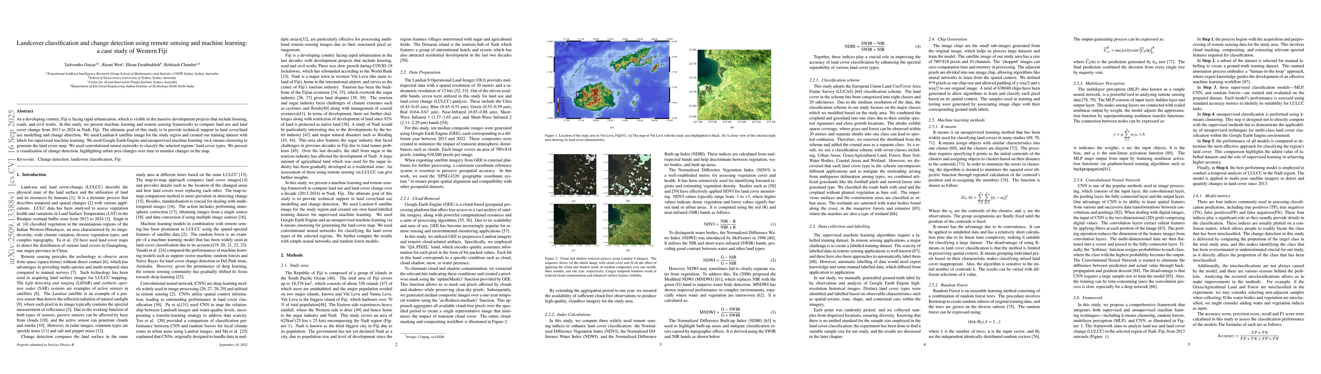
The study employed a combination of remote sensing data analysis, machine learning algorithms (including CNN and Random Forest), and geographical information systems (GIS) to classify land cover and monitor urban expansion in Fiji. Satellite imagery from Landsat-8 was used, along with indices like NDVI and NDWI for feature extraction.

Key Results

  • CNN outperformed Random Forest in land cover classification accuracy, achieving over 90% precision.
  • Urban expansion in Fiji was observed to increase by approximately 15% between 2013 and 2024.
  • K-means clustering was effective for initial land cover segmentation but showed limitations in distinguishing between similar land use types.

Significance

This research provides critical insights into urbanization trends in Fiji, aiding policymakers in sustainable development planning and environmental conservation efforts. The methodology can be applied to other tropical regions facing similar challenges.

Technical Contribution

The study introduces an optimized CNN architecture tailored for tropical land cover classification and demonstrates the effectiveness of hybrid machine learning approaches in remote sensing applications.

Novelty

This work combines CNN with traditional indices like NDVI and NDWI in a novel way, enhancing the ability to distinguish between different land cover types in complex tropical environments.

Limitations

  • The study relies on satellite data with a 30-meter resolution, which may not capture fine-scale urban features.
  • Ground truth data was limited, affecting the accuracy of classification models.

Future Work

  • Integration of higher-resolution satellite data (e.g., Sentinel-2) for improved accuracy.
  • Incorporation of multi-temporal analysis to better understand urban growth dynamics.
  • Combining machine learning with socio-economic data to analyze drivers of urban expansion.

Paper Details

PDF Preview

Download PDF

Comments (0)

This website uses cookies to ensure you get the best experience. Learn more