LOCALIS: Locally-adaptive Line Simplification for GPU-based Geographic Vector Data Visualization
Publication
Metrics
Paper Preview
Abstract
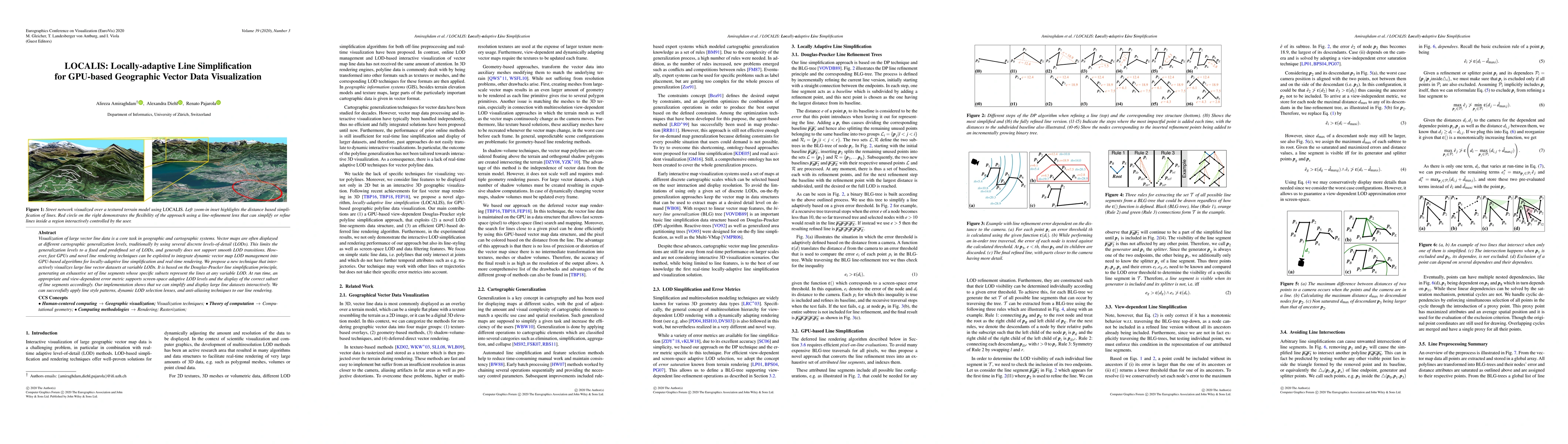
Visualization of large vector line data is a core task in geographic and cartographic systems. Vector maps are often displayed at different cartographic generalization levels, traditionally by using several discrete levels-of-detail (LODs). This limits the generalization levels to a fixed and predefined set of LODs, and generally does not support smooth LOD transitions. However, fast GPUs and novel line rendering techniques can be exploited to integrate dynamic vector map LOD management into GPU-based algorithms for locally-adaptive line simplification and real-time rendering. We propose a new technique that interactively visualizes large line vector datasets at variable LODs. It is based on the Douglas-Peucker line simplification principle, generating an exhaustive set of line segments whose specific subsets represent the lines at any variable LOD. At run time, an appropriate and view-dependent error metric supports screen-space adaptive LOD levels and the display of the correct subset of line segments accordingly. Our implementation shows that we can simplify and display large line datasets interactively. We can successfully apply line style patterns, dynamic LOD selection lenses, and anti-aliasing techniques to our line rendering.
AI Key Findings
Get AI-generated insights about this paper's methodology, results, significance, and more — seven facets brought into focus.
Impact
Paper Details
PDF Preview
Citation Network
Current paper (gray), citations (green), references (blue)
Display is limited for performance on very large graphs.
Discussion 0