Location Intelligence Reveals the Extent, Timing, and Spatial Variation of Hurricane Preparedness
Publication
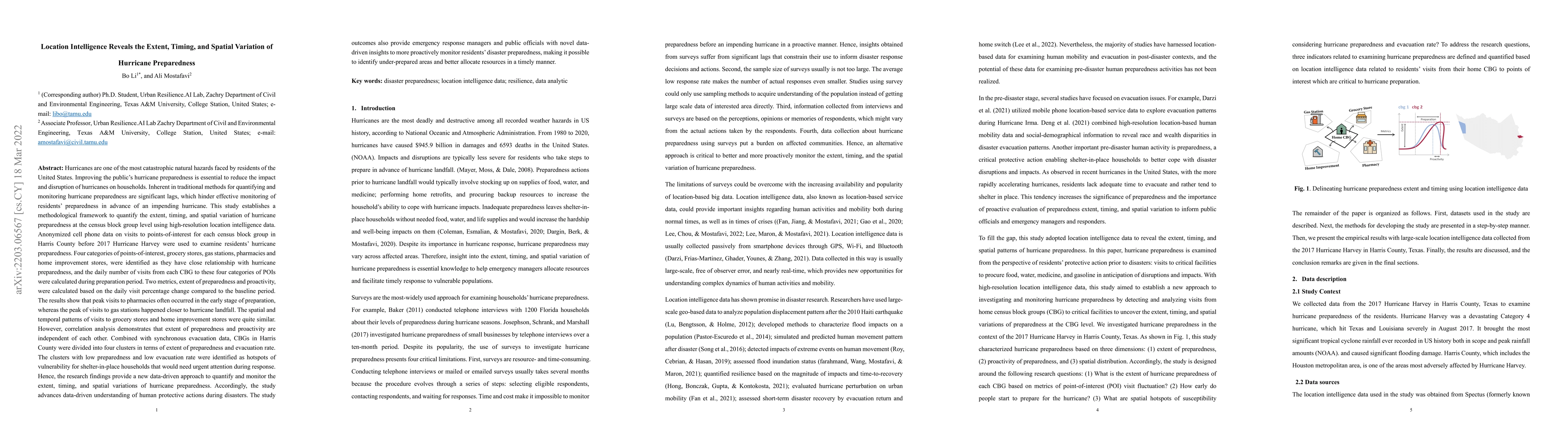
Metrics
AI Quick Summary
This study uses location intelligence data to analyze hurricane preparedness patterns, revealing independent relationships between people's readiness and evacuation rates, and providing insights for emergency management teams.
Paper Preview
Abstract
Improving hurricane preparedness is essential to reduce hurricane impacts. Inherent in traditional methods for quantifying and monitoring hurricane preparedness are significant lags. This study establishes a methodological framework to quantify the extent, timing, and spatial variation of hurricane preparedness at the CBG level using high-resolution location intelligence data. Anonymized cell phone data on visits to POIs for each CBG before 2017 Hurricane Harvey were used to examine hurricane preparedness. Four categories of POI, grocery stores, gas stations, pharmacies and home improvement stores, were identified as having close relationship with hurricane preparedness, and the daily number of visits from each CBG to these four categories of POIs were calculated during preparation period. Two metrics, extent of preparedness and proactivity, were calculated based on the daily visit percentage change compared to the baseline period. The results show that peak visits to pharmacies often occurred in the early stage, whereas the peak of visits to gas stations happened closer to landfall. The spatial and temporal patterns of visits to grocery stores and home improvement stores were quite similar. However, correlation analysis demonstrates that extent of preparedness and proactivity are independent of each other. Combined with synchronous evacuation data, CBGs were divided into four clusters in terms of extent of preparedness and evacuation rate. The clusters with low preparedness and low evacuation rate were identified as hotspots of vulnerability for shelter-in-place households that would need urgent attention during response. The study advances data-driven understanding of human protective actions and provide emergency response managers with novel insights to proactively monitor disaster preparedness, facilitating identifying under-prepared areas and better allocating resources timely.
AI Key Findings
Get AI-generated insights about this paper's methodology, results, significance, and more — seven facets brought into focus.
Impact
Paper Details
Authors
PDF Preview
Key Terms
Citation Network
Current paper (gray), citations (green), references (blue)
Display is limited for performance on very large graphs.
Discussion 0