Publication
Metrics
Paper Preview
Abstract
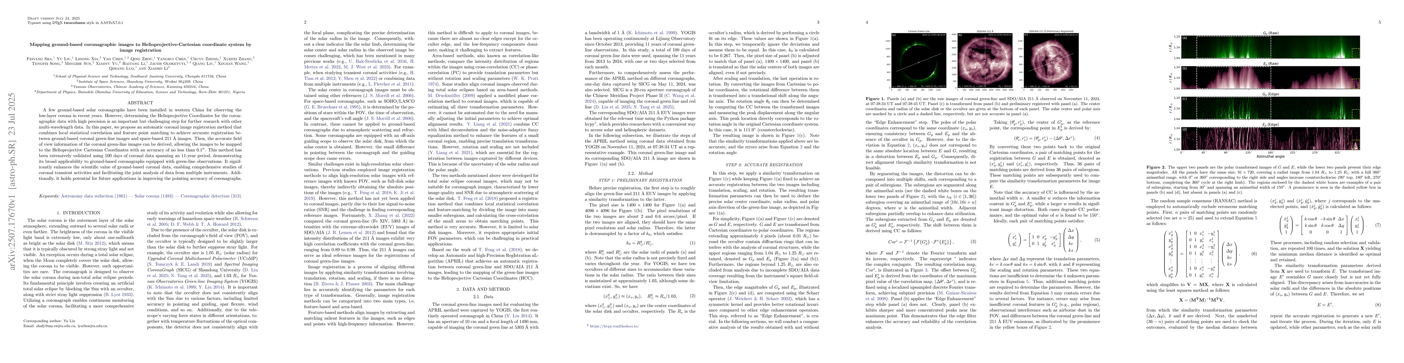
A few ground-based solar coronagraphs have been installed in western China for observing the low-layer corona in recent years. However, determining the Helioprojective Coordinates for the coronagraphic data with high precision is an important but challenging step for further research with other multi-wavelength data. In this paper, we propose an automatic coronal image registration method that combines local statistical correlation and feature point matching to achieve accurate registration between ground-based coronal green-line images and space-based 211 {\AA} images. Then, the accurate field of view information of the coronal green-line images can be derived, allowing the images to be mapped to the Helioprojective Cartesian Coordinates with an accuracy of no less than 0.1''. This method has been extensively validated using 100 days of coronal data spanning an 11-year period, demonstrating its broad applicability to ground-based coronagraphs equipped with green-line observations. It significantly enhances the scientific value of ground-based coronal data, enabling comprehensive studies of coronal transient activities and facilitating the joint analysis of data from multiple instruments. Additionally, it holds potential for future applications in improving the pointing accuracy of coronagraphs.
AI Key Findings
Get AI-generated insights about this paper's methodology, results, significance, and more — seven facets brought into focus.
Discussion 0