Publication
Metrics
AI Quick Summary
This paper proposes an automated framework to delineate urban areas at the parcel level using ordnance surveys and points of interest, employing a vector cellular automata model. The approach is applied to map urban areas across 654 Chinese cities, demonstrating greater precision and efficiency compared to mid-resolution remote sensing and population density methods.
Paper Preview
Abstract
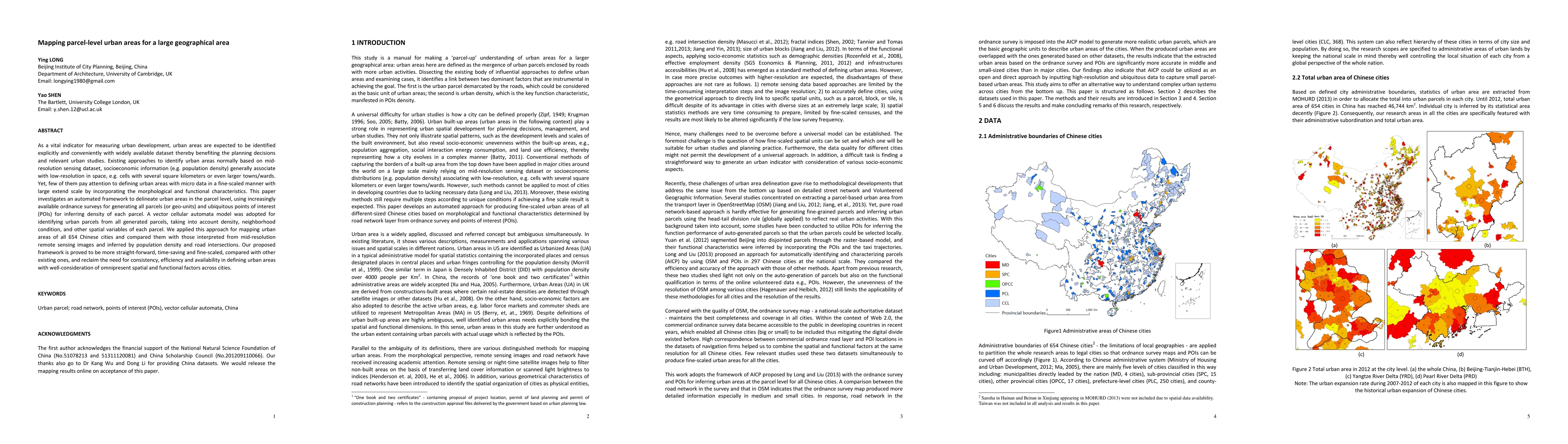
As a vital indicator for measuring urban development, urban areas are expected to be identified explicitly and conveniently with widely available dataset thereby benefiting the planning decisions and relevant urban studies. Existing approaches to identify urban areas normally based on mid-resolution sensing dataset, socioeconomic information (e.g. population density) generally associate with low-resolution in space, e.g. cells with several square kilometers or even larger towns/wards. Yet, few of them pay attention to defining urban areas with micro data in a fine-scaled manner with large extend scale by incorporating the morphological and functional characteristics. This paper investigates an automated framework to delineate urban areas in the parcel level, using increasingly available ordnance surveys for generating all parcels (or geo-units) and ubiquitous points of interest (POIs) for inferring density of each parcel. A vector cellular automata model was adopted for identifying urban parcels from all generated parcels, taking into account density, neighborhood condition, and other spatial variables of each parcel. We applied this approach for mapping urban areas of all 654 Chinese cities and compared them with those interpreted from mid-resolution remote sensing images and inferred by population density and road intersections. Our proposed framework is proved to be more straight-forward, time-saving and fine-scaled, compared with other existing ones, and reclaim the need for consistency, efficiency and availability in defining urban areas with well-consideration of omnipresent spatial and functional factors across cities.
AI Key Findings
Get AI-generated insights about this paper's methodology, results, significance, and more — seven facets brought into focus.
Impact
Paper Details
PDF Preview
Key Terms
Citation Network
Current paper (gray), citations (green), references (blue)
Display is limited for performance on very large graphs.
Discussion 0