Publication
Metrics
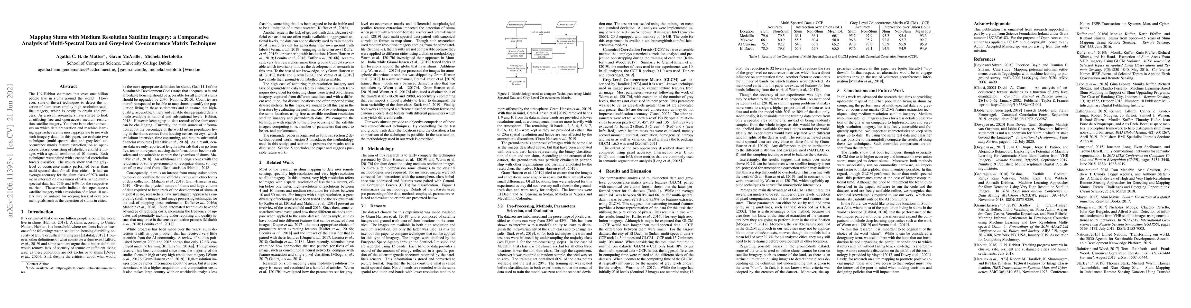
AI Quick Summary
Researchers used medium-resolution satellite imagery to detect slum areas with 97% accuracy, suggesting it may be a suitable alternative to high-resolution images for tracking development goals.
Paper Preview
Abstract
The UN-Habitat estimates that over one billion people live in slums around the world. However, state-of-the-art techniques to detect the location of slum areas employ high-resolution satellite imagery, which is costly to obtain and process. As a result, researchers have started to look at utilising free and open-access medium resolution satellite imagery. Yet, there is no clear consensus on which data preparation and machine learning approaches are the most appropriate to use with such imagery data. In this paper, we evaluate two techniques (multi-spectral data and grey-level co-occurrence matrix feature extraction) on an open-access dataset consisting of labelled Sentinel-2 images with a spatial resolution of 10 meters. Both techniques were paired with a canonical correlation forests classifier. The results show that the grey-level co-occurrence matrix performed better than multi-spectral data for all four cities. It had an average accuracy for the slum class of 97% and a mean intersection over union of 94%, while multi-spectral data had 75% and 64% for the respective metrics. These results indicate that open-access satellite imagery with a resolution of at least 10 meters may be suitable for keeping track of development goals such as the detection of slums in cities.
AI Key Findings
Get AI-generated insights about this paper's methodology, results, significance, and more — seven facets brought into focus.
Impact
Paper Details
Authors
PDF Preview
Key Terms
Citation Network
Current paper (gray), citations (green), references (blue)
Display is limited for performance on very large graphs.
Discussion 0