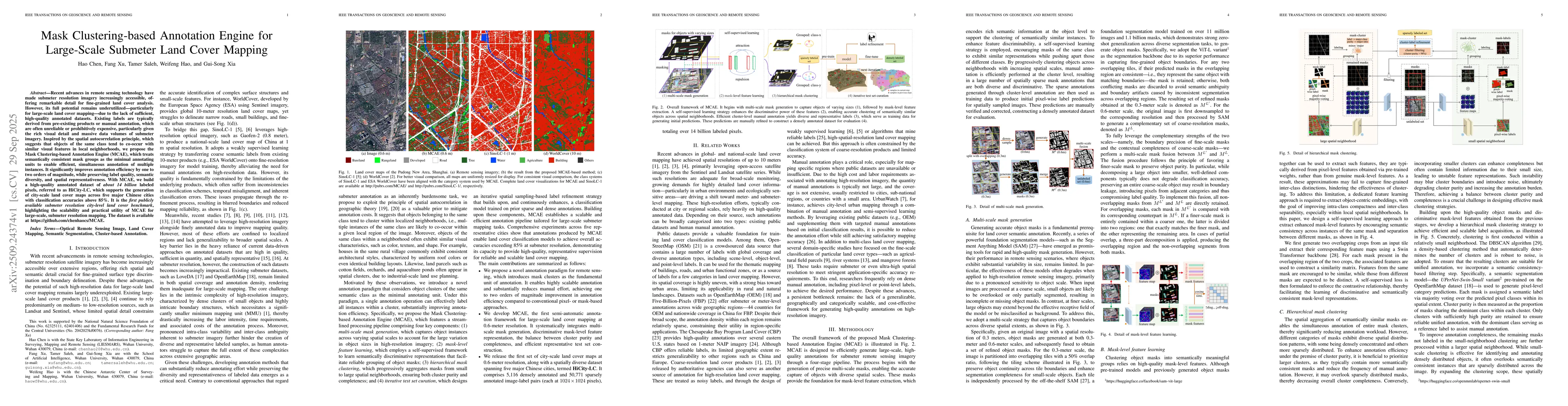
Recent advances in remote sensing technology have made submeter resolution
imagery increasingly accessible, offering remarkable detail for fine-grained
land cover analysis. However, its full potential remains underutilized -
particularly for large-scale land cover mapping - due to the lack of
sufficient, high-quality annotated datasets. Existing labels are typically
derived from pre-existing products or manual annotation, which are often
unreliable or prohibitively expensive, particularly given the rich visual
detail and massive data volumes of submeter imagery. Inspired by the spatial
autocorrelation principle, which suggests that objects of the same class tend
to co-occur with similar visual features in local neighborhoods, we propose the
Mask Clustering-based Annotation Engine (MCAE), which treats semantically
consistent mask groups as the minimal annotating units to enable efficient,
simultaneous annotation of multiple instances. It significantly improves
annotation efficiency by one to two orders of magnitude, while preserving label
quality, semantic diversity, and spatial representativeness. With MCAE, we
build a high-quality annotated dataset of about 14 billion labeled pixels,
referred to as HiCity-LC, which supports the generation of city-scale land
cover maps across five major Chinese cities with classification accuracies
above 85%. It is the first publicly available submeter resolution city-level
land cover benchmark, highlighting the scalability and practical utility of
MCAE for large-scale, submeter resolution mapping. The dataset is available at
https://github.com/chenhaocs/MCAE
Discussion 0