Mobilkit: A Python Toolkit for Urban Resilience and Disaster Risk Management Analytics using High Frequency Human Mobility Data
Publication
Metrics
AI Quick Summary
Summary: Mobilkit is an open-source Python toolkit that facilitates post-disaster analytics using high-frequency human mobility data from smartphones, aimed at enhancing urban resilience and disaster risk management. It addresses the lack of specialized tools for this purpose, with considerations for privacy and system scalability.
Paper Preview
Abstract
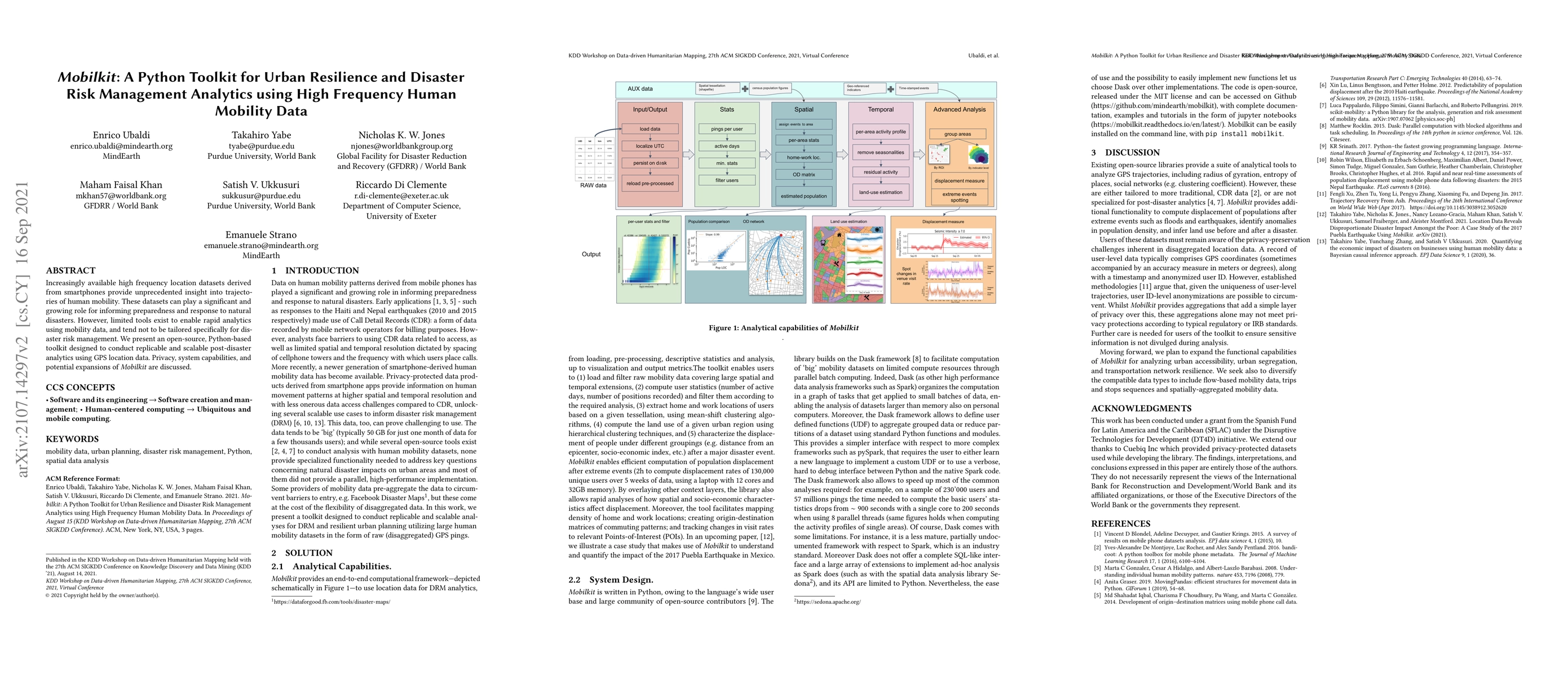
Increasingly available high-frequency location datasets derived from smartphones provide unprecedented insight into trajectories of human mobility. These datasets can play a significant and growing role in informing preparedness and response to natural disasters. However, limited tools exist to enable rapid analytics using mobility data, and tend not to be tailored specifically for disaster risk management. We present an open-source, Python-based toolkit designed to conduct replicable and scalable post-disaster analytics using GPS location data. Privacy, system capabilities, and potential expansions of \textit{Mobilkit} are discussed.
AI Key Findings
Get AI-generated insights about this paper's methodology, results, significance, and more — seven facets brought into focus.
Impact
Paper Details
Authors
PDF Preview
Key Terms
Citation Network
Current paper (gray), citations (green), references (blue)
Display is limited for performance on very large graphs.
Discussion 0