Multitask GLocal OBIA-Mamba for Sentinel-2 Landcover Mapping
Publication
Metrics
Paper Preview
Abstract
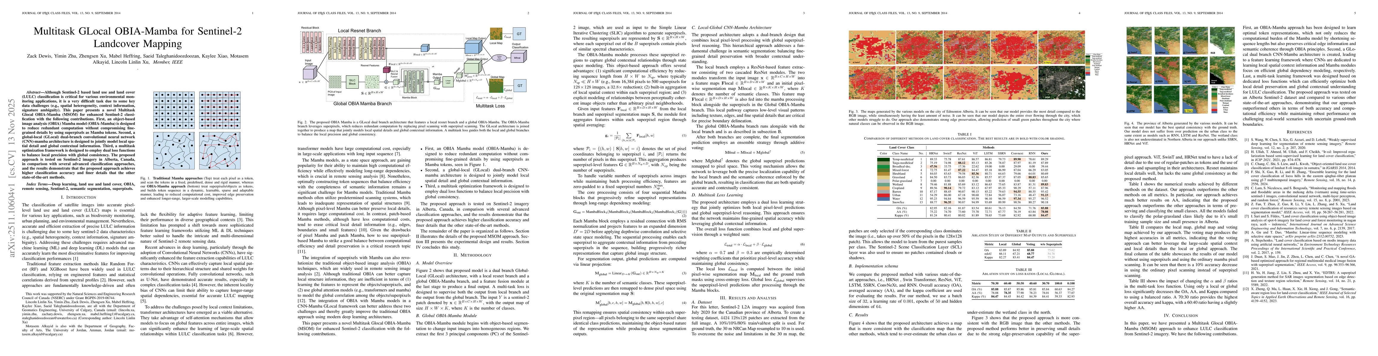
Although Sentinel-2 based land use and land cover (LULC) classification is critical for various environmental monitoring applications, it is a very difficult task due to some key data challenges (e.g., spatial heterogeneity, context information, signature ambiguity). This paper presents a novel Multitask Glocal OBIA-Mamba (MSOM) for enhanced Sentinel-2 classification with the following contributions. First, an object-based image analysis (OBIA) Mamba model (OBIA-Mamba) is designed to reduce redundant computation without compromising fine-grained details by using superpixels as Mamba tokens. Second, a global-local (GLocal) dual-branch convolutional neural network (CNN)-mamba architecture is designed to jointly model local spatial detail and global contextual information. Third, a multitask optimization framework is designed to employ dual loss functions to balance local precision with global consistency. The proposed approach is tested on Sentinel-2 imagery in Alberta, Canada, in comparison with several advanced classification approaches, and the results demonstrate that the proposed approach achieves higher classification accuracy and finer details that the other state-of-the-art methods.
AI Key Findings
Get AI-generated insights about this paper's methodology, results, significance, and more — seven facets brought into focus.
Discussion 0