Precipitation plays a critical role in the Earth's hydrological cycle,
directly affecting ecosystems, agriculture, and water resource management.
Accurate precipitation estimation and prediction are crucial for understanding
climate dynamics, disaster preparedness, and environmental monitoring. In
recent years, artificial intelligence (AI) has gained increasing attention in
quantitative remote sensing (QRS), enabling more advanced data analysis and
improving precipitation estimation accuracy. Although traditional methods have
been widely used for precipitation estimation, they face limitations due to the
difficulty of data acquisition and the challenge of capturing complex feature
relationships. Furthermore, the lack of standardized multi-source satellite
datasets, and in most cases, the exclusive reliance on station data,
significantly hinders the effective application of advanced AI models. To
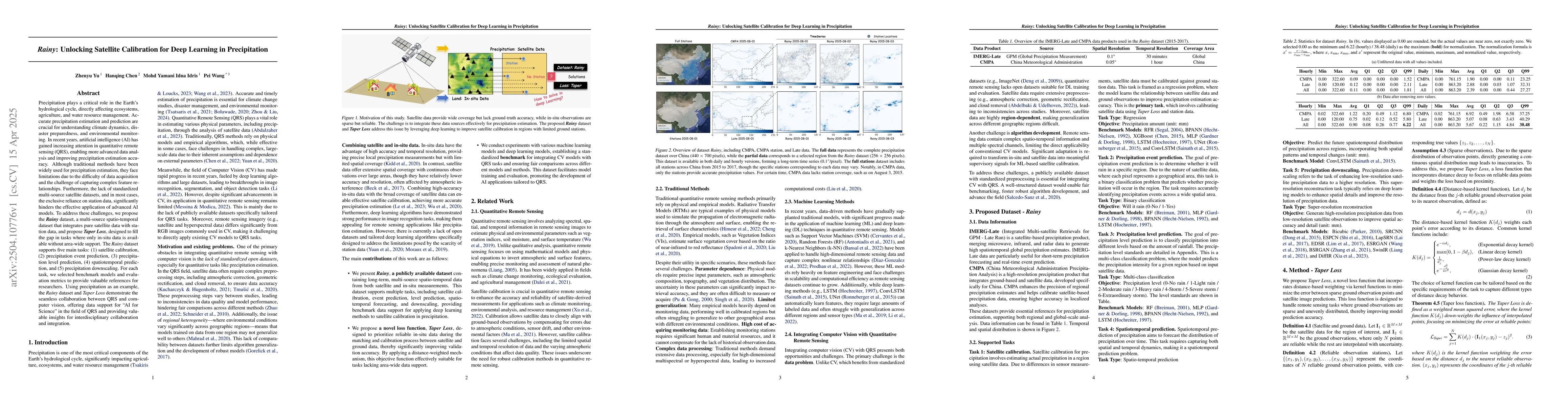
address these challenges, we propose the Rainy dataset, a multi-source
spatio-temporal dataset that integrates pure satellite data with station data,
and propose Taper Loss, designed to fill the gap in tasks where only in-situ
data is available without area-wide support. The Rainy dataset supports five
main tasks: (1) satellite calibration, (2) precipitation event prediction, (3)
precipitation level prediction, (4) spatiotemporal prediction, and (5)
precipitation downscaling. For each task, we selected benchmark models and
evaluation metrics to provide valuable references for researchers. Using
precipitation as an example, the Rainy dataset and Taper Loss demonstrate the
seamless collaboration between QRS and computer vision, offering data support
for AI for Science in the field of QRS and providing valuable insights for
interdisciplinary collaboration and integration.
Discussion 0