Real-time Kinematic Ground Truth for the Oxford RobotCar Dataset
Publication
Metrics
AI Quick Summary
This paper introduces a new dataset providing centimetre-accurate ground truth data for the Oxford RobotCar Dataset, including 72 route traversals under varied conditions. The aim is to enable quantitative evaluation of long-term autonomous vehicle localization and mapping in urban environments.
Paper Preview
Abstract
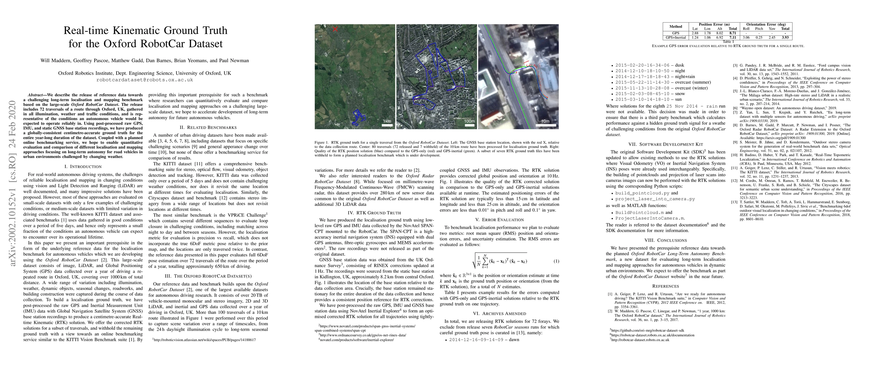
We describe the release of reference data towards a challenging long-term localisation and mapping benchmark based on the large-scale Oxford RobotCar Dataset. The release includes 72 traversals of a route through Oxford, UK, gathered in all illumination, weather and traffic conditions, and is representative of the conditions an autonomous vehicle would be expected to operate reliably in. Using post-processed raw GPS, IMU, and static GNSS base station recordings, we have produced a globally-consistent centimetre-accurate ground truth for the entire year-long duration of the dataset. Coupled with a planned online benchmarking service, we hope to enable quantitative evaluation and comparison of different localisation and mapping approaches focusing on long-term autonomy for road vehicles in urban environments challenged by changing weather.
AI Key Findings
Get AI-generated insights about this paper's methodology, results, significance, and more — seven facets brought into focus.
Impact
Paper Details
Authors
PDF Preview
Key Terms
Citation Network
Current paper (gray), citations (green), references (blue)
Display is limited for performance on very large graphs.
Discussion 0