Publication
Metrics
AI Quick Summary
This paper introduces the Oxford Road Boundaries Dataset, comprising 62,605 labelled samples for machine-learning-based road-boundary detection, with 47,639 curated examples from two 10 km-long segments of the Oxford Robotcar Dataset. The dataset includes diverse scenarios and tools for data manipulation.
Paper Preview
Abstract
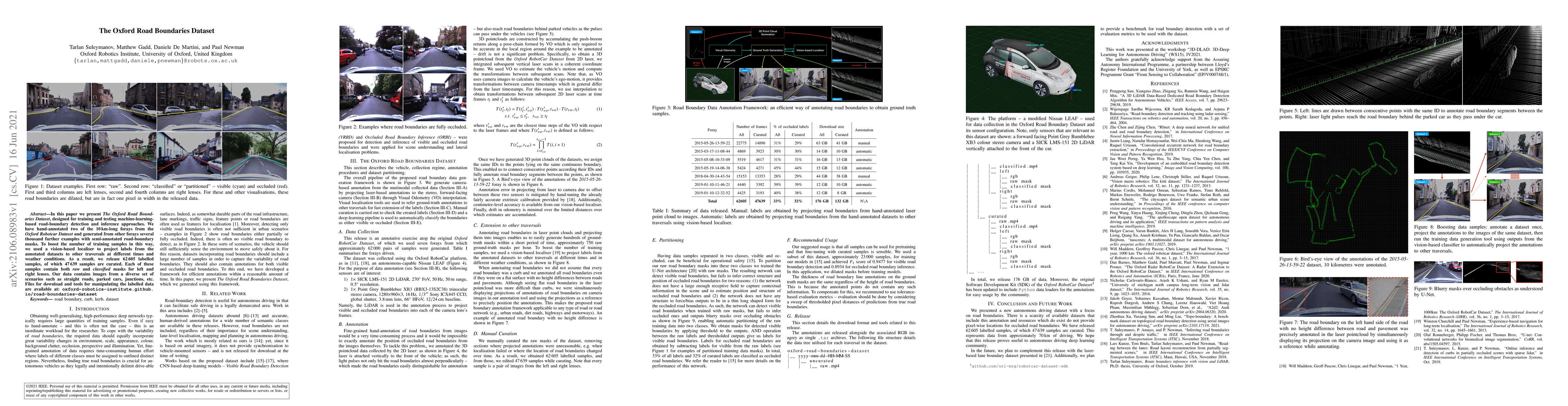
In this paper we present the Oxford Road Boundaries Dataset, designed for training and testing machine-learning-based road-boundary detection and inference approaches. We have hand-annotated two of the 10 km-long forays from the Oxford Robotcar Dataset and generated from other forays several thousand further examples with semi-annotated road-boundary masks. To boost the number of training samples in this way, we used a vision-based localiser to project labels from the annotated datasets to other traversals at different times and weather conditions. As a result, we release 62605 labelled samples, of which 47639 samples are curated. Each of these samples contains both raw and classified masks for left and right lenses. Our data contains images from a diverse set of scenarios such as straight roads, parked cars, junctions, etc. Files for download and tools for manipulating the labelled data are available at: oxford-robotics-institute.github.io/road-boundaries-dataset
AI Key Findings
Get AI-generated insights about this paper's methodology, results, significance, and more — seven facets brought into focus.
Impact
Paper Details
Authors
PDF Preview
Key Terms
Citation Network
Current paper (gray), citations (green), references (blue)
Display is limited for performance on very large graphs.
Discussion 0