Robust Recursive Fusion of Multiresolution Multispectral Images with Location-Aware Neural Networks
Publication
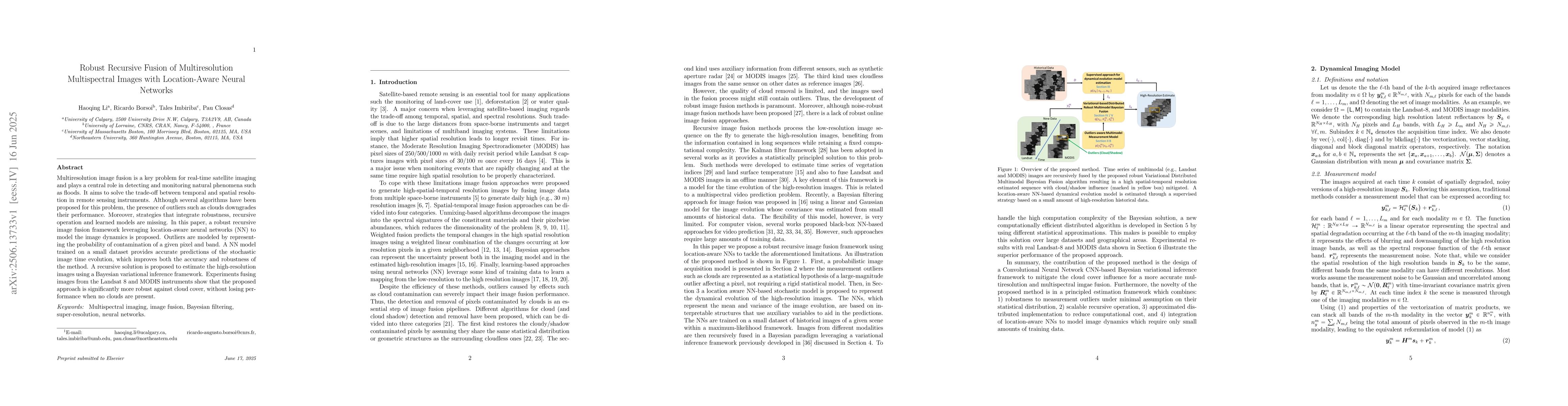
Metrics
Paper Preview
Abstract
Multiresolution image fusion is a key problem for real-time satellite imaging and plays a central role in detecting and monitoring natural phenomena such as floods. It aims to solve the trade-off between temporal and spatial resolution in remote sensing instruments. Although several algorithms have been proposed for this problem, the presence of outliers such as clouds downgrades their performance. Moreover, strategies that integrate robustness, recursive operation and learned models are missing. In this paper, a robust recursive image fusion framework leveraging location-aware neural networks (NN) to model the image dynamics is proposed. Outliers are modeled by representing the probability of contamination of a given pixel and band. A NN model trained on a small dataset provides accurate predictions of the stochastic image time evolution, which improves both the accuracy and robustness of the method. A recursive solution is proposed to estimate the high-resolution images using a Bayesian variational inference framework. Experiments fusing images from the Landsat 8 and MODIS instruments show that the proposed approach is significantly more robust against cloud cover, without losing performance when no clouds are present.
AI Key Findings
Get AI-generated insights about this paper's methodology, results, significance, and more — seven facets brought into focus.
Impact
Authors
PDF Preview
Citation Network
Current paper (gray), citations (green), references (blue)
Display is limited for performance on very large graphs.
Discussion 0