Academic Profile
Statistics
Similar Authors
Papers on arXiv
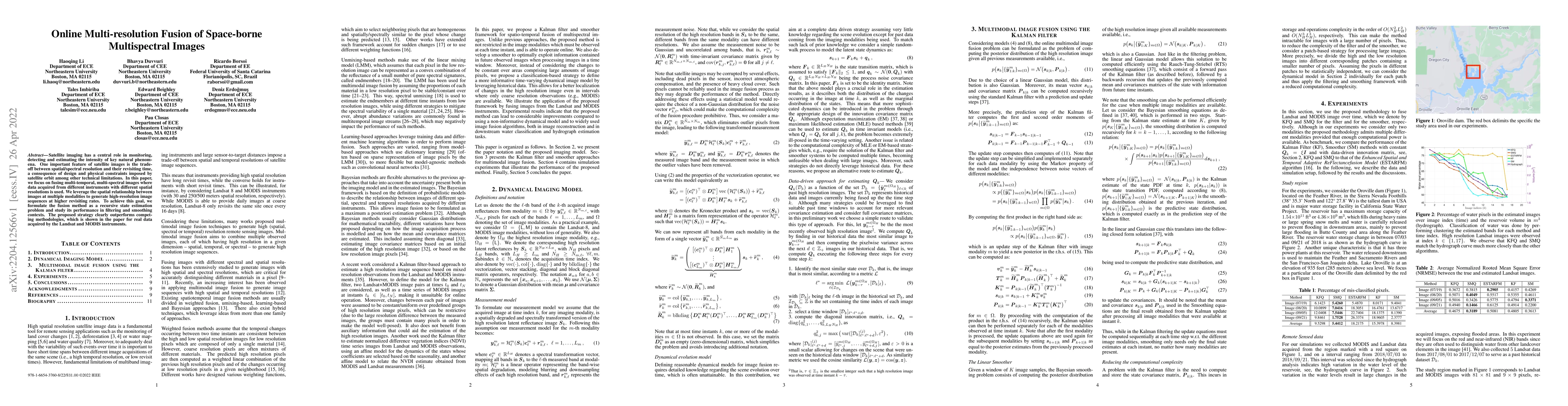
Real-time satellite imaging has a central role in monitoring, detecting and estimating the intensity of key natural phenomena such as floods, earthquakes, etc. One important constraint of satellite ...
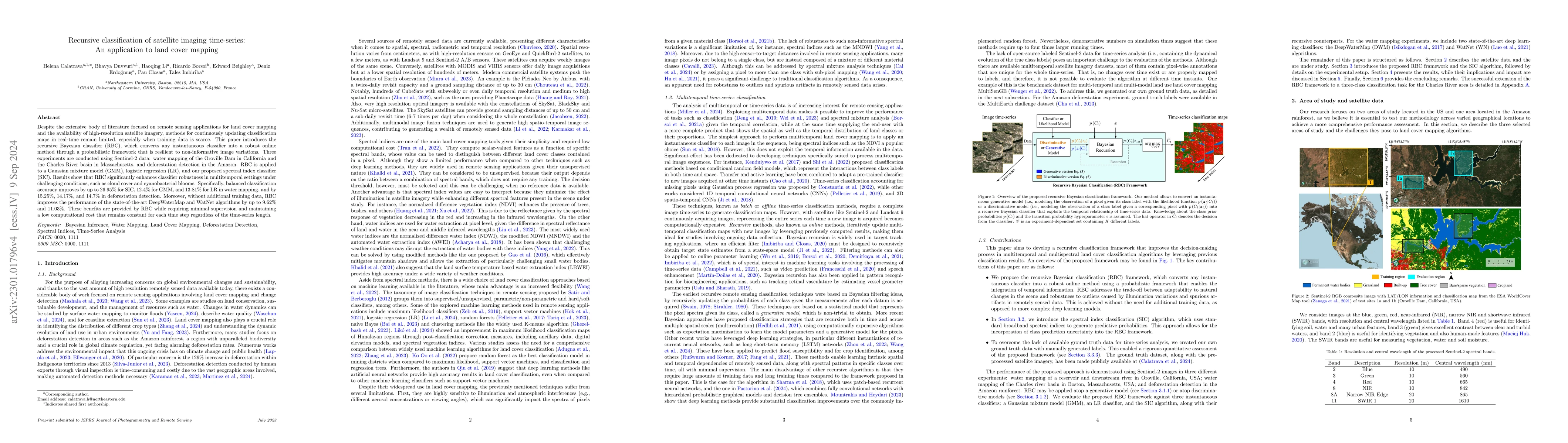
A wide variety of applications of fundamental importance for security, environmental protection and urban development need access to accurate land cover monitoring, for which the analysis of optical...
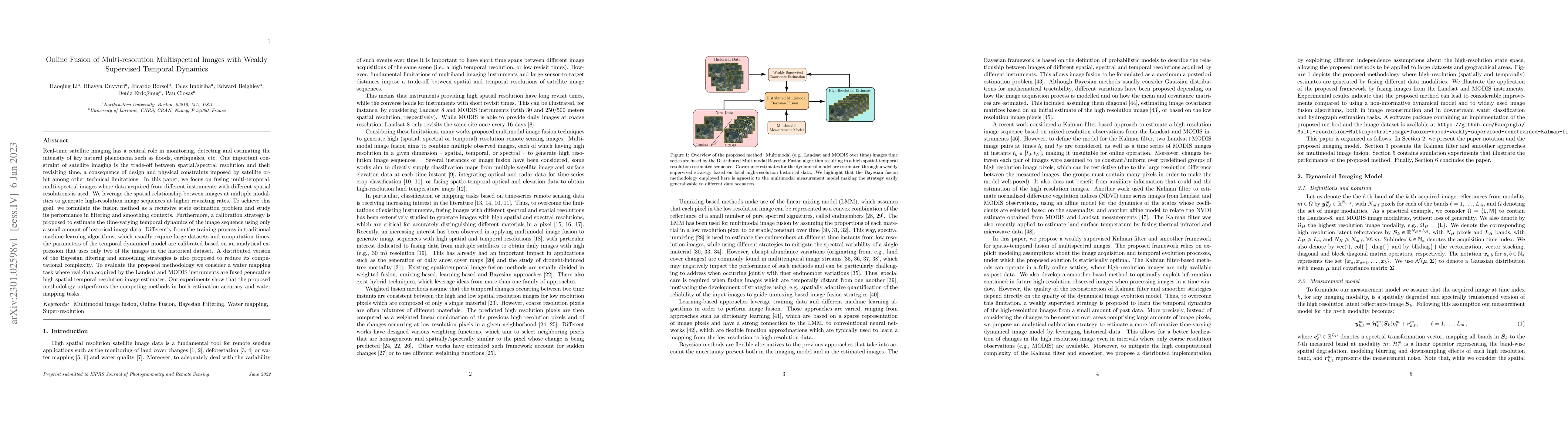
Satellite imaging has a central role in monitoring, detecting and estimating the intensity of key natural phenomena. One important feature of satellite images is the trade-off between spatial/spectr...
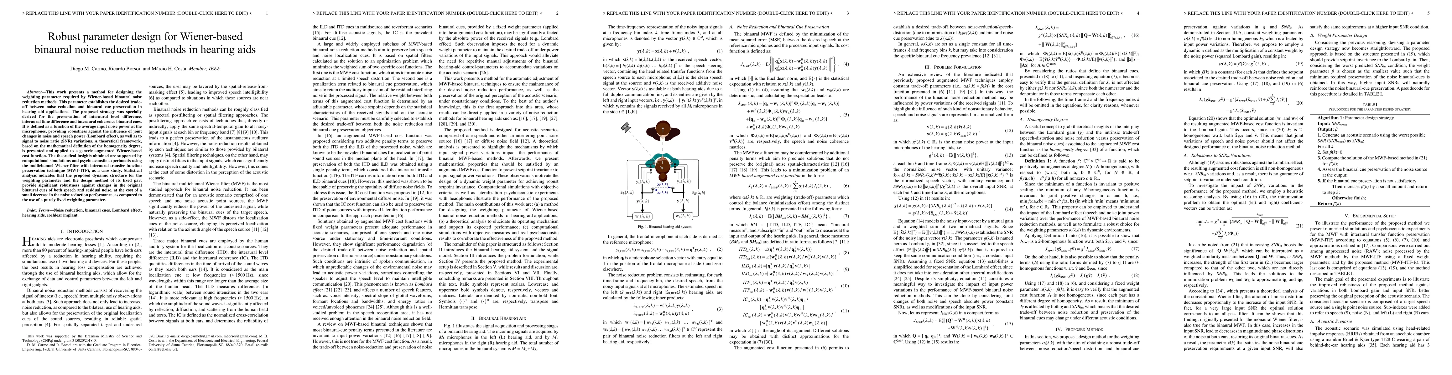
This work presents a method for designing the weighting parameter required by Wiener-based binaural noise reduction methods. This parameter establishes the desired tradeoff between noise reduction a...
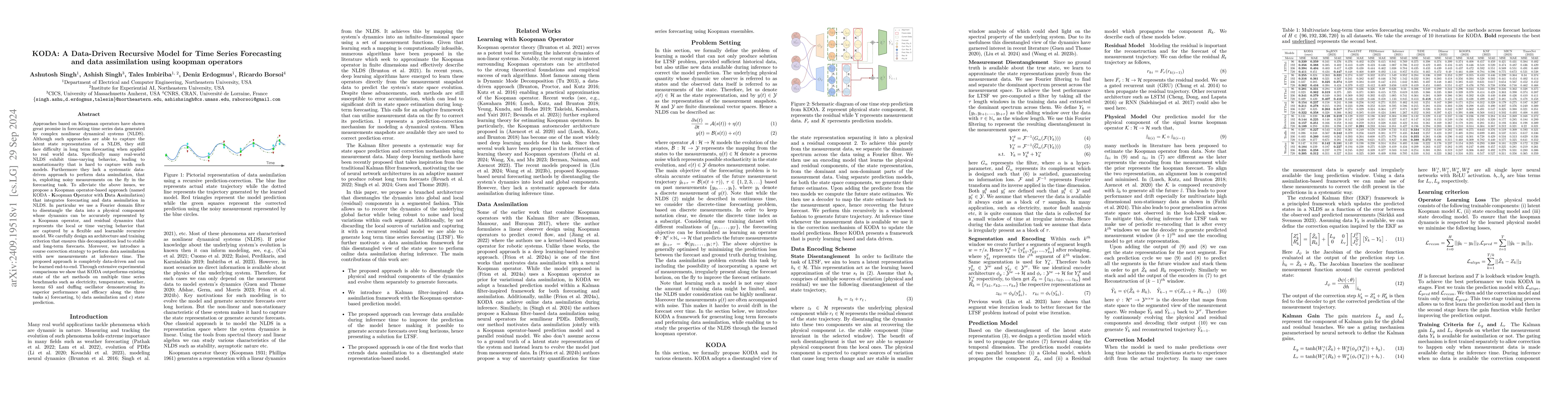
Approaches based on Koopman operators have shown great promise in forecasting time series data generated by complex nonlinear dynamical systems (NLDS). Although such approaches are able to capture the...
Polynomial Neural Networks (PNNs) possess a rich algebraic and geometric structure. However, their identifiability -- a key property for ensuring interpretability -- remains poorly understood. In this...
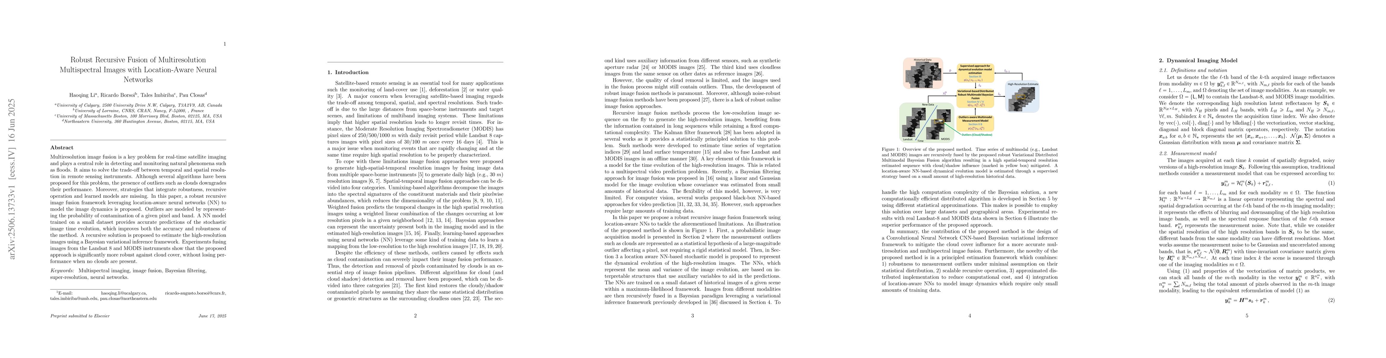
Multiresolution image fusion is a key problem for real-time satellite imaging and plays a central role in detecting and monitoring natural phenomena such as floods. It aims to solve the trade-off betw...
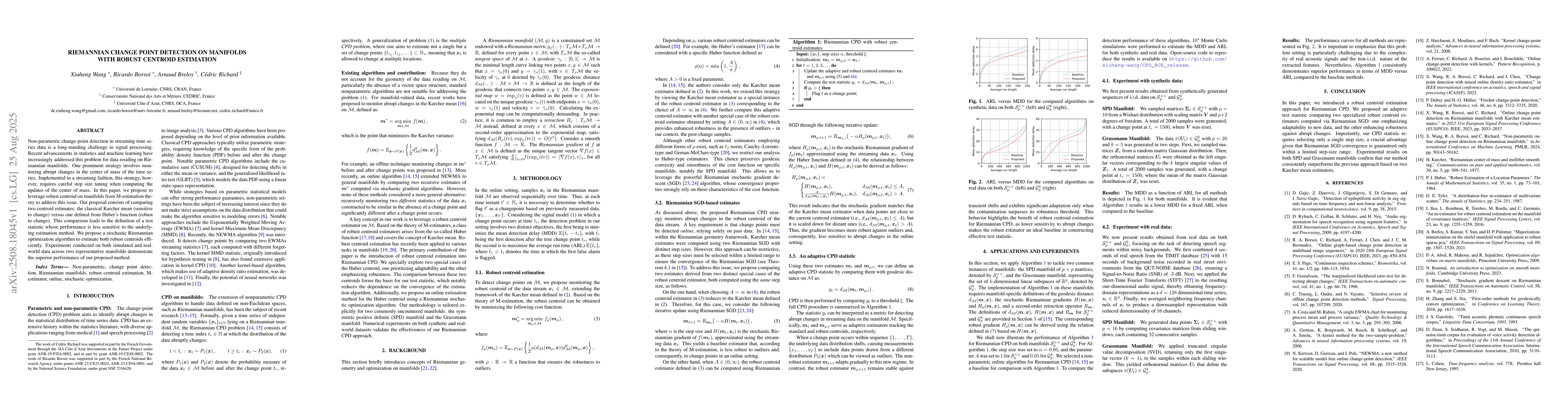
Non-parametric change-point detection in streaming time series data is a long-standing challenge in signal processing. Recent advancements in statistics and machine learning have increasingly addresse...
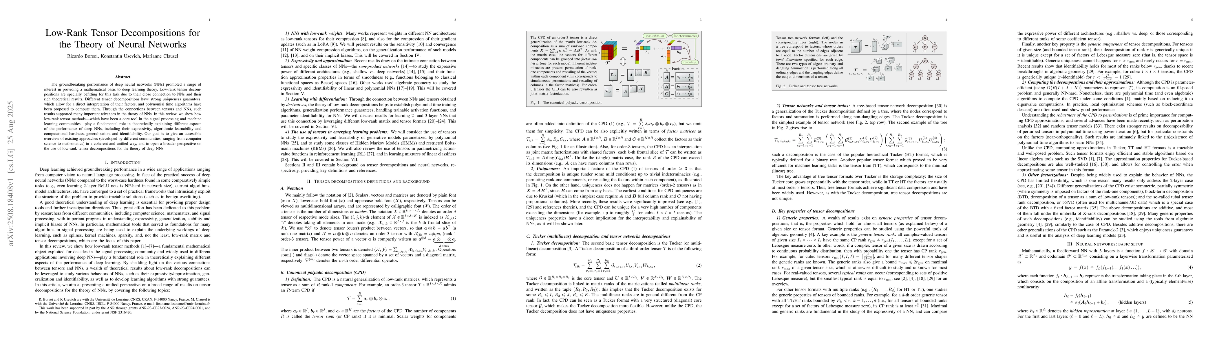
The groundbreaking performance of deep neural networks (NNs) promoted a surge of interest in providing a mathematical basis to deep learning theory. Low-rank tensor decompositions are specially befitt...
This paper studies the problem of distributed Riemannian optimization over a network of agents whose cost functions are geodesically smooth but possibly geodesically non-convex. Extending a well-known...