01
MethodologyHow they did it
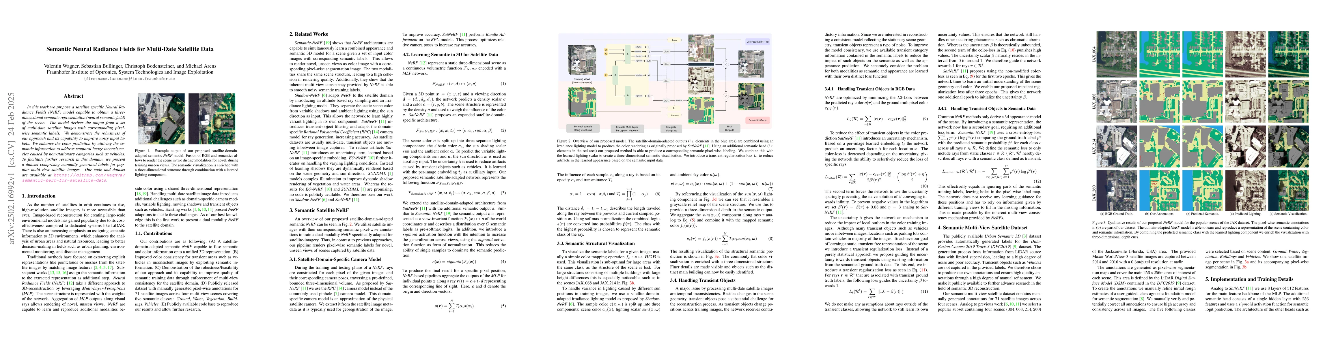
The paper proposes a satellite-specific Neural Radiance Fields (NeRF) model that generates a 3D semantic representation (neural semantic field) from multi-date satellite images with pixel-wise semantic labels. It combines satellite domain-adapted outputs with a lighting model for color rendering and introduces a semantic head for pixel-wise labeling, creating a three-dimensional semantic visualization.
Discussion 0